All posts by exploRVistas

We are full time RVers on a mission to find America's story. We feel that by moving our house to a location and living among the locals for a bit, we allow ourselves the opportunity to understand that area's people. Our motto is "Don't just see it...BE it"©

Keweenaw Peninsula – Michigan’s Other Thumb


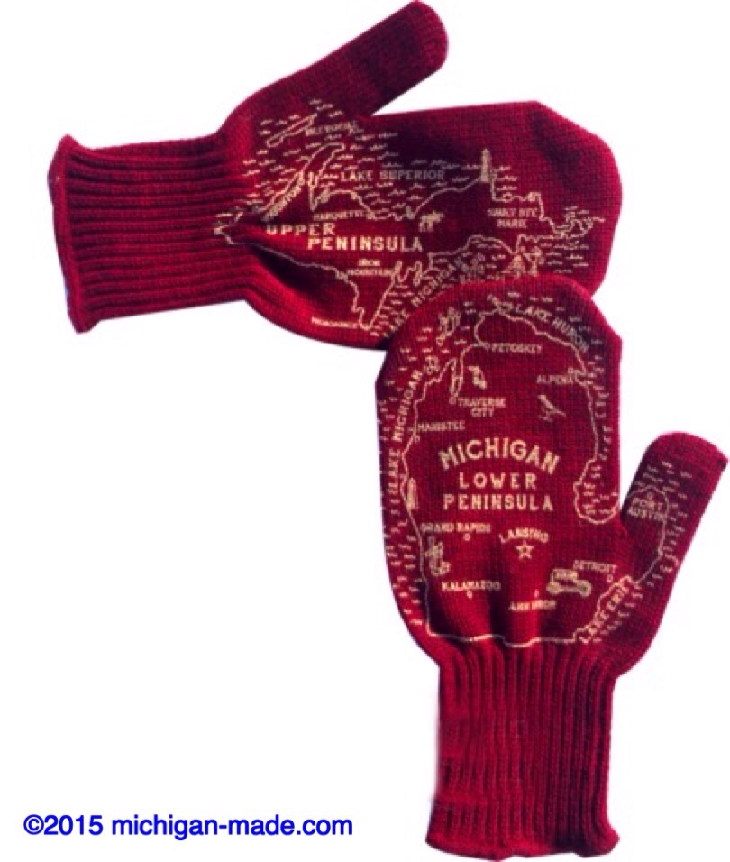
Ask most Michiganders where they are from and watch them pull up their trusty maps attached to the ends of their arms.  Pardon the pun, but it can be quite handy at times!

On Wednesday, we visited Michigan’s left thumb, the Keweenaw Peninsula.


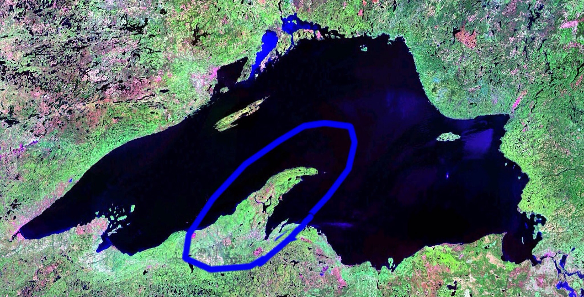
Jutting halfway across Lake Superior, the peninsula is home to one of the oldest known lava flows on the planet.  Copper is king here, as those flows deposited easily recoverable ore and pure veins of the metal.  Before the mining boom in the 18th century, pure copper could readily be found on the surface.


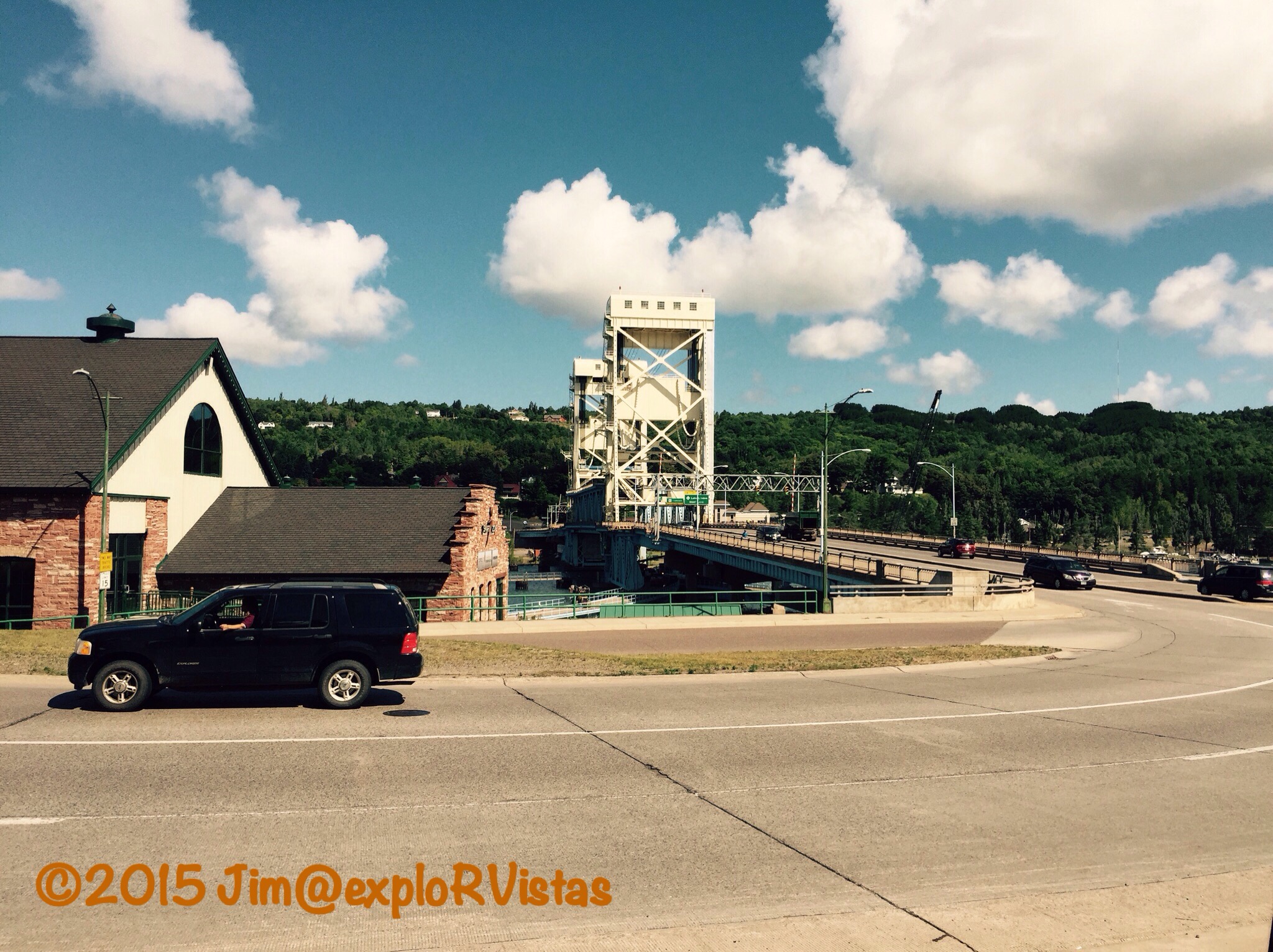
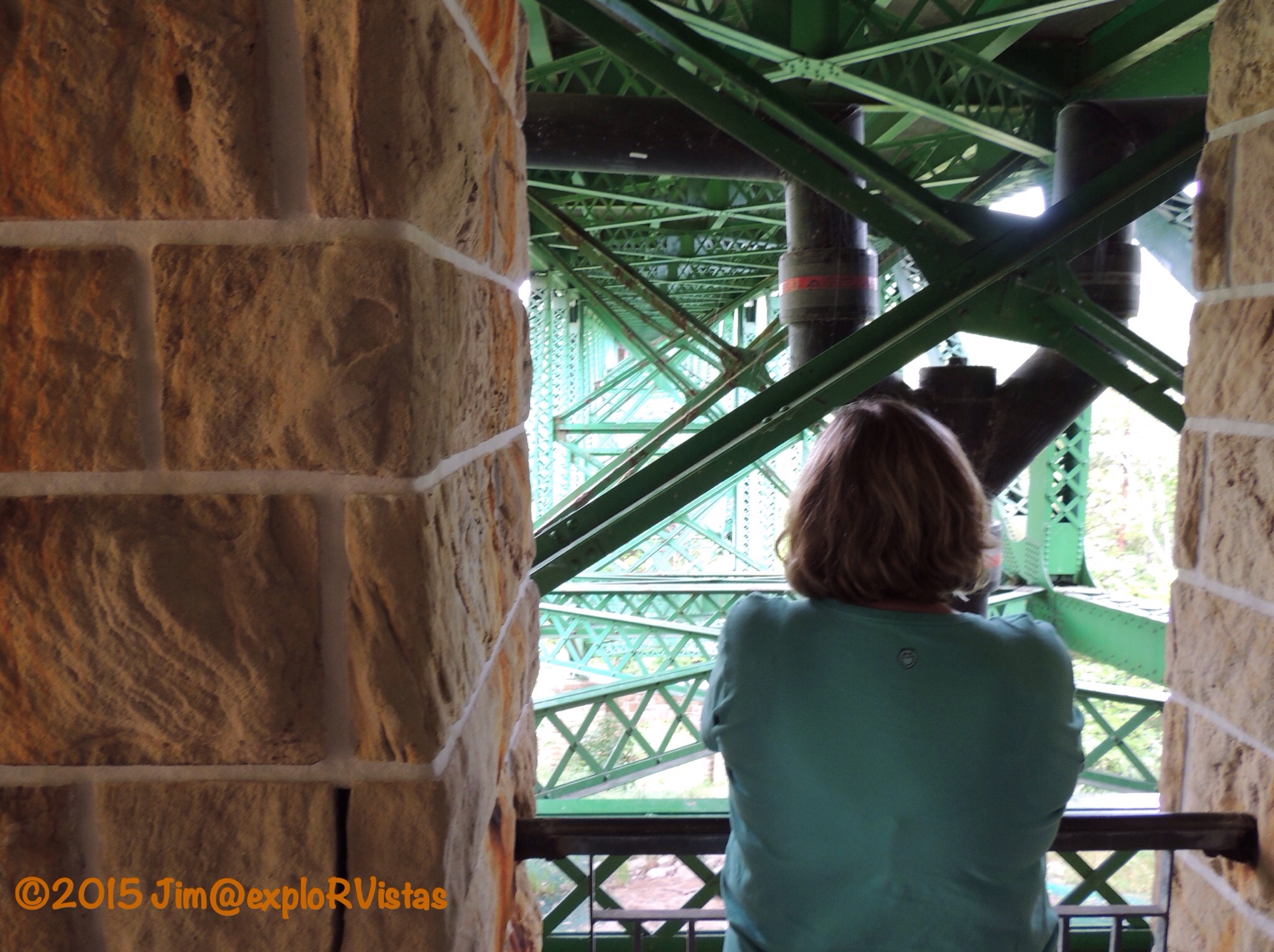
About a third of the way north, the peninsula is traversed by the Keweenaw Waterway.  Points north of that are unofficially known as Copper Island by local residents.  The only road across the canal is the Portage Lake Lift Bridge, which carries US 41 northward between Houghton and Hancock.

Climbing the hill out of Hancock, the Quincy Mine hoist comes into view.


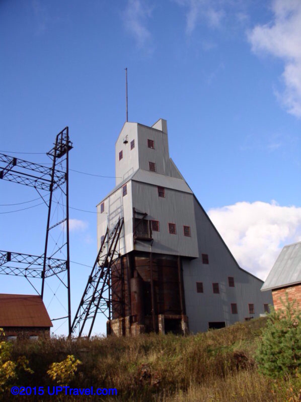
Recently restored, the hoist is the centerpiece of the Keweenaw National Historic Park.  Though we chose not to go on one this time, tours of the mine are available.

With the peninsula jutting so far out into Lake Superior, lake effect snow is a force to be reckoned with up here.


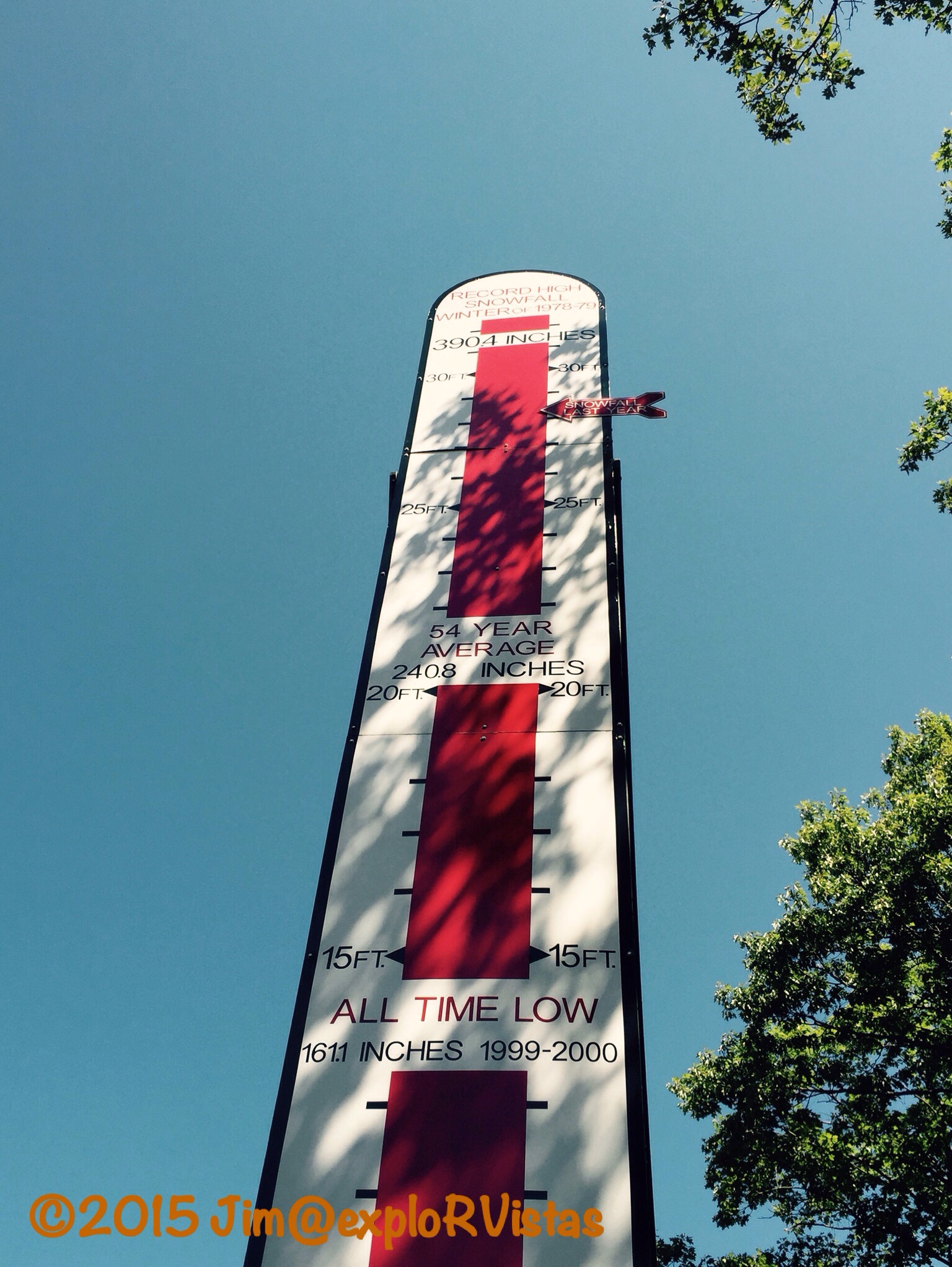
Along US 41 to the north of Calumet is the Snomometer.  The area averages 20 feet of snow each winter.  Last year’s total was over 28 feet.  That’s a lot of snow!

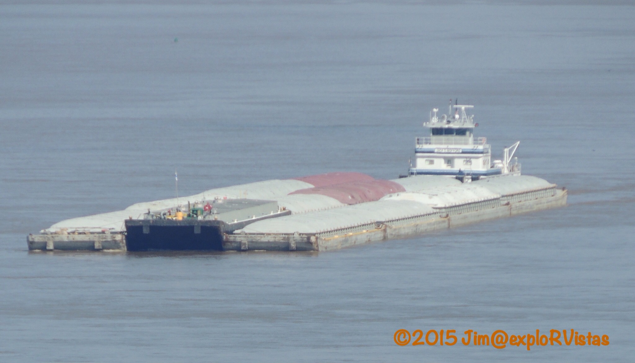
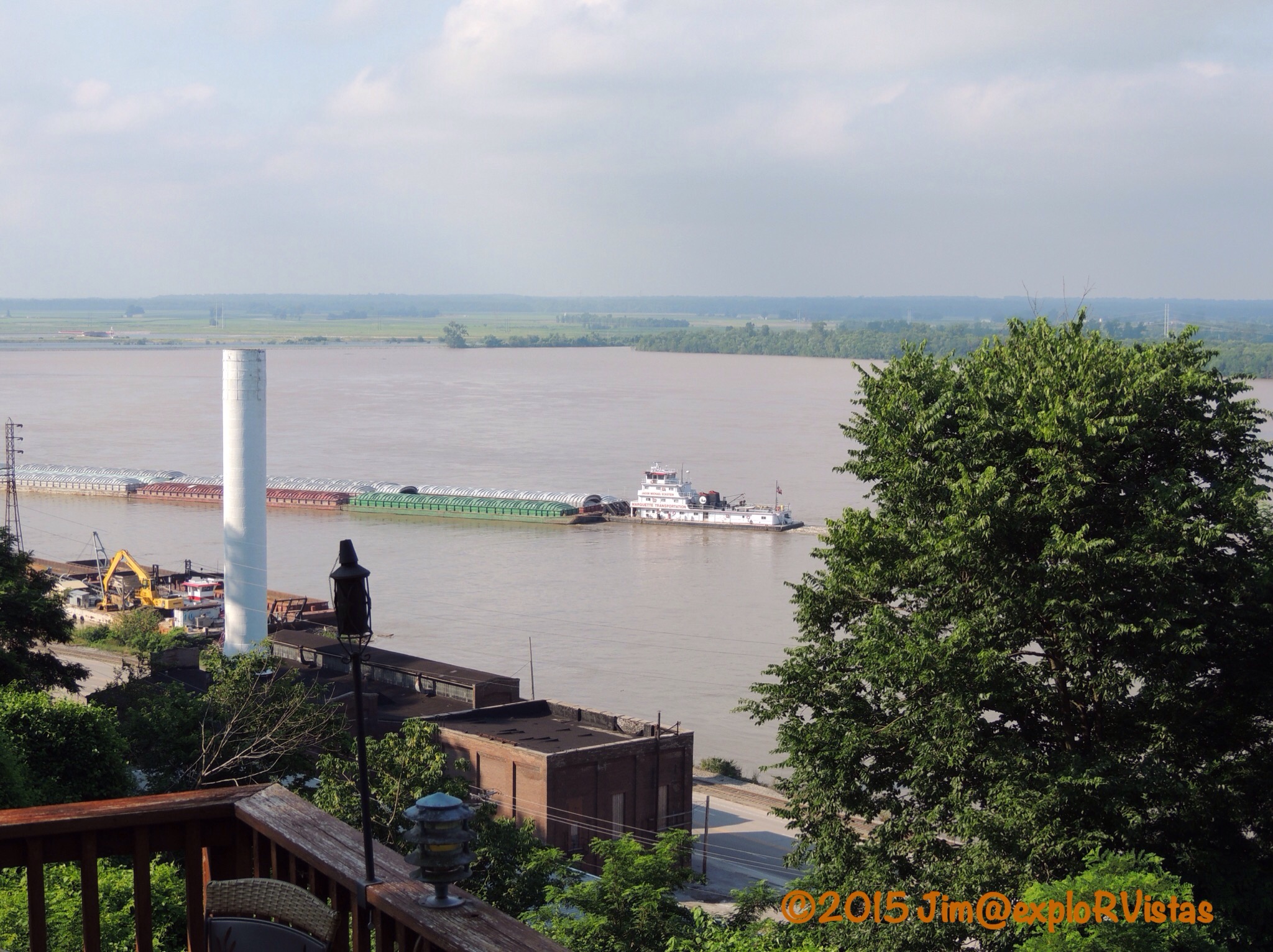
While driving along the northwest shore of the peninsula, we spotted a freighter off in the distance.


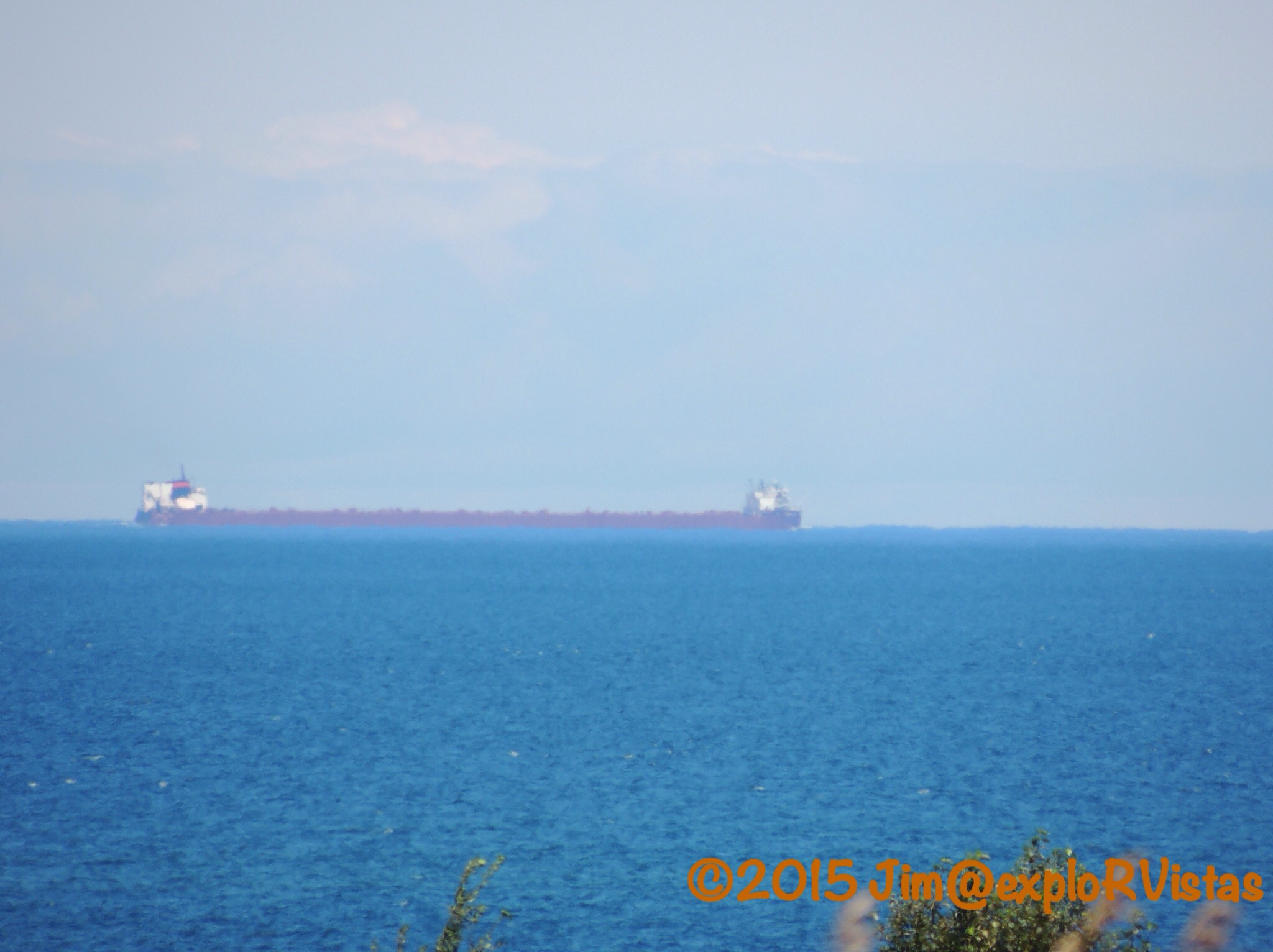
As best I could tell from that distance, I identified it as the Stewart J. Cort… by it’s stack colors, and also it is only freighter of that length with a forward pilot house.  This ship was the first 1000 foot freighter on the Great Lakes, and it still carries the proud “#1” painted just forward of it’s stack.  I remember the day in 1972 that my paternal grandfather came over and told me he had just watched it glide up the Detroit River on it’s maiden voyage.

Farther north, we came to Eagle Harbor.  The bay has a small entrance in the rocky outcroppings extending from each side.


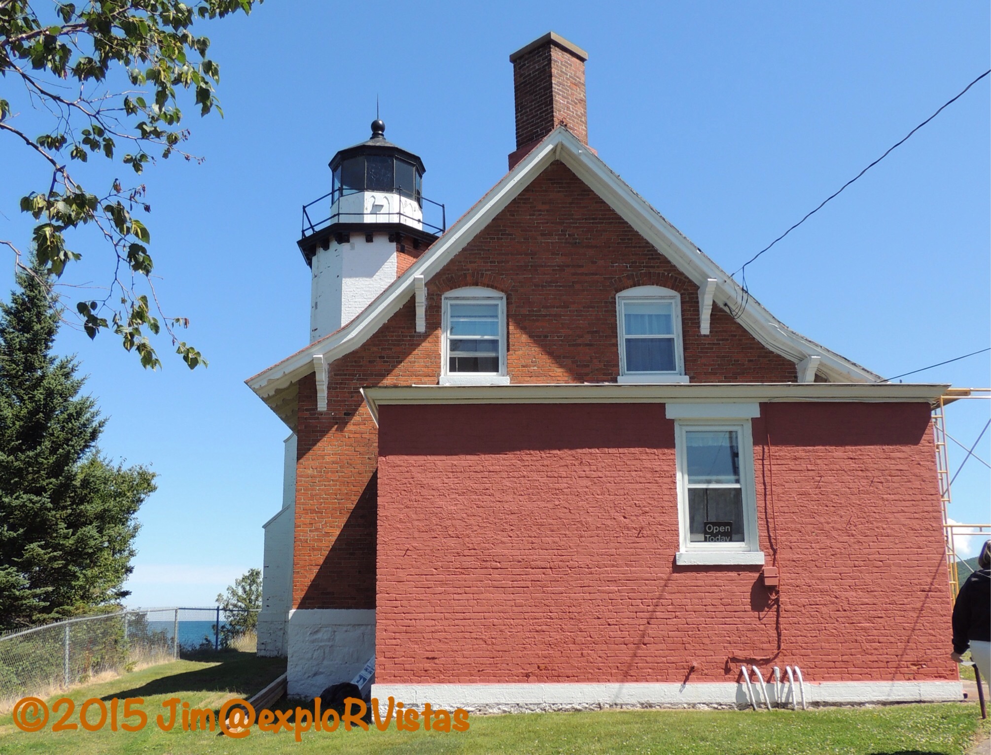
The Eagle Harbor Lighthouse stands as a sentinel over the shore here.  The first lighthouse was commissioned here in 1851, and the current building was brought into service in 1871.  The light is still in use today. There is also a set of range lights to guide watercraft into the small port.  The house and the surrounding buildings are open to visitors as a museum.  We visited and enjoyed it, but FYI…the lantern room is not open to the public, as it is a working lighthouse.


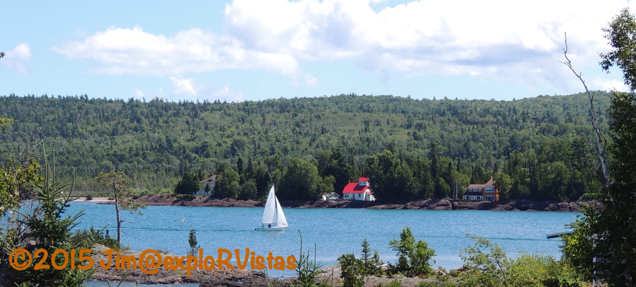
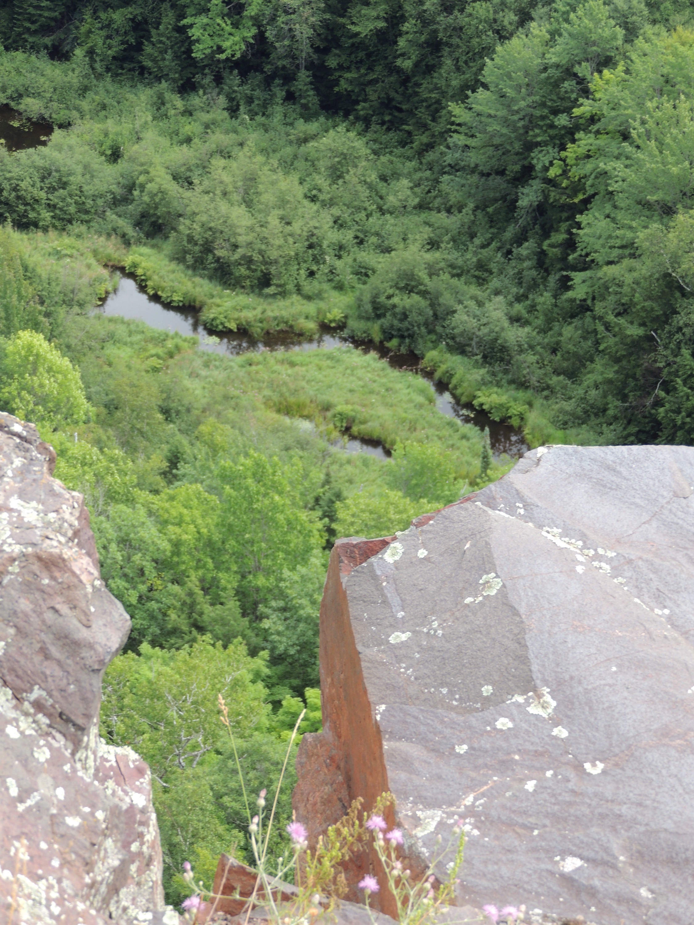
The craggy shoreline is reminiscent of Downeast Maine and is very picturesque.

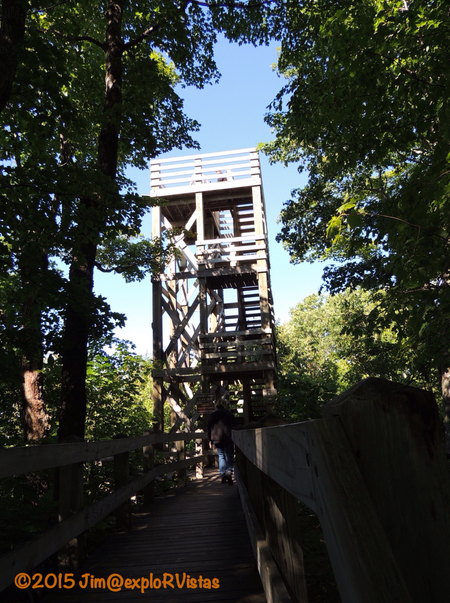
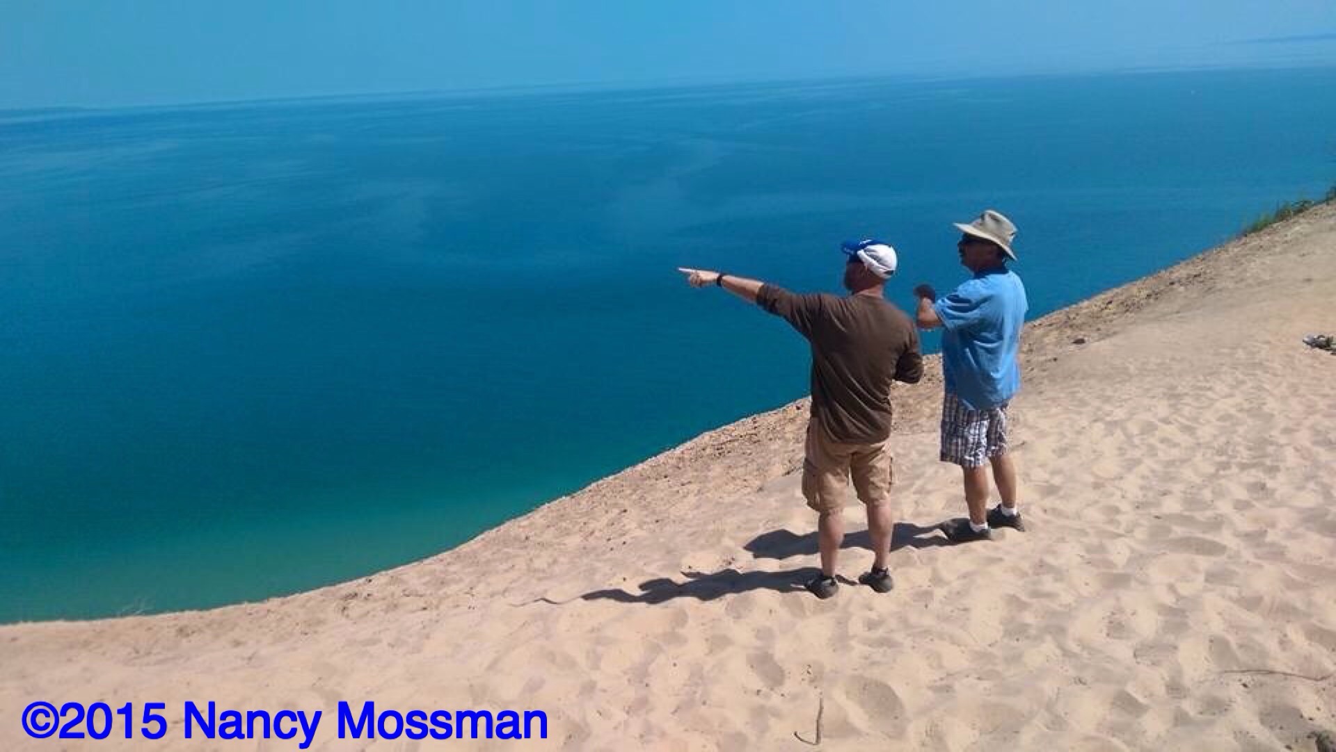
From Eagle Harbor, we had the choice to continue northeast on either US 41 or on Brockway Mountain Drive.  We chose the latter.  Be advised that at the time of our visit, the road was in moderately poor condition.  With that being said, the views were well worth it.

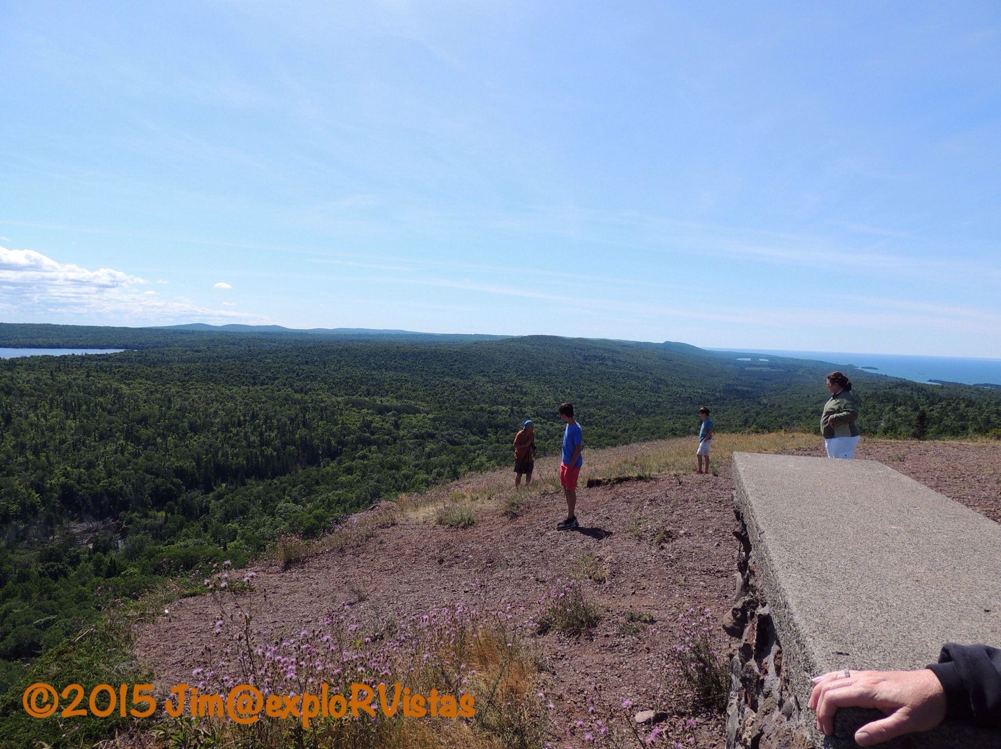
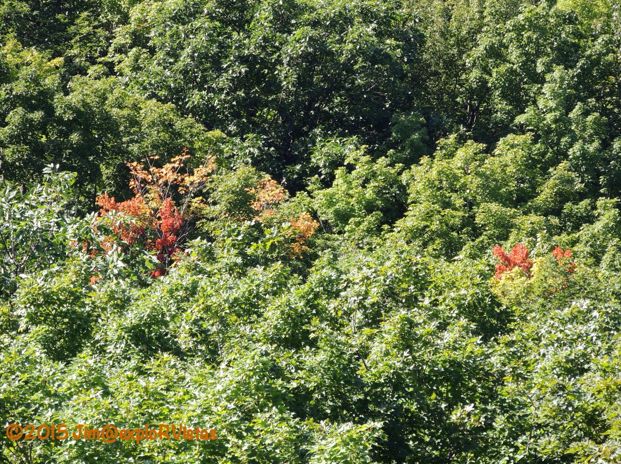
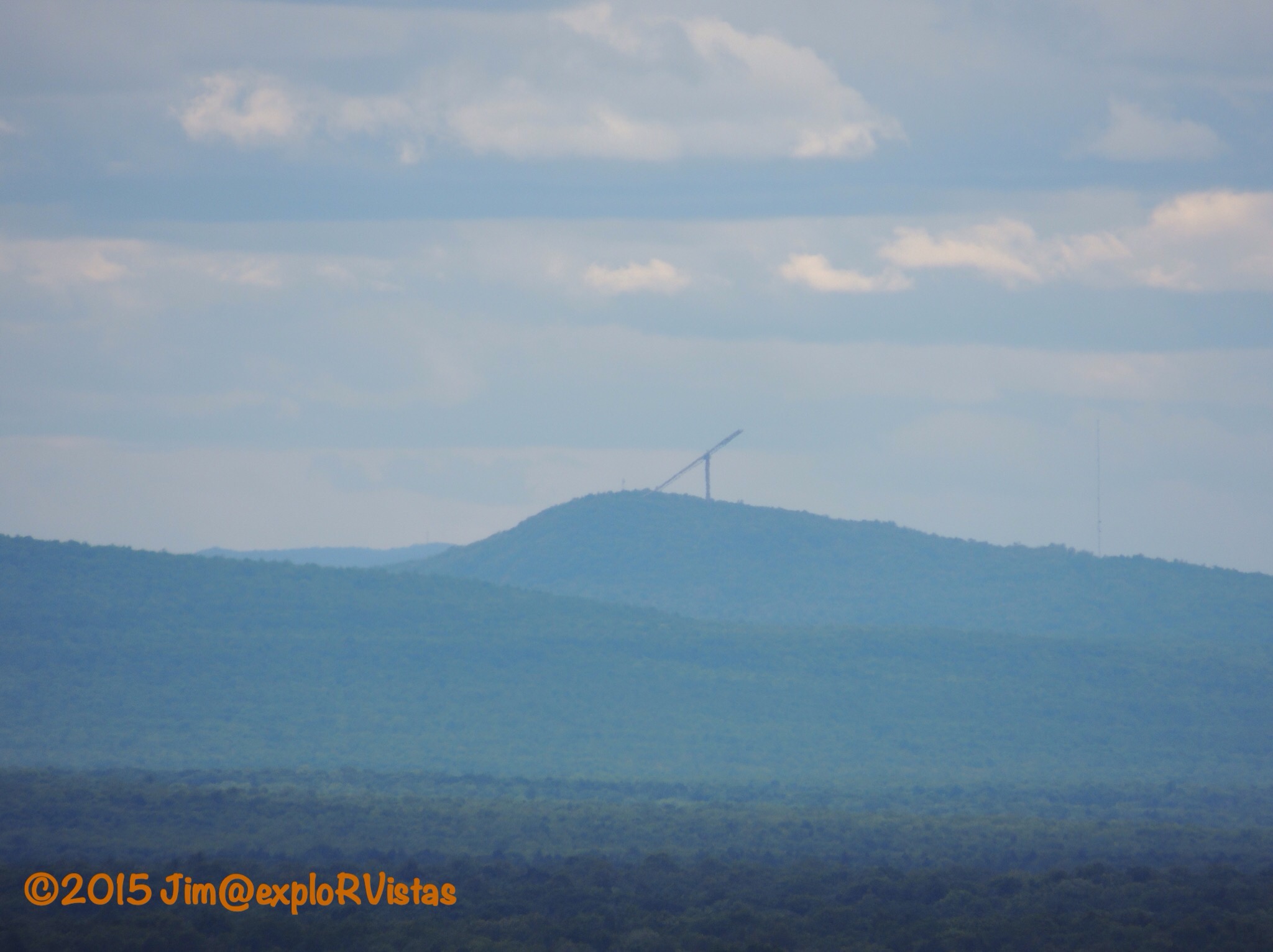
The drive was a CCC project in the 1930’s that was undertaken to keep unemployed copper miners working during the Great Depression.  Climbing along the ridge of Brockway Mountain, the road offers outstanding views of Copper Harbor, Eagle Harbor, Lake Superior and (on a clear day) Isle Royale.


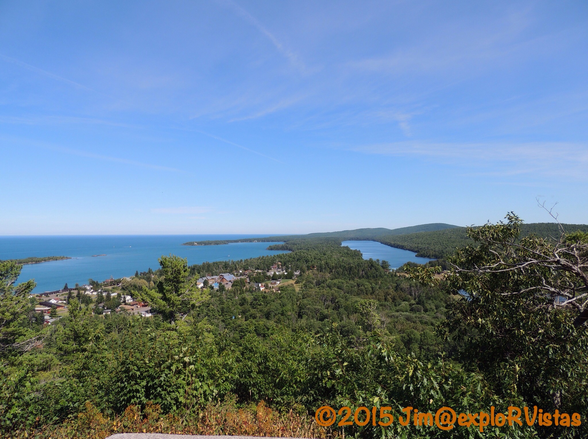
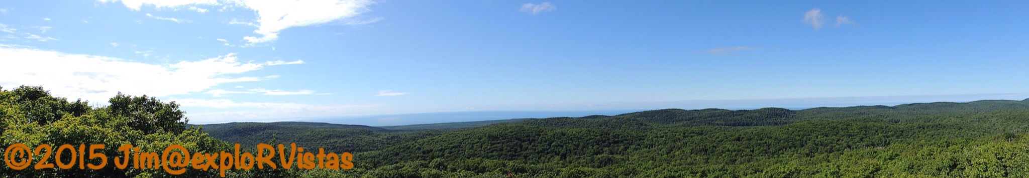
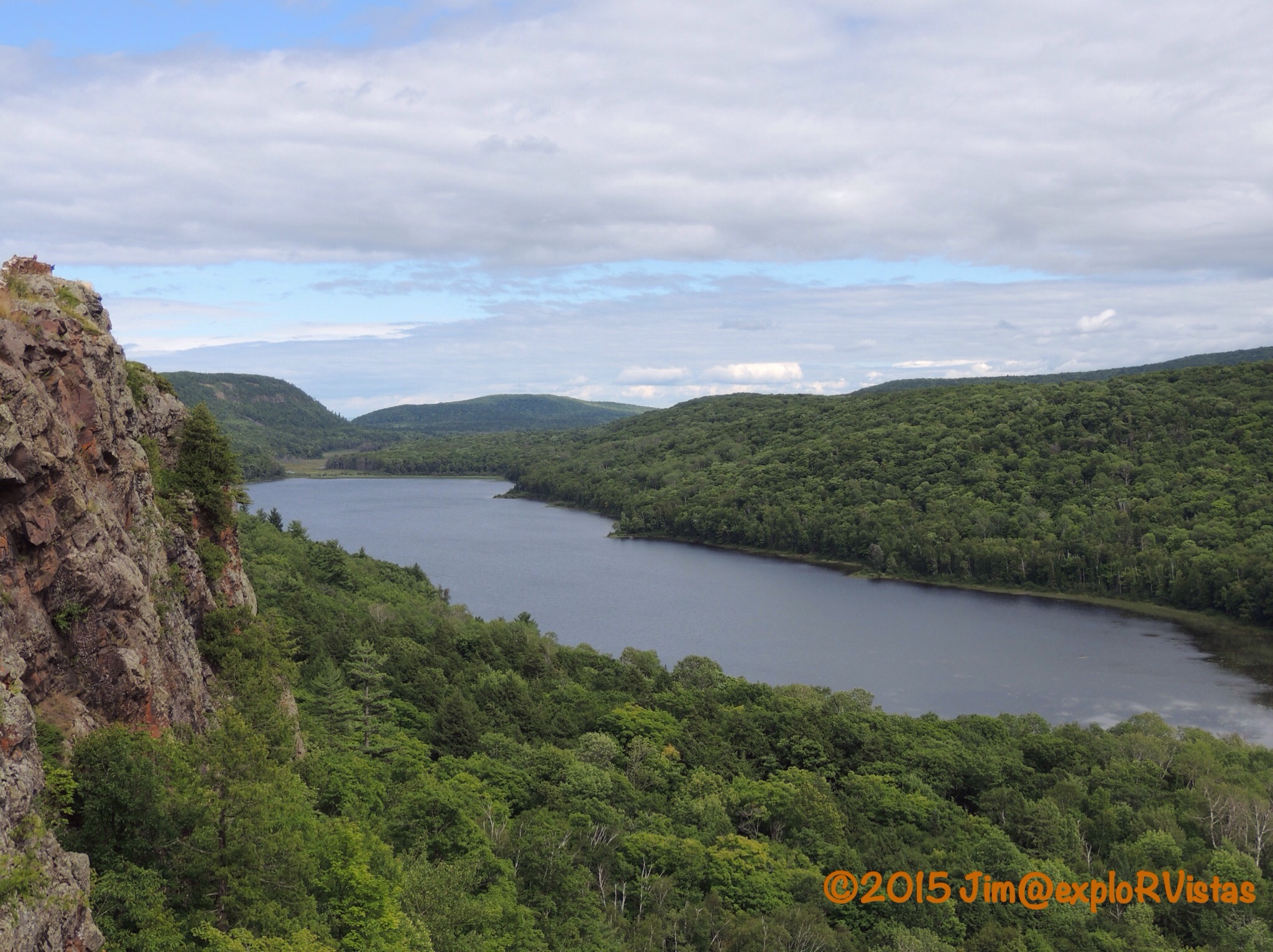
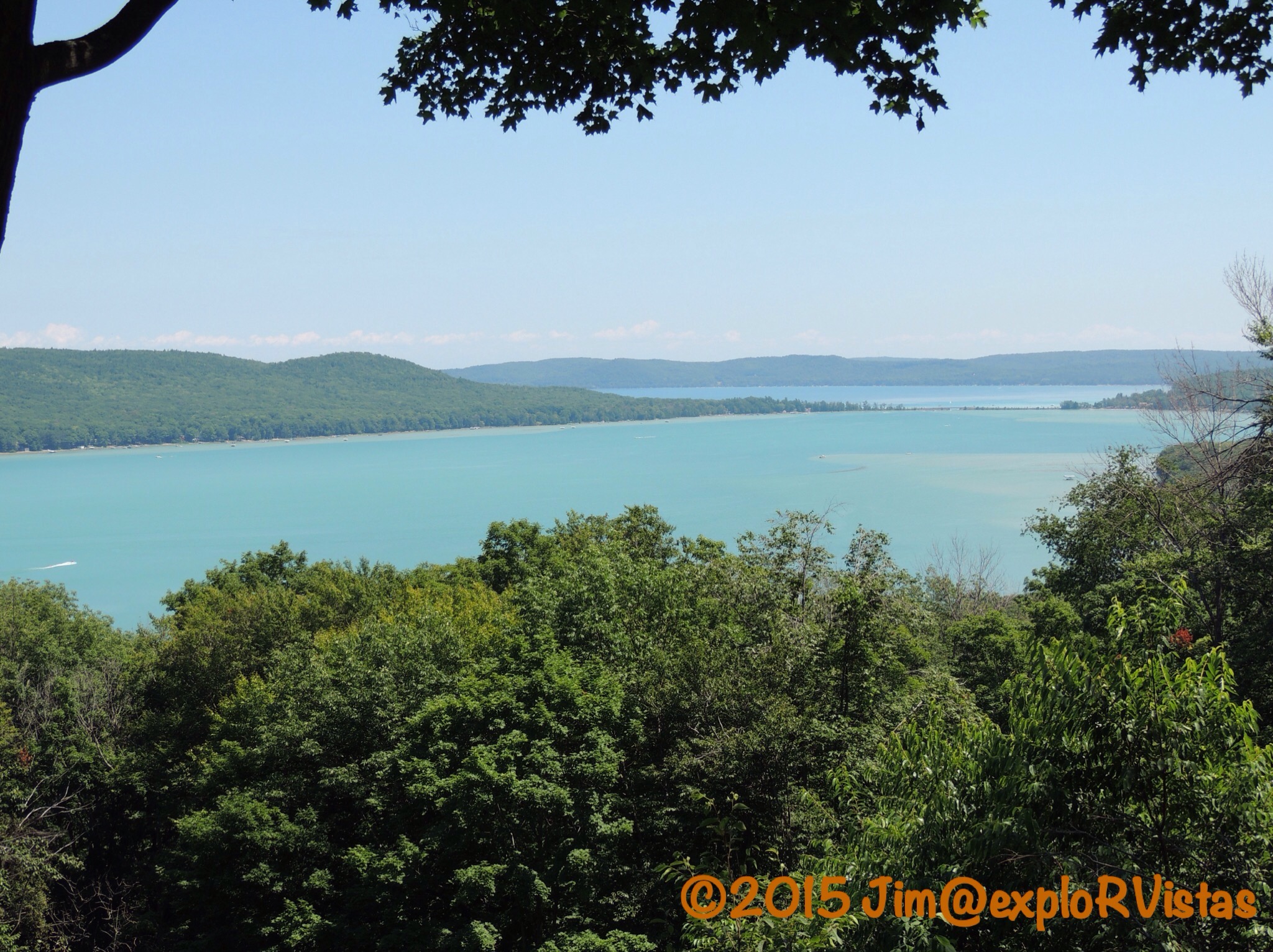
Here is the view from  the Copper Harbor Overlook.  Copper Harbor is to the left, Lake Fanny Hooe is to the right and the village of Copper Harbor is in the foreground.


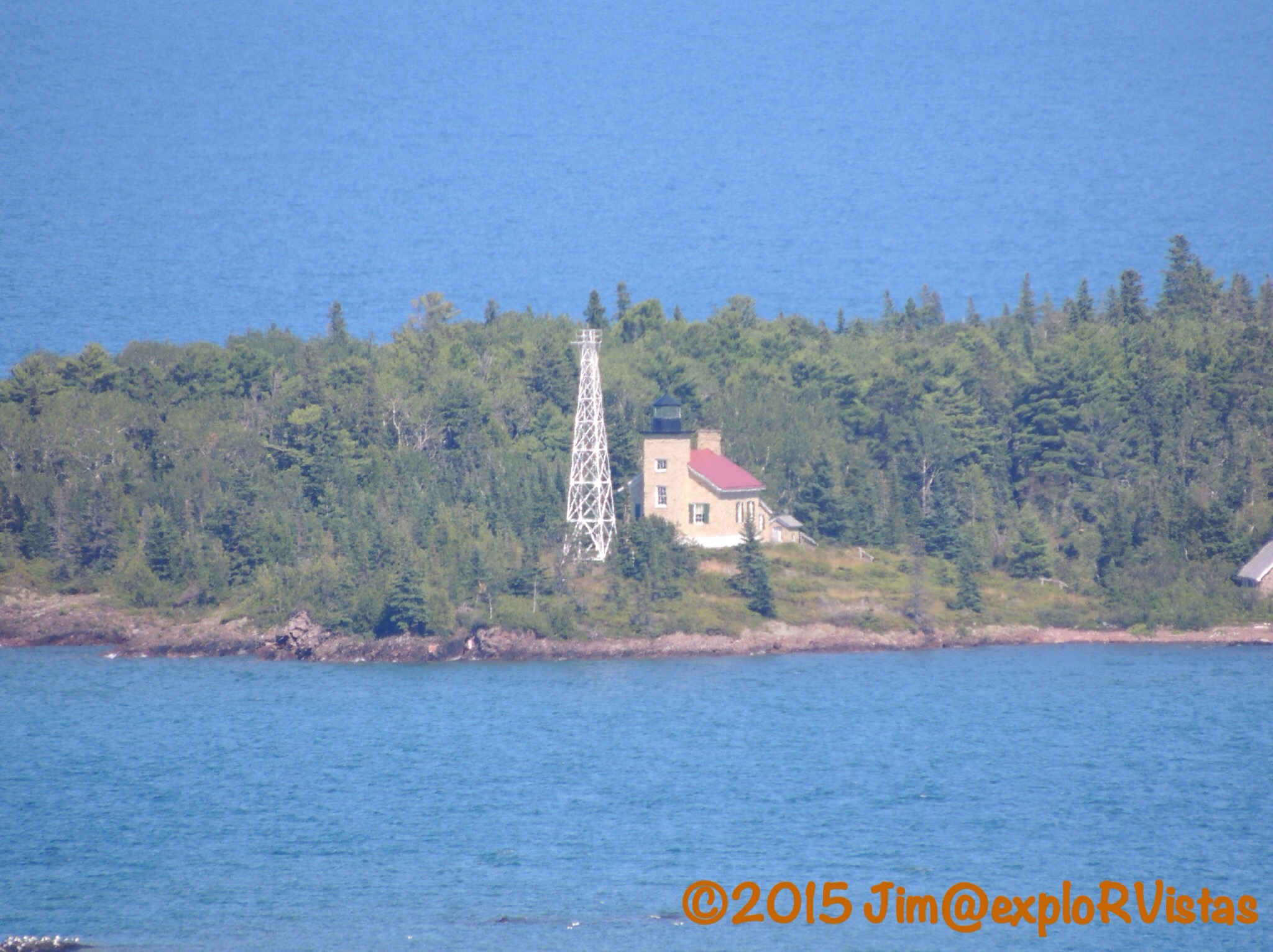
At the Far East end of the harbor is the  Copper Harbor Lighthouse.  The lighthouse…the second at this site…was pressed into service in 1866.  It was deactivated in 1933, when the automated light on the steel tower was commissioned.  The lighthouse is open as a museum, accessible by ferry from town.

Beyond the village of Copper Harbor lies Lake Fanny Hooe.  The lake was named for Lucy Frances Hooe, who legend says drowned in it’s waters in 1844.


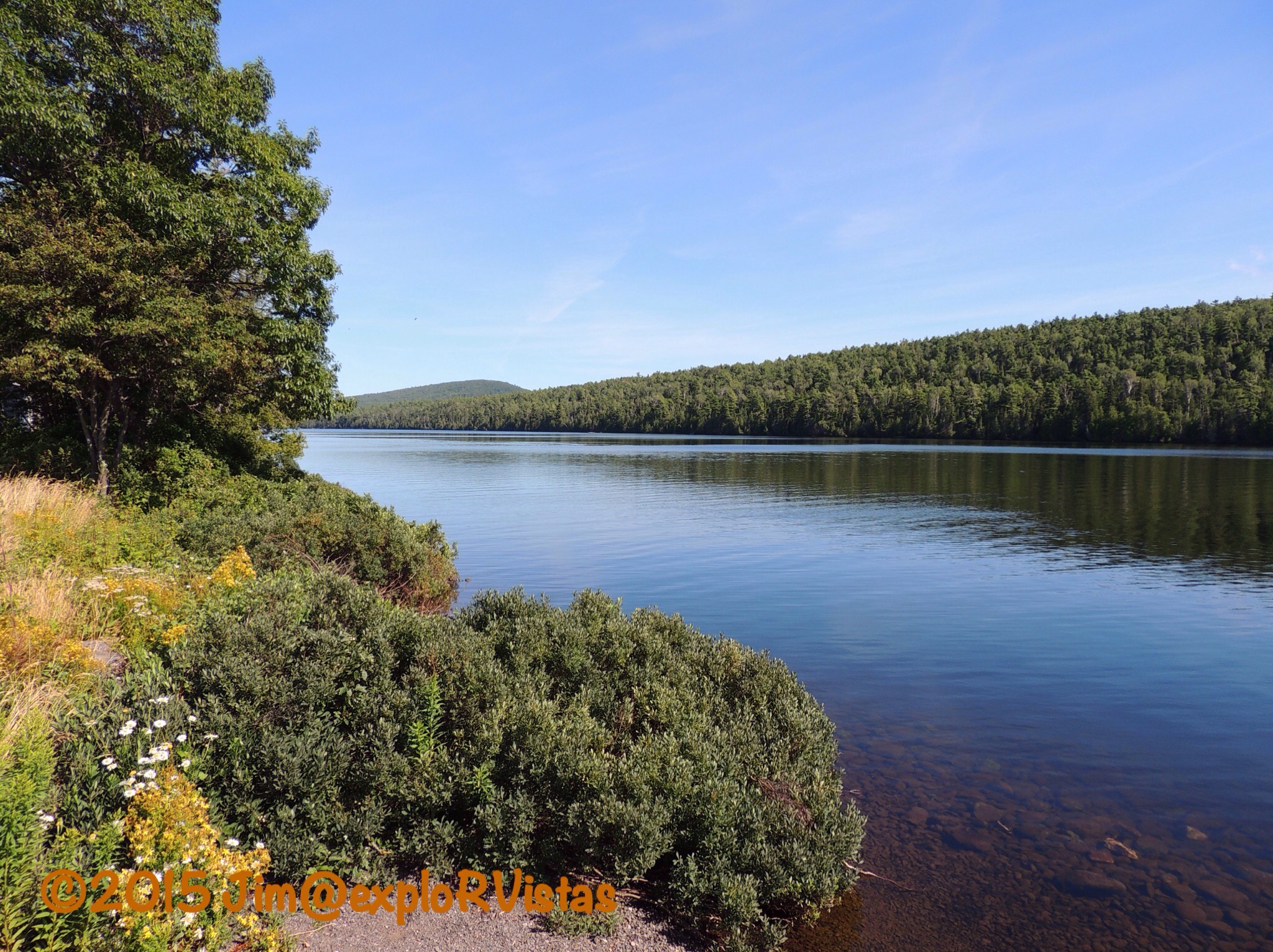
It is a very peaceful setting in August.  Let it be noted that we have been here in the past when the biting black flies were active, and it wasn’t so pleasant. The flies are usually at their worst in spring and early summer.


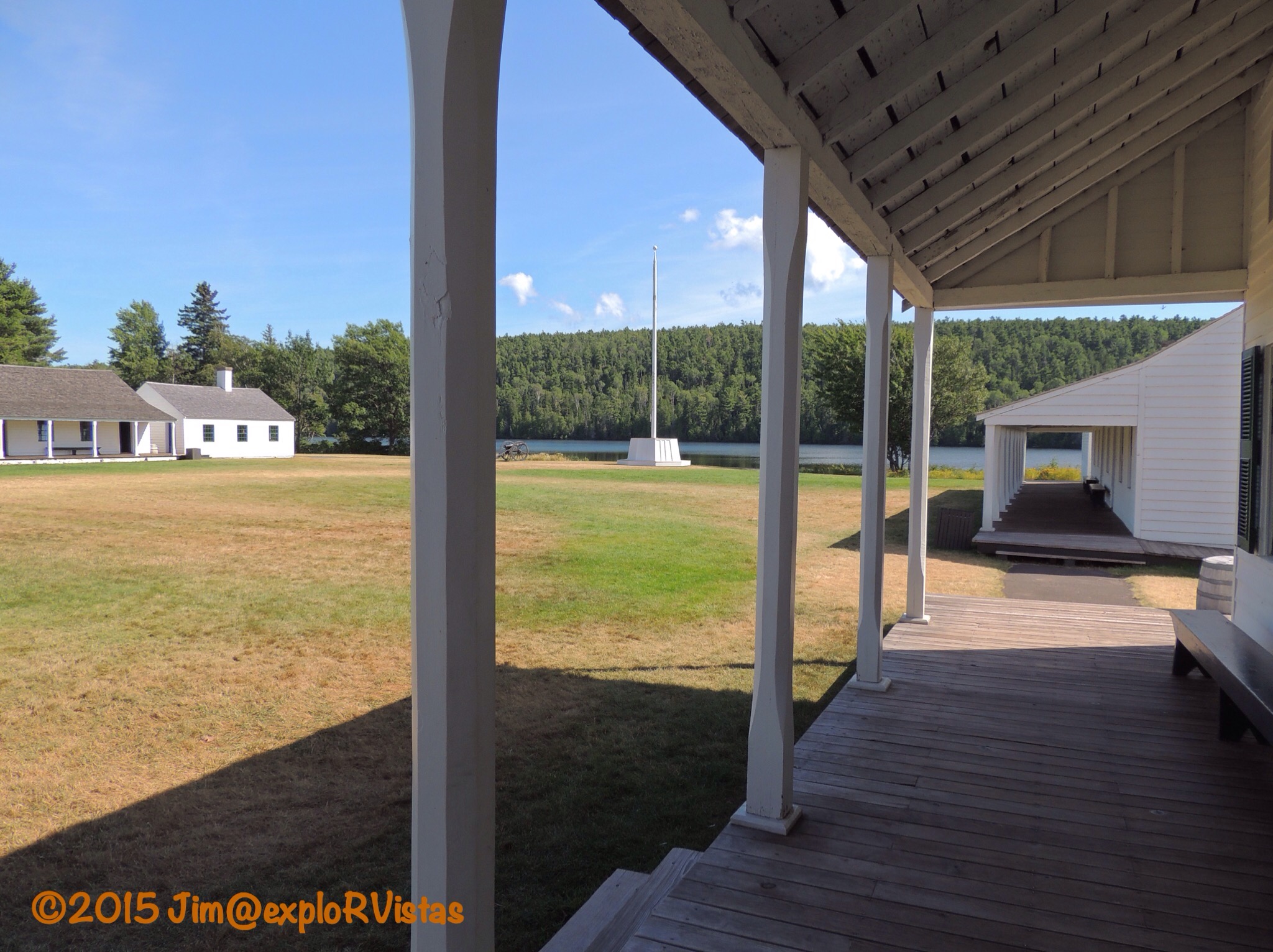
It is on this shore that Fort Wilkins stands, a restored U.S. Army post, built in 1844 as a security measure to protect the national copper interests.  Many of the original buildings still stand today.  The fort is now a Michigan State Park.

Just beyond Fort Wilkins, US 41 comes to an end…or a beginning, depending on your point of view.


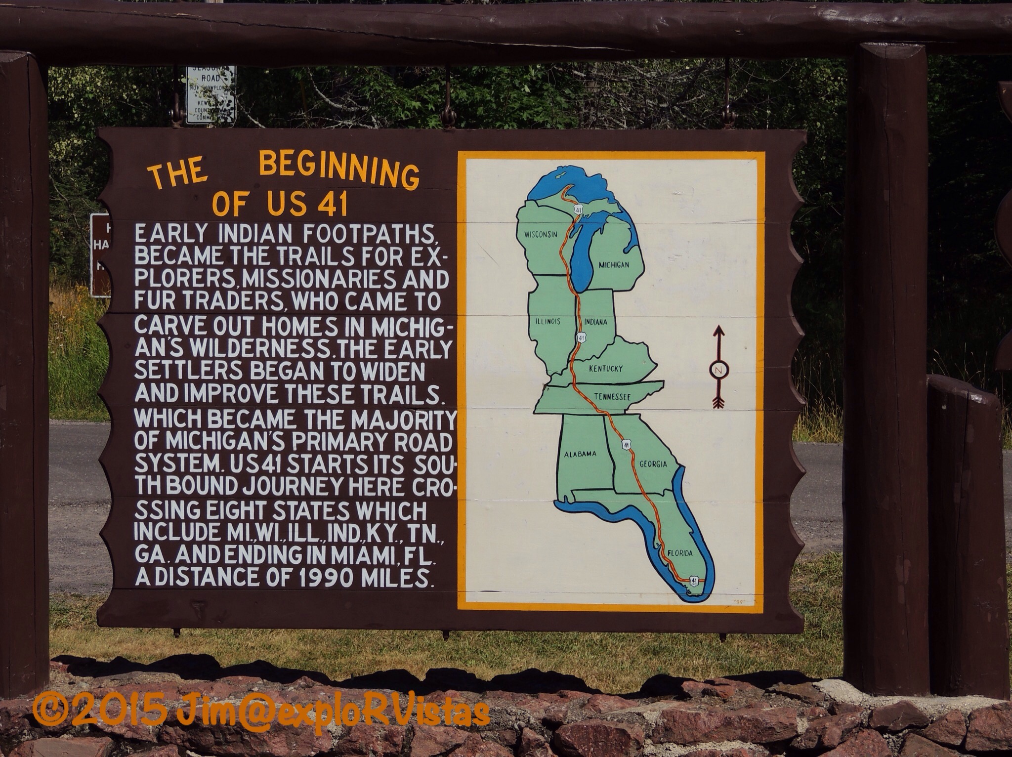
The point is marked with this sign, surrounded by a cul-de-sac.  Follow the road to it’s southern terminus and you will end up in Miami, Florida.  Yes, this is the same road that the Allman Brothers referred to in ‘Ramblin’ Man’ when Dickey Betts wrote “And I was born in the back seat of a Greyhound bus, rollin’ down Highway 41”.  In reality, he wasn’t.  🙂

So if you ever wonder where the copper in your pennies comes from, hold your hands like the mittens at the beginning of this post and look at your left thumb.  Just don’t be surprised if someone asks you “Are you from Michigan?”

To the Top of Michigan We Go

Up until the late 1950’s, Summit Peak in the Porcupine Mountains Wilderness State Park was thought to be the tallest peak in Michigan.  Back then, it was known as ” the peak one mile south of Mirror Lake”.  Thinking it was the highest point in Michigan at 1958 feet above sea level, the name ‘State Summit’ was decided upon.  It was discovered shortly after that Mt. Curwood, 100 miles to the east, was 20 feet taller.  At that point, the name ‘State Summit’ was changed to Summit Peak.  It was then discovered in 1982 that Mt. Curwood’s neighbor, Mt. Arvon, was 11 inches taller.  Granted, these two peaks are in some fairly remote wilderness, but it is still remarkable that those numbers were not officially surveyed until the year we were married!  With that being said, neither Mt. Curwood or Mt. Arvon has any sort of structure at the top of them.  Summit Peak has a 40 foot tower, which puts an observer at the top of Michigan! The only people possibly getting above that point are radio tower workers.  🙂

After exploring the Presque Isle River on Tuesday, we decide to check out Summit Peak on our way back to camp.

  
The trail to the top of Summit Peak begins at a paved parking area at the end of Summit Peak Road.  It is a fairly easy 1/2 mile climb through an old growth hardwood forest to the top via a gravel pathway, wooden boardwalk and stairs.

  
Two thirds of the way up, we came to the Lake Superior Overlook.

  
To offer some perspective, this photo is looking northwest.  Lake of the Clouds and the Escarpment Overlook are hidden by the ridge a few miles away. Lake Superior can be seen in the distance.

Heading back into the woods, we came to this sign.

  
1958…hey, that’s the year we were born!  🙂

  
After climbing quite a few stairs, the tower came into view.

  
With the tower being 40 feet high, the climber’s eye level ends up to be higher than 2000 feet above sea level.

  
What a view!  If you pull in the horizon on the above panorama, you can see Wisconsin’s Apostle Islands in the distance.

  
Back towards the east are the Huron Mountains.  Somewhere out there are Mt. Curwood and Mt. Arvon.

Below us, we could see a preview of what is coming soon.

  
It won’t be long before the entire area is ablaze with fall colors!

On the way back down, Diana spotted this beauty.

  
This is Indian Pipe, known also as Corpse Plant of Ghost Plant.  It lacks chlorophyll, therefore it has no color to it.  With the forest being old growth, the floor was fairly wide open and easy to see across.  That made it easy for us to not only see wildflowers, but to also keep an eye out for bears!

  
We also spotted this Downy Woodpecker working away on a tree.

So while Summit Peak may not officially be the highest peak in Michigan, it’s tower does offer the highest mountaintop vista available in the state.  Make sure to take the time to check it out if you are in the area!

Presque Isle River

When the word ‘pothole’ is mentioned, the thought of a crater in a late winter road comes to mind.  At the western end of the Porcupine Mountains Wilderness State Park, there is a very different kind of pothole to be explored.

Tuesday morning, we headed to the Presque Isle River.  The name is of French origin, meaning “almost an island”, and refers to the peninsula/island at the mouth of the river. On the way to our destination for the day, we were treated to a very healthy black bear bounding across South Boundary Road in front of us.  The Porkies have a large population of black bears, which are seldom seen by humans. Unfortunately, we didn’t get a picture, as the bear didn’t stick around to pose for the blog. 🙂


We arrived at the river a short time later. From the parking area, the North Country Trail heads towards the river.  The river runs through a mixed old growth forest, which leaves the forest floor fairly wide open.


And some of the trees are huge!  This giant is an Eastern Hemlock.


The riverbed is comprised primarily of sedimentary rock, referred to as Nonesuch Shale.  The uplift of the shale has created numerous waterfalls along the way.  The water itself is stained with tannins from decaying vegetation upstream, giving it a tea coloring and creating foam in the eddies below the falls.


And there are those potholes we were talking about!


They are created as the water swirls smaller rocks in a low point in the riverbed, resulting in a circular hole.  It is amazing how razor sharp and perfect the edges are!


The river continues it’s march toward Lake Superior.  Boardwalk and stairs follow the western shore, making access for visitors fairly easy.


Near the mouth of the river, a suspension bridge crosses the active channel to the ‘presque’ isle.  This bridge is actually part of the North Country Trail.


On the far side of the island, the trail crosses the dry riverbed.  In the springtime, the flow of the river is high enough to cover this portion of the riverbed.


Below that point, the river water is ponded until the next spring.


A young girl pointed out this turtle in one of the small pools.  It appears to be a baby snapping turtle. There were also tadpoles swimming around.


Where the pool meets Lake Superior, there is a sandbar between the east riverbank and the presque isle. In the springtime, that bar is breached, thereby creating a true island.  The sandbar is a great place for rock hunting.


I kept handing rocks to Diana, saying “Look at this one!”  She finally set them all down and took a picture of them. 🙂 


There were also several varieties of wildflowers to be found along the riverbank.  Here are a bunch of Common Tansy.


The Presque Isle River is definitely a great place to spend an afternoon!  Just remember one thing…

  
Watch out for the potholes!  🙂


West Across the Upper Peninsula 

The Upper Peninsula of Michigan is definitely different than it’s southern counterpart.  Only 3% of the state’s population lives up here.  They actually have their own state fair, as they are so far removed from Detroit. The weather in the U.P. Is sometimes referred to as 9 months of winter, followed by 3 months of bad sledding. Ontonagon averages 200 inches of snow each year!

After spending the night at the KOA in St. Ignace, we set our course west for the Porcupine Mountains.  The Porkies, as they are affectionately called, have been a draw for Diana and I for years.  We both were there as teenagers, and were there together one time during the 1990’s.

We left the KOA in a thunderstorm, which was the first rain we had seen in quite awhile.  Behind us, a little drama was unfolding on the Mackinac Bridge.

  
A wind gust had blown this RV onto it’s side, closing the bridge.  There is a very good reason they want high profile vehicles to go 20 miles an hour!

As we made our way west on US 2, our weather cleared up.  We stopped at the Cut River bridge, a favorite place to explore.

  
Michigan’s Department of Transportation maintains parks on both sides of the bridge.  From the roadway, the beauty of the structure and the gorge below can’t be seen.  It is definitely worth stopping to take a look.

  
Here is Diana checking out the superstructure under the roadway.

  
This doorway was immediately behind her. We found the nameplate on it to be amusing. 🙂

On our way west along U.S. 2, we were able to look south over the northern shore of Lake Michigan.  What we saw in the distance was disturbing.  The sky was as black as night, and the radar on our iPhones was indicating that a major storm was headed straight for the Leelanau Peninsula, about 100 miles south of us.  All of our friends at Wild Cherry were in for some nasty weather.  It wasn’t long, and the photos started rolling in on Facebook:

  
This is what they saw coming at them at Sleeping Bear. Glen Arbor and the national lakeshore took the brunt of it.

  
Latest reports indicate that Glen Arbor sustained straight line winds of over 90 miles an hour!  M-22 coming in from the south is still impassable, 2 days later.  Fortunately, no one was killed.  Wild Cherry never lost power, and just had a few branches down.  The photo above is on what was a heavily forested stretch coming into Glen Arbor along Glen Lake.  It was a gorgeous drive.  So sad…..

Back to our trip:  We continued west to Marquette for the night.  Going on a tip from Cherie and Chris at Technomadia about casino camping, we stopped at Ojibwa Casino, east of Marquette.  The casino actually paid us to camp there!

  
They gave us each $15 in free slot play, a free mixed drink (or beer), and $10 in match play for blackjack.  We passed on the blackjack, and we came away with almost $10 total from the slots.

  
Oh, and this wooded campsite was free!  It even included 50 amp electric!  For anyone thinking about staying here, make sure you come with a full fresh water tank and empty holding tanks.  They don’t have a dump station or water available.  We ended up dumping farther west on Monday at Van Riper State Park, which was free with our Michigan Recreation Passport.  Thanks to the Ojibwa nation for the hospitality!

Our next stop was River Road RV Park in Ontonagon, Michigan, which is the eastern gateway to the Porcupine Mountains.  We set up camp for a few days of fun in the area.  We were given a nice full hookup site, just a few yards away from the Ontonagon River.

Late Monday afternoon, we headed up to the visitor center at Porcupine Mountains Wilderness State Park.  We discovered that the state park was established in 1945 in response to the U.S. National Park Sevice contemplating making it a national park.  Michigan wanted it for their own.  Diana first came here with her family in the early 1970’s and I came with a buddy in 1975 at 17 years old, just after getting my driver’s license.  

After we left the visitors center, we headed up to Lake of the Clouds.

  
The lake is accessible by foot trail only, and is totally surrounded by wilderness.  There are no boats to be seen on this beautiful body of water. The surrounding hardwood forest in the park is the largest stand of virgin, old growth hardwoods west of the Adirondack Mountains.  The fall colors here are outstanding in late September.

  
The viewing area is on an escarpment high above and adjacent to the creek that feeds the west end of the lake.

  
This gentleman was playing a Native American flute on the boardwalk at the edge of the cliff.

  
To the west, I was able to zoom in on the Copper Peak Ski Flying Hill about 30 miles away.  It is the only ski flying hill in the Western Hemisphere.  Ski flying covers greater distances than normal ski jumping.  Anyone care to try it?  🙂

  
Zooming back out shows just how vast this wilderness is.

  
We have more of the park to explore, and we look forward to passing along our discoveries.  The Upper Peninsula is definitely a unique place to visit!

Vacation from our vacation!

One of the benefits of our work camping job at Wild Cherry RV Resort is a chance to take a break and head out for a bit.  Sort of a ‘vacation from our vacation’, so to speak.  Thank you JoAnn and Paul for covering for us!  

We are headed to Michigan’s Upper Penninsula for a week and a few days.  First destination for last night was slated to be Mackinaw City and an overnight at Mill Creek Campground. Well….our normally trusty Ford pickup Henry had other plans.  :). Remember our post ‘South to Florida’?  You may recall that we had a front caliper lock up on us, so Bass Auto in Talahassee, Florida replaced both front calipers and pads.  This go around, we made it to Elk Rapids, Michigan and Diana noticed a smoking rear wheel.  Yep…same issue.  So we did a quick Google search and found Uncle Rod’s Auto Repair.  Rated very well, we gave them a call.  Mark told us to bring it in, and he assured us we would be able to get the trailer into the lot.  Seeing as it was 4 PM on a Friday, there was no way they were going to be able to get parts AND fix it before they closed.  Mark said we were able to stay in the lot overnight, so we were all set. Uncle Rod’s is a Uhaul facility also, so we did have the option of renting a truck, if we needed to run to the grocery store or check out the town. It was nice knowing we weren’t totally stuck!


What a beautiful campground, Mark!  Clara looks so cozy nestled in next to the tiger and day lilies!  Uncle Rod’s is about a quarter mile from the east arm of Grand Traverse Bay, so we had a nice lake breeze.  Knowing we were going to be running fairly flat terrain, I luckily put about 2/3 of a tank of fresh water in the tank before we left Wild Cherry.  Mark let us plug into their 20 amp electrical outlet, and he even fixed us up with a couple of quarts of Brita drinking water.  Now that’s service!

  
They do have guest wifi, which was spotty out in our trailer, but there was also a Verizon tower right next door.  5 bars of smokin’ hot 4G LTE!

Uncle Rod’s is far enough from US-31 that we didn’t notice the highway noise.  That was a big plus, as we couldn’t run the A/C with 20 amp.

  
And they back up to a cherry orchard. The trees had already been shaken, so we grabbed a few stragglers.  Stone Hardy Gold cherries….Yum!

In the morning, Taylor (our mechanic) was there at 8 AM…well before the rest of the crew.  We asked him for a recommendation for a good breakfast, and he pointed us towards downtown Elk Rapids…about a mile and a half walk.  Since the work was going to take a few hours, we decided to hoof it into town.

This is where good travel karma comes into play.  We had travelled through Elk Rapids on US-31 before, but never stopped to really check out the town.  In fact we were PAST town this time when Diana noticed the brakes smoking.  Our little detour to Uncle Rod’s allowed us to stop and smell the Elk Rapids roses!  With the town being about an hour from Wild Cherry, we will come back and do some more exploring in the near future.

  
First place we saw was a cool art store called Twisted Fish Gallery.

  
Next up was this funky old motor court called Paradise Pines Motel.  Now closed, this was once a viable business, back when Bayshore Drive was US-31.  When the highway was realigned, these cool little cabins closed up shop.

  
Next up was this cool old Gulf station.  Somebody enclosed the overhang where the cars would pull in to get gas, but it was still fun to see nonetheless.

  
Further up the road, the east arm of Grand Traverse Bay came into view.  That is the tip of Old Mission Peninsula, which divides the east and west arms of the bay.

  
Still further, the road turned into town, and the open waters of Lake Michigan came into view.

 
Coming into downtown, we saw several interesting places, which we will check out in detail on a future visit.  The town itself is quite charming.

  
Taylor’s recommendation, Harbor Cafe, was a home run.   The place was hopping! 

  
Tip the cook and ring the bell!   Thanks, Taylor…for the recommendation AND the great service on our truck!  
Once we got back to the shop, Mark even shot some grease into our Bearing Buddies on our trailer…no charge.  Thank you, Mark, for everything you did to help us out and make the best of what could have been a bad situation.

So, even though life handed us a lemon, we made delicious lemonade out of it.  We actually had a great time, and we met some new faces that we will never forget.  By all means… If you find yourselves in Elk Rapids and need auto repair or a Uhaul, call Mark at Uncle Rod’s.  They do great work at fair prices!

Tonight, we are in St. Ignace at the KOA.  We crossed the Mackinac Bridge in high crosswinds, so we were limited to 20 miles an hour.  Seeing the bridge is 5 miles across, it took us 15 minutes to get from one end to the other.  I was a tad ‘white knuckled’ going over…so that we literally didn’t go over the side…but Diana had all the confidence in the world with my driving,  She fell asleep.  🙂

More from our adventure soon!

Pierce Stocking Scenic Drive

When people think of Sleeping Bear Dunes, two places tend to stand out above all the others.  One is the iconic Dune Climb.  The other is the Pierce Stocking Scenic Drive.

  
Pierce Stocking was a local lumberman who owned a good portion of the land in the area that Sleeping Bear Dunes National Lakeshore now occupies.  He built the scenic drive prior to the national park’s existence, so that people could enjoy the area’s beauty. He passed away in 1976, the day after the federal government paid him for his land.  The drive was named in his honor. 

    
Stocking had originally named his drive Sleeping Bear Dunes Park.  He built a covered bridge at this point as an enhancement to the park.  When the National Park Service paved the drive’s 7.4 miles of roads in the 1980’s, they completely reconstructed the bridge, so as to allow higher clearance vehicles to pass beneath it’s roof. The structure was built purely for aesthetics, as there is no water that passes beneath it.

  
One of the first pull offs on the drive overlooks the two Glen Lakes.  Little Glen Lake, in the foreground, is much shallower than Big Glen Lake in the distance.  Though difficult to see in this photo, there is a distinct difference in the color, due to the difference in the lake’s depths. The two bodies of water are separated by the M-22 causeway.  Alligator Hill, named for the shape of the land seen from this vantage point, is to the left of Little Glen Lake.

  
Looking north from the Dune Overlook, the upper portion of the dune complex can be seen.  To the right is the parking lot for the Dune Climb.  Beyond it are the iconic barns from the D. H. Day farm.  The historic town of Glen Haven lies beyond that.  Lake Michigan fills the horizon beyond the dunes to the north.

  
From the Dune Overlook, Diana was able to get this photo comparing my schnozolla to Alligator Hill’s snout.  🙂

  
Cottonwood trees are common on the exposed dune.  As a cottonwood is buried by the shifting sand, the roots sprout new growth.  As a result, what appears to be several trees, is actually one tree.

  
Further along, the drive enters the back dune forest.  Here is a fine example of Michigan’s state tree, the White Pine.

The most popular stop along the drive is the Lake Michigan Overlook.

  
Though permitted, the trip down to the water’s edge is definitely discouraged.

  
The lake is 450 feet below at this vantage point!  For orientation purposes, this photo looks due west.  Lake Michigan dominates the horizon.  Note the size of the two boats rafted together, as we will revisit them at the end of the post.

  
There is an excellent viewing platform that extends out over the dune to take in the view.  In the distance, South Manitou Island can be seen.

  
The platform is so far up, even the planes are flying below it!

  
Looking to the southwest, Manitowac, Wisconsin lies a good 100 miles away over the horizon.  The lake wraps back around to the left, with Milwaukee and Chicago being approximetely 200 and 300 miles away, respectively.  From this point, a person really is able to fully grasp the size of this body of water.  Look at how tiny the people appear on the bluff!

  
Heading down the bluff is easy, but coming back up is hard.

  
Really, really hard.  The pose the gentleman in the red shirt is assuming is known locally as the ‘ant crawl’.  I did the extremely difficult 350 foot climb up Grand Sable Dunes on Lake Superior as a teenager; for now, I will pass on attempting this 450 foot ascent as a 57 year old.  🙂

  
One of the last vistas on the drive is the North Bar Lake Overlook.  The visitor’s guide explains that the shifting sands will eventually close off the channel between the lake and Lake Michigan.  Noticing all the people down there, we decided to take a closer look.

  
The lake is still within the national park, and has a nice parking area and outhouses.  It has a sandy bottom, and is fairly warm.

  
The channel where the lake meets Lake Michigan is extremely small.

  
There were a few brave souls in Lake Michigan, including Diana…seen here sporting her cute, new hat!

  
And remember those two boats rafted together earlier in the post?  Here they are from lake level.  They are a LOT bigger than they appeared from up top!

For anyone visiting Sleeping Bear Dunes, the scenic drive is a must.  We all owe Pierce Stocking our gratitude for building the road, as it may not have ever been conceived otherwise.  He opened up the dunes for all to see and experience. Take a few hours and enjoy the views, if you find yourself in this part of the world.

Paddling Michigan’s Lower Platte River

Recipe: Start with three couples and one happy dog.  Stir in a teaspoon of nice river and a pinch of perfect weather.  Pour into two canoes and two kayaks and bake them in the sun for a few hours.  Result:  Paddle Primavera! 

Over the weekend, Diana organized a paddle on the Lower Platte River in Honor, Michigan.  Rod and Mary, who are fellow work campers, brought their dog Gracie with them.  George and Grace, seasonal residents at Wild Cherry, joined in the fun.  The journey began at Riverside Canoe Trips, as we were the only ones with our own boats.  Diana and I put in at the National Park Service access across the road.
  
Here are George and Grace, having a fabulous time.  🙂

  
And here are Rod and Mary with their dog Gracie.  She was living the doggy-dream!

  
Diana was sporting her paddling smile as she floated along in her kayak Mustard.  🙂

About halfway through the trip, an influx of party tubes entered the river.  We were a bit surprised at the quantity of them, as it was Sunday afternoon.  Our theory was that most folks would have headed back home to the cities in southern Michigan by then. But aside from the traffic issues, everyone was having a great time!

Once we got to the take out point, we loaded up our kayaks and our friends headed back to Wild Cherry Resort.  Diana and I stayed behind and enjoyed the area awhile longer.
  
The point where the Platte River enters Lake Michigan is a favorite hangout for families.  The relatively warmer river water is great for swimming.

  
The bluffs at Sleeping Bear Dunes can be seen in the distance.

  
I got a kick out of this paddler.  Her paddle is tucked away and she is enjoying a glass of white wine.  Click on the photo and zero in on it.  Now there’s someone enjoying all the region has to offer!

After we left the Platte River, we headed a little farther south to check out Point Betsie Lighthouse.  

  
We had been there several times in the past, and we have always taken in this iconic view from the south.

  
The Coast Guard transferred ownership to a local preservation group, and now the lighthouse is open for tours…allowing us to look at the north side. We unfortunately arrived after the last tour of the day, but we were able to walk the grounds.  Our interest is piqued!

  
The fog signal building appears to be a replica, built on the old foundation.  They also have an oil house to the right, which was used to store the flammable oil required to light the lamp in the tower, back in the day.  We look forward to coming back here when we have more time.

Once we left Point Betsie, it was getting a bit late.  Instead of driving an hour back to Wild Cherry and making dinner, we decided instead to grab a bite to eat at Art’s Tavern in Glen Arbor.

  
Art’s has been an area tradition for over 80 years.

  
Here is one happy guy, knowing that there is a burger on the way with a gluten free bun!

So, from Paddle Primavera to a gluten free burger, Sunday turned out to be a delicious day!

 Workin’ Hard and Playin’ Often!

It is remarkable how a simple answer to a question can be the impetus to overcoming an obstacle.  So it was with Site 94 at Wild Cherry Resort.  A project to build an upscale Class A site had reached the point of laying the pavers.  None of us had ever done that sort of work before, and not much was happening as a result.  When our newest work campers, Rod and Mary, showed up in mid-June, the question was asked if Rod knew how to do pavers. Mary replied “Yes he does”, and Rod was immediately appointed to be the foreman.  🙂

  
First day on the job, Rod started rounding up the tools needed and put us to work.  Here he is manning a rake, with Paul on the compactor.

  
Jim S. (the owner) started running sand with the Truckster.

As the week wore on, the crew kept at it.  I missed part of the work when we made our previously scheduled trip to St. Louis.  Our goal was to have the site finished for the July 4th weekend.

  
Rex, our longtime mower, kept the rest of the park looking great while we were tied up on the site.  Rex celebrated his 91st birthday last week with happy hour at his and Nellie’s place.  The only thing that keeps Rex from mowing is an invitation to go salmon fishing on Lake Michigan.  🙂

  
After the pavers were laid, we spread a sand/concrete mix over the top and Rod shook it in with the compactor.  

  
We then swept off the excess and Rod sprayed the site with water to set the mix and the pavers in place.

  
The site also features a lower patio, which Mary did the landscaping on.


From left: myself, Dave, Rod, Mary, Rex and Paul….
  
…and the owner of Wild Cherry, Jim.

After working our tails off, we welcomed the first motor home onto Site 94 on July 2nd.  🙂  Time to play!

One of the many things we took in since then was Paddle for Pints, which I have previously posted about.  A few days later, Diana’s cousins Reed and his wife Emily, and Nancy and her husband David came over from Luzerne to visit.

  
We took them to Sleeping Bear Dunes National Lakeshore and hiked up to Pyramid Point.  Here is Reed and I looking out towards North Manitou Island.  After we completed the hike, we had a nice lunch at Hearth and Vine at Black Star Farms.

And then there are evenings on the patios of the local wineries, which feature local musicians.

   
Here we are with Camilla at Aurora Cellars, listening to Drew Hale.

  
Mary noted on a later visit that Drew has a Zac Brown influence.  I also detected a little Keith Urban in his voice.

  
And here is singer/songwriter Blake Elliott at Shady Lane, an event we also attended with Camilla. Blake is often compared to Traci Chapman but, per Robert Downes from Northern Express, is as “hard to pin down as liquid mercury”.  Crazy good, for sure!

  
And here are The Accidentals at Blustone.  We showed up later here with Rod and Mary after listening to Drew Hale again with Paul and JoAnn.  Camilla is out in the crowd already.  🙂   If you haven’t heard of The Accidentals, chances are you will someday.  Fresh out of high school and Interlochen, their list of accomplishments is amazingly long.  The girls play 12 instruments between the two of them. Best described as indie/folk/bluegrass….uh, well…they really defy description.  🙂

And it is cherry picking time!

  
Before the mechanical shakers came in, we were told we could pick some for ourselves.  Here is Diana picking some black sweet cherries.  Oh, my….they are delicious!

  
And while Jim S. and a few others were picking cherries, I was driving the Truckster around, picking up golf balls.  Always a nice way to spend an hour.  🙂 I’ve also been tackling a fence painting project, along with my normal duties on my work days.  Diana has been very busy with the office, which is a huge job.  As is evident, we are working hard and having fun!  We are fortunate to be part of a great group of people, both workers and seasonal residents.  The weather is outstanding…low humidity and temperatures just below 80 for highs.

If you are looking for a place to spend a nice vacation, come on up and see us!


Paddle for Pints

  
Sometimes an event presents itself that defies logic.  After all, what sane person would jump in their kayak and paddle from brewery to brewery along with 125 other kayakers?  Well, when Diana’s cousin Abby told us about Paddle for Pints in Traverse City, and proposed that the family join the Ale Trail, how could we refuse?  On Monday, we made our way down to Traverse and joined in the fun!

Paddle for Pints starts out on Boardman Lake on the south side of town, follows the Boardman River through the city, and ends at Clinch Park on Grand Traverse Bay.  On a normal summer day, it is a fairly easy paddle.  Monday was a bit different, and it offered up a couple challenges.  There was a stiff 20 mile-per-hour breeze coming from the south, out ahead of a cold front that was approaching from the northwest. On top of that, the National Cherry Festival was in full swing.  The cherry capital was packed with people!

  
As we were checking in, the U.S. Air Force Thunderbirds streaked overhead as they were leaving town.  They had performed a series of air shows over the weekend for the cherry festival.  The power behind a squadron of F-16’s commands your attention!

  
The first leg of our paddle was from the north shore of Boardman Lake at Hull Park. A special note:  When we purchased Ketchup and Mustard (our kayaks) twenty years ago, Hull Park was the place that Eastern Mountain Sports allowed us to compare brands of boats. This was a homecoming of sorts.  🙂   On this day, we paddled to Right Brain Brewery, about 1/2 mile south along the lakeshore.  As previously mentioned, there was a strong southerly breeze, so my camera stayed safely packed away.  The above photo was from a previous event on a much calmer day.  We plowed straight into the whitecaps and did just fine.  

  At Right Brain, from left: Michael, Tim, Abby, Emily and Thomas.


From left: Marlana, David and myself.

The trip back to the river entrance on the north end of the lake was fairly easy, as the wind was at our backs. Once we were on the river, the wind was no longer a factor.

  
While this event was mixing boating with drinking, everyone was behaving responsibly on the water.  For us, we were enjoying seeing Traverse City from a perspective that we had never seen before.  As stated in previous posts, we have been coming here since the 1970’s, yet we have never paddled the river through town.

  
As evident by the smile on her face, Diana was having a great time!

Halfway through town, we had to portage around the dam.  It was at that point we visited our next two breweries.

  
Here is Nancy, Ben and Michael being photo bombed while we waited in line.  🙂

  
While at Rare Bird Brewery, we were able to grab something to eat to go with our beverages.  Diana managed to get us a couple of leather couches around a huge coffee…er…beer table while we waited for the food.

  
From left: Abby, Thomas (standing), Michael, Marlana, Josh, Ben, Diana and Tim.  Not pictured are Emily, Nancy, David and myself.

Back on the river, we had one last paddle to complete.  We had only hit three breweries over the course of three hours, so everyone was fine.

  
As seen in the photo above, there was a pedestrian bridge with several supports extending into the river.  Just as we approached it, two girls managed to get their kayaks sideways and block off most of the river. Diana backpaddled until a hole opened up and managed to shoot through.  I was tangled up with one of the girl’s kayaks, and as I pulled her bow around, my kayak got sideways.  I had to lean downriver to keep from swamping my boat, and I was able to get my bow around and through the bridge supports. Whew!

  
After paddling through downtown, the river emptied into Grand Traverse Bay.  Once in the bay, we had to paddle a half mile back west to the marina at Clinch Park.  Unfortunately, even though we were at the south end of the bay, the swimming area on the shore kept us a good 200 yards out.  That stiff southerly breeze was able to churn up the waves in that distance, so we had to work hard to get across.  We all eventually made it.  🙂

Once on shore, there were several more breweries within walking distance.  We chose to forego visiting them and instead rode back to retrieve our vehicles from Hull Park.  Diana’s cousins had to get back to Luzerne, Michigan…an hour and a half east…so they headed home, once they loaded up their kayaks.  Diana and I only had a 20 minute drive back to Wild Cherry Resort, so we decided to check out the National Cherry Festival, seeing the marina was smack dab in the middle of it.  While we were there, we saw some of the children’s portion of the cherry pit spitting contest.


We found it to be amusing to watch the kids.  We were amazed to find out the pit spitting record in Traverse City is 88 feet!  The official world record is 95 feet, but the unofficial record is 110 feet!  

Paddle for Pints proved to be a great time. Though we were apprehensive about the wind at the beginning of the event, we all made it through safe and sound.  Diana and I enjoyed seeing Traverse City from a vista we weren’t used to seeing it from, and breweries we hadn’t had a chance to experience.

A little weekend jaunt to Alton, Illinois

We broke the cardinal rule of full time RVing. What rule is that, you ask?   I’ll explain more about that in a bit….

On Thursday, we drove our Ford Escape from Lake Leelanau to visit Diana’s mom. We then continued on to Donaldson, Indiana to visit my aunt and uncle, whose birthdays were both this weekend.  Aunt Marge is 91 and Uncle Ed is 89.  Both are my mom’s siblings, and are doing well. We stayed overnight, then headed to our friend’s house in Alton, Illinois the next day to spend the weekend with a total of four families of our college friends.

  
Along the way, we stopped for a photo at Weezy’s, an old Route 66 roadhouse that is alive and well.  Illinois still has most of its portion of the famous highway intact, as it runs alongside Interstate 55.  We ate at Weezy’s the last time we were through with our friends Mike and Cindy, and we couldn’t resist the photo op this go-around.

  
We made it to Jim and Sue’s place by early evening.  As you can see, they have a fabulous view of the Mississippi River from their deck.

  A few years ago, they purchased this stately, century old home which sits high on a bluff along the Mississippi.  It was built for a riverboat captain, and is absolutely beautiful inside and out.

  
They also have a great view from the front porch.

   
Here is a closer view from the back deck.  The building in the foreground is the Abbott Machine Works.  Just beyond it is the Great River Road.

  
Pulling in the horizon with my telephoto lens reveals St. Louis and the Gateway Arch. Between Alton and St. Louis lies the Missouri River, as it converges with the Mississippi just south of Alton.

  
The previous owners added this dining room, along with an upper deck.  It really is a great place to entertain guests.

On Saturday morning, we decided to take a walk through their neighborhood and into downtown Alton.  

  From the street, we were admiring this gorgeous home with a commanding view of the river, when the owners, Janet and Rich, walked out.  We asked them if they would take a group photo for us when Rich said “Why don’t we take it on the point?”  The point he was referring to was a huge concrete patio/pedestal of theirs that jutted out from the bluff.  Very nice, indeed.

  
Thank you, Rich and Janet!  From left to right:  Me and Diana, Karen and Bill from Livonia, Michigan, Paul and Sheryl from Kalamazoo, Michigan, and Sue and Jim from Alton. We missed Mike and Cindy from Kalamazoo and Scott and Jan from Rockford, Illinois, as they were unable to attend.  With everyone’s busy schedules, it was quite an accomplishment to get a date that worked for eight of us.

  
Downtown Alton offers the conveniences of a large city, yet retains the charm of the historical town it is.
  
At Lincoln – Douglas Square, there are two bronze statues commemorating the last and most important of the seven debates of 1858 between Stephen Douglas and Abraham Lincoln for the Illinois Senate seat.  The issue of slavery was the primary concern.  While Lincoln ended up losing the election, the spotlight that was shone upon him after the debates ascended him to victory over Douglas for the U.S. Presidency two years later.

  
The plaque in the plaza explains the importance of the site.

  
Another thing downtown Alton is known for is the flooding it endures from time to time.  This year’s rains have swollen the Mississippi River to the brim.  The businesses along the river are having to run pumps in their basements to remove the water.

  
Along our walking tour, we stopped at Mac’s for lunch.  They offered a large menu, and everyone was pleased with their meals.

After lunch, we headed to see Jim and Sue’s youngest son play baseball.  They were playing a double header.

  
Jake is quite the accomplished baseball player.  Though they lost the first game, Jake’s pitching, base running and hitting skills ended up making the difference in the second game, and propelled them to victory.  All three of Jim and Sue’s children are athletic, and their daughter Jessica won the Illinois state track championship as a high school junior in the Division 1-A 200 meter dash.  She currently runs for Southern Illinois University.  Josh, their oldest, a multi-sport athlete and our godson, will be attending law school at SIU this fall. A special treat for me was realized on Friday when it dawned on me that I had seen my godson and godfather (Uncle Ed) on the same day.

  
Later in the evening, we made the pilgrimage to Fast Eddie’s Bon Air, an Alton landmark.  The watering hole was opened in 1921 by Anheuser Busch.  It was sold ten years later to the Balaco family, who operated it for 50 years. Then, in 1981, Eddie Sholar bought the place and turned it into the establishment it is today.  Up until recently, the 1/2 pound burgers were 99 cents.  They are now $1.99.  They also have steak kabobs, peel and eat shrimp and a few other items, all ridiculously cheap.  When Illinois enacted an indoor smoking ban, Eddie bought the side street next to the bar from Alton and made an outdoor enclosed ‘patio’, complete with stage, additional bar space and water misters to keep the patrons cool.  We had a really good time, although it was a bit loud and crowded.  We have been there before in the middle of the afternoon and, while still lively, it is a little more our speed.  The Bon Air is definitely the place to be in Alton. If you go, remember that it is cash only. It is a lot of fun!

On Sunday morning, Karen, Bill, Sheryl, and Paul headed home.  We stayed one more day, and took the opportunity to head up to Grafton along the Great River Road with Jim and Sue.  The parkway runs alongside the eastern shore of the Mississippi River, and it features limestone bluffs that tower high above it.  Just upstream from Jim and Sue’s house is a painting of the Piasa Bird, next to a cave in the bluff.

  
The bird is an Illini Indian legend as a creature that would emerge from the caves and devour men.  The painting was first recorded in 1673 by Father Jacques Marquette.  Alton celebrates the legend and maintains the painting. It should be noted that the bluffs are frequented by vultures, as the updrafts created by them are favorable for soaring.

We arrived in Grafton and found the southern half of town to be quite busy.  There were many touristy shops open and doing quite well.  The northern half of town was a bit different….

   
The Great River Road currently disappears into the Mississippi halfway through Grafton.  The water was still rising, so this area is probably underwater now.

  
There are a number of streets that run between the main road and the river in Grafton, and they are obviously well under water.  With that being said, Grafton is used to this, so they manage and thrive in this environment.

  
On the way back to Alton, I was able to get this photo of just how high the water was.  There was a constant parade of uprooted trees flowing down the river, and at one point over the weekend, we saw someone’s dock and boat hoist float by.  The flooding is nowhere near as bad as it was in 1993, but it is definitely causing some issues with the resident’s daily lives.

So, what was the full time RVer’s rule we broke?  That would be the 2-2-2 rule.  No more than 200 miles a day, a 2 night minimum stay, and be off the road by 2 PM.  Well, on Monday, we drove the entire route home in one day.  A total of 592 miles!  We were home at 9 PM, including the time we spent visiting Diana’s mom in Grand Rapids.  I am fairly certain that is the longest day we have ever driven since we were married in 1982.  Needless to say, our Sleep Number bed felt pretty good that night!