Category Archives: Arizona

Adapting to the Altitude

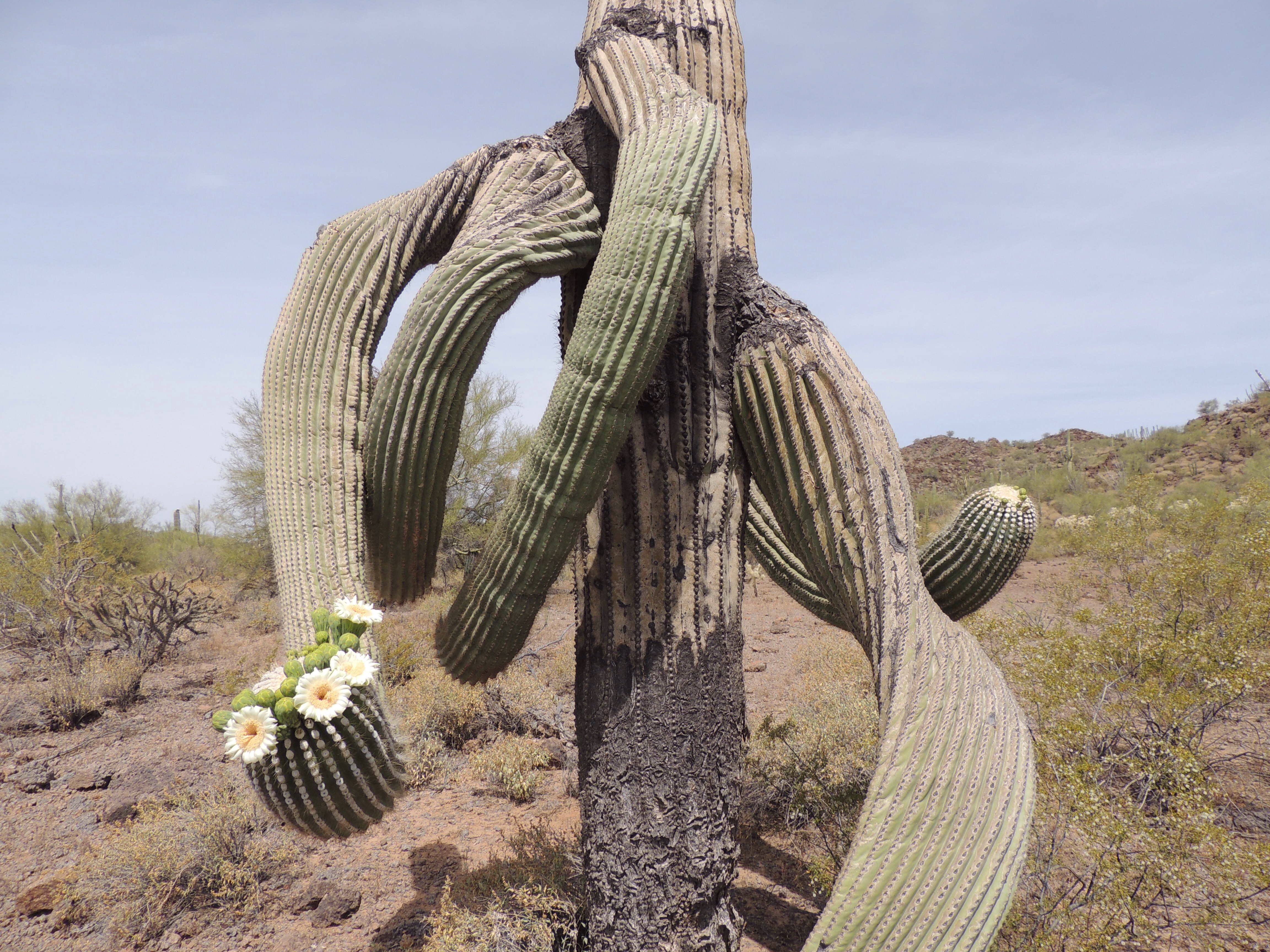
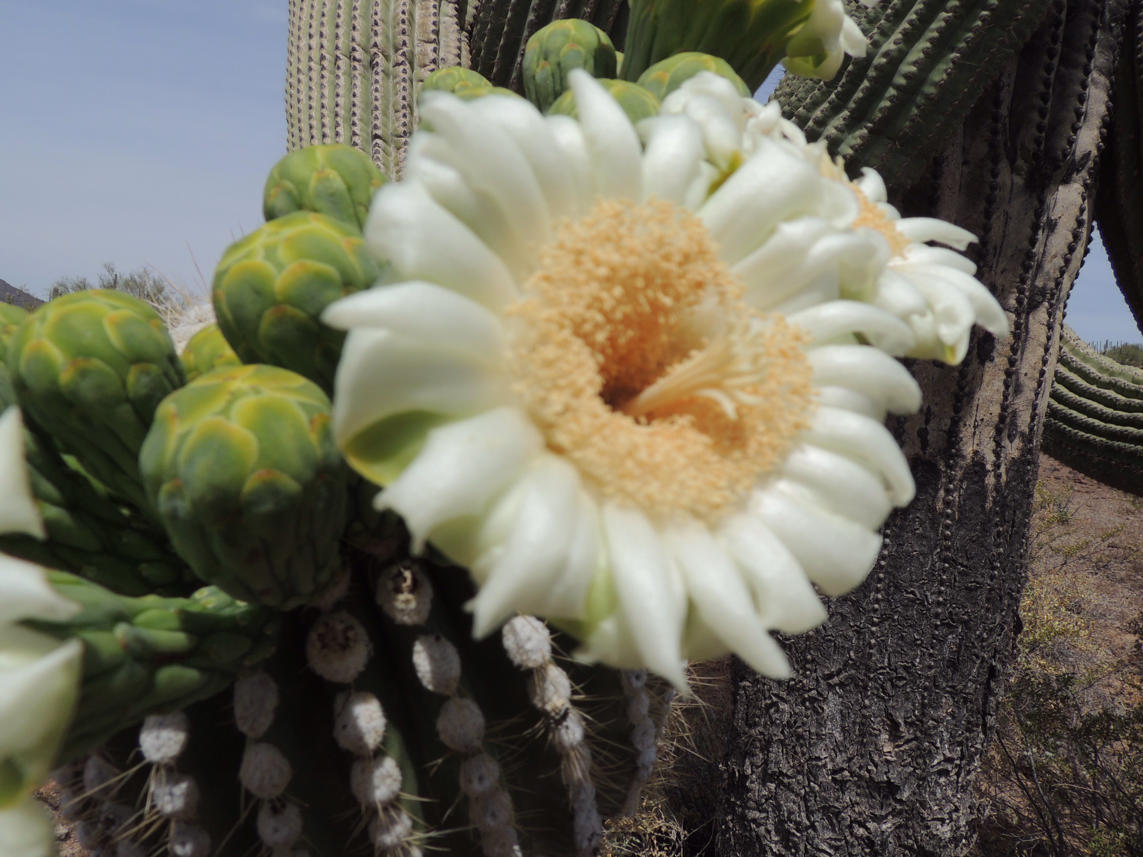
May 15-21, 2019  –  Kaibab Plateau and Page, Arizona

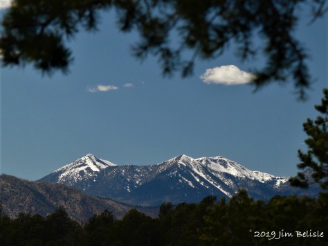
One thing we had paid little heed to in planning our trip west was our ability to adapt to the altitude.  Our winters in Melbourne Beach, Florida are spent at a whopping 10 feet above sea level.  So when we arrived in Santa Fe a mere 8 days after leaving the Florida coast, we found that were struggling with the 7000 foot-plus altitude gain.  Diana woke up with a terrible headache, and we were both having a difficult time breathing.  Throughout the trip we were up and down the mountains, so we drank plenty of fluids and tried to follow the advice for adjusting to altitude.  Bryce Canyon was tough at 7700 feet, but we dropped to 3200 feet at Hurricane, Utah and were OK again.  Our next stop was Jacob Lake, just north of the Grand Canyon.

IMG_2538 (2)

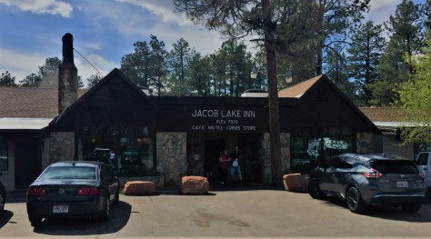
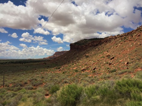
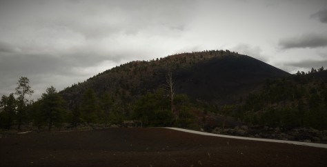
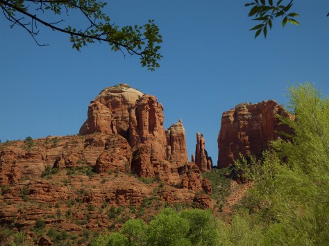
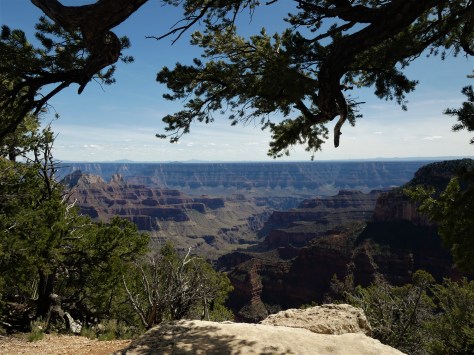
The sign on the front of the Jacob Lake Inn says it all.  We set up camp about 1/4 mile away, just shy of 8000 feet.  We figured we would go to the North Rim of the Grand Canyon the next day, so we took the advice of the volunteer at the Kaibab National Forest Visitor Center and went to see the nearby Vermilion Cliffs overlook.

P1010690 (3)

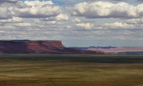
Our jaws dropped at the vista before us!  The wide open House Rock Valley stretched out for miles.  Highway 89-A angled across it, beckoning us to explore it…so that’s exactly what we did.  We ended up driving all the way to Marble Canyon, stopping at Navajo Bridge to see if we could finally see a California Condor.

P1010696 (2)

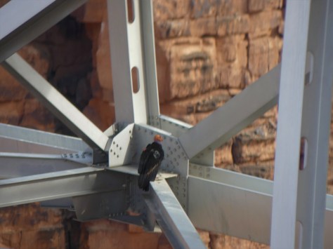
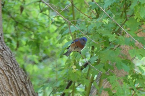
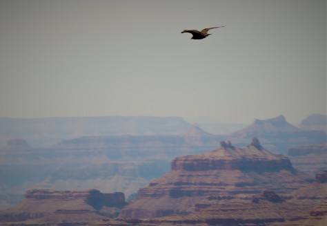
From the old bridge (now a pedestrian crossing), we finally were able to see what we were looking for.  Since these birds were so close to extinction, wildlife experts have put wing tags and radio transmitters on them to identify and keep track of them.  This one is labeled as H9, and she was sitting underneath the new bridge. We stayed as long as we could watching two adults and a juvenile, then headed back to Jacob Lake before sunset.

The next morning, I woke with a headache that was as bad as any migraine I had ever experienced.  Diana immediately knew what was going on, as she had felt the same way in Santa Fe. We knew we needed to get to a lower elevation, so we made some quick changes and headed to Page, Arizona two days earlier than planned.  A mere 43 miles from the North Rim of the Grand Canyon and we drove away from it. We took the long route running through Kanab and Big Water, as this would allow us to see the the last of four visitor centers for Grand Staircase-Escalante National Monument.  As we traveled at the lower altitude, I began to feel better.

IMG_2543 (2)

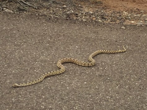
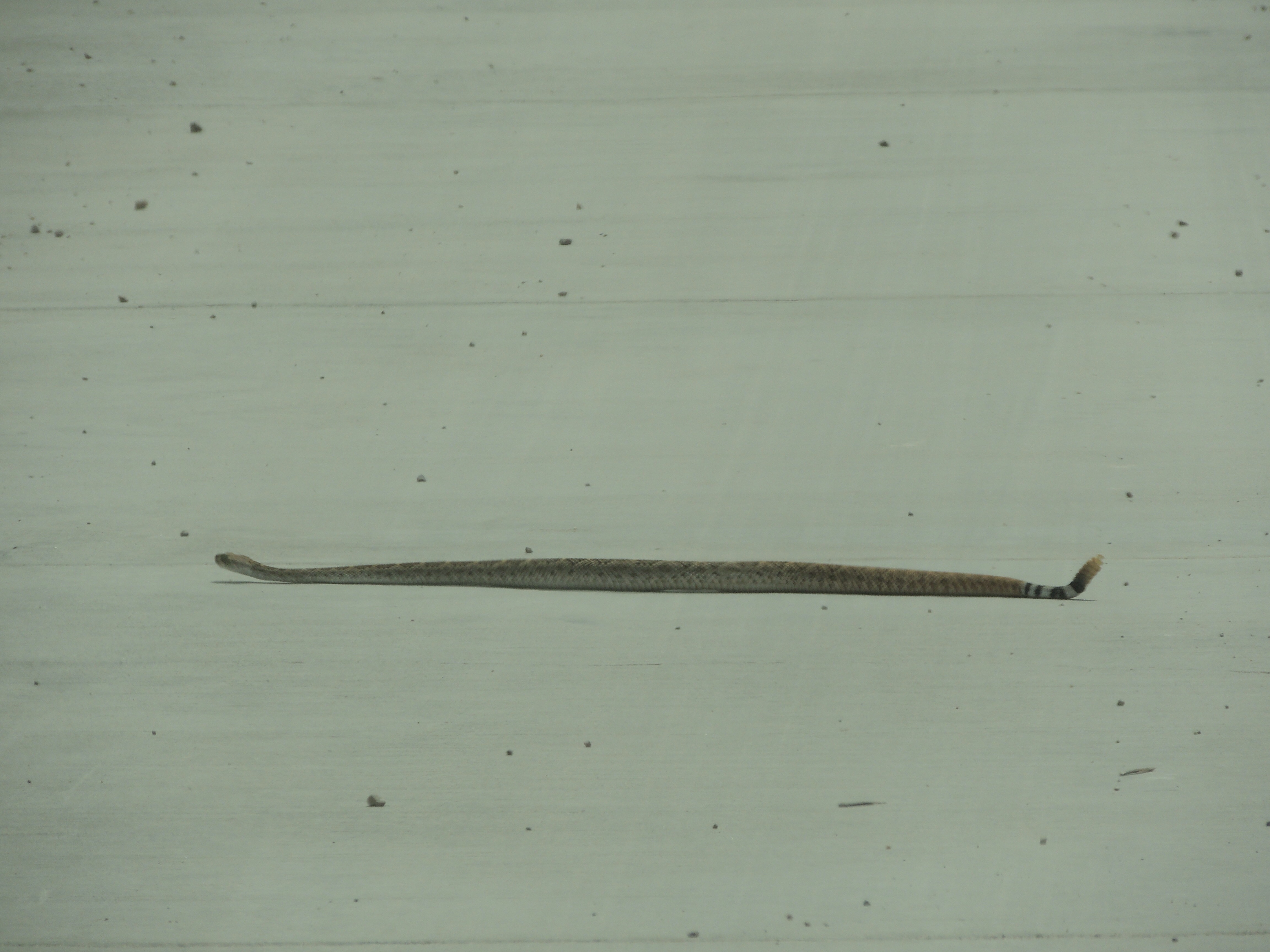
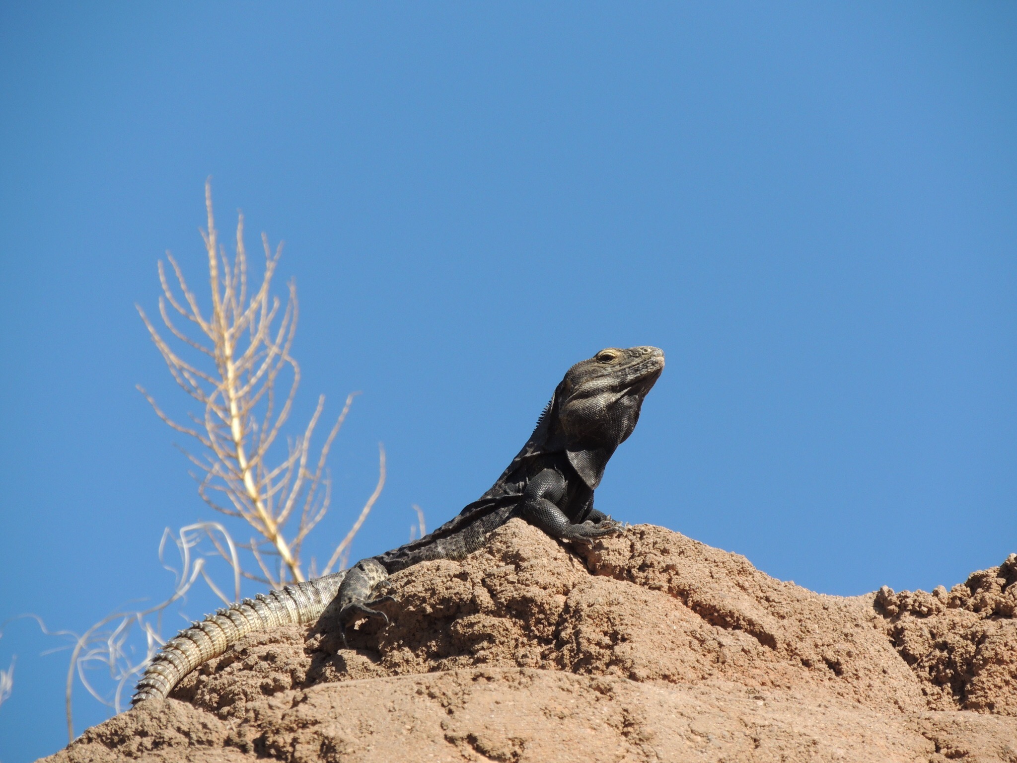
On the way into the Big Water Visitor Center, Diana spotted this beautiful bull snake.  We were first introduced to these amazing reptiles by Ranger Mariah in 2017 at Prineville, Oregon.  It’s always good to see them, as they have a tendency to keep the rattlesnakes away.

Once at Page, we readjusted the remainder of our trip to include campsites at lower altitudes.  For us, the trigger seemed to be sleeping, as less oxygen is taken in then.  Once we had that taken care of, we were off to see the sights!  First place we wanted to see was the much talked about Horseshoe Bend.  We’ve had many friends who have ventured to this place, parked at the trailhead, walked to the edge of Marble Canyon and peered into the abyss at the 270 degree bend of the Colorado River.

IMG_2110 (2)

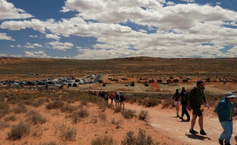
Things have changed this year.  The City of Page owns the land people were parking on, so they built a paved parking lot, complete with fee booths.  The lot is already being doubled in size to accommodate the huge crowds.

IMG_2129 (2)

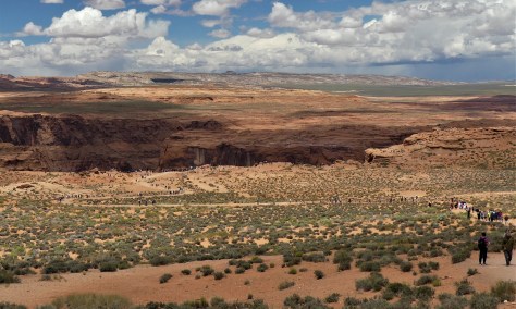
Look closely: that’s a huge parade of visitors! The idea of so many people being so close to the edge of a sheer drop off wasn’t comforting to us, as all it takes is one person to bump into another and send them on a free fall.  We had heard that the National Park Service, who oversees the rim of the canyon as part of the Glen Canyon National Recreation Area, had made some changes of their own this year…so we decided to take a look for ourselves.

P1010727 (2)

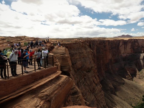
Here is that change…an accessible viewing platform with railing.  Works for us!  There are still plenty of places available to stand along the unguarded rim and snap an Instagram selfie.  Just note that people have died here are a result of venturing too close to the unguarded edge.  And what is it that all these people are looking at?

IMG_2124 (2)

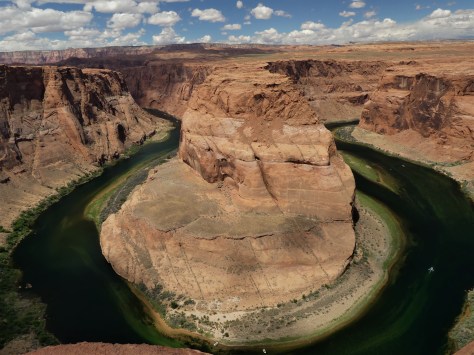
It’s Horseshoe Bend!  Those little white things on the river are boats. Definitely an amazing sight that was worth seeing, but the massive amounts of people are a detriment to this place…us included.  We are glad we saw it for ourselves this one time, but we will respectfully leave this unique feature for others to discover in the future.

Our next stop was Glen Canyon Dam and Lake Powell.

P1010739 (2)

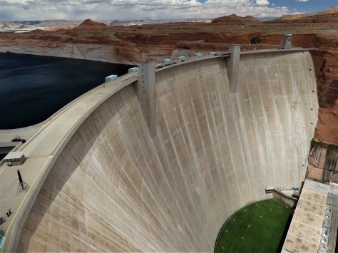
As we walked through the exhibits in the visitor center, we saw a display about seepage.  Unlike Hoover Dam which is anchored to granite,  Glen Canyon dam is anchored to Navajo sandstone.

P1010822 (2)

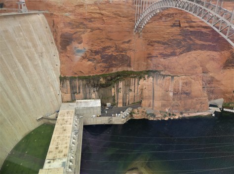
That green line is vegetation growing in the seams that the lake water is leaking through.  Several of them extend down the canyon on both sides.

P1010826 (2)

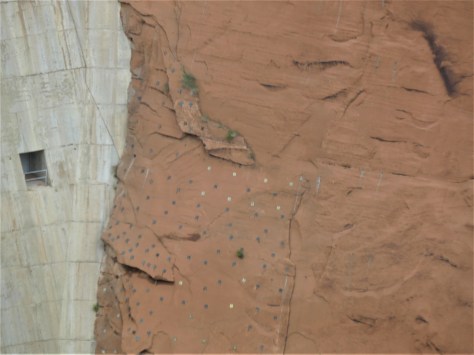
They’ve even had to put long bolts in the sandstone to keep it in place.  This is an ongoing process.  The more I read about this dam, the less I wanted to be around it.  Meanwhile, the water level continues to drop in both Lake Powell and Lake Mead (behind Hoover Dam), due to ongoing drought conditions. If the water behind this dam drops another 90 feet, it stops generating power.  If by some miracle the lake fills to capacity, there is a chance it might give way, as it nearly did in 1983 (read about it HERE).  There are many people who are proponents of filling Lake Mead first and just bypassing Glen Canyon Dam.  It will be interesting to see what the future holds.  One thing is for sure: it won’t be status quo forever.  Mother Nature always has the last word.

Next thing up was a tour of Antelope Canyon.  We have a lot of friends who have toured the upper and lower sections of this beautiful place, so we were looking forward to going there.  The day of our reservations was windy and raining.  This tour requires sunlight to make it worthwhile, and thunderstorms are a no-no in a slot canyon.  We weren’t able to reschedule.

Oh my…so was Page a wash for us?  Absolutely not.  We found Big John’s Texas BBQ!  The place was far better than the two places we ate in Amarillo, so we visited there twice. 🙂  And with some time on our hands, we decided to take a little 150 mile one way day trip…

P1010771 (2)

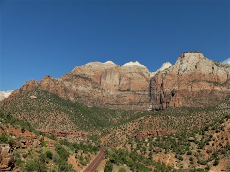
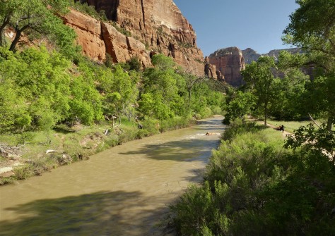
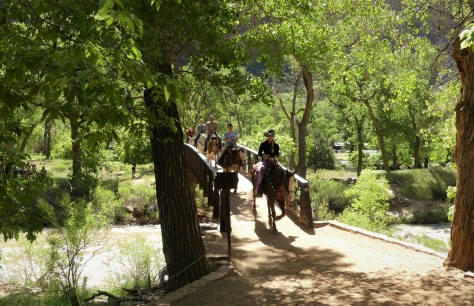
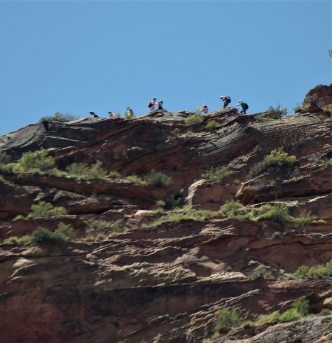
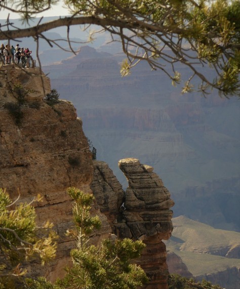
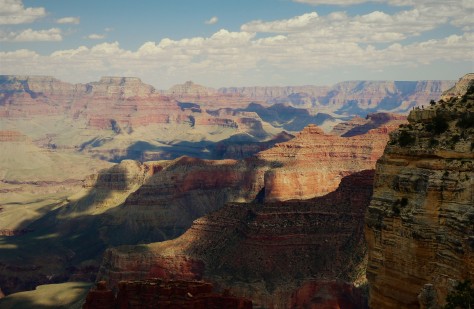
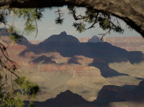
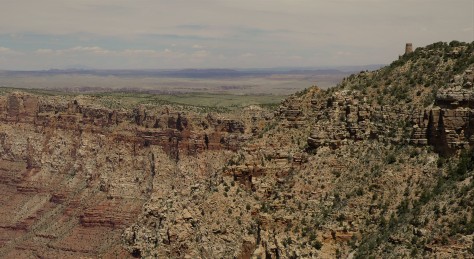
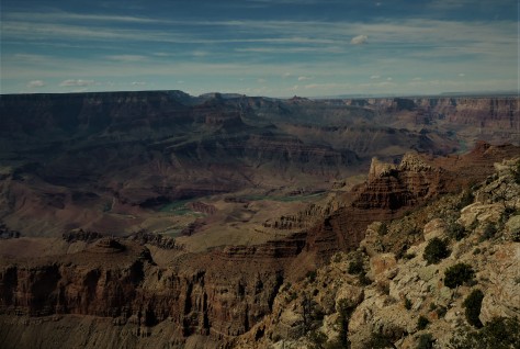
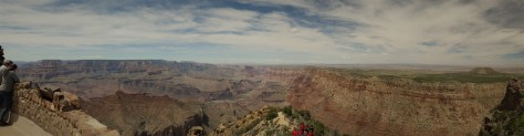
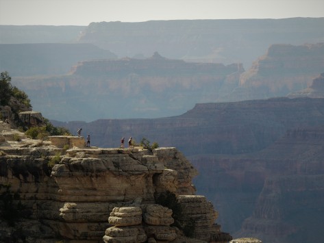
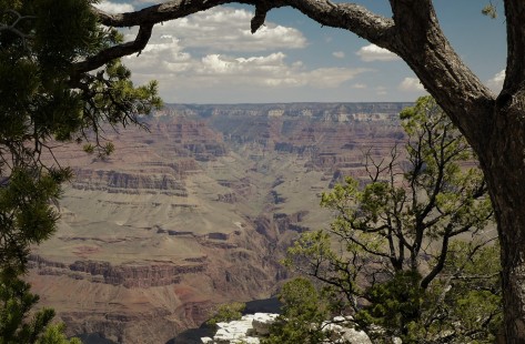
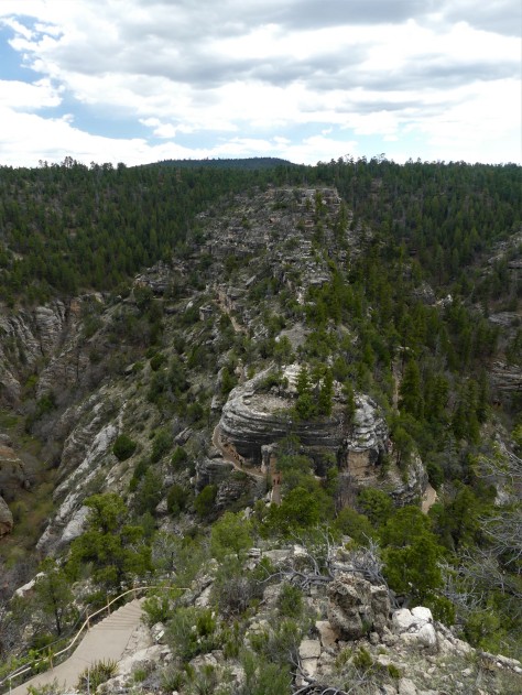
…to the North Rim of the Grand Canyon.  We figured that if we didn’t sleep there, we would be fine…and we were.  Our time was spent at the lodge and the nearby Bright Angel Point trail. Unfortunately, we weren’t able to visit many of the remote views off of the National Forest roads on that day, as many were still closed due to snow or winter damage.  We did, however, enjoy the meadows along Highway 67 on our trip in from Jacob Lake.  And our dinner at the Jacob Lake Inn was delicious! The Kaibab Plateau and North Rim deserve much more time.  Perhaps we will day trip from Kanab in the future, a much shorter distance than Page.

Speaking of that trip from Page, it had two awesome benefits.  We were able to traverse House Rock Valley again along the Vermilion Cliffs in both directions and…

P1010795 (2)

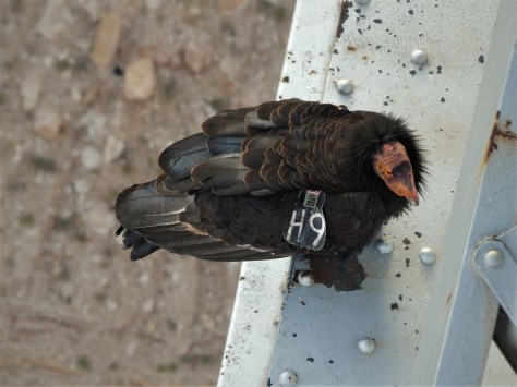
…we were able to visit our old friend H9 again.  This time, she was immediately below the pedestrian bridge deck, so I could photograph her much closer.  I keep my shutter on silent, as I learned in Oregon that the noise disturbs the wildlife.

P1010815 (2)

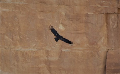
We even watched the juvenile fly a few times, which was a great thrill for us.  Adult condors have an outstanding 9-1/2 foot wingspan!

P1010820 (3)

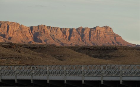
As the sun set on the Vermilion Cliffs, we were happy that our visit to Northern Arizona ended so well.

Next up:  We head east and north to visit relatives and friends along the Front Range of Colorado.  There was even a couple of unexpected surprises. Be sure to stay tuned for that in our next post.  Until then, safe and happy travels to all!


The Path to Zion

Hurricane, UT – May 11 through 14, 2019

The path to Zion is described by Miriam-Webster as a journey to a spiritual place or nirvana, in reference to Mount Zion in Jerusalem.  Anyone who has ever been to Zion National Park in Utah can see what the Mormon pioneer Issac Behunin was thinking when he named the area.  It is one of the most beautiful places we have ever seen, rivaling Yosemite Valley in California and Icefields Parkway between Banff and Jasper, Alberta.  Our path to Zion took us on a southerly route into Arizona, as a late winter snowstorm had damaged the switchbacks on the Utah tunnel route on the east side of the park in March.  Our original plans to stay in Mt. Carmel were changed to a campground in Hurricane, Utah at that time.  The road has since been repaired, but our camping plans were set so we didn’t change them.  Our hidden bonus was that we would get to explore Pipe Spring National Monument along the way.

Pipe Spring is a gem of a park, in that it keeps a piece of history alive that would otherwise be forgotten.  It is here, along the vermilion cliffs that border Arizona Highway 389, that water flows from a hillside into an area that today seems to be otherwise devoid of moisture.  Once an area of verdant grasses and plentiful wildlife, this thin length of land lies between the Grand Canyon to the south and the cliffs to the north.  It is known as the Arizona Strip, as it is cut off from the rest of the state by the canyon.  With the arrival of the Mormon settlers the delicate balance that supported the grasslands was disrupted, as their cattle overgrazed the area and destroyed the soil.  When the Paiute Indians were kind enough to show the settlers the spring, the Mormons promptly built a fort over it to claim it for themselves.

IMG_2492 (2)

That stone fort still stands to this day.  The park service has done an excellent job in preserving the building and interpreting what happened here.

IMG_2490 (2)

The spring itself bubbles up underneath the floor beneath this organ and is channeled via pipe to the other side of the fort. This allowed for indoor plumbing and, as the water from the spring ran under the floor, it cooled the home.

IMG_2498 (2)

That pipe empties into this wooden trough in the basement of the building on the east side of the fort. This was a root cellar and had an area for making cheese. They had plenty of milk for making cheese, as the Mormons often paid their tithe with dairy cattle.

IMG_2512 (2)

From there, it empties into a pond outside the walls. Since a 1933 agreement, the water flow from the spring has been evenly divided among the National Park service, the tribe, and private cattlemen.

IMG_2514 (2)

Another point of interest to note are the telegraph poles and wires outside the fort.  Pipe Spring was the first telegraph office in Arizona.

Our visit, while short, provided a fascinating look into the struggles between the settlers and the native people.  This park is well worth spending a few hours to explore, if you are passing through on this route.  While the parking lot is large enough to support a couple of large RVs, consult a satellite view on Google Maps to decide for yourself whether or not to bring your RV there.

Once we reached Hurricane, we set up camp at WillowWind RV Park.  As Midwesterners, it was divine to see real grass and trees again!  They even allowed us to wash our vehicles, a rarity in this water-starved region.  The town itself received its unusual name when Erastus Snow, the leader of a group of Mormon surveyors, had the top blown off his buggy by a strong desert wind.  He declared the place to be named Hurricane Hill.  We found it to be a great town to use as a base camp for visiting Zion National Park.

Our first priority was hooking up with our friends, Nancy and Bill.

05 (2)

We were introduced to this charming couple by David and Sharon when we were in Myrtle Beach last year, and we hit it off right away.  They offered to show us the east side of Zion in their Jeep, which meant we were going to see the tunnel after all!

IMG_1900 (2)

The road leading to the tunnel was beautiful.  The native name for this area is Mukuntuweap, meaning either straight canyon or straight up mountains, depending on the source.  William Howard Taft declared this to be Mukuntuweap National Monument, but the Mormons complained loudly and the acting National Park Service director at the time bowed to their pressure and changed it.  No matter which name is used, either one describes this place perfectly.

Once we passed through the mile long tunnel, we came to one of Zion’s unique features…

IMG_1873 (2)

…Checkerboard Mesa.  This sandstone hill is unusual in that it not only has its horizontal layering lines, but also has vertical cracks, believed to be caused by expansion and contraction.

After lunch, the four of us headed to the end of the canyon and hiked Riverside Walk, a trail that leads to the Narrows.  That last trail was closed, as the water level was too high in the Virgin River.

IMG_2060 (2)

Our mode of transportation to get there was the Zion Shuttle, a bus and trailer combination that is unlike any system we had seen at other parks.  It was fast, efficient and rarely over-crowded.  The tilted roof vents funneled the canyon air in, which kept us cool.  The secret to their system is that they don’t have to compete with other vehicles, as the parks roads are closed to traffic during most of the year.  There also is a lot of them, so there isn’t a long wait at the bus stop. Do take into account that we were there before Memorial Day; chances are that it is busier during the summer.

IMG_1916 (2)

Nancy pointed out this beautiful waterfall at the Temple of Sinewava.  This is an emphemeral waterfall, in that it only appears after a rainstorm.  The following day, it was gone.

06 (2)

We thoroughly enjoyed our day with Nancy and Bill; we will see you two down the road. 🙂  Thanks for the Jeep tour and the great day!

Our next day saw us arriving early…a key to getting a space in the Visitor Center parking lot.  From there, we used the shuttle to explore the rest of the stops in the canyon.

IMG_1987 (2)

This huge Fremont Cottonwood tree at the Zion Lodge is over a century old.  As big as it is, it pales in comparison to the height of the canyon walls.  From the lodge, we hiked across the river to Lower Emerald Pool.

IMG_1988 (2)

From the bridge, it is apparent how swift the river was running.  Due to trail damage, the trail didn’t go beyond Lower Emerald Pool.

IMG_2013 (2)

Still, the view from here was amazing.

IMG_2021 (2)

The trail continued behind the waterfall…

IMG_2025 (2)

…to the place where the rockfall occurred.  This isn’t Disney, folks.  Glad no one was on the trail when this happened!

IMG_2037 (2)

When we got back to the bridge, we had a bit of a traffic jam.  Still another example of the different ways to enjoy Zion.

Once back at the lodge, we headed up the Grotto Trail.

IMG_2046 (2)

This cabin was built in 1924 to house the park museum.  It now is housing for the artist-in-residence, and is the oldest building in Zion.

IMG_1985 (2)

The Grotto was also a good place to see wildlife, including this bluebird.

From there, we went to Weeping Rock, which is a formidable wall of dripping sandstone.  The thing that stood out at this location was not so much the wall itself, but the view of the canyon the trail afforded.

IMG_2056 (2)

This is one of the best overall views of the valley that doesn’t require a significant vertical hike.  Had it not been for others wanting to see this same view, we could’ve stood here all day long.  🙂

To round out our visit, we continued on to the shuttle stop at the Temple of Sinewava, a place we had visited the day before with Nancy and Bill.  Our reason for this visit was because we had heard there were California Condors frequenting the area.  You may recall that we had been trying to see them at the Grand Canyon.  While we did see some large birds soaring here, we determined them to be turkey vultures.  Will we ever see a condor? Obviously not here, but what we did notice was the traffic jam 900 feet up on the Angel’s Landing trail.

IMG_2062 (2)

At this point, the trail is only a few feet wide and it drops off the same distance on the other side.  Note that there isn’t a railing, only a chain to hang on to…and it is a two way trail.  Again, this isn’t Disney, folks….although this hike would definitely be considered to rival Space Mountain.

IMG_2070 (2)

This fellow observer was as interested at the spectacle far above as we were.  We had no plans to join in that fun, but we did view a friend’s outstanding video afterwards where they hiked Angel’s Landing in November a few years back.  In it, Jim had a GoPro mounted above his head looking downward that shows just how narrow this trail is…including the shuttle stop I took my photo from.  You can access their YouTube video by following this link: Vertigo Inducing Video of Angels Landing Hike in Zion National Park .  Again, this trail is not for someone with a fear of heights.  Jim and Barb picked a great time to do it, in that it wasn’t crowded that day.

Our path to Zion was worth the effort it took to get there, and we will make it a point to return to this amazing place someday. The place the Native Americans call Mukuntuweap is one of our favorite destinations on this trip.

Next up:  Our trip plans get shuffled, due to another run-in with altitude sickness.  More on that in our next post, so be sure to stay tuned for that.  Until then, safe and happy travels to all!

Grand Canyon – Southern Style

Some places are so grand, they require two separate locations to access them from.  Such is the case with Grand Canyon National Park, with its North and South Rim units.  Even then, the canyon extends well beyond the park boundaries into Native American lands for a total of 277 miles in length.  In this post, we will detail our visit to the Grand Canyon National Park South Rim unit.

Diana was at the park in her youth, and I flew over it once on our way to Las Vegas.  From 32,000 feet, it looks a bit flat.  That was not the case this time.

IMG_1269 (2)

We were awestuck as we walked up to the rim for our first glimpse.  The words I was trying to use to describe it would not come out of my mouth.  They certainly were not needed, as Diana was feeling every bit the same as I was.

IMG_1231 (2)

The depth and enormity of what we were seeing was breathtaking.  We were not alone in feeling that way.  People from all over the world were there to take in the enormous vistas.  No matter what language they were speaking, their excitement was being expressed with the same excited tone.  🙂

IMG_1364 (2)

It is difficult to comprehend that this grandest of canyons was carved by a river.

IMG_1262 (2)

The clouds moving overhead made for a constantly changing scene, as their shadows moved across the canyon floor.

IMG_1387 (2)

At the eastern end of the park, Desert View Watchtower marks the beginning of the uplift that the Colorado river had to carve through to create the cataract.

IMG_1406 (2)

California Condors are known to frequent the area, as are turkey vultures.  It was difficult to identify which of the two this bird was, but it was fun to watch it take advantage of the updrafts and soar through the sky.

IMG_1415 (3)

In all, we walked more than 5 miles along the south rim; sometimes alone and other times with people we had just met.  We had never seen so many people from so many cultures who were just really glad to be in a particular place.

IMG_1403 (2)

No matter the viewpoint, the scenery before us was outstanding!

IMG_1221 (2)

Some people scrambled beyond the barriers for a closer view.  This activity isn’t recommended, and has actually turned deadly on more than one occasion already this year.  Hopefully these kids made it back safely.  Even behind the railings, we found ourselves staying back a step.  That’s a long way down!

At this point, I want to recognize the recent passing of Diana’s Uncle Bob.

IMG_0236 (2)

Uncle Bob was always a pure joy to be around.  Any story that he delivered usually had us in stitches.  He was a huge supporter of us being on the road and he loved to hear about our travels, telling us how much he’d liked to have done what we are doing.

IMG_1322 (2)

Well, this one is for you, Bob.  You would love it here. Hop up in the front of my new Ford and enjoy the ride.  It is going to be Grand!

Next up:  We head on up to Utah to explore the many parks in that state.  There is quite a bit that we plan to explore, so be sure to stay tuned.  Until then, safe and happy travels to all!

There Really IS an Arizona

A number of years ago, we visited the Rock and Roll Hall of Fame in Cleveland, Ohio.  As we walked into the lobby, my country music-loving sweetheart heard the guest artist Jamie O’Neal performing her country hit There is no Arizona.  Diana was giddy, to say the least, to hear a country artist performing in the shrine to artists like Lennon, Dylan, the Rolling Stones and so on.  As we waited in line for tickets to the museum, the lyrics and melody filled the atrium:

There is no Arizona

No Painted Desert, no Sedona…

Well, after what we’ve seen over the course of this last week, we beg to differ, Jamie. 🙂

IMG_2301 (2)

From the moment we arrived in Springerville, Arizona for a one night stopover, we knew it was going to be a great week.  Looking back east from a fairly nice sunset revealed this surreal moon rise.

We continued on to Petrified Forest National Park where we spent a few nights.  We scored a nice campsite at the Crystal Forest Museum just south of the park that gave us 30 amp electric for only $10 a night.

IMG_1017 (2)

At first glance, the old cars with the flat tires in the parking lot gave us pause.  We found out they parked them there a long time ago to make the place look busy.  I guess its time to either update the cars or at least air up the tires.  🙂

IMG_0897 (2) (1)

Petrified Forest was outstanding.  The southern end of the park was filled with logs that had been turned to stone after being buried for millions of years.

IMG_0902 (2)

This particular one was huge!  There is a photo in the visitor center with Albert Einstein and his wife standing next to it.

IMG_0933 (2)

Although the outside of the tree looks like bark, that is actually stone.

IMG_0953 (2)

Halfway through the park, we came to Blue Mesa.  Taking the trail, we hiked down into an area that appeared very much like the painted hills we saw in Oregon a few years ago.  Not quite blue, but very interesting to look at!

IMG_1013 (3)

At the north end of the park is the Painted Desert Inn.  This is a restored Civilian Conservation Corps era building that is very interesting to tour.

IMG_1010 (2)

Behind it is…you guessed it…the Painted Desert!  Guess Jamie O’Neal was wrong about that one!  Wow…it was absolutely beautiful.  It seemed like it went on forever.

From Petrified Forest, we moved on to Meteor Crater.

IMG_1029 (2)

This giant hole in the ground was caused by a 150 foot long meteorite that hit here 50,000 years ago.  It was estimated to have been travelling at 26,000 miles an hour.  Pretty impressive, to say the least.  Equally as impressive was the interactive visitor center.  This entire facility is privately owned, and kudos to the owners for offering a prime visitor experience.

While at the adjoining Meteor Crater RV Park, we drove back into Winslow to visit one of Rock and Roll’s other shrines…

IMG_1066 (2)

…the corner, from the Eagle’s song Take it Easy.

IMG_1059 (2)

Its my girl, my lord, by a flatbed Ford, taking a good long look at me!

IMG_1048 (2)

We also checked out the La Posada Hotel.  We had a fabulous lunch in the hotel’s Turquoise Room.

IMG_1050 (2)

The lobby was pretty, but the ‘death art’ on the walls was a bit much.  Turns out the hotel owner is the artist.

IMG_2993 (2)

I did my best to plunk out Hotel California….

From there, we moved west to Flagstaff for a few days.  The town got its name when some men stripped the branches and bark from a Ponderosa pine tree in 1876 and flew an American flag from it.

IMG_1081 (2)

We visited two parks in the area while we were there.  The first was Sunset Crater National Monument.  This cinder cone is part of a chain of volcanic features that dot the area. IMG_1086 (2)

This feature was called a squeeze up, which occurred when the molten rock was squeezed out of the earth like Play Dough.  As it cooled, it sagged under its own weight.

IMG_1124 (2)

We also visited Walnut Canyon National Monument.  This park features a trail, seen above, that descends into the canyon.

IMG_1114 (2)

Once down there, the path winds past several ancient cliff dwellings.  It was interesting to see the protection the overhanging rock offered.

eZy Watermark_25-04-2019_06-36-56AM (2)

From the rim, there was a nice view of Humphrey’s Peak and it’s neighbors.  Humphrey’s is the tallest peak in Arizona.

On our final full day in Flagstaff, we headed south to meet fellow blogger Ingrid from Live Laugh RV. We have followed her blog since 2014.  She has a similar camera to mine, and she offered to drive up from Phoenix to meet us and give me a few camera tips.  We met in…

IMG_1143 (2)

…Sedona!  Again, we’ve proven Ms. O’Neal wrong.  🙂

IMG_2985 (2)

While Ingrid and I were shooting photos of the scenery, Diana was shooting photos of us.  🙂

IMG_2984 (3)

Here we were taking photos of the cairns near Budda Beach.

IMG_1176 (2)

I managed to focus on this fly sunning itself on top of one of the cairns.

IMG_1191 (2)

I learned a lot about my new camera, thanks to Ingrid.  Hopefully that translates to better photos in the future!  It sure was a pleasure to finally get to meet her in person.  🙂

And Sedona?  It was beyond words.  We were amazed at every bend in the road.  We are happy to report that there IS a Sedona, a Painted Desert and most importantly, an Arizona.  All are beautiful and a pleasure to explore.

Next up:  The Grand Canyon South Rim!  Until then, safe and happy travels to all!

Organ Pipe and a Low Tire

After leaving Tucson, we made a quick hop over to Ajo, Arizona to see Organ Pipe National Monument.  Seeing that this was one of our shorter travel days at 136 miles, we thought we would do a little exploring after we set up camp.  As we started to drive away from our campsite, the tire pressure warning indicator came on in the Escape.  Well, Ajo isn’t exactly a booming metropolis, so we asked the campground owner where we could find a tire store.  They suggested the used tire shop down the street.  The business consisted of a well worn building filled with old equipment and a bevy of used tires.  It was run by an older Hispanic gentleman and his wife, who happened to be eating their lunch at a combination desk/kitchen table/parts counter.  I immediately could sense that this guy had been here for years and knew his stuff.  😉. He jacked the car up, took the wheel off and proceeded to dunk it in an old claw foot bathtub filled with dirty water.  It didn’t take long before he found the leak, which actually was from a failed patch that we had done in Kentucky.  He explained that it was too close to the sidewall and would never hold long term, so I had him plug it and went off looking for a new tire.  There was a Napa parts store close by and he explained to me that the closest tire dealers were in Phoenix.  After a few phone calls, I located an identical Goodyear SR/A at a Goodyear store in Goodyear, Arizona, of all places. So off we went on an 80 mile journey to Goodyear.

After paying for the tire, I couldn’t help but ask Nile the store manager if there was a connection between the town’s name and the tire company.  He explained that the city was named after the business, and that the store we were standing in was one of the first Goodyear tire stores.  He showed us an old photograph on the wall of the building in its early years, which looked like not much more than a 1920’s era gas station.  Over time, it had morphed into the full service auto center it is today. Back in 1916, Goodyear purchased a large amount of land in the area to grow cotton, which was used in tires back in those days.  

They eventually build this aerospace facility there, which manufactured blimps and airframes.  All of this amazing history we might have never known, were it not for that low tire pressure warning!   We drove the 80 miles back to Ajo, making what was our shortest travel day of this trip our longest. 😊

The next day, our friends Jeanne and Keith drove down from Mesa, so we could explore Organ Pipe National Monument together. We met them at the 2014 Fall RV Dreams Rally and had lunch with them last April in Junction, TX. It was great to see them again! Our first stop was at the Kris Eggle Visitors Center.

It was named for National Park Ranger Kris Eggle, who was killed in a shootout in the park with Mexican drug smugglers in 2002.  Kris was a Cadillac, Michigan native, and was previously a ranger at Sleeping Bear Dunes.

Stocked up on information, we set out to explore the park.  We chose the 21 mile Ajo Mountain Drive as our first trip of the day.

It didn’t take long before we found a crested Organ Pipe cactus…

…and our second Western Diamodback rattlesnake of the trip!

This double arch was perched high up on a mountain ridge.

This unique Saguaro caught our eye also.  

The blooms were close enough to get a good look at.  Amazingly, a bee had descended into this bloom as I prepared to take this photo.  It completely disappeared into the flower!

Along the way, we saw this unusual outcropping.  What does it remind you of?

After the Ajo Mountain Drive, we decided to go down and take a look at the border.

Wow.  This was not the friendly border we had experienced in Big Bend last year.

At a few points, the border fence snaked up the hillsides.  After driving a few miles along it, we decided we had seen enough.  We headed back to Ajo to check out a little more of the town.

We toured the Immaculate Conception Church, with its colorful stained glass.  We also visited the town plaza, although most of the businesses surrounding it were empty.  

That didn’t matter, as we had a great day with Keith and Jeanne!

Next up: California.  Stay tuned to see what we discovered!

———-

How to ride the blimp and also search our Amazon link here!
———-

explorRVistas is a participant in the Amazon Services LLC Associates Program, an affiliate advertising program designed to provide a means for sites to earn advertising fees by advertising and linking to Amazon .com. Shopping through our link does not add anything to your cost, but it does help support this blog. Thank you for shopping through exploRVistas!


 Saguaro Serendipity

Diana and I have seen a huge chunk of this continent, but we had never seen a Saguaro cactus (pronounced sa-WAH-row) until this past week.  As we drove into the Sonoran Desert on I-10 in Arizona, they began to appear along the roadside.  Diana likened them to cartoon characters and my mind immediately went to the Peanuts comics, in which Snoopy’s brother Spike always seemed to be surrounded by them.

We were concerned that we were going to arrive in Tucson too late for any hiking or meetups, as it was getting too hot, the snakes were out, and all of our blogging buddies had headed north. After we set up at Mission View RV Resort, I decided to see what was happening online.  I noticed that Steve and Mona Liza from Lowe’s RV Adventures had posted that they were still in town, even though they were supposed to have moved on. Although we had followed their blog for years, we had yet to meet them. Well it turns out that Steve found out he had cancer that required surgery.  We contacted Mona Liza and said we would like to meet them, if they were up to it.  I explained that I was a 7 year cancer survivor, and was doing well. She replied that Steve was in the hospital recovering from his surgery, but she would love to meet us.  We set up a time to meet for dinner the next night.  

The next morning, we were up early to try to beat the heat.  Our destination was the Arizona-Sonora Desert Museum.  This facility is a combination of zoo, botanical garden, art museum, aquarium, and aviary.  It was recommended to us by several people, and we figured it would be a good introduction for us to the unique Sonoran Desert.  While we aren’t on board with caging otherwise healthy mammals, we thought the other aspects of the museum were well done and helpful.

The desert blooms were absolutely beautiful.

This spinytail iguana kept watch over the surroundings.

The butterflies were enjoying the spring blooms.

The museum had a great hummingbird aviary.  This is a species called Anna’s Hummingbird.

And just to prove this was more than just a zoo, a Western Diamondback rattlesnake slithered across a very busy pathway in front of us!

One thing we learned after getting to the Sonoran desert was that the Saguaro cactus normally bloom in May.  Most winter RVers miss this, as they typically move north before the cactus show their flowers.  As luck would have it for us, the blooms appeared early this year!

The bees were hard at work pollenating them.  Each individual bloom is open less than 24 hours before it closes to begin the process of becoming fruit.

Even the doves enjoyed a soft place to land!

After we finished at the museum, we went to Saguaro National Park West.  We picked up our Not-So-Junior Ranger book so we could learn more about the park.  Seeing that this park has an east and west unit, we saved the bulk of the exploration for our trip to the east unit the next day.  We headed back to Tucson and met up with Mona Liza.

What a fun and energetic person to spend an evening with!  We went to dinner with her at a funky little outdoor restaurant called La Cocina.

She cracked up after she caught me trying to take a photo of her listening to the band.  We had a great time, and it was good for all of us to get together and talk.  Here’s hoping Steve’s recovery will go smoothly and we will all enjoy a meet up in the future.

The next day, we checked out Saguaro National Park East.  We took the 8.3 mile Cactus Forest Loop Drive into the foothills of the Rincon Mountains.

Remember the cartoon characters?  “These flowers are for you, my dear!”

And check it out…we became Not-So Junior Rangers!  Thanks to Gaelyn at Geogypsy for tipping us off to this great program.  It makes exploring the parks that much more fun!

Next up, we head to Ajo!  Stay tuned for that adventure!

———-

Here is our link for our exploRVistas Amazon search
———-

explorRVistas is a participant in the Amazon Services LLC Associates Program, an affiliate advertising program designed to provide a means for sites to earn advertising fees by advertising and linking to Amazon .com. Shopping through our link does not add anything to your cost, but it does help support this blog. Thank you for shopping through exploRVistas!