Category Archives: South Carolina

Serendipity Along the Grand Strand

Have you ever been put somewhere by what seems like sheer luck?  Maybe it’s that, or maybe it’s meant to be.  We had that situation last May when we were put in a campsite next to a guy who I had a Facebook friend request into for ages, as we had 11 friends in common.  Turns out our now great friend Rick wasn’t big on checking his Facebook account.  🙂  Neither of us had any connectivity at the campground we were at on the Oregon coast, and our mutual friend Tracy (who figured out we were both there) was frantically trying to get in touch with us.  By the time she did, Rick had met us…even though we hadn’t made the mutual friends connection yet.  Thinking back, it was as if we were supposed to be there.

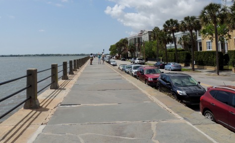
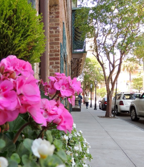
Such was the case on April 16th at Myrtle Beach State Park in South Carolina.  We really didn’t have any plans for what we were going to do once we got there, only that we wanted to see what the place known as the Grand Strand looked like.  We pulled in and got ourselves set up and prepared to settle in for the evening.  As I kicked back in my recliner, I could see a Bighorn fifth wheel passing by.  A few minutes later, I saw the back of it peeking out from behind the motorhome next door.  The woman that was helping direct the rig back looked really familiar to me.  I thought ‘Hmmmm….that looks like Sharon’, a fellow RV-Dreamer who we had yet to meet.  Before I could totally grasp that thought, her husband David popped into view.  Neither of us had any idea the other was going to be coming to Myrtle Beach. Here were two people that we had long wanted to get to know, placed just two campsites away from us.  We had been following their blog Two Lanes of Freedom for years, as they had with ours.  Dumb luck?  We choose to think it was more than that.  We were out of the rig and headed over to meet them in a flash!

They recognized us right away.  🙂  We talked for a bit and then called it a night, as we were all tuckered out from traveling. The next day, they invited us to go to Brookgreen Gardens with them, as they were meeting longtime RV-Dreamers, Bill and Nancy there.  Oh my goodness…two more people we had wanted to meet!

z4

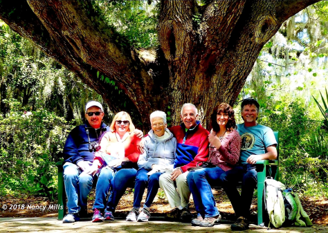
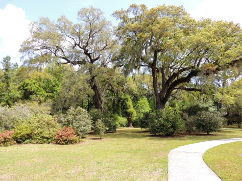
Here we are gettin’ cozy on a park bench.  We slowly wound our way through Brookgreen’s trails, admiring the sculptures, landscaping, and animals.  All the while, we were learning more about each other.  🙂

z7

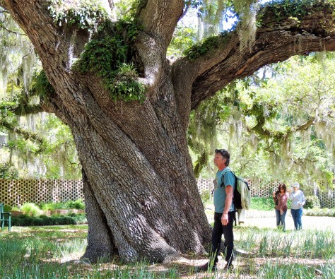
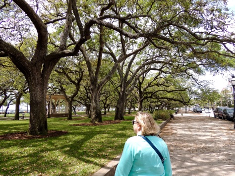
Here’s David admiring the gardens from the shade of a huge Live Oak tree.  Nancy and Sharon are in the background.

z6

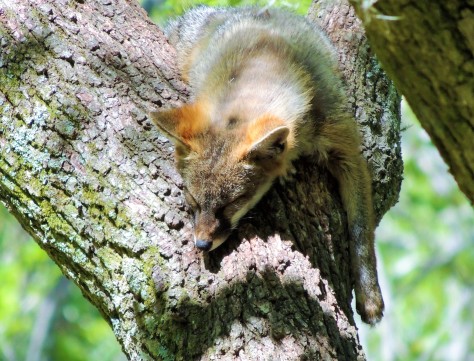
This red fox had other plans for the lazy afternoon.

z9

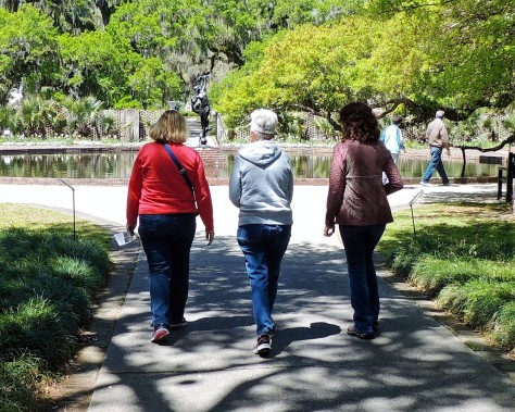
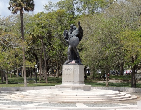
Diana, Nancy, and Sharon are headed towards a sculpture of…

z8

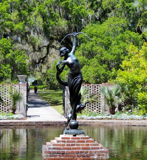
Diana of the Chase.  This amazing work was created by Anna Hyatt Huntington in 1922.  She and her husband, Archer Huntington, founded Brookgreen in 1931 on four former rice plantations.  Close to 1500 works are displayed throughout the gardens.

z1

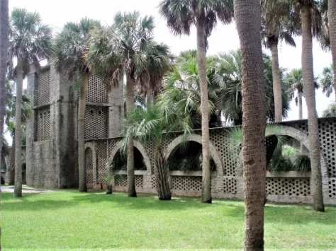
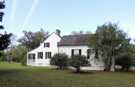
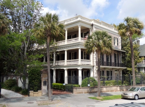
Their former winter home, Atalaya Castle, is located across US-17 in what is now known as Huntington Beach State Park.  Anna had an indoor and outdoor studio in the home.  She kept live animals in the courtyard, so she could study their muscle structure as they moved about.  What an amazing day with Bill, Nancy, David, and Sharon!

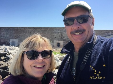
The next day was a beach day for Diana and I.  The temperature climbed above 80, which was perfect for putting our toes in the sand….except when the wind would shift and the cooler ocean air would roll in. David and Sharon stopped over for a bit, and we made plans for a campfire that evening.

z2

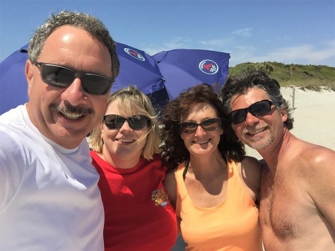
They were wondering who the couple was all bundled up on the beach, when they realized it was US!  Hey, our Michigan blood has thinned to a Florida viscosity.  🙂  That night we enjoyed a nice campfire and some excellent company, complete with several songs from David and his guitar.

The next morning was our travel day, but not before a sunrise meetup on the beach.

z5

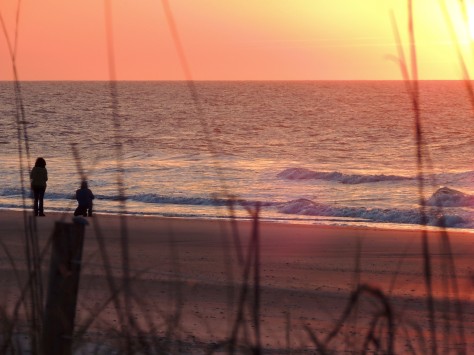
I spotted them taking photos, so I took a few of my own.  We all headed back to camp, and Diana and I packed to leave. As we stopped by to say our farewells, David greeted us with his guitar.

z3

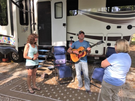
He sang us one of his ballads to see us on our way.  What a fitting and perfect ending to our time together.  Travel safely friends, we will see you down the road!


Charles Who?

As we were exploring Charleston, we kept coming upon a name that sounded familiar to us:  Charles Pinckney.  That was due in large part to our Michigan lineage, as there is a town in the Wolverine state named Pinckney.  I remember it well, as I did a 50 mile bicycle ride there one day with some friends.  After some research, it turns out that the South Carolina Pinckneys appear to not be related to the Michigan clan.  But who was this Charles Pinckney, and why does he have a national historic site in his honor?  Well, it turns out that there were several people by that name in Charleston.  In this post we are going to focus on the one who is honored at Charles Pinckney National Historic Site.

z2

Charles Pinckney (October 26, 1757 – October 29, 1824) came of age in a wealthy family as the people of the English colonies in America prepared to declare their independence from Britain. As a young man he fought in the Revolutionary War.  He was captured during the battle of Charleston and was taken prisoner until after the war ended.  Over his career, he was a four term Governor of South Carolina, a U.S. Senator, a U.S. Representative, and an ambassador to Spain.  But his biggest claim to fame was as a member of the Continental Congress when the U.S. Constitution was drafted.  On May 29, 1787, he submitted a plan to the convention that was called the Pinckney Draught.  It was similar in many ways to the Virginia Plan, calling for the following:

  • Three branches of government: Congress, Judicial and Executive branches.
  • A separate House and Senate.
  • A President shall inform Congress the conditions of the nation (State of the Union).
  • The President shall be Commander-in-Chief.
  • No state shall coin money, establish tariffs, keep troops, or enter into a treaty.
  • Only the House shall have the power of impeachment.

He also exclusively came up with the idea that no person should be held to a religious test to hold any elected office in the United States.

Eventually, ideas from all of the plans presented were woven into what became the United States Constitution.  Pinckney spoke often during the convention that was responsible for the creation of the instrument, and his signature is on the final document.

So how did his country plantation become a national historic site overseen by the National Park Service?  At first glance, the answer to that is a bit confusing…as the 1820’s era home that occupies the site was built by a subsequent owner.

z3

It turns out that the property had been sold to developers in the latter half of the 20th century.  Most of the original 715 acre estate was turned into a golf course, homes, and such.  US-17 even runs through it.  When the builders began to prepare the final 28 acres for development into 42 individual home sites, a group of local preservationists led by two women came to the rescue.  In 1986 they negotiated a $2 million purchase price, and proceeded to raise the money to cover it.  In 1990, they donated the property to the National Park Service.  The park opened to the public in 1995.

z4

The grounds are beautiful, with several paths winding through the property.  Over 150,000 artifacts have been unearthed from the site, along with the foundations from the original buildings.  The visitor center has many displays regarding Pinckney’s life of service, several of the found artifacts, and an interesting display on the Gullah culture along the lower Eastern seaboard.  Gullah is a language developed by the slaves that has an English base with West African influences.

z5

A fantastic example of the language is this Bible they have on display.  The English translation is on the sidebars.  I found it mesmerizing.  They actually let visitors page through it.

As with our other recent National Park visits, we completed our Junior Ranger books and earned our badges.  Having to search the displays for answers really makes sure we read each display carefully.  While the Charles Pinckney National Historic Site wasn’t a major attraction, we were glad we made the effort to go there.  We now have an appreciation for the man and his contributions to our nation.  As we see his name in the future, we will have a better understanding of who he was and where he came from.

Next up: A serendipitous assignment of campsites in Myrtle Beach.  Be sure to see the amazing meetup that resulted from that, and the friendships that came about as a result!  🙂

A Harbor Well Protected

Charleston Harbor is home to one of the most significant historic sites in the nation; Fort Sumter.  This massive brick structure at the entrance to the harbor saw the first shell of the Civil War explode above its walls. With that said, there are other historic military compounds around the perimeter of the harbor…each having significance in their own unique way.  Come on along as we tour these fascinating locations and find out the importance each one holds.  We even found a few surprises along our path!

Fort Sumter

z30
© moultrienews.com


Fort Sumter was not the first defense built in Charleston Harbor, but it was by far the most imposing.  Built in 1829, it was intended to defend against invaders coming in from the ocean. Able to fire cannons at three levels, it appeared to be invincible.  The Confederate states needed control of this fort, in order to bring supplies into Charleston and beyond. On April 12, 1861, Confederate Brigadier General P.G.T. Beauregard ordered his soldiers to fire upon the garrison that was held by Union Major Robert Anderson and 85 men under his command.  It was a difficult decision for Beauregard, as Anderson had been his artillery instructor at West Point.  The Union soldiers were not effective in hitting any Confederate targets, as the rebel forces were spread out around the large waterway.  The flip side of the coin was that Beauregard’s men had one thing to focus on, and they inflicted heavy damage.  When the Union soldiers called a truce on April 14, Fort Sumter had been heavily damaged.  Amazingly, no one had been killed in the battle on either side.

Once the Confederates held the structure, it was the Union’s turn to try to get it back.  Several attempts were made, but the South had a firm hold on it and the harbor.  Remember the building was tall, massive, and made of brick.  By 1865, the North had pounded it with seven million pounds of artillery shells. Most of that brick fell and created a solid mound of material that was stronger than the original fort. Only Sherman’s troops approaching on their March to the Sea, were enough to cause the Confederate troops to abandon the fort.

z3

Today’s structure bears little resemblance to the original.  The fallen brick has been cleared away and the lower portion of the walls are once again in view.  The black concrete battery in the center of the fort was completed in 1899, in preparation for the impending Spanish-American War.

z7

That battery was manned in both World Wars I & II, after which point the fort was decommissioned.

z4

Little remains of the lower level casemates.

z5

The older brick against the relatively newer concrete.

z6

This massive leaning wall was knocked off kilter when the powder magazine behind it accidentally exploded, killing 11 Confederate soldiers.  The National Park Service has installed these metal supports to prevent it from moving further.

Note that access to the island is by ferry boat, either from Liberty Square in Charleston or from Patriot’s Point in Mt. Pleasant.

z1

We chose the latter, which gave us this awesome bow view of the U.S.S. Yorktown aircraft carrier as we passed by!

Castle Pinkney

z8

Castle Pinkney sits in the center of the harbor, between Fort Sumter and Charleston.  Built in 1810, it was used for six weeks as a prisoner of war camp during the Civil War.  It also housed artillery, although it is believed that a hostile shot has never been fired from there.  In 1924 it was designated as a national monument, only to see that status taken away in 1951.  It was deemed excess property and sold to the South Carolina in 1958.  Attempts to turn it into a tourist attraction failed, so the state tried to give it back to the federal government.  They declined the offer. The Sons of Confederate Veterans took over care of the island, but were unable to raise the cash to buy it.  Finally, in 2011, the State of South Carolina sold Castle Pinckney to the Sons of Confederate Veterans for the sum of $10…in Confederate currency.  The Stars and Bars of the Confederacy fly over it today.

Fort Johnson

Fort Johnson was built in 1708.  Only a small powder magazine remains at the site that actually fired the first shot of the Civil War.  The rest of the site is occupied by South Carolina Fish and Wildlife and the College of Charleston.  It is unfortunate that this prominent place in American history wasn’t preserved.

Fort Moultrie

Last, but by no means least, is Fort Moultrie.  This location has the longest history of all the Charleston garrisons, having been manned for 171 years.

z2

Located on Sullivan’s Island, this was the second defensive structure built to protect Charleston.  Due to the natural curve in the river channel, ships had to pass here before they were ever within sight of town.  Soldiers would fire a cannon to notify the townsfolk of an approaching ship.  In 1776, a palmetto log fort was constructed by Colonel William Moultrie and his men to defend against a British invasion.  They fought a one day battle that heavily damaged the enemy ships, yet little damage was done to the fort.  Turns out that palmetto logs, a member of the cabbage family, are fibrous.  The British cannonballs simply bounced off.  To add insult to injury, the American soldiers would retrieve the balls and fire them back.

During the battle, the soldiers wore hats with a crescent. The shape had the word ‘Liberty’ inscribed in it.  This was also on South Carolina’s flag.  A palmetto tree was added to the flag at a later date to signify the palmetto logs of Fort Moultrie.

z12

That symbol is everywhere throughout the state.  Coffee mugs, keychains, license plates…you name it.  At first glance, we thought the flag represented a waning moon rising or setting over a palm tree.  The crescent represents a gorget, the throat plate that protected officers’ throats at that time.  In designing the flag, Colonel Moultrie chose the the crescent and blue color to match the uniforms they wore.  So much for that romantic image of an evening walk on a South Carolina beach with your sweetheart. 🙂

Between the Revolutionary and Civil wars, the fort continued to be manned.  It is interesting to note that a young private by the assumed name of Edgar A. Perry was stationed there from 1827 through 1828.  We know him as Edgar Allan Poe.  Fittingly, the establishment we ate at on the day of our tour of the fort was called Poe’s Tavern.

Another resident of the fort at that time was the famous Seminole leader, Osceola.  He was held there by the U.S. Army after being taken prisoner under a flag of truce in Florida.  In failing health, Osceola died there in 1838.

z9

His grave lies just outside the fort gate.  The John Anderson classic Seminole Wind came to mind as we stood there.  While it is sad that he isn’t buried in Florida, it is nice that he is given an honorable grave.  Also on the property is Colonel Moultrie’s grave, which is along the shore of the cove behind the visitor center.

At the beginning of the Civil War, Major Robert Anderson was originally garrisoned at Fort Moultrie.  By 1861, the walls had gone from palmetto to being made of brick.  However, the Union commander felt it was indefensible, as the area around it had been developed with homes that looked down into it. The Confederate army took over the post after Anderson and his men left for Fort Sumter.  Fort Moultrie had one of the best positions to shell Fort Sumter, with only a mile separating them.

Like Fort Sumter, Fort Moultrie had batteries built in the late 1800’s.

z14

These were used through World War II.  A gas and bombproof building was added following World War I.

z31

Referred to as HECP/HDCP, it was a joint command post run by the Army and Navy.  The building is maintained as a museum as it would have looked in the 1940’s.  It is interesting to note that German U-boats slipped past this post and mined Charleston’s harbor at different times in the war.

z11

We had a great time exploring the forts around Charleston this week.  We even earned two Junior Ranger badges in the process!  Stay tuned for one last adventure in Charleston, along with our move up the coast.  We hope you will tag along!


Charleston, South Carolina

We arrived in Charleston, South Carolina this past Monday without a plan as to what we were going to be seeing.  Sure, we knew that this was the location of Fort Sumter, the place that received the first shot of the Civil War.  Beyond that, we knew little of Charleston’s story.  By pure luck, we opted to stay at the same KOA that our friend Kathy was working at.

z1

You may recall that we had met her while working at Amazon, and we also caught up with her in the Black Hills last September.  On this occasion, she was heading out the following day to her next KOA gig in New York…one we are staying at later in our trip.  We went out to a local pizzeria and she filled us in on a few things to see in town.

On Wednesday, our friends from Melbourne Beach Mobile Park, Brenda and Jim, met us in Charleston’s historic district.

z2

Brenda’s blog, No More Sticks and Bricks, details their journey as fulltime RVers.  Definitely check it out.  The four of us had lunch at the Brown Dog Deli, then we set out to do some exploring!

z15

All throughout the town, we saw these plates with nuts in the center of them.  They are called earthquake bolts, and they were put there following the 7.0 quake in 1886 that rocked the city.  They are rods that run completely through the buildings that help straighten the bulging walls.

z11

This is St. Michael’s Episcopal Church.  It is the oldest religious structure in Charleston, dating back to the 1750’s.   It’s graveyard  holds two of the signers of the U.S. Constitution: John Rutledge and Charles Pinckney.

z17

Both George Washington and Robert E. Lee attended services here, each sitting in Pew #43, some 70 years apart.

z14

On State Street, we found the Union Insurance building.  Back in the day, each insurance company in town also had their own fire truck.  See that seal at the top of the building?  Each insured home displayed the seal from the company they were insured by.  While all companies would respond to a fire, only the one that insured the home was responsible to fight the blaze.

z10

Jim, Brenda and Diana are admiring the Heyward-Washington house.  Thomas Heyward, signer of the Declaration of Independence, owned this home.  George Washington stayed here on his visit to the city in 1791.

z5

Twice we passed by St. Phillip’s Episcopal Church, but were unable to view the interior.  The first time, a funeral was in progress and the second time it was closed.  This building was built in the 1830’s, after fire destroyed its predecessor.  In 1861, the bells in the steeple were donated to the Confederate Army to be made into munitions.  They were not replaced until 1976.

z16

On Bay Street is this collection of houses known as Rainbow Row.  Alternating pastel colors adorn each home.  This concludes our tour of the upper part of town with Jim and Brenda.  What a fun day!

On Friday, Diana and I decided to check out the lower portion of the historic district.

z13

This beautiful building is the Circular Congregational Church.  Part of the United Church of Christ, this progressive congregation has been meeting at this site since 1681.  The current building was built after the earthquake.

z18

We also saw several of these ‘single’ houses, meaning they were only one room wide.  This allowed the sea breezes to flow through the homes.  Note the front door.  It actually opens to the porch, thereby allowing privacy for the homeowners when they were sitting outside.

z19

Overlooking the harbor is the High Battery.  Named for the artillery that was mounted there during the Civil War, this raised walkway allowed for the construction of lower Bay Street.

z20

One of the many homes across from the High Battery is the Edmondston-Alston house.  It is from the second floor porch that Confederate General P.G.T. Beauregard observed the shelling of Fort Sumter, which can be easily seen from that vantage point.

z7

Further down the street is this monument to the men of the Confederacy.  The figures are looking directly across the harbor at Fort Sumter.

z6

White Point Garden sits at the extreme south end of town.  The beautiful park has a checkered past, as Stede Bonnet and 50 of his fellow pirates were hung here in 1791.  They were left hanging for days as a successful deterrent to piracy along these shores.  It was also the site of heavy artillery during the Civil War.

z12

That wraps up our tour of the historic district in Charleston.  Next up is a tour of Forts Sumter and Fort Moultrie, both including some surprises found there that we weren’t aware of.  Be sure to stay tuned for that adventure in our next post!