Category Archives: National Monuments

The Path to Zion

Hurricane, UT – May 11 through 14, 2019

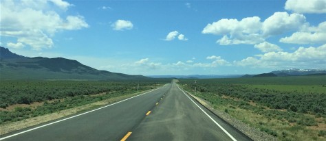
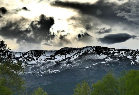
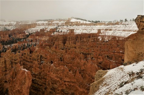
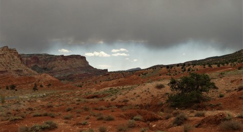
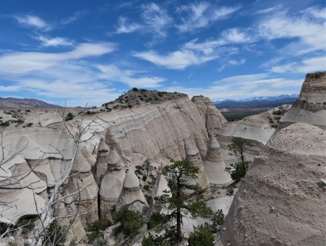
The path to Zion is described by Miriam-Webster as a journey to a spiritual place or nirvana, in reference to Mount Zion in Jerusalem.  Anyone who has ever been to Zion National Park in Utah can see what the Mormon pioneer Issac Behunin was thinking when he named the area.  It is one of the most beautiful places we have ever seen, rivaling Yosemite Valley in California and Icefields Parkway between Banff and Jasper, Alberta.  Our path to Zion took us on a southerly route into Arizona, as a late winter snowstorm had damaged the switchbacks on the Utah tunnel route on the east side of the park in March.  Our original plans to stay in Mt. Carmel were changed to a campground in Hurricane, Utah at that time.  The road has since been repaired, but our camping plans were set so we didn’t change them.  Our hidden bonus was that we would get to explore Pipe Spring National Monument along the way.

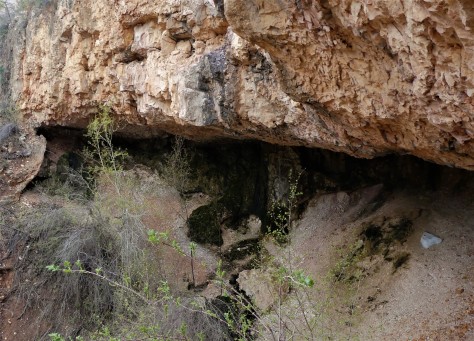
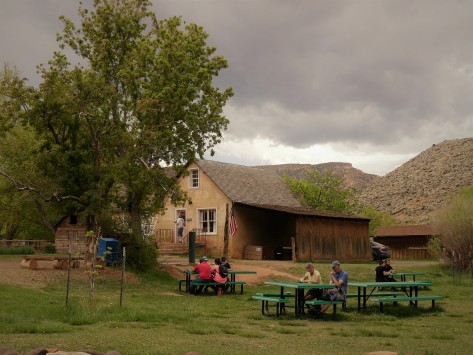
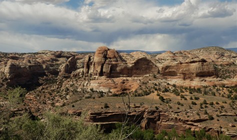
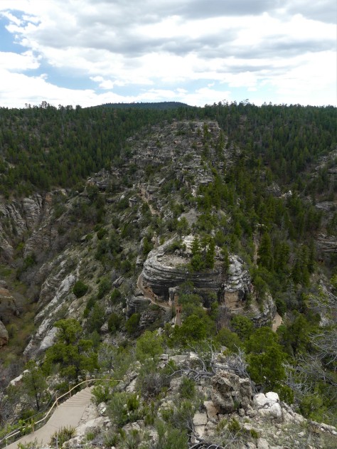
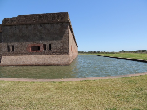
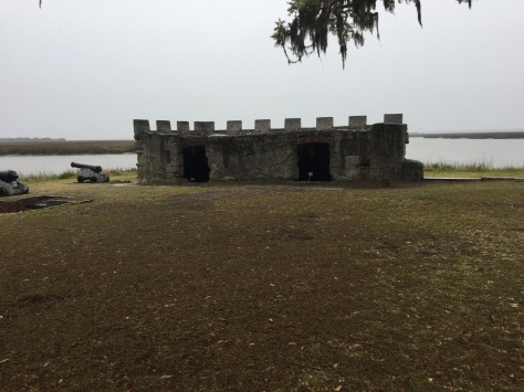
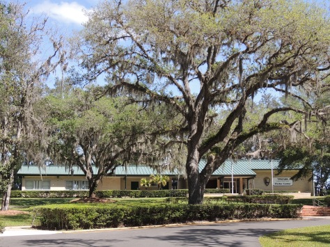
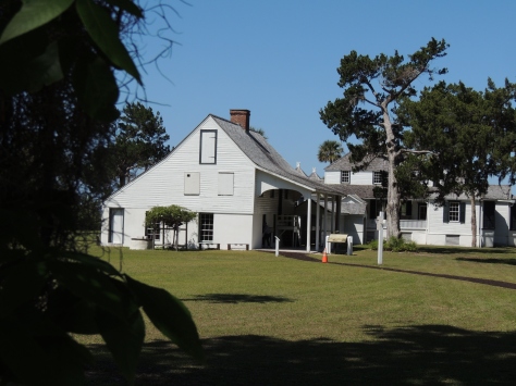
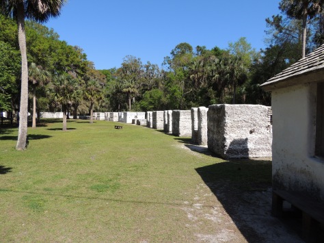
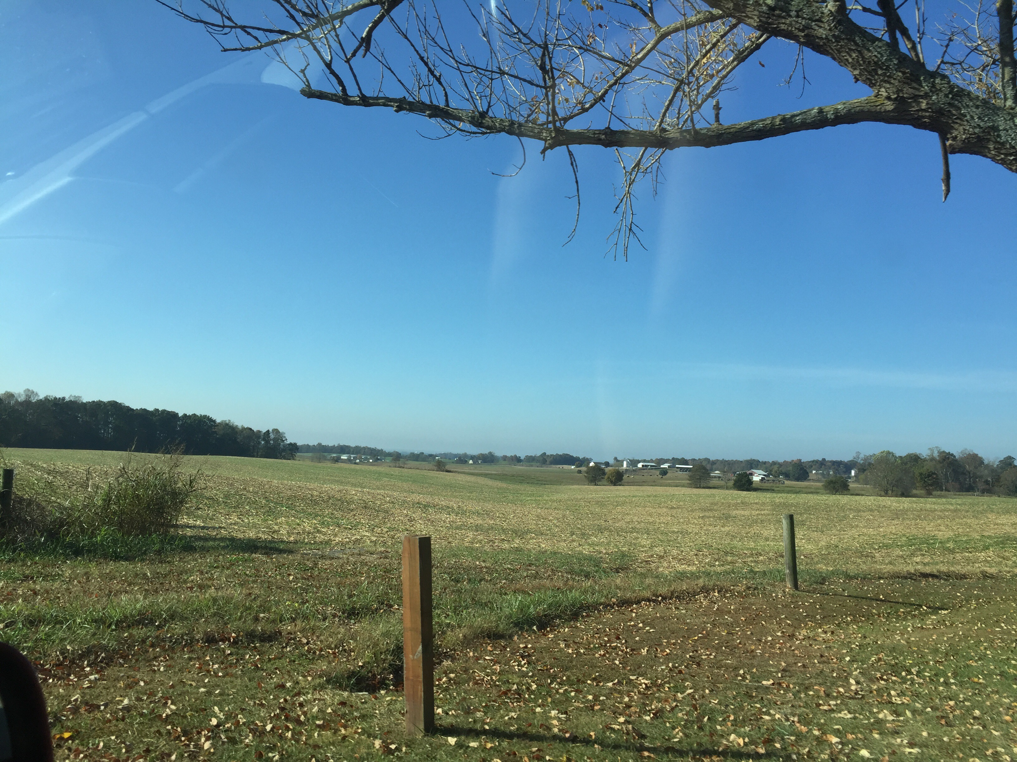
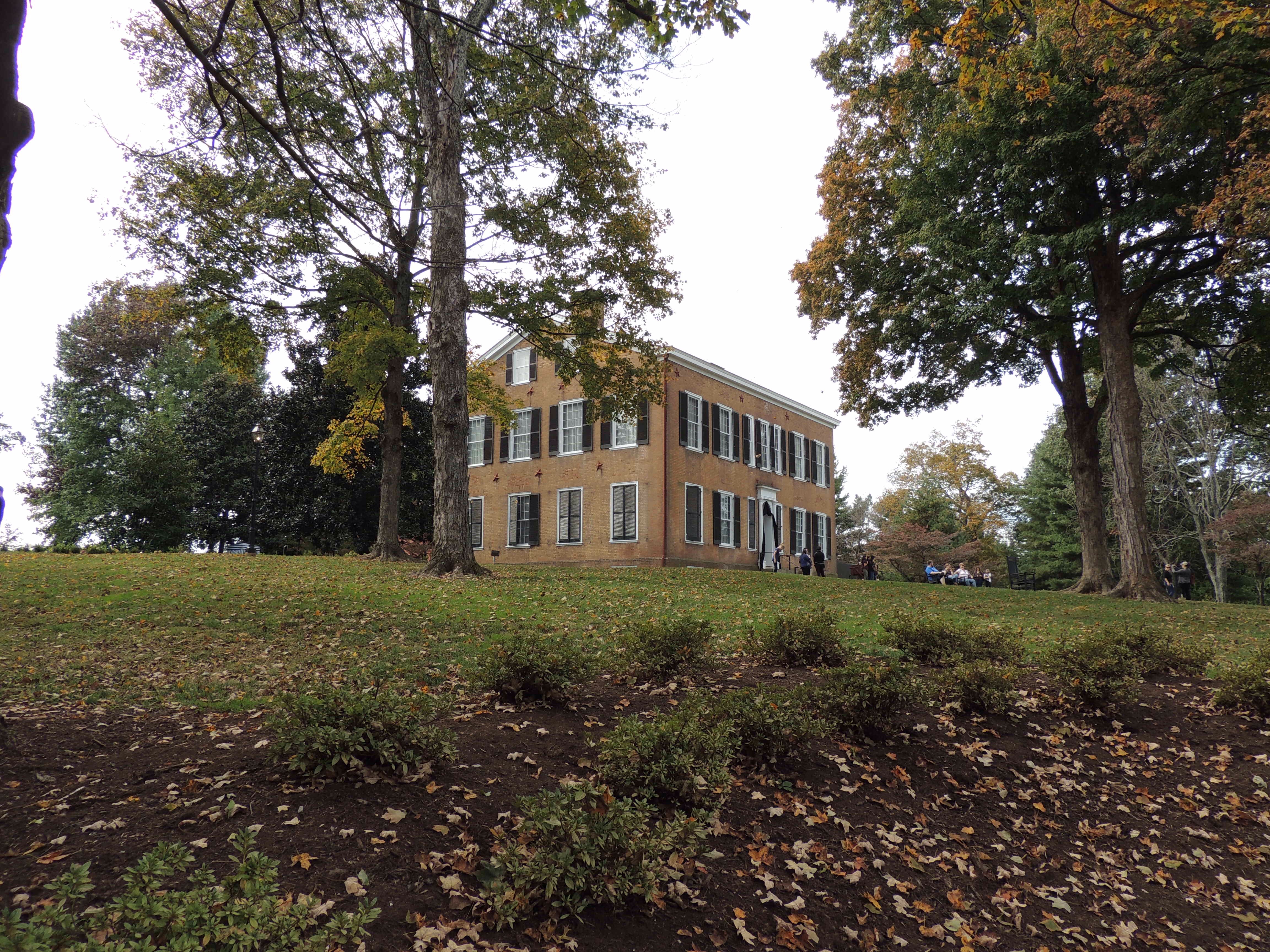
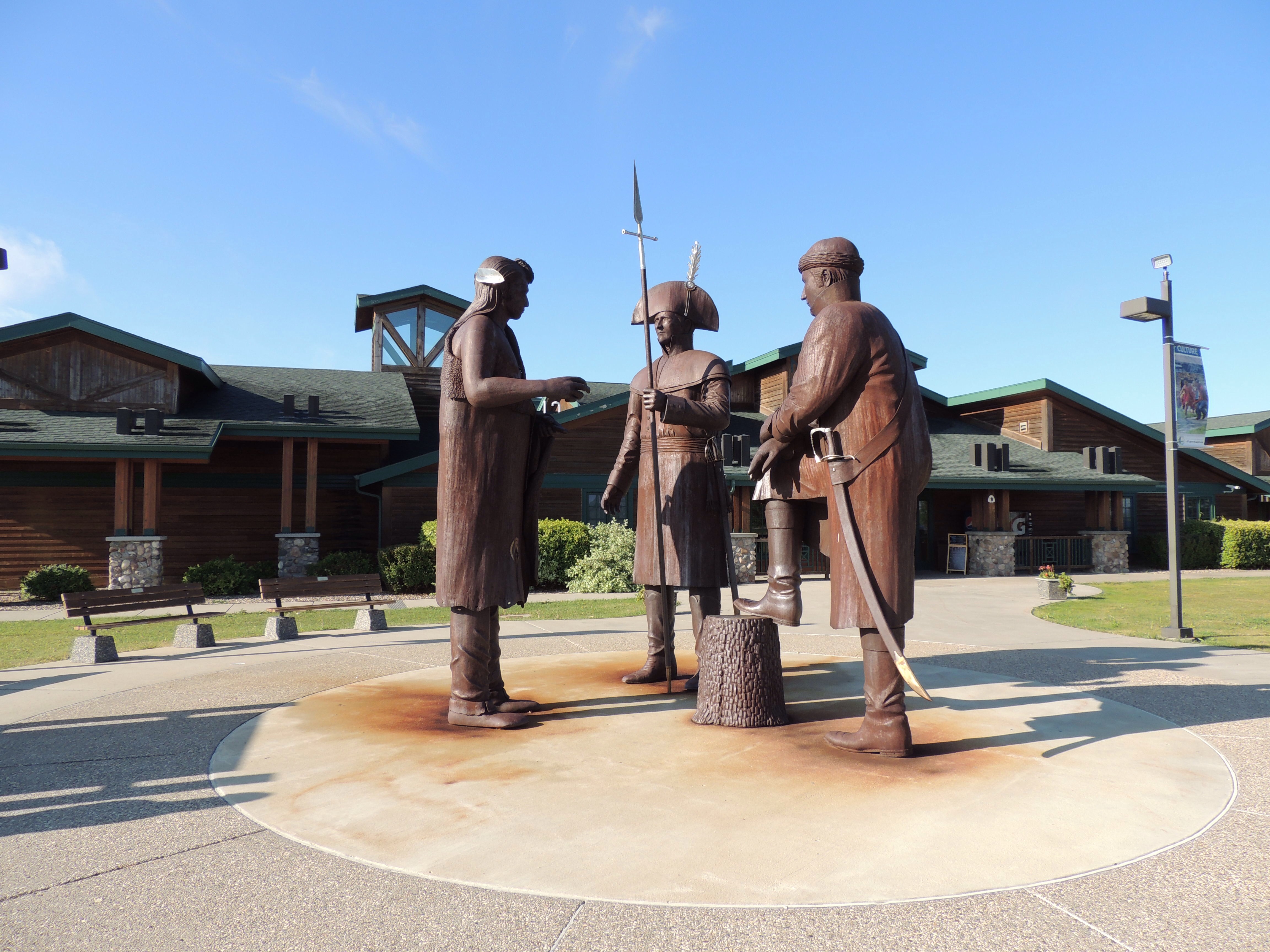
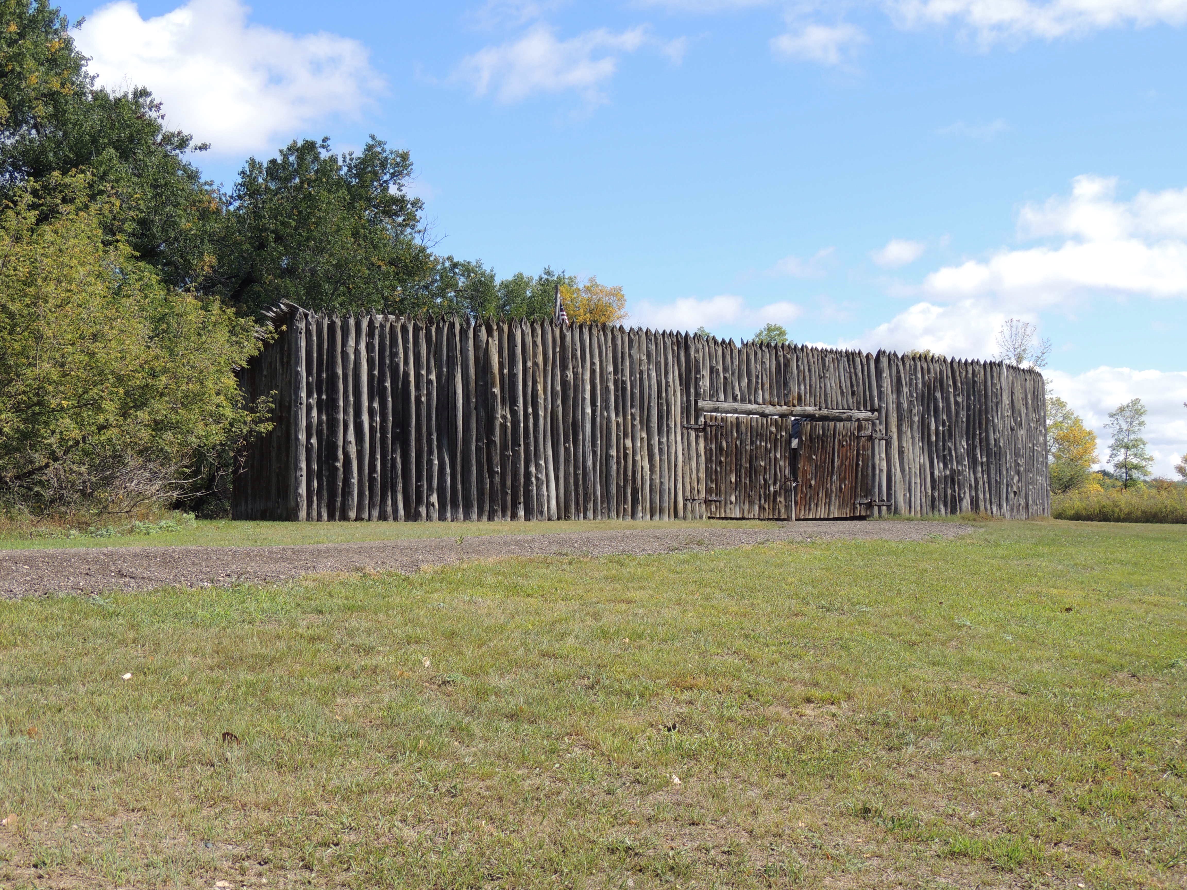
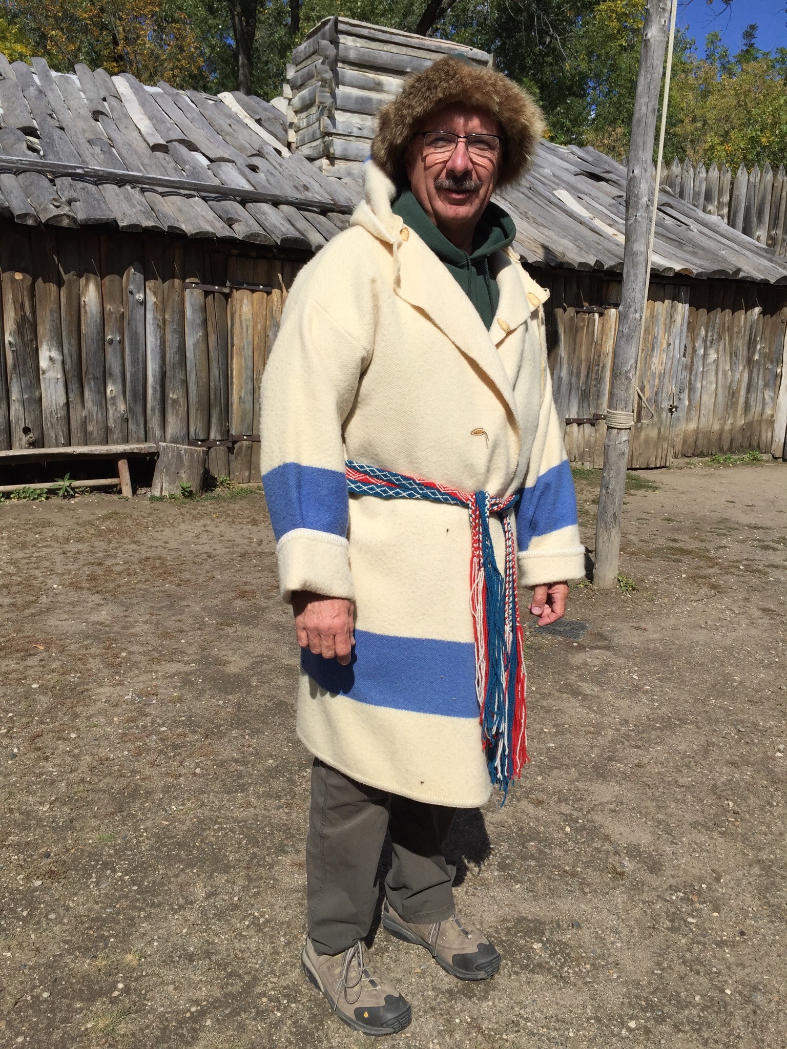
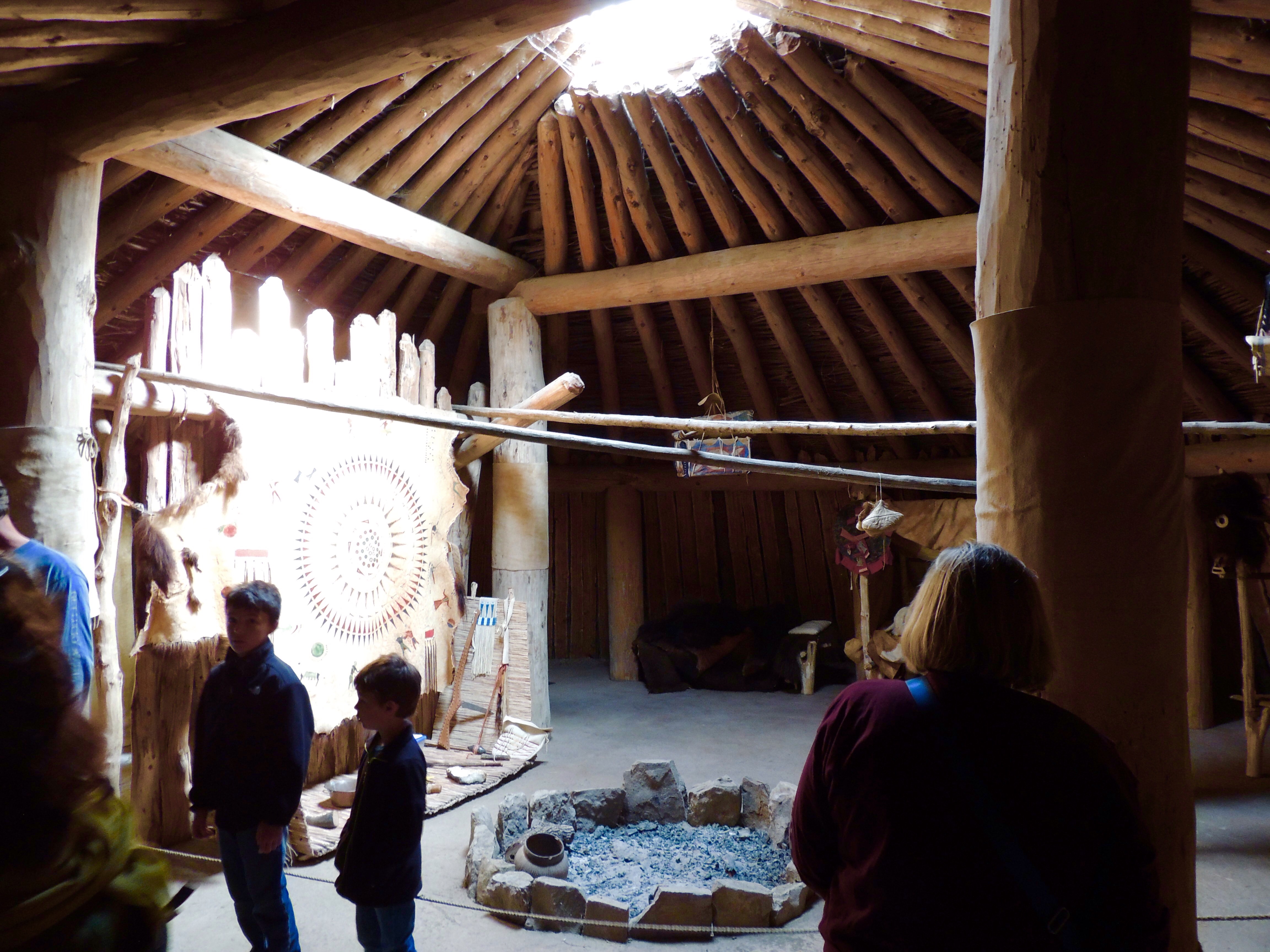
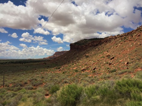
Pipe Spring is a gem of a park, in that it keeps a piece of history alive that would otherwise be forgotten.  It is here, along the vermilion cliffs that border Arizona Highway 389, that water flows from a hillside into an area that today seems to be otherwise devoid of moisture.  Once an area of verdant grasses and plentiful wildlife, this thin length of land lies between the Grand Canyon to the south and the cliffs to the north.  It is known as the Arizona Strip, as it is cut off from the rest of the state by the canyon.  With the arrival of the Mormon settlers the delicate balance that supported the grasslands was disrupted, as their cattle overgrazed the area and destroyed the soil.  When the Paiute Indians were kind enough to show the settlers the spring, the Mormons promptly built a fort over it to claim it for themselves.

IMG_2492 (2)

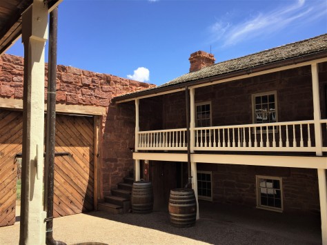
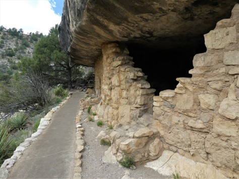
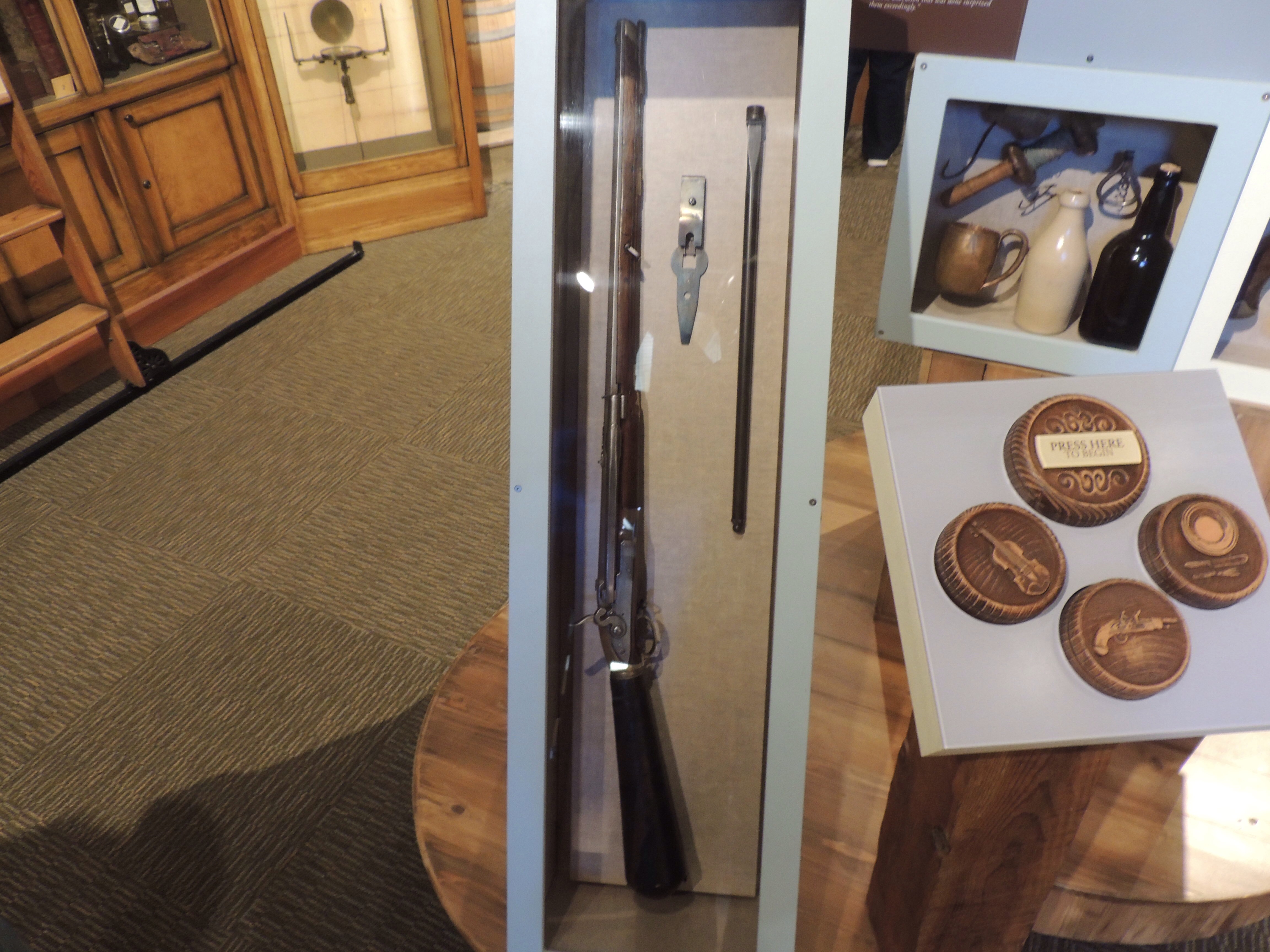
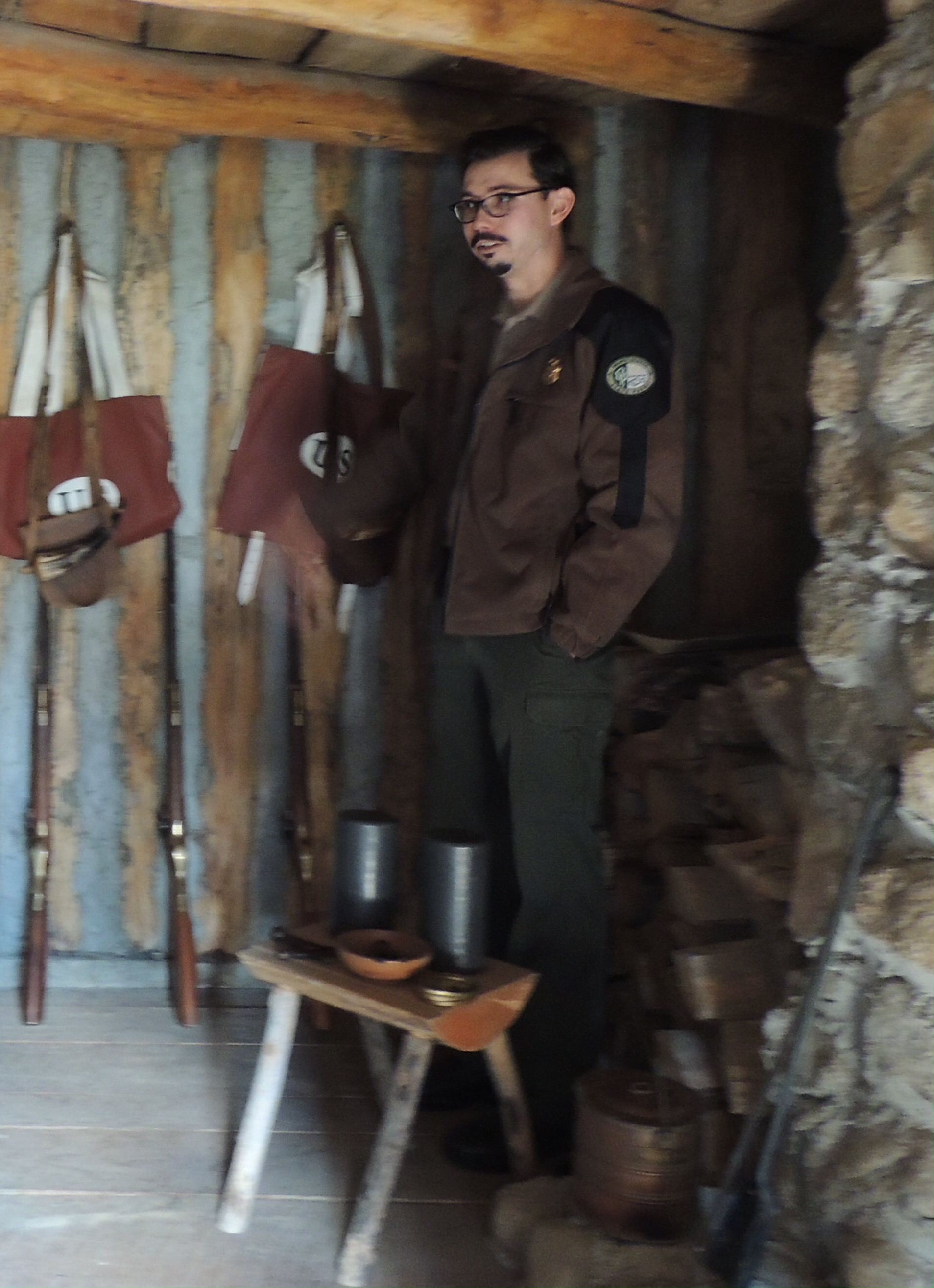
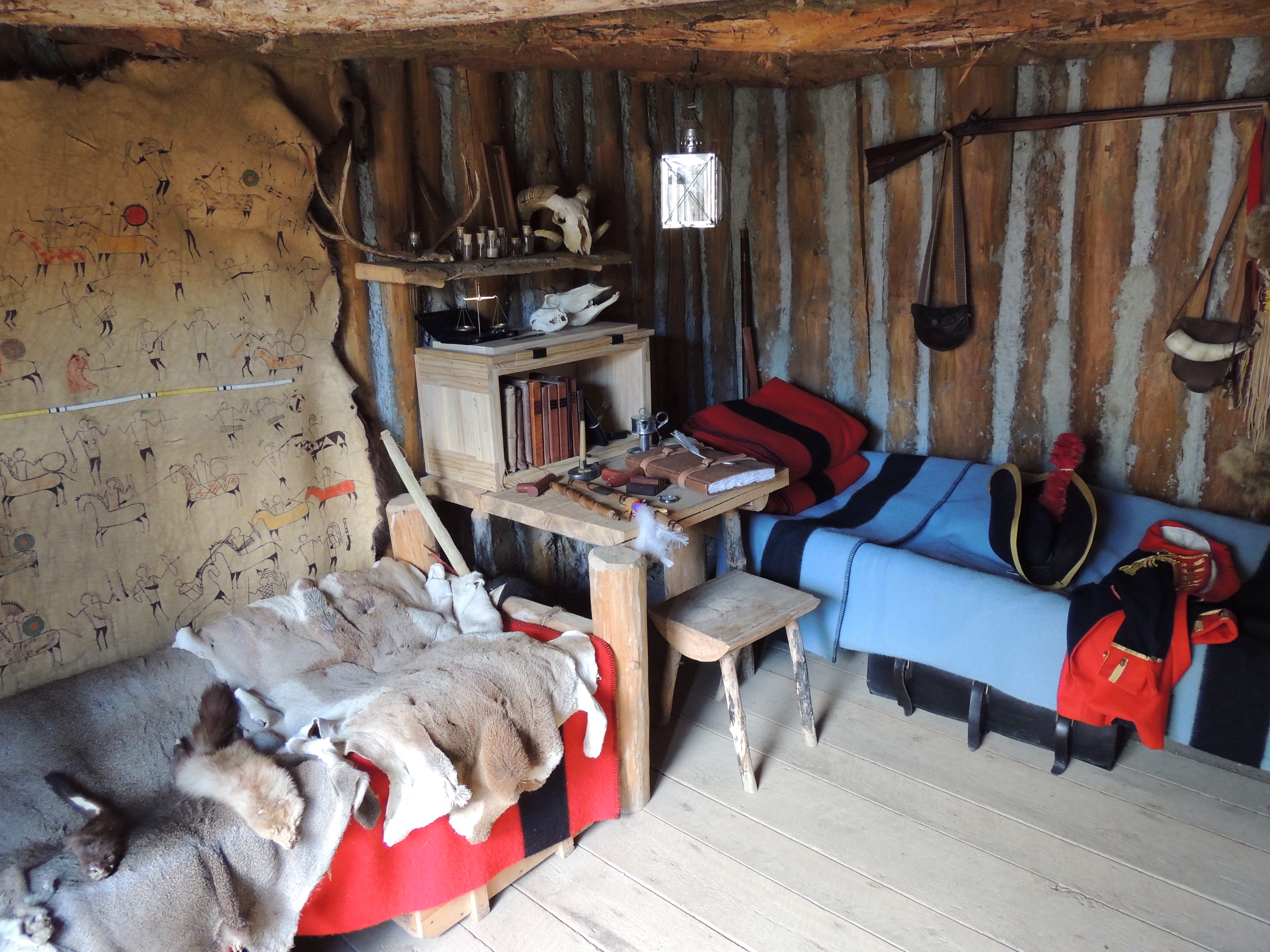
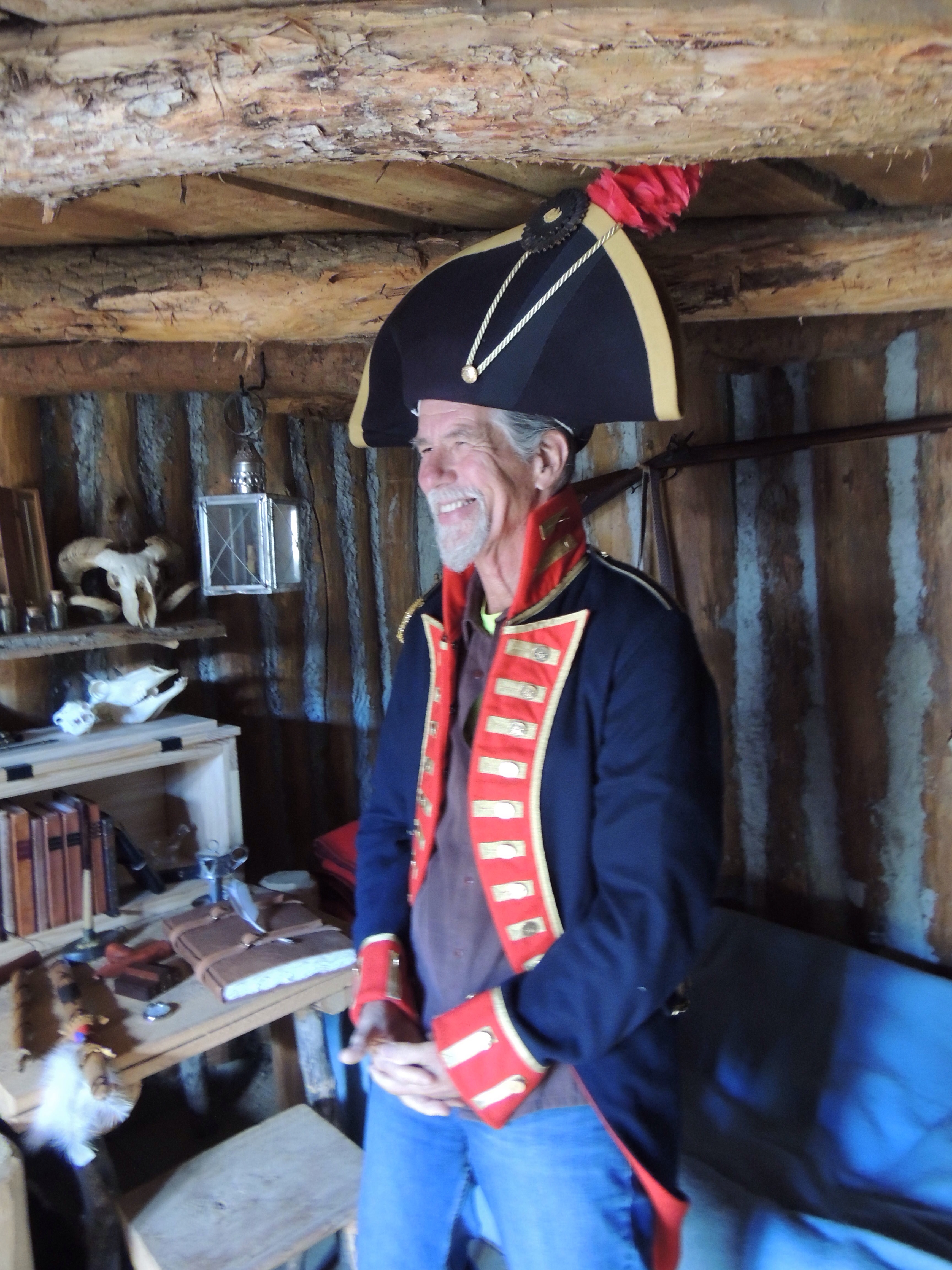
That stone fort still stands to this day.  The park service has done an excellent job in preserving the building and interpreting what happened here.

IMG_2490 (2)

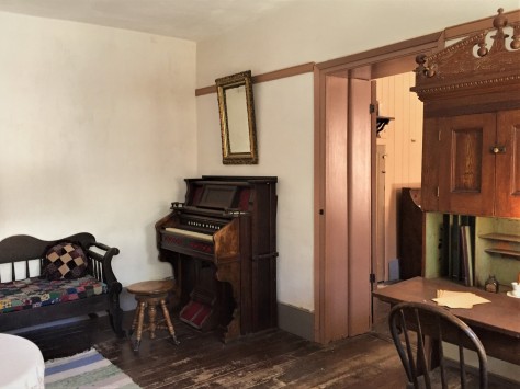
The spring itself bubbles up underneath the floor beneath this organ and is channeled via pipe to the other side of the fort. This allowed for indoor plumbing and, as the water from the spring ran under the floor, it cooled the home.

IMG_2498 (2)

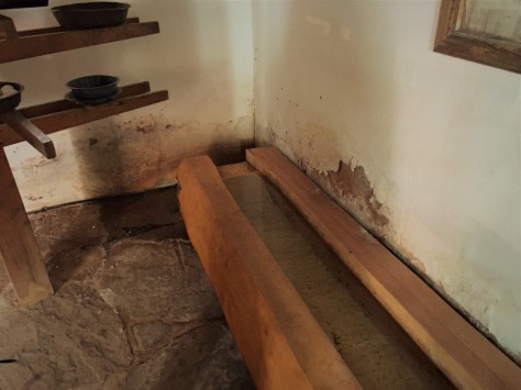
That pipe empties into this wooden trough in the basement of the building on the east side of the fort. This was a root cellar and had an area for making cheese. They had plenty of milk for making cheese, as the Mormons often paid their tithe with dairy cattle.

IMG_2512 (2)

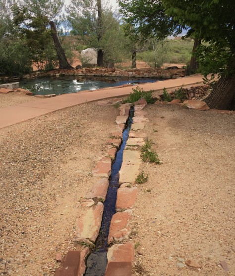
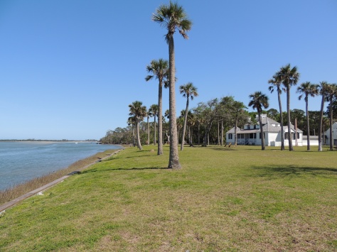
From there, it empties into a pond outside the walls. Since a 1933 agreement, the water flow from the spring has been evenly divided among the National Park service, the tribe, and private cattlemen.

IMG_2514 (2)

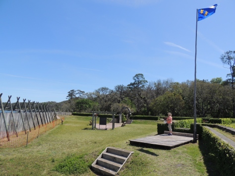
Another point of interest to note are the telegraph poles and wires outside the fort.  Pipe Spring was the first telegraph office in Arizona.

Our visit, while short, provided a fascinating look into the struggles between the settlers and the native people.  This park is well worth spending a few hours to explore, if you are passing through on this route.  While the parking lot is large enough to support a couple of large RVs, consult a satellite view on Google Maps to decide for yourself whether or not to bring your RV there.

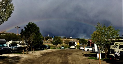
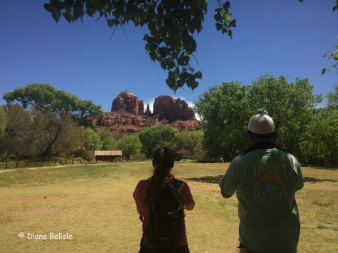
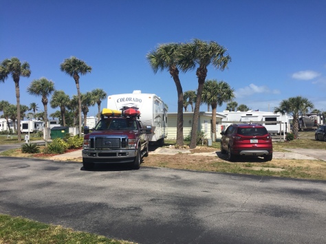
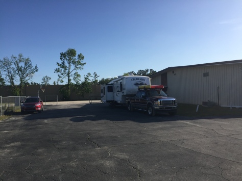
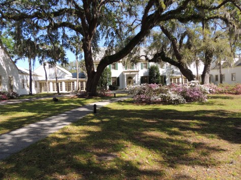
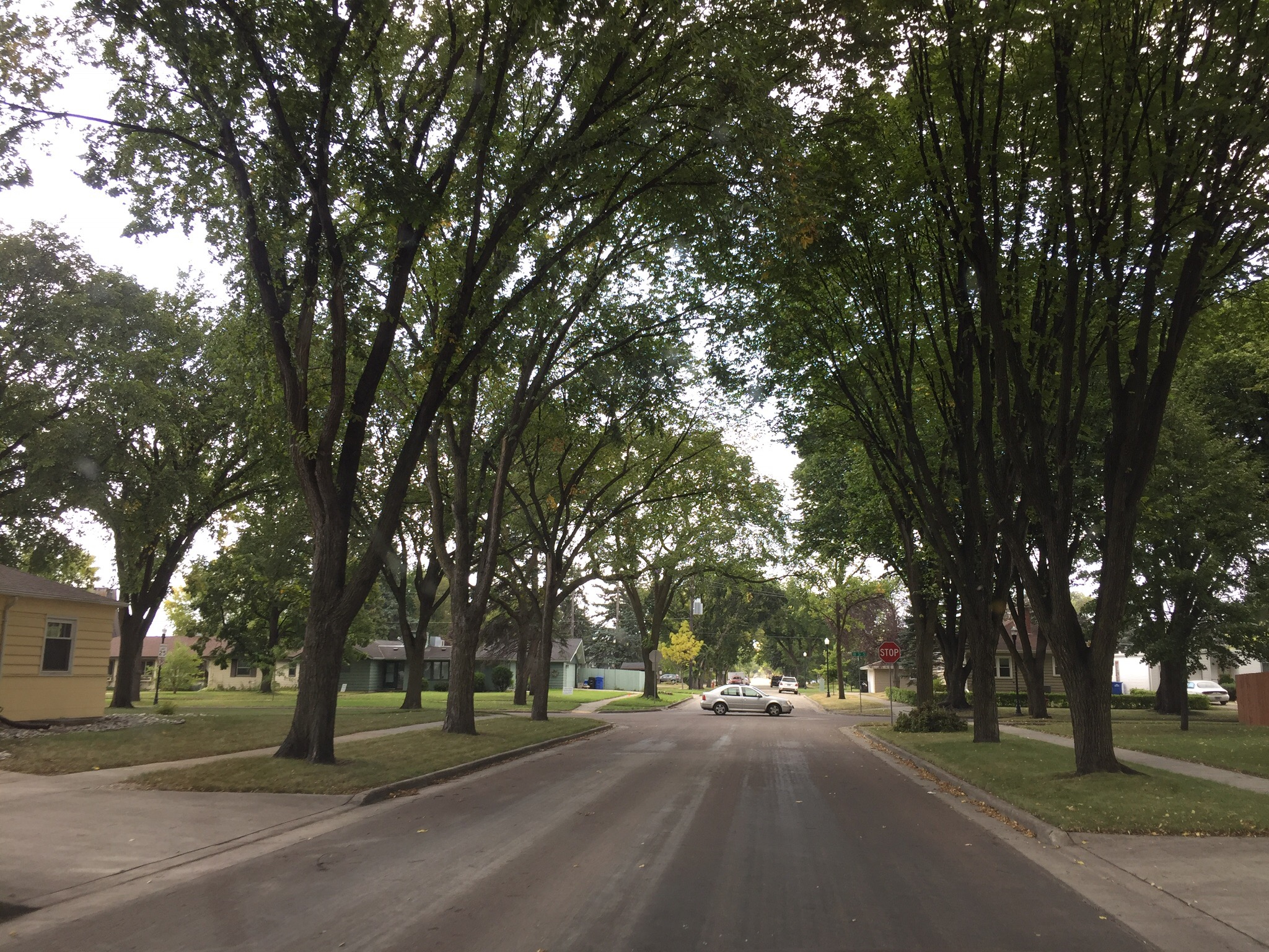
Once we reached Hurricane, we set up camp at WillowWind RV Park.  As Midwesterners, it was divine to see real grass and trees again!  They even allowed us to wash our vehicles, a rarity in this water-starved region.  The town itself received its unusual name when Erastus Snow, the leader of a group of Mormon surveyors, had the top blown off his buggy by a strong desert wind.  He declared the place to be named Hurricane Hill.  We found it to be a great town to use as a base camp for visiting Zion National Park.

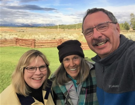
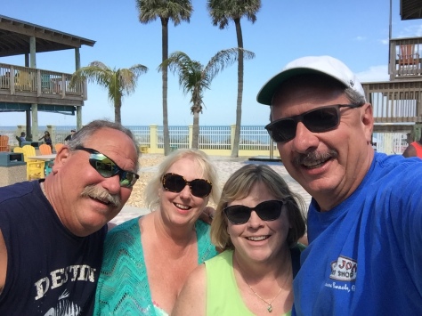
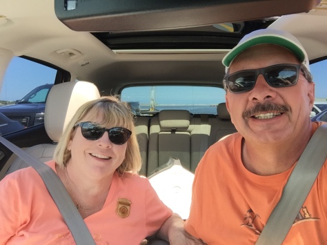
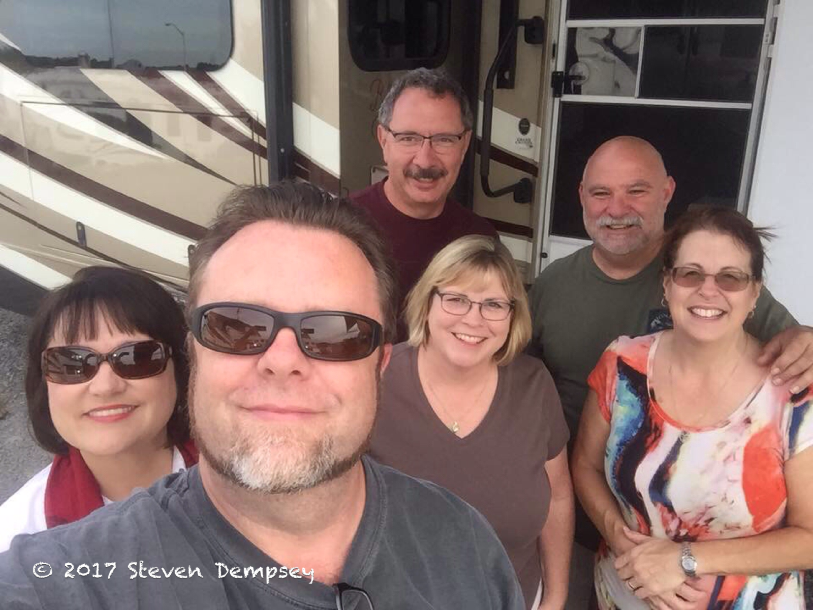
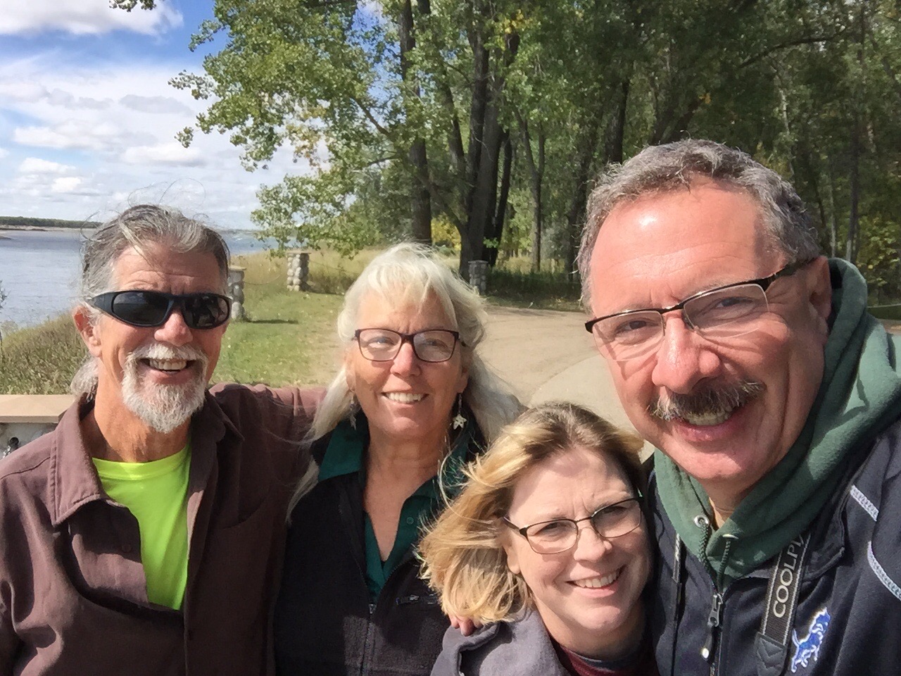
Our first priority was hooking up with our friends, Nancy and Bill.

05 (2)

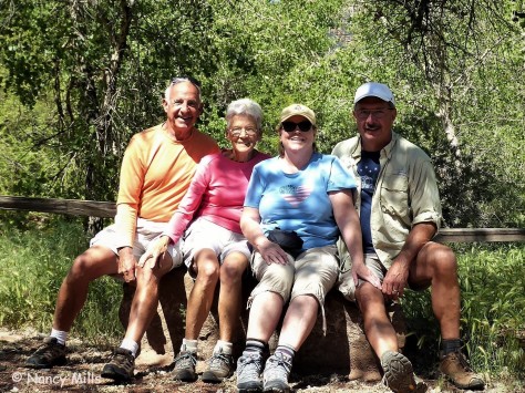
We were introduced to this charming couple by David and Sharon when we were in Myrtle Beach last year, and we hit it off right away.  They offered to show us the east side of Zion in their Jeep, which meant we were going to see the tunnel after all!

IMG_1900 (2)

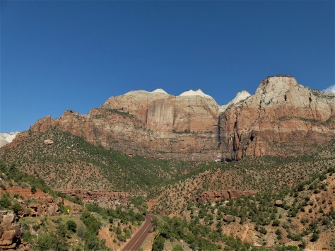
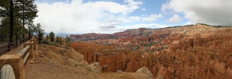
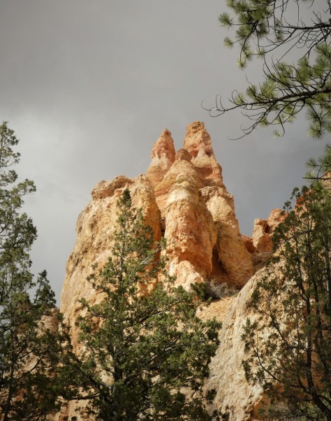
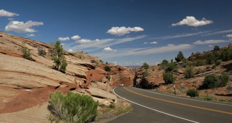
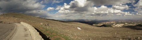
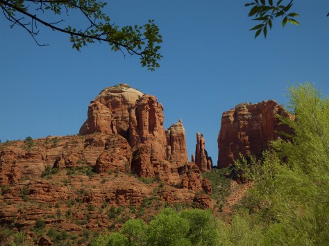
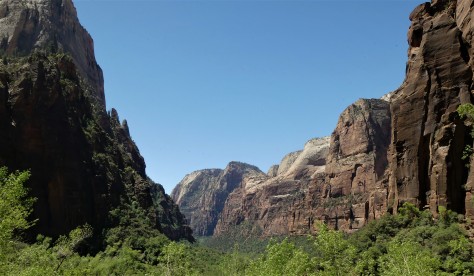
The road leading to the tunnel was beautiful.  The native name for this area is Mukuntuweap, meaning either straight canyon or straight up mountains, depending on the source.  William Howard Taft declared this to be Mukuntuweap National Monument, but the Mormons complained loudly and the acting National Park Service director at the time bowed to their pressure and changed it.  No matter which name is used, either one describes this place perfectly.

Once we passed through the mile long tunnel, we came to one of Zion’s unique features…

IMG_1873 (2)

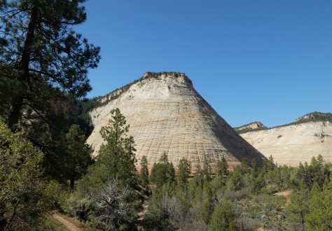
…Checkerboard Mesa.  This sandstone hill is unusual in that it not only has its horizontal layering lines, but also has vertical cracks, believed to be caused by expansion and contraction.

After lunch, the four of us headed to the end of the canyon and hiked Riverside Walk, a trail that leads to the Narrows.  That last trail was closed, as the water level was too high in the Virgin River.

IMG_2060 (2)

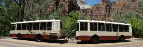
Our mode of transportation to get there was the Zion Shuttle, a bus and trailer combination that is unlike any system we had seen at other parks.  It was fast, efficient and rarely over-crowded.  The tilted roof vents funneled the canyon air in, which kept us cool.  The secret to their system is that they don’t have to compete with other vehicles, as the parks roads are closed to traffic during most of the year.  There also is a lot of them, so there isn’t a long wait at the bus stop. Do take into account that we were there before Memorial Day; chances are that it is busier during the summer.

IMG_1916 (2)

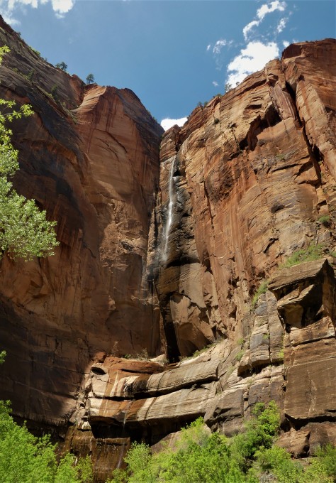
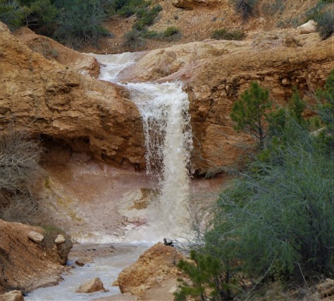
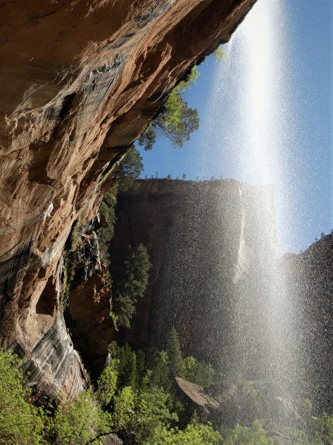
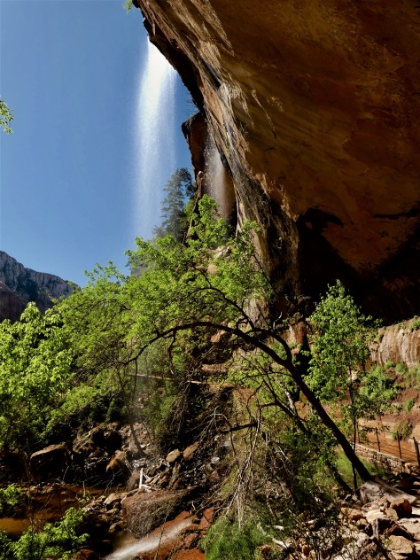
Nancy pointed out this beautiful waterfall at the Temple of Sinewava.  This is an emphemeral waterfall, in that it only appears after a rainstorm.  The following day, it was gone.

06 (2)

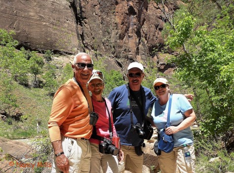
We thoroughly enjoyed our day with Nancy and Bill; we will see you two down the road. 🙂  Thanks for the Jeep tour and the great day!

Our next day saw us arriving early…a key to getting a space in the Visitor Center parking lot.  From there, we used the shuttle to explore the rest of the stops in the canyon.

IMG_1987 (2)

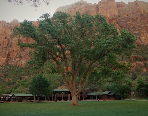
This huge Fremont Cottonwood tree at the Zion Lodge is over a century old.  As big as it is, it pales in comparison to the height of the canyon walls.  From the lodge, we hiked across the river to Lower Emerald Pool.

IMG_1988 (2)

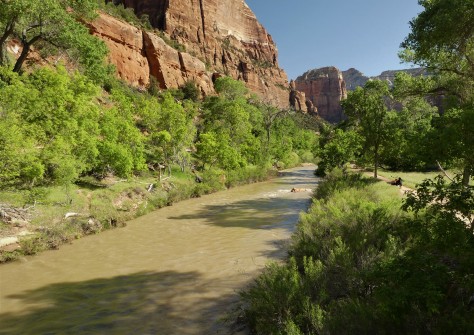
From the bridge, it is apparent how swift the river was running.  Due to trail damage, the trail didn’t go beyond Lower Emerald Pool.

IMG_2013 (2)

Still, the view from here was amazing.

IMG_2021 (2)

The trail continued behind the waterfall…

IMG_2025 (2)

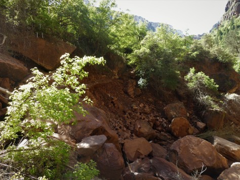
…to the place where the rockfall occurred.  This isn’t Disney, folks.  Glad no one was on the trail when this happened!

IMG_2037 (2)

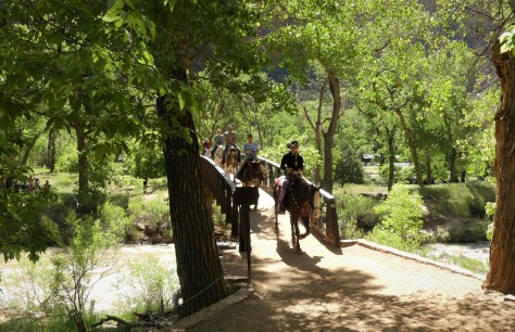
When we got back to the bridge, we had a bit of a traffic jam.  Still another example of the different ways to enjoy Zion.

Once back at the lodge, we headed up the Grotto Trail.

IMG_2046 (2)

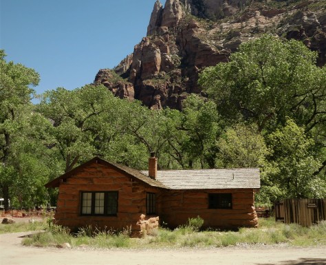
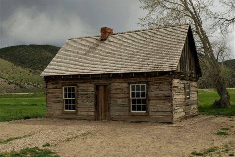
This cabin was built in 1924 to house the park museum.  It now is housing for the artist-in-residence, and is the oldest building in Zion.

IMG_1985 (2)

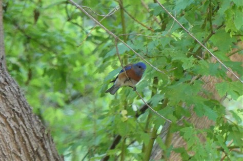
The Grotto was also a good place to see wildlife, including this bluebird.

From there, we went to Weeping Rock, which is a formidable wall of dripping sandstone.  The thing that stood out at this location was not so much the wall itself, but the view of the canyon the trail afforded.

IMG_2056 (2)

This is one of the best overall views of the valley that doesn’t require a significant vertical hike.  Had it not been for others wanting to see this same view, we could’ve stood here all day long.  🙂

To round out our visit, we continued on to the shuttle stop at the Temple of Sinewava, a place we had visited the day before with Nancy and Bill.  Our reason for this visit was because we had heard there were California Condors frequenting the area.  You may recall that we had been trying to see them at the Grand Canyon.  While we did see some large birds soaring here, we determined them to be turkey vultures.  Will we ever see a condor? Obviously not here, but what we did notice was the traffic jam 900 feet up on the Angel’s Landing trail.

IMG_2062 (2)

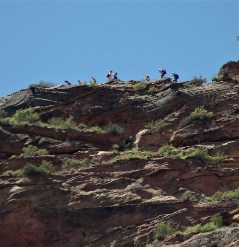
At this point, the trail is only a few feet wide and it drops off the same distance on the other side.  Note that there isn’t a railing, only a chain to hang on to…and it is a two way trail.  Again, this isn’t Disney, folks….although this hike would definitely be considered to rival Space Mountain.

IMG_2070 (2)

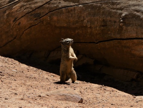
This fellow observer was as interested at the spectacle far above as we were.  We had no plans to join in that fun, but we did view a friend’s outstanding video afterwards where they hiked Angel’s Landing in November a few years back.  In it, Jim had a GoPro mounted above his head looking downward that shows just how narrow this trail is…including the shuttle stop I took my photo from.  You can access their YouTube video by following this link: Vertigo Inducing Video of Angels Landing Hike in Zion National Park .  Again, this trail is not for someone with a fear of heights.  Jim and Barb picked a great time to do it, in that it wasn’t crowded that day.

Our path to Zion was worth the effort it took to get there, and we will make it a point to return to this amazing place someday. The place the Native Americans call Mukuntuweap is one of our favorite destinations on this trip.

Next up:  Our trip plans get shuffled, due to another run-in with altitude sickness.  More on that in our next post, so be sure to stay tuned for that.  Until then, safe and happy travels to all!

Heading to Bryce Canyon

After establishing in Torrey that we weren’t going to be taking Route 12 to go to our next destination at Bryce Canyon, we selected a series of roads that ran west of the Grand Staircase instead.  The first north/south portion of this journey took us along Utah Route 62.

IMG_2442 (2)

This road runs a little over 40 miles down a wide valley until it joins up with US-89.  We literally saw only two other vehicles over that distance…both heading in the opposite direction.  I couldn’t help but think of the 1960’s TV series, The Big Valley as I motored along.  It was a scene that spoke to the vastness of this part of the country.  It was also noticed while we were planning this route that the Mormon pioneers laid out their towns in the same way.  Known as the Plat of Zion, each village uses a grid system with a north/south Main Street and an east/west Center Street.  The town of Loa is a prime example of this.

IMG_2147

The streets are wide and the blocks are large.  The streets use the same numbering system, based off of the ones in Salt Lake City, which begin at Temple Square.  For instance, E 200 S Street is the second street south of Center, on the east side of Main.  There are four 1-1/4 acre parcels within each block.  The original settlers would determine what parcel they would receive by lottery.  It made it pretty simple for us when navigating these communities, once we realized they were all laid out the same.

Once on US-89, we broke up the trip by stopping at the town of Circleville.  This little burg was the childhood home of the legendary bank robber and outlaw, Butch Cassidy.

IMG_1718 (2)

The log cabin he grew up in still stands along the highway.  There are several interpretive panels that tell a bit about him and his time on this small ranch.

IMG_1717 (2)

I found this video camera amusing, in that banks use these now to thwart robberies.  Maybe Butch would’ve had second thoughts on his career choice, had this monitor been here a century earlier.  🙂

IMG_1719 (2)

This was our view out the rear window of our fifth wheel in Circleville.  Utah certainly received its share of snow this past winter!

From there, we headed into the mountains to Bryce Canyon National Park.  Once set up at Bryce Canyon Pines RV Park, we made a quick trip to the Visitor Center to grab our Junior Ranger books.  We were alerted to the fact that they were difficult by Ranger Keith, with him quipping that they were PhD level.  He wasn’t kidding.  It was probably the second most difficult program, coming in just behind John Day Fossil Beds in Oregon.  Not wanting to wait any longer, we buzzed out to Sunrise Point for a peek at the hoodoos that this park is famous for.

IMG_1734 (2)

Photos of them would have to wait, as my camera trained on a herd of mule deer descending into the formations.  This trio leading the pack were alerted to something in their path.

IMG_1740 (2)

Turns out it was a line of horses and mules coming up the trail.  There was a bit of excitement when this lead horse spotted the deer, but the experienced rider quickly regained control of his stead.

That evening, we attended a program called Things That Go Bump in the Night, led by the same Ranger Keith who gave us out Junior Ranger books.  It was at that event where we met a longtime friend for the first time.  How is that possible?  We will tell you in a bit.  The program itself was fantastic, reminding us of the wonderful programs that Ranger Mariah would present while we worked with her in Prineville, Oregon.

The next day found us heading back into the park to see the hoodoos.

IMG_1746 (2)

What a gorgeous place!  Bryce is technically not a canyon, as it is not carved by a river. It is rather a series of amphitheaters that look east over the Colorado Plateau.  These formations are at the top of the Grand Staircase, which steps down all the way to the bottom of the Grand Canyon.

IMG_1759 (2)

Our visit that day saw a mixture of sun and clouds, with brief periods of snow.  Rainbow Point, the highest point on the Scenic Drive, tops out at 9115 feet.  I actually had issues with the altitude in this park, as I was finding it difficult to catch my breath.

IMG_1796 (2)

This massive anvil cloud rose near the town of Escalante in the distance.  We revisited there during our visit to Bryce to become Junior Rangers at Grand Staircase-Escalante National Monument.  It’s to be noted that we got their well before closing time this go-around.  🙂

IMG_1785 (2)

The stunning scenery at Bryce, such as Natural Bridge, produce an interesting phenomenon:

IMG_1790 (2)

The hoards of tourists witness most of it through a viewfinder.

IMG_8151 (2)

No one is immune to it…not even yours truly. 😉

As you can see in this last photo, there seems to be a bit more snow than in the previous Bryce images.  That is because we awoke one morning to the following scene:

IMG_1835 (2)

Yikes!  These sea-level Floridians aren’t used to dealing with this!  Knowing it would likely soon melt, we headed into the park to take in the view.

IMG_1849 (3)

The sprinkling of white on the top of each spire added depth to them, bringing definition to the scene before us.

Due to the strong winds, cold temperatures and snow that we had while we were there, our hiking was limited for this visit.  We did take one short and easy walk out to Mossy Cave, one of the wettest spots in the park.

IMG_1814 (2)

Yessir….its a cave with moss in it!

IMG_1805 (2)

Along the trail, this pretty waterfall appears to be the idyllic natural scene.   It is anything but.  Carved out by Mormon pioneers with picks and shovels over a century ago, this river is part of a canal known as the Tropic Ditch.  Since it was completed in 1892, the creek has provided the communities of Tropic and Cannonville a near steady flow of irrigation water.

Returning to our reference to a longtime friend that we mentioned earlier in the post.  At the evening program on Tuesday, we met Gaelyn from Geogypsy in person for the very first time.  We have followed each others blogs for a long time, with Diana discovering her journal in early 2014.  On Friday evening, we met for dinner.

IMG_2481 (2)

Gaelyn is a veteran NPS Ranger, having begun her career with the U.S. Department of Interior at Mount St. Helens in the mid 1990’s.  She is the person who inspired us to seek out the Junior Ranger programs at the parks we visit.  With our constant commenting back and forth on our blogs, our conversation over dinner was as natural as the outdoors we all three love so much.  It was truly a joy to finally get to meet her in person.

Oh, and that PhD Junior Ranger badge?

IMG_2148 (2)

We got ’em!  Definitely worth the effort.  🙂

IMG_1824 (2)

Bryce Canyon National Park is surely on our ‘return to’ list.  We thoroughly enjoyed our introduction to this scenic Utah beauty.

Next up:  we head southwest to the westernmost point of this trip, Zion National Park.  Along the way, we find a little gem of a park that most people pass by on their way there.  We also spend the day with friends we last connected with in South Carolina. Stay tuned for all of that in our next post.  Until then, safe and happy travels to all!


“Best Plan B Ever”

Some days call for a switch to Plan B.

On May 4, we arrived in Torrey, Utah to rain and thunder.

IMG_2430 (2)

Once the storm headed east, we received our traditional rainbow after a family member arrives in heaven.  This tradition began in 1980 with my aunt requesting one from my grandfather and has continued without fail ever since. Thank you for the sign, Uncle Bob!

The next day, after a stop in the visitor center at Capitol Reef National Park, we headed into the preserve to do some exploring.

IMG_1664 (2)

Our starting point was located in the former Mormon settlement of Fruita.  In that community, there is a pull-off along Utah 24 that has some amazing petroglyphs.  A boardwalk leads along the rock wall they are carved into.  We spent a good half hour viewing these drawings, attempting to decipher what they meant.  While we were there, a large group of Italian tourists stopped, all marveling in their own language at what they were seeing.  After returning to the parking lot, we saw that they had not been traveling on a tour bus.  Quite to the contrary…

IMG_1669 (2)

…they were exploring in a line-up of Class C motorhomes.  They sure seemed to be having a great time.  🙂

Our next stop was to Gifford House, just south of the visitor center.

IMG_1673 (2)

This is a former farmhouse that now doubles as a museum and store.  Diana purchased one of their small pies, and I got some homemade ice cream and a couple of gluten free cookies.  Delicious!

Capitol Reef’s claim to fame is the 100 mile long “waterpocket fold” that runs from Thousand Lake Mountain south to Lake Powell.  The fold is basically a fault in which the uplifted rock traps pockets of water behind it. The long, slender park is filled with hikes through slot canyons and over sandstone ridges.  We drove the 8 mile paved Scenic Drive, looking over possible hikes as we went.  At the end, a dirt road to Pleasant Creek continued onward.  This route was recommended to us by one of the rangers at the visitor center.

IMG_1674 (2)

It was at that point that the weather turned against us, as looming dark clouds rolled over the mountains.  Again, the rain fell and the thunder rolled.  The last thing we wanted to do was hike on ridges or slot canyons, or be driving on a road that followed a wash when a storm was imminent.  We scooted back to Torrey without delay.

On our way back, we came up with a Plan B, which was a 65 mile drive to Escalante along Utah Scenic Byway 12.  I had previously discussed this route with our friend Jodee, who recommended it as a beautiful drive, just not in an RV.  Definitely a great road to explore in the Escape.  We grabbed a cup of java in Torrey at Castlerock Coffee, where the barista confirmed we were about to take one of America’s most scenic highways.  Off we went!

IMG_1677 (2)

Climbing 3000 feet out of Torrey, the road was gorgeous.  We encountered rain which quickly turned to snow.  We drove on, hoping the other side of the mountain was sunny and dry…

IMG_1678 (2)

…which it was!  We were greeted with a completely different viewpoint than we had been seeing on the roads within Capitol Reef, as we were now far above the ridges.

IMG_1680 (2)

Deep canyons were carved through the desert floor below us.

IMG_1685 (2)

Domes of sandstone rose in the distance.  What would time and erosion turn these sentinels into over the next millennia?  Whatever they would become, the scenes would most likely be equally as grand as what we were currently witnessing.

IMG_1686 (3)

At each viewpoint, we continued to be amazed at the beauty of the landscape before our eyes.

IMG_8134 (2) (1)

While we did see one ‘brave’ RVer in a 40 foot motorhome towing a car on this route, sections such as this confirmed Jodee’s recommendation to leave the fifth wheel in Torrey.  🙂  One wrong move would’ve sent us tumbling a thousand feet down either side.

IMG_1687 (2)

It was at this vista that we met a gentleman from Palm Bay, Florida, just across the Indian River from our winter home of Melbourne Beach.  He was also thrilled with what he was seeing.  When we told him that this was our Plan B for the day, he came up with the quote of the trip:  “Best Plan B ever!  We parted ways with him and his brother, maybe catching him and his 1960 jet black Chevy at a car show next winter.  🙂

We got to Escalante, just as the visitor center at Grand Staircase-Escalante National Monument was closing.  We ran inside to a weary ranger waving her hands at us, yelling “WE ARE CLOSED!”  I told her we only needed two Junior Ranger books, as we knew we would be visiting again from the other direction when we were at Bryce Canyon.  A gentleman working alongside her gave us the books.  As we headed out the now-locked door, one of the other visitors laughed and said, “That was the nicest question they had all day…’Can we just have our Junior Ranger books?’ ”  Our apologies to the ranger…we’ve been there and we appreciate your efforts.

IMG_1690 (2)

Heading back north, we could see the clouds still looming over Torrey and Capitol Reef.

IMG_1695 (2)

Climbing to the top of the mountain pass, we took one last look across the amazing landscape before descending down the other side.

IMG_8137 (2) (1)

As we drove along, we passed several mule deer, who were quite comfortable with us stopping next to them along the roadway.

So while we weren’t able to explore Capitol Reef the way we wanted to, our trip along Utah Scenic Byway 12 definitely lived up to the man from Palm Bay’s description:

“Best Plan B ever!

Next up: We head south to Bryce Canyon to meet up with a longtime friend for the very first time.  Seriously! 🙂  Stay tuned for that and more as we continue our journey around the American southwest.  Until next time, safe and happy travels to all!

There Really IS an Arizona

A number of years ago, we visited the Rock and Roll Hall of Fame in Cleveland, Ohio.  As we walked into the lobby, my country music-loving sweetheart heard the guest artist Jamie O’Neal performing her country hit There is no Arizona.  Diana was giddy, to say the least, to hear a country artist performing in the shrine to artists like Lennon, Dylan, the Rolling Stones and so on.  As we waited in line for tickets to the museum, the lyrics and melody filled the atrium:

There is no Arizona

No Painted Desert, no Sedona…

Well, after what we’ve seen over the course of this last week, we beg to differ, Jamie. 🙂

IMG_2301 (2)

From the moment we arrived in Springerville, Arizona for a one night stopover, we knew it was going to be a great week.  Looking back east from a fairly nice sunset revealed this surreal moon rise.

We continued on to Petrified Forest National Park where we spent a few nights.  We scored a nice campsite at the Crystal Forest Museum just south of the park that gave us 30 amp electric for only $10 a night.

IMG_1017 (2)

At first glance, the old cars with the flat tires in the parking lot gave us pause.  We found out they parked them there a long time ago to make the place look busy.  I guess its time to either update the cars or at least air up the tires.  🙂

IMG_0897 (2) (1)

Petrified Forest was outstanding.  The southern end of the park was filled with logs that had been turned to stone after being buried for millions of years.

IMG_0902 (2)

This particular one was huge!  There is a photo in the visitor center with Albert Einstein and his wife standing next to it.

IMG_0933 (2)

Although the outside of the tree looks like bark, that is actually stone.

IMG_0953 (2)

Halfway through the park, we came to Blue Mesa.  Taking the trail, we hiked down into an area that appeared very much like the painted hills we saw in Oregon a few years ago.  Not quite blue, but very interesting to look at!

IMG_1013 (3)

At the north end of the park is the Painted Desert Inn.  This is a restored Civilian Conservation Corps era building that is very interesting to tour.

IMG_1010 (2)

Behind it is…you guessed it…the Painted Desert!  Guess Jamie O’Neal was wrong about that one!  Wow…it was absolutely beautiful.  It seemed like it went on forever.

From Petrified Forest, we moved on to Meteor Crater.

IMG_1029 (2)

This giant hole in the ground was caused by a 150 foot long meteorite that hit here 50,000 years ago.  It was estimated to have been travelling at 26,000 miles an hour.  Pretty impressive, to say the least.  Equally as impressive was the interactive visitor center.  This entire facility is privately owned, and kudos to the owners for offering a prime visitor experience.

While at the adjoining Meteor Crater RV Park, we drove back into Winslow to visit one of Rock and Roll’s other shrines…

IMG_1066 (2)

…the corner, from the Eagle’s song Take it Easy.

IMG_1059 (2)

Its my girl, my lord, by a flatbed Ford, taking a good long look at me!

IMG_1048 (2)

We also checked out the La Posada Hotel.  We had a fabulous lunch in the hotel’s Turquoise Room.

IMG_1050 (2)

The lobby was pretty, but the ‘death art’ on the walls was a bit much.  Turns out the hotel owner is the artist.

IMG_2993 (2)

I did my best to plunk out Hotel California….

From there, we moved west to Flagstaff for a few days.  The town got its name when some men stripped the branches and bark from a Ponderosa pine tree in 1876 and flew an American flag from it.

IMG_1081 (2)

We visited two parks in the area while we were there.  The first was Sunset Crater National Monument.  This cinder cone is part of a chain of volcanic features that dot the area. IMG_1086 (2)

This feature was called a squeeze up, which occurred when the molten rock was squeezed out of the earth like Play Dough.  As it cooled, it sagged under its own weight.

IMG_1124 (2)

We also visited Walnut Canyon National Monument.  This park features a trail, seen above, that descends into the canyon.

IMG_1114 (2)

Once down there, the path winds past several ancient cliff dwellings.  It was interesting to see the protection the overhanging rock offered.

eZy Watermark_25-04-2019_06-36-56AM (2)

From the rim, there was a nice view of Humphrey’s Peak and it’s neighbors.  Humphrey’s is the tallest peak in Arizona.

On our final full day in Flagstaff, we headed south to meet fellow blogger Ingrid from Live Laugh RV. We have followed her blog since 2014.  She has a similar camera to mine, and she offered to drive up from Phoenix to meet us and give me a few camera tips.  We met in…

IMG_1143 (2)

…Sedona!  Again, we’ve proven Ms. O’Neal wrong.  🙂

IMG_2985 (2)

While Ingrid and I were shooting photos of the scenery, Diana was shooting photos of us.  🙂

IMG_2984 (3)

Here we were taking photos of the cairns near Budda Beach.

IMG_1176 (2)

I managed to focus on this fly sunning itself on top of one of the cairns.

IMG_1191 (2)

I learned a lot about my new camera, thanks to Ingrid.  Hopefully that translates to better photos in the future!  It sure was a pleasure to finally get to meet her in person.  🙂

And Sedona?  It was beyond words.  We were amazed at every bend in the road.  We are happy to report that there IS a Sedona, a Painted Desert and most importantly, an Arizona.  All are beautiful and a pleasure to explore.

Next up:  The Grand Canyon South Rim!  Until then, safe and happy travels to all!

Enchanted Surprises in New Mexico

If there is one way we can summarize our past week in New Mexico, it would have to be that it was full of surprises.  From the time we arrived in Santa Fe to the day we slid out of the state on US-60, the Land of Enchantment did its best to do just that.

We set up camp in Santa Fe at an old KOA that is now called Rancheros de Santa Fe Campground.  It was an unremarkable place, other than the fact that the camp scene from Every Which Way But Loose was filmed there.  That, and our first enchanted surprise…

IMG_2196 (2)

What the heck!  Just to let y’all know, this is the first snow that has fallen on the exploRVistas entourage since early in 2015.  We did see previously fallen snow in Oregon, but the temperatures were much warmer.  So rather than hunker down…

IMG_0670 (2)

…we chose to embrace it by heading above 10,000 feet to Ski Santa Fe.  🙂

IMG_2200 (2)

Here’s Diana after an exhilarating run down the Double Black Diamond slope.

IMG_0676 (2)

It was a tremendous place to spend a morning, indeed.

We found the city of Sante Fe to be charming.  The town’s pueblo architecture envelops visitors with a sense of warmth.

IMG_2204 (2)

Our NARM membership from the Foosaner Art Museum in Florida gained us free admission into the Georgia O’Keeffe Museum.

IMG_2202 (3)

If there is anything that speaks to southwestern art, it is this talented artist’s work.

IMG_7952 (2) (2)

Images of New Mexico are the first thing that come to our minds when hearing her name.  With that being said, our next enchanted surprise came during this visit.  We had no idea that a vast portion of her career had been spent in none other than…

IMG_2201 (2)

…New York City!  She loved it there, as do we.

Santa Fe also has a couple of well known churches.

IMG_0687 (2)

One is the Cathedral of St Francis.  We were surprised to find out that this was once the seat of an archdiocese that covered the entire southwest, all the way up to (and including) Denver.

IMG_2241 (3)

And this is the famous miraculous staircase in the Loretto Chapel.  Our surprise here was not the staircase, but where the Sisters of Loretto came from.  You see, there was only one other place we had ever seen this name:  Loretto, Kentucky…home of Makers Mark bourbon.  Indeed, that is the area these pioneer women came from!

We also did a couple of hikes while we were based in Santa Fe.

IMG_2227 (2)

Our first was in Petroglyphs National Monument near Albuquerque.   We ventured into Rinconada Canyon to see what it had to offer.

IMG_2215 (2)

No this isn’t graffiti, in a modern sense of the word. The carvings into the rocks were left by early native people and also by Spanish sheep herders in the area.  The images were a ways off the roped-off trail, and I unfortunately had failed to charge my new camera’s battery the night before.  This trail and my iPhone did not work well together.  Thankfully, we had arranged our hikes in the order we did, as our next day was outstanding!  When Ingrid from Live Laugh RV heard we were in the area, she recommended we visit one of her favorite places, Kasha-Katuwe Tent Rocks National Monument.

IMG_0699 (2)

With a fully charged battery at our disposal, we gave the new camera a workout!

IMG_0706 (2)

What an amazing place.  We loved the combination of desert and tall Ponderosa pine trees.

IMG_0736 (2)

The ‘tent’ rocks that give the monument its name look like they are from another planet.

IMG_0717 (2)

Nothing better than squeezing through a slot canyon!

IMG_0759 (2)

The desert environment was full of life.

IMG_0746 (2)

The view from the top was simply breathtaking.  Thank you Ingrid!!!

Next up, we moved south to San Antonio, New Mexico.  Our focus there was to visit Bosque del Apache National Wildlife Refuge.  We first became aware of this place while reading Life Unscripted, as Peter and his wife Peg volunteered here.  Our driving force to visit here was when fellow blogger, the late Lynne Braden, left a legacy gift to the refuge after her terminal cancer diagnosis. This was the first place she volunteered after her retirement and she fell in love with it.

IMG_0862 (2) (1)

This is her photo that became the cover art for the latest Festival of the Cranes.  To our surprise, we were fortunate to be able to purchase the last remaining copy of the festival poster.  We will indeed treasure this.  Lynne was a sweet person who never lost her million dollar smile, despite the cancer she was forced to face.  She chose to view it as a gift.  Peruse through her blog, Winnie Views, by following the link.

IMG_0808 (2)

Touring the refuge, it was easy to see why Peter, Peg, and Lynne loved this place.

IMG_0803 (7)

What a variety of wildlife!

IMG_0856 (2)

Some just seemed to pose for the camera…

IMG_0776 (2)

…while others were more interested in fishing.

IMG_0782 (4)

Some were just out for an evening stroll.

The biggest surprise in this little blip of a town was a small parcel of land on the southern edge of the village.

IMG_2263 (2)

Pretty unremarkable, right?  Well, what you are looking at is the birth of one of the world’s largest hotel chains to which I owe a fair amount of my career.  That building to the right was the old post office.  Across the street from it was a little mercantile/rooming house, run by a person named…

IMG_0821 (2)

…Conrad Hilton.  It all began here.  And wile the building may be gone,…

IMG_2259 (2)

…the long wooden bar he worked behind at his dad’s place can be found just up the road at the Owl Bar, where it was moved to many years ago.  It amazes us at the history that can be uncovered in the small towns of this world.  🙂

Last up was a place we had wanted to see for a long time.

IMG_0867 (2)

The Very Large Array Radio Telescope.  These dishes span out in a “Y” pattern, 13 miles in each direction.

IMG_0879 (2)

Twenty-seven dishes work in unison to gather radio waves from distant galaxies to form images that aren’t visible to us though our eyes.  The dishes can be moved along railroad tracks to form different images.  The science behind this is WAY over our heads, but the massive nature of the project is amazing to look at.  While we were there, the dishes all moved in unison several times, eventually pointing straight up.  While we knew this facility was here, it was quite a surprise to crest the mountain pass west of Magdalena and see these antennas spread out before us.

We had a wonderful visit to New Mexico this time around.  The land of Enchantment revealed a bevy of surprises and a trove of memories we won’t soon forget.

Next up: Arizona!  Until then, safe and happy travels to all!


Fort Pulaski

On the east end of Cockspur Island, in the middle of the Savannah River, sits one of the most massive brick fortifications ever built; Fort Pulaski.  This impressive structure was named for Count Casimir Pulaski, a Polish soldier who fought in the American Revolution and lost his life during the Battle of Savannah in 1779.  It was constructed over an 18 year period beginning in 1829, and sits on the Georgia side of the border with South Carolina. Sporting 7-1/2 foot thick walls that tower 32 feet above the 8 foot deep moat, it was felt that the structure was impenetrable.

z15

It was part of a coastal defense system put into place by President James Madison after the War of 1812.

z20

It is interesting to note that preliminary construction of the fort…including the canal system seen above…was the first assignment for a young cadet fresh out of West Point by the name of Robert E. Lee.  He was here from 1829 until 1831.

Even though it was completed in 1847, Fort Pulaski had not yet been manned by the army, nor was it fully gunned by the time 1860 rolled around.  On January 3, 1861, Georgia governor Joseph E. Brown ordered the state militia to occupy the fort.  This was in response to federal troops seizing Fort Sumter to the north at Charleston just two weeks earlier, after South Carolina voted to secede from the Union.  Savannah was an important port for the southern states, and vital to the success of the Confederacy.

z16

Work began in earnest to ready the post for the battle that was sure to come.  Thick timbers, such as can be seen in the photo above, were leaned against the inner walls.  This allowed a protected passageway between the casemates that surrounded the perimeter.

z14

Within a year, Union troops were setting up a series of 11 batteries on nearby Tybee Island, just to the southeast.  Those positions are signified in red in the above photo.  With the south and southeast walls of the fort (noted in green) at more than a mile away, it was felt by the Confederates that they were safe from anything the Union army could lob at them from that distance.  What they did not know was that the Federal troops had a new weapon: the 30 pound Parrott rifled cannon.  This gun had spiraled grooves the length of its bore which increase the accuracy and velocity of its 30 pound bullet-shaped projectiles.  This gun had a range of nearly five miles, so breaching Fort Pulaski’s walls at a mere mile away was a fairly easy task.  There were five of these guns in the Union’s arsenal on Tybee’s shore, along with five smaller rifled guns and twenty-six mortars.

z2

On April 10, 1862, Captain Quincy A. Gilmore sent a boat to Cockspur under the flag of truce to demand the confederates surrender the fort.  That demand was refused, so Gilmore ordered his men to open fire. Thirty hours and over five thousand shells later, the Union army opened a hole in the southeast corner of the fort.  The area that was destroyed was reconstructed and can be seen above as darker red brick.  The rest of the garrison walls still show the damage to this day.  Fearing that his powder magazines would be breached and the entire fort would be destroyed by the resulting explosion, Confederate Col. Charles H. Olmstead surrendered.  Similar to the unsinkable Titanic that sank almost 50 years to the day later, this impenetrable fort was penetrated.  Needless to say, confederate leaders were shocked.

z4

Visitors today can still see some of the shells embedded in the walls, the backs of which all face northeast.

z3

Even the tip of the southeastern-most cannon was damaged in the battle.

z12

This is the view the Union soldiers had from Tybee Island, about one mile from the garrison’s southeast flank.

z13

Amazingly, little Cockspur Island Lighthouse received hardly any damage during the siege, even though it was in the direct line of fire.  It is still standing strong.  It was re-lit in 2007 for historical purposes.

The 30 hour battle at Fort Pulaski rendered brick fortifications obsolete.  Union troops repaired the hole in the outer walls and turned the structure into a prison until the end of the war.  It was here that the Immortal Six Hundred…Confederate prisoners who refused to take an oath of allegiance to the United States…were held under horrible conditions. Thirteen of them died there and were buried along the outside bank of the moat. By 1880, only a lighthouse keeper and a caretaker remained.  They too were soon gone, and the fort was left to the forces of nature.  In 1924, Fort Pulaski was made a national monument, with restoration efforts taking place during the Great Depression.

z17

We learned a lot from our visit to Fort Pulaski, all while each adding a Junior Ranger badge to our collection.  If there is one important takeaway from this monument, it is the fact that no one is invincible.

Stay tuned to see what we find as we explore further up the coast.  Until next time, safe travels!

Jekyll and St. Simons Islands

When we left you last, we had explored northern Florida in an area that had been contested by the French and the Spanish back in the 1500’s.  On Thursday, we moved a mere 70 miles up the road to Brunswick, Georgia.  Here we found stories of the pre-Revolutionary British, the Civil War, the early 20th Century elite, and modern day foreign trade.  With only a few days here it was not only a lot to discover, but it was hard to keep it all straight!

We began by pulling into our first Boondockers Welcome location.  This is a program where people allow you to camp on their property for free.  This particular location was hosted by Leslie and Skipper, and they were just super to us.  We even hung out with them one evening around their fire pit, and got to know them and their neighbors over cocktails.  To show our appreciation for their hospitality, we gave them a small gift bag with some goodies from Michigan.  🙂

z14

They lost several trees during Hurricane Irma.  Fortunately, they all fell across the driveway when no one was home.  Thank you again, Leslie and Skipper!

On Friday, we headed out to St. Simons Island.  This particular barrier island is home to Fort Fredrica, an 18th Century British outpost and townsite.  The settlement was put into place under the watchful eye of James Oglethorpe; a soldier, member of Parliament, and a visionary.  His plan was to establish somewhat of a Utopia for people in debtors prisons back in England, all the while creating a buffer between British colonies to the north and the Spanish to the south.  A fort was erected along the Altamaha River in 1734, and a fortified town was laid out just behind it.  There were 84 lots, most of which were 60 by 90 feet.  Each family also received 50 acres in the surrounding countryside to raise crops.  As the town began to spring up, the Spanish to the south took notice.  Sensing the rising tensions, Oglethorpe sailed back to England and brought back a regimen of over 600 soldiers.  In 1740, the British went on the offensive and set sail for St. Augustine.  The ships bombarded the Spanish fort for two weeks straight to no avail.  Details as to just why that was, can be viewed in our post on St. Augustine by clicking here.  The British headed back to Fredrica and the Spanish followed not too long afterwards.  They brought an army of 2000 men with the intention of taking the fort and town.  Unfortunately for them, the British were more familiar with the area and their troops and townsfolk  used guerrilla tactics to chase the Spanish soldiers back south.  Without too much bloodshed, the skirmish ended and order was restored.

z8

When we arrived we requested our Junior Ranger materials, and enjoyed the movie and displays in the visitor’s center. Not letting the fairly steady rain deter us, we headed out through the town-site to the fort.  The river has changed course, so much of the location of the fort is now underwater. A couple of magazines remain above ground. The foundations of many structures have been unearthed by extensive archaeological studies, including the storehouse which John Wesley lived above.  We were able to make out the earthen berms that were the base of the fort’s walls, as well as footings of many of the homes.

z11

The town’s streets were well marked, as were each of the foundations.  After we received our badges, we went to explore the rest of the island.

Across from the fort is this monument and memorial garden to John and Charles Wesley.

z3

John Wesley is the founder of the Methodist Church. Diana is United Methodist and was pretty excited to walk the same ground as John Wesley, especially on Good Friday.  He made five separate trips to Fredica from England in 1736 and 1737.  It was after leaving Georgia for the last time that he began the Methodist Church.  There is a large Methodist conference center and museum on the island.  We drove around the beautiful campus, but were too late to tour the museum.

We also visited the St. Simons Lighthouse.

z6

This impressive structure looked very familiar to us.  It turns out that the engineer responsible for it was a man named Orlando Metcalfe Poe.  He was General Sherman’s chief engineer who accompanied him on his March to the Sea near the end of the Civil War.  After the war, Poe became the chief engineer of the U.S. Lighthouse Service. He developed this style of lighthouse and St. Simons was constructed in 1872.  Just prior to that, Poe was promoted to become the Great Lakes lighthouse chief engineer, as the region’s burgeoning shipping industry required sentinels to keep them safe.  He oversaw the construction of 8 lighthouses on the Great Lakes that used this same design.  He also designed the first of the Soo Locks, which was named after him.  He was injured during its construction and died of a subsequent infection in Detroit shortly afterwards.  He is buried in Arlington National Cemetery. His lock, which he never saw completed, was totally rebuilt in the 1960’s to allow 1000 foot freighters to pass between Lake Superior and the lower lakes.  They kept his name on it. 🙂

z5

The view from the top is outstanding!  The original 3rd order Fresnel lens is still in use.

While we were at the top of the tower, we asked a local woman about the ships pictured above.  Brunswick is home to a huge port that deals with ‘roll off-roll on’ cargo, in other words…vehicles.

z7

This is a screenshot of the port from Google Maps.  The five rows in the area circled in red contains over 3000 cars and trucks.  Considering all the other vehicles in the lots, there has to be well over 50,000 of them there!  We saw several of those ships coming and going while we were in Brunswick, so they must really employ a lot of people to move those cars.

On Saturday, we made our way to Jekyll Island for a bike ride.  We had scoped it out on Thursday evening, and we found the paths on the island to be favorable for our TerraTrikes.

z1

That day, we visited Driftwood Beach.  In the photo, I am looking across the water at St. Simons lighthouse.

z2

We also toured the historic district that was established in the late 1800’s.  The Jekyll Island Club attracted the wealthy elite; names like Rockefeller, Morgan, and Vanderbilt.

z4

Here is the Rockefeller ‘cottage’.  🙂

So on our return trip, we set out to circle most of the island.

z13

We rode through the historic district…

z10

…over the marshes…

z12

…and along the seashore.  It was good to be back on the trikes!

That wraps up our time in Brunswick.  Our next destination is Savannah, but not before a quick stop to see a good friend.  Stay tuned for that adventure!  Until then, safe travels to all.


Timucuan Preserve and Jacksonville

On Tuesday, March 27th, we packed up and began our journey towards Maine and then Michigan.

a3

It took a little bit, as we had so many ‘see you in the fall’ goodbyes!   We will miss seeing everyone and look forward to next winter. We did manage to hit the road before noon.  🙂

Our first stop was Jacksonville, Florida, to take care of some errands and to do a little sightseeing. Diana tried out her new Moose membership to get us a nice little camping spot for two nights.  Wait…what?  Moose membership???  Let’s back up a step.  On Sunday, we met Diana’s sister Cheryl and her hubby Doug for lunch at the Beach House at Patrick Air Force Base.

a2

They are also fulltime RVers. Cheryl mentioned to us that she was a Moose member and how Moose International was not only a great fraternal organization, it also allowed RV parking.  We decided to have Diana join first to see if the membership is something we will use.  We met them next night at a local Moose lodge and with Cheryl as a sponsor and $35, she signed up!

a4

Long story short, we ended up with a last minute overflow spot at a lodge in Jacksonville.  For $15 a night we has access to electricity, water, and a dump station….perfect!

First order of business was to get our mail in Green Cove Springs and head over to the DMV to renew our Escape and trailer plates.  We have always been impressed with our adopted hometown, in that they embrace having thousands of their residents be fulltime RVers, marine cruisers, and military.  Many of those folks never see the town after the first initial contact, but we like making an appearance at least once a year.  Tuesday was our second time through this season, and I have to say they outdid themselves.  We pulled into the parking lot at our mail forwarding service at 4:30 PM and grabbed the mail.  We then drove two miles to the DMV and were in and out by 4:45 PM.  That’s 15 minutes to take care of both items. Impressive, to say the least!

So that left Wednesday free for us to explore the area around Jacksonville. Looking for anything that fell under the National Park Service auspices, Diana found Timucuan  Ecological and Historic Preserve (pronounced tee-moo-kwan). This vast area encompasses several national and state sites, not far from a major city.  It was donated in the 1960’s by a man named Willie Brown.  He was offered millions of dollars by developers, but he wanted it saved as an unspoiled wilderness for future generations. On this particular day, we chose three locations.

First up was Fort Caroline National Memorial.

z2

This is where the main visitor center for the entire preserve is located. Inside, the story is told of  this place where the waters of the Atlantic Ocean and St. Johns River meet.  There is evidence of over 5000 years of human habitation that has been unearthed in the area.  The first people here were the Timucua, a broad group of several tribes of natives. Sustained by the marine life found in the salt marshes, and also by plants and animals of the land, these people thrived here for centuries.

z9

This wooden owl was found in the preserve and is estimated to have been carved in the 1400’s.  It is the largest wooden effigy ever discovered from an archaeological site in the Americas.

z10

This yellow pine dugout was also unearthed here.  These canoes were the mode of transportation used on the St Johns waters by the Timucua.

In 1562, a French expedition, led by Jean Ribault, landed here and claimed the land for France.  Ribault left 50 settlers to establish an outpost and returned to France.  In 1564, the French built a triangular fort and named it ‘le Caroline’.

z3

The French did not do well in this new land and were facing starvation when Ribault arrived with help from their homeland. The relief increased the population, and also caught the attention of Spain.  The Spaniards soon established a claim to the south at St Augustine, with the intention of dislodging the French to their north.  Ribault sailed south to attack the Spanish post, only to encounter a hurricane that disrupted his ships and he beached too far south.  Admiral Pedro Menendez seized the opportunity and marched north to Fort Caroline.  His men massacred 140 French people, sparing women and children. 40 to 50 French escaped and were able to sail back to France. He then marched south and found the shipwrecked men.  The French pleaded for mercy to no avail.  Menendez killed 350 of them…all but those professing to be Catholics or musicians. That site became known as Matanzas, a Spanish word meaning ‘slaughter‘.  After driving out the French, the Spaniards took over Fort Caroline and renamed it San Mateo.  In 1568, the French returned for the sole purpose of seeking revenge. They killed most of the Spanish at the former French outpost, except for a few who escaped to St Augustine.  After burning the fort, the force returned to France.

From Fort Caroline, we drove northeast to  Kingsley Plantation.

z11

Along the way, Edsel 2 took his first ferry ride!  As you can see, Diana is sporting her Fort Caroline Junior Ranger badge.  🙂

z4

Kingsley Plantation was built in 1798 and is the oldest surviving plantation house in Florida.  No small feat, considering it’s exposure to hurricanes, termites, fire, and humidity.  The story is told here of plantation life, with the owners fortunes amassed at the expense of slaves’ labor and freedom.

z6

Located on the St Johns River, the farm was perfectly situated to transport its goods via water.  Cotton was king here, as was indigo, and sugar cane.

z7

Near the entrance to the property were the remains of the slave quarters, laid out in a semi-circle.  These 23 structures housed 60 to 80 men, women, and children.  They are made of tabby. This construction material is oyster shells cooked with water and lime, and then mixed with sand to form cement. The horrors of slavery were well portrayed here, serving as a reminder of this disturbing time in American history.

Our last stop was Ribault Club.

z8

This was a millionaires resort built in the 1920’s.  During the depression, membership declined and the building fell into disrepair.

z12

The State of Florida acquired the property in 1989, and through a partnership with the National Park Service and the City of Jacksonville, restored the club in 2003.

z13

The building is used mostly for weddings and events, and is open for the public to view at other times.

We really enjoyed discovering Timucuan Preserve on what turned out to be a beautiful day.  We left several sites to explore at a future time, making sure we thoroughly soaked in the beauty and history the areas we visited.  Be sure to follow along to see our next adventure as we head north along the eastern coast.

Kentucky – Foster and Lincoln Style

When we worked at Amazon in Campbellsville Kentucky last fall, Diana and I mentioned to each other how great the area would be to visit without the work obligations.  Keeping that in mind, we set out to do just that this year.  There were several places we had yet to visit in the area, plus we had some friends we wanted to see.

We pulled into Three Springs RV Resort in nearby Columbia early on Saturday, October 21.  That was the campground we stayed at while we were working last year.  We chose to return for the resort’s peaceful setting, plus Greg and Nevis are really nice people.  We were able to catch up with them for a few minutes before heading off to visit our friends.

That’s Linda & Steven on the left and Bill & Kelly on the right.  Seeing that Diana and I are Amazon Associates through our blog…as are Kelly and Bill, all six of us are currently employed by the company.  We help generate the orders that they will be filling this Christmas season.  It was  really great to be able to spend a couple of happy hours with them, along with dinner at Brothers Restaurant. 😊

On Sunday, we set out to visit several sites we missed last year.  Our tour took us north to Bardstown, then meandered down through Hodgenville and back to Campbellsville.  The route was over Kentucky’s famous backroads, which are quite often too narrow for two passing vehicles.  However, they do feature state-of-the-art rumble strips on their three inch wide shoulders.  Closest we can figure, they are there to notify the driver that they have left the roadway and are hopelessly dropping into the ditch. 😉  But….

…the land the roads traverse is absolutely gorgeous!  Autumn certainly is a beautiful time to be in Kentucky.

Our first stop of the day was My Old Kentucky Home State Park in Bardstown.  Built in 1795 for John Rowan, a prominent judge and U.S. Congressman, the home was originally named Federal Hill.

Mr. Rowan’s cousin was composer Stephen Foster, who was a frequent visitor.  The estate was the inspiration for Foster’s ballad My Old Kentucky Home, Good Night, which was written in the mid 1800’s.  The home was passed through several generations before being purchased by the Commenwealth of Kentucky in 1923 to preserve its’ history.  The tune itself was adopted as Kentucky’s state song in 1928.

Our tour was conducted by guides dressed in period attire, with this gentleman singing his rendition of the song in a beautiful tenor voice.  No photography is allowed inside the home, so we aren’t able to show the mostly original furnishings and artwork that reside there.  With Halloween approaching, the current tour theme dealt with the 19th century death customs.  It was interesting to learn how people grieved back then, as compared to now.

We thoroughly enjoyed our visit to My Old Kentucky Home State Park!

Our next stops were devoted to the early life of our 16th president, Abraham Lincoln.  While most people associate Illinois as Lincoln’s home, it is Kentucky where Lincoln spent his first years.  The first place we toured was his boyhood home at Knob Creek.

Located along the Old Cumberland Trail (now US-31), this farm was where Lincoln lived from age two to age seven.

This cabin is actually the home of his friend Austin Gollaher.  It was moved to this location to show what the Lincoln home would have looked like.  After the Lincolns left, Gollaher used the wood from the Lincoln cabin to build a horse stable.  In the distance behind the cabin, a sign denotes the spot where Austin saved young Abe from drowning when the two boys attempted to cross the swollen creek by jumping from rock to rock. When Lincoln slipped and fell, Gollaher extended a tree branch to him and pulled him to safety.

From Knob Creek, we continued on to Abraham Lincoln’s birthplace.

We arrived to find this Beaux-Arts neo-classical stucture sitting on the approximate location of the cabin where Lincoln was born.  We ascended the fifty-six steps, with each one representing the number of years in Lincoln’s life.

The building houses this cabin, which was at one time thought to have been reconstructed from the original Lincoln logs.  It was discovered years later that this was not the case.  The literal historians in us were initially disappointed with this location, as very little remained of the original farm.  But in the end, we saw the symbolism this place was meant to portray: it is possible to be born in a log cabin and ascend to become President of the United States.

Next up, we travel to Tennessee to examine the life of country music royalty.  Be sure to stay tuned for that adventure!

———-

Search here for anything imaginable on our exploRVistas Amazon link!
———-

explorRVistas is a participant in the Amazon Services LLC Associates Program, an affiliate advertising program designed to provide a means for sites to earn advertising fees by advertising annd linking to Amazon .com. Shopping through our link does not add anything to your cost, but it does help support this blog. Thank you for shopping through exploRVistas!

Feeling ‘Midwest’ in North Dakota 

When we last posted, we were leaving Jim and Barb’s place in the Black Hills of South Dakota and heading up to Bismarck, North Dakota.  We broke that trip up into two days, with a stopover in Bowman, ND for the night.  The trip from Bowman to Bismarck on Friday, September 15 was pouring rain with a stiff headwind.  Even though we were losing elevation across the plains, the transmission in the truck was constantly downshifting to compensate for the rush of air coming at us.  The upside?  Free car washes!  I barely recognized the truck, as the layer of tan Oregon dirt on it had become part of the North Dakota soil beneath it.

Once in Bismarck, our goal was to see a friend of ours who lives there.  Nina has been working as an engineer for a road construction company in the area after graduating from Michigan Tech a few years ago.  We met up with her and her friend John, who was visiting from Minneapolis for the weekend.

We had breakfast and checked out the street fair that was going on downtown.  Very fun!

Nina is part of the second generation of our WMU friends. It was great to see her and to also meet John! 

That afternoon, Diana and I headed to the North Dakota Heritage Center and State Museum.  It’s located directly adjacent to the State Capitol.

Diana saw this unique bison statue, which uses reinforcing rod for the fur near its head.  :). While we found the museum interesting, we realized that we really prefer to see artifacts in context; in other words, where the history actually occurred.  They definitely had a lot of things to look at, though!  A little bit of everything that is North Dakota.

A nice surprise for me was that the state tree of North Dakota is the American Elm.

Growing up in Detroit, almost every street was lined with these vase-shaped giants.  It gave the roads a bit of a gothic archway effect.  Dutch Elm Disease wiped most of them out, and I watched as they cut them down, one by one.  To say I was thrilled to see these in North Dakota was a huge understatement!

The next day, we met up with our friends Kat and Bob, who we last saw in Prineville, Oregon.  They are headed to the sugar beet harvest, so we took the opportunity to check out a few Lewis and Clark sites with them.  The first place we visited was the Lewis and Clark Interpretive Center near Washburn.

It is a beautiful building with nice collection of some of the items that would have been brought on the expedition.

One particularly interesting piece was this air rifle; the same type that Meriwether Lewis took along on the journey to impress the natives.

  But the best part of this museum was located a few miles up the road:

A re-creation of Fort Mandan, the place where the expedition spent the winter of 1804/1805.  Now this is in context!  While this fort isn’t the original, nor is it even in its initial location (which could possibly be underwater, as the river has changed course), it is built to the specifications described in the journals, using the same materials. Not only that, it is furnished and stocked with similar items that would have been there when the Corps of Discovery occupied it.  If that isn’t enough, tours are led by interpretive rangers, who encourage visitors to actually pick up and examine the different items in the outpost.  They sure know the way to these history buffs hearts!

Our interpretive ranger, Robert, explained each room in the fort to us.  While there were only 6 people in our group, there was also a tour bus that was being led by another ranger.  Robert explained that the combined groups totaled the amount of people who lived at the post, so it was a great visual in that regard.

Here he explains the lead canisters that Meriwether Lewis had designed to store the gunpowder in.  Each one contained 8 pounds of lead and 4 pounds of gunpowder, as it took half the weight in powder to propel a lead musket ball.  Each was sealed with wax to keep the powder dry, which it succeeded in doing the entire journey.

This would have been Lewis and Clark’s quarters.

By golly…Bob makes a pretty darned good Meriwether Lewis!

When Robert found out I was related to George Drouillard, he decided to put me in his clothes to see if there was a resemblance.

I do believe I have the French-Canadian nose down pat!  We want to give a huge thank you to Robert and his colleagues, as they deliver on what is an important piece of American history!

We had one other thing that we needed to do before we left there:

Diana wanted to see the statue of Seaman, Meriwether Lewis’ Newfoundland dog.  😊

From Fort Mandan, we drove up to the Knife River Indian Villages National Historic Site.

While this looks like a lawn with mounds scattered around it, it’s actually where Sacajawea lived with the Mandan Indians.  These mounds are all that remain of the earthen lodges they lived in.

This is an example of the exterior of one of the lodges…

…while this would’ve been what the interior looked like.  Quite large, sturdy and warm.  Even still, the natives only expected them to last around 10 years.  Not your average teepee, but I’m sure the winters up here dictated the use of these!

It was great to see Bob and Kat again, and to experience the transition from the West to the Midwest in beautiful North Dakota!
———-

Click here for a selection of Fort Mandan articles, along with everything else under the sun on our exploRVistas Amazon link!
———-

explorRVistas is a participant in the Amazon Services LLC Associates Program, an affiliate advertising program designed to provide a means for sites to earn advertising fees by advertising and linking to Amazon .com. Shopping through our link does not add anything to your cost, but it does help support this blog. Thank you for shopping through exploRVistas!