Category Archives: National Parks

The Pull of Leelanau

There is definitely something magical about Leelanau.  Standing upon the hills that are the remains of long ago glaciers, we get a sense of calm that we have yet to find elsewhere.  Miles of orchards, vineyards, shorelines, trees, and meadows continue to pull us in.  In reading that, one would think that the question at the end of our last post would be answered…will we be back next year?  It turns out that we indeed will be, and it will definitely be different than it has been in years past.  More on that in a minute.

I’m happy to announce that the rope project is complete!

IMG_3296 (2)

This is the last piece they asked me to do; a rudimentary barrier across a set of concrete stairs outside the Cannery.  Out of 200 feet of rope, I ended the project with a foot to spare.

Also, we had a nice surprise when a couple walked into the Cannery and asked “Are you exploRVistas?”

IMG_8502 (2)

It was long time blog followers Kathy and John, who came all the way from Delaware to visit Sleeping Bear Dunes!  It was fun to visit with them for a bit and we wish them well in their travels.

So, back to the future.  Over the past several years, I’ve had a habit of browsing on Zillow, the real estate website.  Those sessions always ended with a ‘maybe someday’.  Well, someday has arrived.  We found some land with a view, a hill, a driveway, a building site, deer tracks, trillium, and bunch of maple trees.  Seeing that it is a glacial moraine composed of sand and gravel, it passed the perc test with flying colors.  We mulled it over, sorted out the initial details, and closed on it this past week.  Will this take us off the road as fulltime RVers?  Not for several years, as we are going to build in phases.  We intend this to be a summer home, as we plan to continue to winter in Florida, sprinkling spring and fall travel into the mix.  We will change our status at the national lakeshore to community volunteers, once we complete our upcoming project.

IMG_3273 (3)

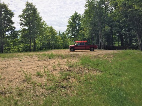
Here is our building site, looking south.  We have room for a small home, a large garage, and an RV or two.  A few of the trees will come out to open up a long view of the surrounding area.

IMG_3285 (2)

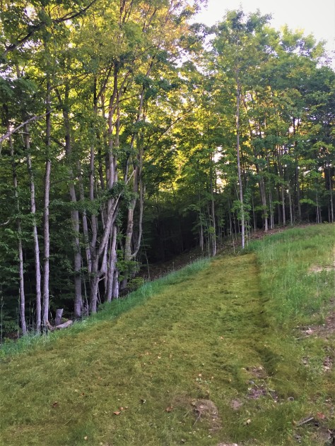
This view is looking north.  There are lots of possibilities as to what we will do with the space.  We will be doing most of the work ourselves, so plan on us taking a few years until our heads hit the pillows in our new home.

IMG_3346 (2)

One of the first things we wanted was a shed to store a few things in.  We’ll attempt to get that built in the time we have before we head to the UK.

IMG_8511 (2)

If it doesn’t get totally done, we will finish it when we get back.

IMG_3371 (2)

Diana is making sure the site doesn’t get reclaimed by the forest.

IMG_8513 (2)

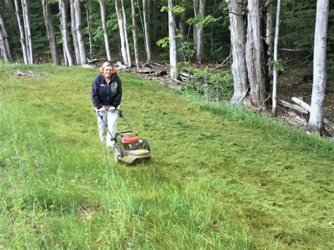
She is making quick work mowing the ground cover the previous owner put in. Our new to us string trimmer is perfect for the job.

IMG_8490 (2)

A few of the leaves have started to turn color, so we should be in for quite a show when we get back from our trip.  Our trees are about 90-plus percent maples.

IMG_3329 (2)

Be sure to stay tuned over the next several years as we turn our little slice of heaven into a place to call home.  This next week will be a busy one, so look for our next post to come from somewhere in London.  Until then, safe and happy travels to all!

A Very Different Year

When we chose to return to Sleeping Bear Dunes National Lakeshore this summer, we were hoping to build upon what we learned in 2018.  That has indeed happened, making this a very different season than we experienced last year.  And even though the subject matter was pretty much the same at our venues, the constant flow of new visitors has made each day unique and special.

When we first arrived, Ranger Matt asked if we would learn a new skill and work it into our interpretation; rope splicing and binding.  Many of the ropes in our museums were becoming frayed and worn and needed replacing.  Also, since our structures were built at the beginning of the 20th century and are not entirely critter-proof, mice find their way in during the winter.  Evidently, Mickey and Minnie have a thing for hemp.  🙂  I was given 200 feet of synthetic rope to replace the old lines with.  Larry, a volunteer with Inland Seas Education Association in Suttons Bay, stopped by to teach me how to backsplice a rope into an eye splice, along with making a sailmakers whip to keep the rope ends from fraying.

IMG_3227 (2)

This is my first attempt at a sailmaker’s whip on a practice piece of hemp rope.

IMG_3248 (2)

The lines are intended to act as a non-intrusive barrier between the visitors and the artifacts.

IMG_3247 (2)

The new line is much thicker than the old.  I found it difficult to maintain the structure of each strand, due to the slippery nature of the synthetic line.  Still, I was pretty happy with the way it ended up.  Note the hooks, which are made in our blacksmith shop.

IMG_3294 (2)

I needed some additional hooks and spikes for the Cannery, so Linda and Liz made them for me.  They are two of our volunteer blacksmiths, and they did an outstanding job!

IMG_3254 (2)

While I worked on the rope, the view from our ‘office’ was amazing!  Off on the horizon, the 1,000 foot freighter Mesabi Miner steams empty from delivering a load of iron ore to the steel mills near Chicago.

IMG_3258 (2)

Some days reminded us of the reason the lifesaving station was located where it was.  Here is Old Glory flying straight south on our radio tower/flagpole, with gloomy skies looming overhead.  Could the gales of November be far away?


IMG_3260 (2)

That earlier peaceful view can change in an instant.  In this photo, the 767 foot long freighter Philip R. Clarke heads north along the horizon through heavy seas.  Seas like this brings a crystal clear reality to our interpretation of the U.S. Lifesaving Service, as the visitors get a glimpse of what the surfmen were up against.  Most shake their heads in disbelief that they would row out into those conditions.

IMG_3228 (2)

The park’s Heroes of the Storm program helps folks to visualize a beach rescue using a Lyle gun and a breeches buoy.  Here is Ranger Gayle explaining the role of the 7 surfmen who worked at the station.

IMG_3231 (2)

One of the surfmen acts as the black powder charge in the gun, as the crowd yells BANG.  Here he runs at full speed with the projectile, trailing the shot line.  Captain Diana waits with crew member Raggedy Ann aboard the ‘sinking ship’ (our flagpole) for the line to arrive.  Every program has a fresh set of characters, and is as entertaining for us as it is for them. 🙂  Sadly, this year’s high water levels brought about a temporary halt to our actual Lyle gun cannon firing each Thursday.

P1020651 (2)

The beach has all but disappeared.  The small cannon recoils backwards a few feet when fired, and the required distance for safe viewing would put our visitors in the fragile dune grass.  Lake Michigan has risen 9 inches in May alone and is 33 inches above average at near record levels.  To get Lake Michigan and Lake Huron (hydrologically one lake) to rise just one inch, an additional 390 billion gallons has to be added to it!

P1020656 (2)

Another foot and we might be mopping the floors in the Cannery!

It hasn’t been all work up here in Leelanau.  We did manage to get out for a ride on the Leelanau Trail, our favorite rail trail.

IMG_3241 (2)

It’s hard to see Diana’s TerraTrike grin from behind, but it is there.  🙂

IMG_3252 (2)

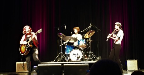
And the Music in the Park concert series continues for a few more weeks in Northport.  Plenty of dancing and wine make for a great evening each Friday.

IMG_3251 (2)

Indeed, Leelanau is a great place to be.  A few more weeks and this season will be a memory.  Soon we will be coming to you from new vistas in the United Kingdom and Ireland.  Will we be back to Leelanau next year?  If we do, we are sure it will yet again be different than years past. Be sure to stay tuned to our next Saturday morning post to see if 2020’s plans include this little slice of heaven.  Until then, safe and happy travels to all!

Planes, Boats, Automobiles and Music

Leelanau and Benzie Counties, MI – July 19-25, 2019

Keep on movin’…

If there is one statement that can describe our last week, the aforementioned line would be it.  Finishing up our shift at Sleeping Bear Dunes last Friday, we hightailed it up to Northport, Michigan to see a musical duo named Mulebone  

IMG_3130 (2)

We had listened to this Brooklyn, NY based pair back in 2017 and couldn’t wait to see them again.  The music they play can best be described as ‘roots blues’, if you can imagine such a thing.  Their hit Keep on Movin’ provided a theme for our week to come. We met up with our friends Rod, Mary, Lane, Patti, JoAnn, Paul and Skip, along with several other acquaintances.  A great evening, indeed!

Saturday morning found me opening the Cannery boat museum, while Diana was off to the Visitor Center to answer questions for the park’s guests.  While I was vacuuming, I heard a roar much louder than the Dyson I was dragging behind me.

IMG_3125 (2)

Four A-10 Warthogs buzzed Glen Haven, doing a wing wag as they passed.  I managed to get a photo of the last one as it flew by.  Later that day, we had a torrential downpour that lasted a good portion of the afternoon.  A couple on their bikes holed up in the building with me while the rain fell.  The noise level on the roof was deafening!  So much for any chance at the lake levels going down. 🙂

That night, Diana and I headed back to Northport to see one of our favorite bands, The Accidentals.

IMG_3149 (2)

Taking their name from the accidental musical note, Katie Larsen and Savannah Buist met by chance in a high school orchestra class.  Joined later by Michael Dause, this trio turns out some very innovative music.  They were recently signed by Sony Masterworks and are fresh off a tour of the United Kingdom.  We’ve seen them numerous times; the most recent being last year with our friends Jodee and Bill.  Unfortunately, the word ‘accidental’ reared its ugly side on Sunday as the group left Traverse City:

IMG_2221 (2)

Someone ran a stop sign and t-boned their van.  Luckily, everyone….and most of the equipment…is ok.  Sad to say that Katie’s carbon fiber cello took a direct blow and will never play their hit Michigan and Again again.  Instruments can be replaced though, as can vehicles.  They are already back on the road and their music lives on.

Keep on movin’…

Our Sunday was a bit better than theirs.  We drove south into Benzie County and visited Point Betsie Lighthouse.

P1020560 (2)

This gem was built in 1858.  The grounds consist of a combined lighthouse/keeper’s quarters, fog signal building, oil house and a separate lifesaving museum/gift shop.

P1020539 (2)

The museum had several pieces of authentic lifesaving equipment, including this time clock the shore patrol would’ve carried on their nightly rounds.

P1020511 (2)

The idea was that they would walk to a post several miles down the beach and insert the key that was attached to it.  That proved to their station’s keeper that they walked the entire distance.

P1020527 (2)

I found this photo interesting in that it shows the lighthouse depot at the foot of Mt. Elliott Street in Detroit, which still exists. My great-grandfather and his crew departed from that very same dock on the USLHS Amaranth in 1892 to build Old Mackinac Point Lighthouse.  The depot is about 1 mile from where he lived at the time.

P1020538 (2)

The museum also had this display that showed how to balance containers on a ship.  Being the hands-on guy I am, I picked up one of the blocks, which in turn caused the boat to roll over and dump the entire cargo.  Diana proceeded to reload the blocks on the deck and send the boat on its way.  🙂

Once we finished up at the museum and fog signal building, we headed into the lighthouse.

P1020548 (2)

The view to the north from the tower shows the entrance to the Manitou Passage.  The beach patrol from the adjacent lifesaving station would’ve walked north several miles each night to the key on a post.  The men at the Sleeping Bear station would walk south to the same post. We’ve made it our goal to attend the lighthouses’ bicentennial in 2058.  We will be 100 at the time.

Keep on movin’…

Monday found us on a morning hike before our shift in Glen Haven.

P1020582 (2)

Our purpose was to test out our new double-collapsible trekking poles that we are taking to the UK in September.  We like them so far.  The trail we chose for our hike was Alligator Hill up to Islands Overlook; an easy three mile round trip.

P1020584 (2)

This is Sleeping Bear Point from that viewpoint.  The black roof of the Cannery and the flagpole at the lifesaving station can be seen in the photo.

P1020568 (2)

This is the vista looking north.  South Fox Island is to the left and Pyramid Point is to the right.  Truly a spectacular view.

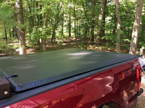
Tuesday saw me complete a project I’d been wanting to do since we purchased Hank the Deuce:

IMG_3168 (2)

This tonneau cover is specially designed to work in conjunction with my behind-the-cab toolbox.  It rolls up tight against the box when I’m hauling the fifth wheel.  It will keep the hitch and the other goodies we carry back there out of the weather.

Keep on movin’…

To wrap up the week, we met up with our friends Paul and Sheryl.  We’ve known each other since our college days at Western Michigan University.

IMG_3183 (2)

We met for dinner at Cherry Republic on Wednesday and took in the Empire Bluffs trail on Thursday morning.  It was good to see them again!  We followed that up with another shift at the Cannery and on to the next week at Sleeping Bear.  Keep on movin’!

Stay tuned for our next Saturday morning post as we look for more of northern Michigan’s gems.  Until then, safe and happy travels to all!


A True Hero of the Storm

Every so often as people travel through time and space, the stars align to put them right where they need to be.  Such is the case with a gentleman by the name of Richard Selissen.  In November of 1958, Dick was a cook on the Coast Guard cutter Sundew, which was stationed in Charlevoix, Michigan.  Back then, as is the case today, large cargo freighters steamed up and down Lake Michigan carrying goods between various ports in the region.

IMG_3087 (2)

Just last week, I photographed the Wilfred Sykes as it steamed north through the Manitou Passage and Sleeping Bear Dunes National Lakeshore.  This particular vessel was built in 1950. Eight years after the Sykes went into service, the steamer Carl Bradley was steaming north on November 18, 1958, from Chicago to its winter lay-up port of Manitowoc, Wisconsin.

IMG_2212 (2)

The 639-foot Bradley had been on the lakes since 1927, and had recently been hauling limestone between Rogers City, Michigan, and Chicago.  Two hours out of Manitowoc, U.S. Steel (the ship’s owner) sent orders  for the vessel to make one last run to Rogers City to pick up another load of stone.

P1020503 (2)

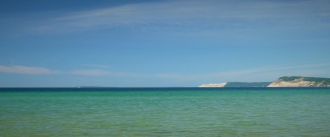
On many days, Lake Michigan looks like the photo above.  But this inland sea has been known to change in an instant.  On that day in 1958, a fierce gale was building as a storm system moved across the Great Plains of the central U.S.

IMG_2219 (2)

When these storms kick up, its not uncommon for the freighters to experience conditions as are shown in the photo above.  On November 18, the captain of the Bradley hugged the coast of Wisconsin to shield it from the sixty-five mile an hour wind that was coming from the southwest.  At some point, he knew he was going to have to turn northeast towards the Straits of Mackinac.  He did that just prior to the entrance to Green Bay.  The ship was moving with the wind with following seas and seemed to be doing well. Suddenly, the crew heard a loud thud.  The great ship had snapped in two in the middle.  A mayday was sent out and the thirty-five men abandoned ship into the relentless seas.

IMG_2218 (3)

The Bradley’s final resting place is shown in red on the map above at a depth of 360 feet.  The Coast Guard sent out several vessels to search for survivors, one being the Sundew, with a quickly assembled skeleton crew.  As the cutter left Charlevoix, local residents gathered to watch them head into the gale, fearing it would be the last time they would ever see the vessel.  The Coast Guard motto of ‘You have to go out…you don’t have to come back’ was surely on everyone’s minds that day. The captain of the cutter Hollyhock, which assisted in the search, described the trip as a “visit to hell”.

As the Sundew reached the Bradley’s last known position, Dick Selissen took up a position in the pilot house to assist in the search for survivors.  He spotted something unusual in the waves and notified the captain of it’s position.  It was a raft containing the only two survivors, Frank Mays and Elmer Fleming.  They had somehow managed to hang on through the night in the fierce gale and freezing temperatures.  Before they headed back to Charlevoix, the crew managed to pull 8 bodies of the Bradley’s crew out of the lake who hadn’t survived the ordeal.

Rogers City, where 23 of the Bradley’s men were from, lies 80 miles east by land of Charlevoix on Lake Huron.  Many of the crew’s families headed west across Michigan to await the Sundew’s arrival.  It was a somber sight as the ship came into port, her flags shredded from the storm.  The Bradley’s sinking hit Rogers City hard, as many families lost their sole breadwinner that day.

Fast forward many years later to a Walmart in Zepherhills, Florida.  Dick Selissen struck up a conversation with a gentleman who was very familiar with Dick’s summer home of Charlevoix.  It turns out that the man was Frank Mays, the seaman that Selisson had spotted in the raft so many years before.  Once again, the stars aligned.  What are the odds of that encounter happening?

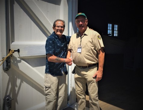
This past Wednesday, Mr. Selissen visited our lifesaving museum at Sleeping Bear Dunes.  He struck up a conversation with fellow volunteer Lucy about the 36-foot motor lifeboats that he also had crewed on while in the Coast Guard.  I showed up in the middle of the conversation at our shift change, when he mentioned he had been stationed in Minnesota at the time.  I asked him “where in Minnesota?” and he said “Duluth…on the CG-36527.”  I told him “Sir, your motor lifeboat is a half mile up the street in the red Cannery building”.

IMG_0823 (2)

He had no idea it was there.  He was thrilled!  Again, the stars aligned for this hero of the storm.

IMG_3114 (2)

What an honor it was to be able to speak with this gentleman.  Thank you for stopping by Sleeping Bear Dunes National Lakeshore, Mr. Selissen!

Be sure to stay tuned for more about our summer in Leelanau in next Saturday morning’s post.  Until then, safe and happy travels to all!

Badlands – in More Ways Than One

June 11-12, 2019 – Badlands of South Dakota

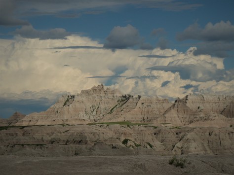
Badlands National  Park holds a special designation for me, as it was the first national park I visited in my youth. Since that time, we have been to many places that have similar qualities – particularly the Painted Hills in Oregon.  But none of those venues seem to combine the mud-like quality of the formations with the sharp spires that occur throughout this park.  Couple that with the fact that they rise from green prairies and you have a true ‘east meets west’ situation.  On this particular trip, we found that last reference had much more than one meaning.  More on that in a minute…

P1020145 (3)

After setting up camp in Wall, we headed on I-90 to the east entrance of Badlands National Park.  This area was known to the Lakota people as mako sika, which roughly translates to ‘land bad’.  They were also the first to notice fossilized remains of sea creatures, leading them to correctly assume that the Badlands were once under water.  That’s quite the assumption for a tribe that was thousands of miles from the nearest ocean!

P1020151 (2)

Since becoming a national park, those fossils have become a focus of scientific study.  Besides the shells and fish bones you would normally expect in a marine environment, species such as alligators and rhinoceros were found here.  When we visited in 1990, I found a small jaw fragment while on a ranger-led tour.  Hopefully it is still where I observed it.

P1020157 (2)

The park is also home to a wide variety of present day wildlife.  Here are several female Bighorn sheep that decided to moon the photographer.

P1020163 (2)

We saw prairie dogs by the hundreds.  This chubby guy stopped his meal long enough to pose for a profile shot.

P1020173 (2)

And this trio was not letting us pass until we snapped an image of them for the blog.  Consider it done!

As I had mentioned earlier, this trip introduced us to more than one meaning for the name ‘badlands’.  When exiting off of I-90, we saw a sign for the Minuteman Missile National Historic Site.  After questioning the ranger at the Badlands visitor center, we decided to tour there the next day.

Heading east again on I-90 from Wall, our first stop was just off the highway at Exit 116.

P1020182 (2)

Along the side of the dirt road, this fenced-in compound sits in plain sight.  Not long ago, this was one of the United States’s hundreds of active missile silos.  This small parcel of land held a missile that was 120 times more powerful than the bomb dropped on Hiroshima.  If launched, the missile would’ve flown over the North Pole to Russia in about a half hour.

ells2 (2)

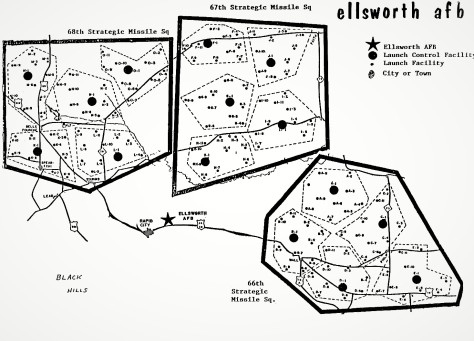
This facility was labeled D-9 of the 66th Strategic Missile Squadron.  Look closely at the map and you will see the towns of Wall, Sturgis, Belle Fourche, Lead, and Rapid City.  Chances are you’ve been within a stone’s throw from one of these silos at some point and didn’t even know it.

P1020185 (2)

At this particular silo, visitors can peer in from the top to see a deactivated Minuteman II missile.  These particular rockets were taken out of service and most of the silos were imploded after the START treaty with the Soviet Union.  About 150 silos remain in Wyoming, North Dakota, and Montana with the much more powerful Minuteman III missile in each of them. 

P1020189 (2)

Growing up just three miles from the massive industrial complex known as the Ford Rouge plant, I was always aware that there was a big Russian target on my head.  Not a comforting thing to think about as a teenager, believe me.  With that in mind, I peppered this ranger with a myriad of questions about these silos.  He was actually a a missile commander back in the day, and was extremely open about the workings of this facility.

P1020190 (3)

This heavy concrete lid covered the silo at one time.  It is currently welded partway over the silo, in accordance with the treaty.  In the 1983 television movie The Day After, there was a scene showing these lids retracting just prior to the missiles launching to their intended targets.  That scene sticks in my mind to this day.

P1020196 (2)

This is actually a hardened communications antenna.  Think of it as a nuclear-proof cell phone tower.  The ranger informed us that it would have not withstood a blast, even though that was the original intention.  When I could think of nothing else to ask, I thanked him for keeping us safe over the course of his career, which he appreciated.

After that sobering visit, we continued to Exit 130 and the Minuteman Visitor Center.

IMG_2911 (2)

This facility has a museum, theater and gift shop.  A gift shop???  Do you really want to be reminded of a possible nuclear holocaust by drinking your morning coffee out of a Minuteman Missile mug? We viewed the movie, which started very much like The Day After, showing peaceful scenes with flyovers of fields of grain and unending prairies.  It didn’t take long for it to show images of nuclear weapons detonating, the polar opposite of the earlier idyllic segments.  After going through the nuts and bolts of the Minuteman program, they got to the story of one Stanislav Petrov, a missile commander from the Soviet Union.  Remember this man.

1ABA9D2A-1DD8-B71B-0BE0FF2327D15C06 (2)

Seen here during a visit to the Minuteman National Historic Site a few years ago, he is credited with single-handedly saving the world as we know it.  In 1983, just before the above-mentioned TV film aired, this commander was alerted by his men of five incoming U.S. missiles on their radar screens.  Tensions were high at that time, as the Soviets had just shot down a Korean Air Lines 747 with 246 souls on board.  Petrov looked at the images and said “How can this be?”  He knew the U.S. would launch far more than five missiles, so he held back from reporting what he was seeing.  It turned out to be sunlight reflecting off high altitude clouds over North Dakota.  Had he let his superiors know, missiles would have started flying in both directions.  That inaction simultaneously ruined his military career and saved us all.  He eventually suffered a nervous breakdown from the stress of it all.  And if that wasn’t frightening enough, we learned later on in the museum that incidents like this happened twelve times…six on each side.  In one of them, someone on the U.S. side inserted a training floppy disk into a computer which lit up the radar screens with incoming Russian missiles.  Fortunately, someone discovered the error before the U.S. retaliated to a non-event.

IMG_2915 (2)

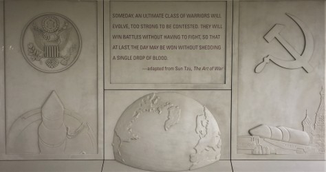
In hindsight, the quote on this display in front of the visitor center may be impossible to achieve, due to the human factor involved with these weapons.  After visiting this facility, we skipped the Junior Ranger badges this go around.  Personally I went a good half hour before I could say anything, as I had a sizable lump in my throat from that film.

P1020174 (2)

Still, it was a well done historic site worth visiting.  Petrov himself stated that never in his wildest dreams would he have thought he could visit such a place on the ‘enemy’ side.  Yes we were the enemy to them, as they were to us.  Hopefully, the only thing we ever see flying over Wall, South Dakota are rainbows and clouds.  Our wish for future generations is that the only ‘bad lands’ are the Lakota mako sica hills that dominate the landscape east of the Black Hills.

Next up, we head east through the remainder of South Dakota into the Missouri River region of the state.  Along the way, we found a pleasant surprise nestled along the river’s banks.  Be sure to stay tuned for that in next Saturday morning’s post.  Until then, safe and happy travels to all!


Flying Along the Front Range

Along the Front Range, Colorado; May 22 – June 4, 2019

Our trip the past few weeks along the Front Range of the Rockies was a homecoming of sorts for us, as Estes Park was our first big vacation to the mountains as a married couple…some 29 years ago.  Diana had been to Denver with her Girl Scout troop as a teenager and I was there as a 6-year old with my mom, dad, and my sister Judy.  Back then, Dad was the sales manager for Schwayder Brothers in Detroit at their metal chair facility.  You may know Schwayder by the name of their product line: Samsonite.

IMG_2169

Issac Schwayder (right) and his four sons. Jesse Schwayder, second from the right, was my dad’s boss.  The company slogan was “The Samsonite – Strong Enough to Stand On”.

At that time, Schwayder was consolidating their operations to their headquarters in Denver, so we were on a scouting mission to see if that would be our new home.  Mom and Dad chose to remain in Michigan, as the pull of family won out over the Rockies…thus forcing Dad to find a new employer.  As much as I love Colorado, I’m very glad they chose to stay in southeast Michigan.  🙂

As mentioned in our last post, we had to change plans to stay at lower altitudes.  That took us south out of Page through Flagstaff, east on I-40 to Albuquerque and then north.

IMG_2885 (2)

While in Albuquerque, we picked up some Oboz waterproof low hikers from REI for our trip to the UK in the fall.  These beauties were field tested by our friends Linda and Steven on their 500 mile walk across Spain on the Camino de Santiago.  Accomplishing that without blisters is a pretty good testimonial for Oboz, which is headquartered in Bozeman, Montana.  We then headed up towards Santa Fe, spending a couple of nights at the Black Mesa casino.  Again, we managed to hit a jackpot on the casino’s free play and walked out the door without spending a penny of our own.  We will take it!  We also paid a return visit to a little Venezuelan restaurant in Santa Fe called Santarepa Cafe.  We went out of our way to eat there again, as it is that good.  The owner is a sweet woman who comes to your table and genuinely inquires as to how you like your meal.

Scooting around the southern end of the Rockies, we headed up the east side and said farewell to New Mexico.

IMG_2601 (4)

In the process, our Colorado fifth wheel entered the State of Colorado for the first time!  We continued up to Colorado Springs to spend the better part of a week.  The first morning at the KOA, we noticed what we thought was an early riser playing music on his RV horn as he left the campground.  Nope…we were parked across from Fort Carson, which plays Revelry every morning at 6:30 AM and Taps at 10 PM.  We’re in the Army now!

Here is a spot I had visited with my family when I was a child; Garden of the Gods.  This land was given to the City of Colorado Springs by the children of late owner Charles Elliott Perkins in 1909 to use as a park.  The stipulation was that they could never charge an admission fee or allow ‘intoxicating liquors’, which they haven’t to this day.

IMG_2620 (2)

I distinctly remember Balance Rock as a 6 year old. 🙂

We also happened to be in town during the Air Force Academy graduation.  Our first tip-off to that was when we heard a jet approaching our car from behind, only to find out we had been buzzed by…

IMG_8245 (2)

…a B-2 Stealth bomber.  We also saw the Thunderbirds practicing. The next day was the graduation, so we set up our chairs in a field across I-25 from the academy.  When the cadets tossed their caps in the air, the Thunderbirds streaked across the field.

P1010847 (2)

There was a long delay after that first pass, and we noticed that there were no cars on the freeway.  Soon there was a procession of motorcycle police, followed by this:

IMG_0529 (2)

There goes the President!  Not too long after he had left, the show resumed.

P1010848 (2)

It sure is fun to see these planes…

P1010879 (2)

…especially with Pike’s Peak as a backdrop.

The other place Diana wanted to visit was the U.S. Figure Skating Hall of Fame, which is located in town.

IMG_2627 (2)

She really was hoping to meet Scott Hamilton.  It wasn’t meant to be, but she did get to see his gold medal from Sarajevo.  There was even someone there that I appreciated…

IMG_2629 (2)

Frank Zamboni!  Those twirlies would fall flat on their faces if it weren’t for the superior talent of us Zamboni drivers.  🙂  All kidding aside, we both really enjoyed the museum.

From Colorado Springs, we headed up to Denver to meet friends and family.

IMG_2633 (2)

First stop was to our college friend Kirsten’s house for a wonderful meal.  Here we are with her mom and her husband Mike.  It sure was great catching up with them.  Mike is an excellent cook!

We also visited Diana’s cousin Abby, her husband Josh and daughter Tara.

IMG_2168 (2)

We forgot to get a photo, so Abby let me use this one.  Abby is Diana’s cousin Jerry’s daughter.  We loved getting to spend the afternoon with them in their beautiful home, especially the sidewalk chalk drawings that greeted us, along with Tara jumping for joy at the front door upon our arrival.  🙂

We also visited a place we long wanted to pay our respects at; the Columbine Memorial.

IMG_2642 (2)

Located in a Littleton city park adjacent to the school, this beautiful remembrance moved us.

IMG_2643 (2)

Since the thirteen students and staff were killed at this school in 1999, over 140 more have died in our learning institutions.  As the husband of a teacher, I worried about this constantly…as I knew the innocent students’ safety was first and foremost to Diana.  If you can, take the time to visit here.  There are moving tributes to each of the victims, along with snippets of thoughts from the survivors.

From Denver, we moved up to Fort Collins for a couple of days.  That was our lower altitude base to revisit Rocky Mountain National Park and Estes Park.  Our last time there was 1990, and we were driving a regular cab Ford Ranger pickup pulling a very heavy Steury pop-up camper.  The number one hit on the radio that trip was Shenandoah’s Next to You, Next to Me.  One verse stood out in my memory:

“If the Good Lord’s willin’ when we’re old and gray
The kids are grown up and moved away
We’ll be rocking’ here side by side
With the BBQ chicken and the TV guide”

Fire up the grill, sweetie and I’ll grab the rockers.  🙂

This go around our mission was to see Bighorn sheep, something we hadn’t seen since our last time there.

P1010987 (2)

Mission accomplished!  We actually saw several of them.

P1020016 (2)

We also saw plenty of elk.  This guy was happy to show off his velvety new rack.

Our special treat was when we drove up Trail Ridge Road towards the Alpine Visitor Center.

P1010940 (2)

We got to Rainbow Curve, 10,500 feet up, and the road was closed due to snow at the top.  They were allowing visitors to walk up as far as they wanted, so we took advantage of it.

P1010950 (2)

It was an absolutely amazing treat.  We went up a half mile or so…over 11,000 feet, before returning.  Although out of breath, we did just fine!  Everyone was having a great time…

P1010955 (2)

…including this young pair.  I’ll bet the road being closed made their day.  🙂

Well, that wraps up our flight along the Front Range!  Next up, we head north to South Dakota to help some friends with a little project.  More on that in our next Saturday morning post.  Until then, safe and happy travels to all!

Adapting to the Altitude

May 15-21, 2019  –  Kaibab Plateau and Page, Arizona

One thing we had paid little heed to in planning our trip west was our ability to adapt to the altitude.  Our winters in Melbourne Beach, Florida are spent at a whopping 10 feet above sea level.  So when we arrived in Santa Fe a mere 8 days after leaving the Florida coast, we found that were struggling with the 7000 foot-plus altitude gain.  Diana woke up with a terrible headache, and we were both having a difficult time breathing.  Throughout the trip we were up and down the mountains, so we drank plenty of fluids and tried to follow the advice for adjusting to altitude.  Bryce Canyon was tough at 7700 feet, but we dropped to 3200 feet at Hurricane, Utah and were OK again.  Our next stop was Jacob Lake, just north of the Grand Canyon.

IMG_2538 (2)

The sign on the front of the Jacob Lake Inn says it all.  We set up camp about 1/4 mile away, just shy of 8000 feet.  We figured we would go to the North Rim of the Grand Canyon the next day, so we took the advice of the volunteer at the Kaibab National Forest Visitor Center and went to see the nearby Vermilion Cliffs overlook.

P1010690 (3)

Our jaws dropped at the vista before us!  The wide open House Rock Valley stretched out for miles.  Highway 89-A angled across it, beckoning us to explore it…so that’s exactly what we did.  We ended up driving all the way to Marble Canyon, stopping at Navajo Bridge to see if we could finally see a California Condor.

P1010696 (2)

From the old bridge (now a pedestrian crossing), we finally were able to see what we were looking for.  Since these birds were so close to extinction, wildlife experts have put wing tags and radio transmitters on them to identify and keep track of them.  This one is labeled as H9, and she was sitting underneath the new bridge. We stayed as long as we could watching two adults and a juvenile, then headed back to Jacob Lake before sunset.

The next morning, I woke with a headache that was as bad as any migraine I had ever experienced.  Diana immediately knew what was going on, as she had felt the same way in Santa Fe. We knew we needed to get to a lower elevation, so we made some quick changes and headed to Page, Arizona two days earlier than planned.  A mere 43 miles from the North Rim of the Grand Canyon and we drove away from it. We took the long route running through Kanab and Big Water, as this would allow us to see the the last of four visitor centers for Grand Staircase-Escalante National Monument.  As we traveled at the lower altitude, I began to feel better.

IMG_2543 (2)

On the way into the Big Water Visitor Center, Diana spotted this beautiful bull snake.  We were first introduced to these amazing reptiles by Ranger Mariah in 2017 at Prineville, Oregon.  It’s always good to see them, as they have a tendency to keep the rattlesnakes away.

Once at Page, we readjusted the remainder of our trip to include campsites at lower altitudes.  For us, the trigger seemed to be sleeping, as less oxygen is taken in then.  Once we had that taken care of, we were off to see the sights!  First place we wanted to see was the much talked about Horseshoe Bend.  We’ve had many friends who have ventured to this place, parked at the trailhead, walked to the edge of Marble Canyon and peered into the abyss at the 270 degree bend of the Colorado River.

IMG_2110 (2)

Things have changed this year.  The City of Page owns the land people were parking on, so they built a paved parking lot, complete with fee booths.  The lot is already being doubled in size to accommodate the huge crowds.

IMG_2129 (2)

Look closely: that’s a huge parade of visitors! The idea of so many people being so close to the edge of a sheer drop off wasn’t comforting to us, as all it takes is one person to bump into another and send them on a free fall.  We had heard that the National Park Service, who oversees the rim of the canyon as part of the Glen Canyon National Recreation Area, had made some changes of their own this year…so we decided to take a look for ourselves.

P1010727 (2)

Here is that change…an accessible viewing platform with railing.  Works for us!  There are still plenty of places available to stand along the unguarded rim and snap an Instagram selfie.  Just note that people have died here are a result of venturing too close to the unguarded edge.  And what is it that all these people are looking at?

IMG_2124 (2)

It’s Horseshoe Bend!  Those little white things on the river are boats. Definitely an amazing sight that was worth seeing, but the massive amounts of people are a detriment to this place…us included.  We are glad we saw it for ourselves this one time, but we will respectfully leave this unique feature for others to discover in the future.

Our next stop was Glen Canyon Dam and Lake Powell.

P1010739 (2)

As we walked through the exhibits in the visitor center, we saw a display about seepage.  Unlike Hoover Dam which is anchored to granite,  Glen Canyon dam is anchored to Navajo sandstone.

P1010822 (2)

That green line is vegetation growing in the seams that the lake water is leaking through.  Several of them extend down the canyon on both sides.

P1010826 (2)

They’ve even had to put long bolts in the sandstone to keep it in place.  This is an ongoing process.  The more I read about this dam, the less I wanted to be around it.  Meanwhile, the water level continues to drop in both Lake Powell and Lake Mead (behind Hoover Dam), due to ongoing drought conditions. If the water behind this dam drops another 90 feet, it stops generating power.  If by some miracle the lake fills to capacity, there is a chance it might give way, as it nearly did in 1983 (read about it HERE).  There are many people who are proponents of filling Lake Mead first and just bypassing Glen Canyon Dam.  It will be interesting to see what the future holds.  One thing is for sure: it won’t be status quo forever.  Mother Nature always has the last word.

Next thing up was a tour of Antelope Canyon.  We have a lot of friends who have toured the upper and lower sections of this beautiful place, so we were looking forward to going there.  The day of our reservations was windy and raining.  This tour requires sunlight to make it worthwhile, and thunderstorms are a no-no in a slot canyon.  We weren’t able to reschedule.

Oh my…so was Page a wash for us?  Absolutely not.  We found Big John’s Texas BBQ!  The place was far better than the two places we ate in Amarillo, so we visited there twice. 🙂  And with some time on our hands, we decided to take a little 150 mile one way day trip…

P1010771 (2)

…to the North Rim of the Grand Canyon.  We figured that if we didn’t sleep there, we would be fine…and we were.  Our time was spent at the lodge and the nearby Bright Angel Point trail. Unfortunately, we weren’t able to visit many of the remote views off of the National Forest roads on that day, as many were still closed due to snow or winter damage.  We did, however, enjoy the meadows along Highway 67 on our trip in from Jacob Lake.  And our dinner at the Jacob Lake Inn was delicious! The Kaibab Plateau and North Rim deserve much more time.  Perhaps we will day trip from Kanab in the future, a much shorter distance than Page.

Speaking of that trip from Page, it had two awesome benefits.  We were able to traverse House Rock Valley again along the Vermilion Cliffs in both directions and…

P1010795 (2)

…we were able to visit our old friend H9 again.  This time, she was immediately below the pedestrian bridge deck, so I could photograph her much closer.  I keep my shutter on silent, as I learned in Oregon that the noise disturbs the wildlife.

P1010815 (2)

We even watched the juvenile fly a few times, which was a great thrill for us.  Adult condors have an outstanding 9-1/2 foot wingspan!

P1010820 (3)

As the sun set on the Vermilion Cliffs, we were happy that our visit to Northern Arizona ended so well.

Next up:  We head east and north to visit relatives and friends along the Front Range of Colorado.  There was even a couple of unexpected surprises. Be sure to stay tuned for that in our next post.  Until then, safe and happy travels to all!


The Path to Zion

Hurricane, UT – May 11 through 14, 2019

The path to Zion is described by Miriam-Webster as a journey to a spiritual place or nirvana, in reference to Mount Zion in Jerusalem.  Anyone who has ever been to Zion National Park in Utah can see what the Mormon pioneer Issac Behunin was thinking when he named the area.  It is one of the most beautiful places we have ever seen, rivaling Yosemite Valley in California and Icefields Parkway between Banff and Jasper, Alberta.  Our path to Zion took us on a southerly route into Arizona, as a late winter snowstorm had damaged the switchbacks on the Utah tunnel route on the east side of the park in March.  Our original plans to stay in Mt. Carmel were changed to a campground in Hurricane, Utah at that time.  The road has since been repaired, but our camping plans were set so we didn’t change them.  Our hidden bonus was that we would get to explore Pipe Spring National Monument along the way.

Pipe Spring is a gem of a park, in that it keeps a piece of history alive that would otherwise be forgotten.  It is here, along the vermilion cliffs that border Arizona Highway 389, that water flows from a hillside into an area that today seems to be otherwise devoid of moisture.  Once an area of verdant grasses and plentiful wildlife, this thin length of land lies between the Grand Canyon to the south and the cliffs to the north.  It is known as the Arizona Strip, as it is cut off from the rest of the state by the canyon.  With the arrival of the Mormon settlers the delicate balance that supported the grasslands was disrupted, as their cattle overgrazed the area and destroyed the soil.  When the Paiute Indians were kind enough to show the settlers the spring, the Mormons promptly built a fort over it to claim it for themselves.

IMG_2492 (2)

That stone fort still stands to this day.  The park service has done an excellent job in preserving the building and interpreting what happened here.

IMG_2490 (2)

The spring itself bubbles up underneath the floor beneath this organ and is channeled via pipe to the other side of the fort. This allowed for indoor plumbing and, as the water from the spring ran under the floor, it cooled the home.

IMG_2498 (2)

That pipe empties into this wooden trough in the basement of the building on the east side of the fort. This was a root cellar and had an area for making cheese. They had plenty of milk for making cheese, as the Mormons often paid their tithe with dairy cattle.

IMG_2512 (2)

From there, it empties into a pond outside the walls. Since a 1933 agreement, the water flow from the spring has been evenly divided among the National Park service, the tribe, and private cattlemen.

IMG_2514 (2)

Another point of interest to note are the telegraph poles and wires outside the fort.  Pipe Spring was the first telegraph office in Arizona.

Our visit, while short, provided a fascinating look into the struggles between the settlers and the native people.  This park is well worth spending a few hours to explore, if you are passing through on this route.  While the parking lot is large enough to support a couple of large RVs, consult a satellite view on Google Maps to decide for yourself whether or not to bring your RV there.

Once we reached Hurricane, we set up camp at WillowWind RV Park.  As Midwesterners, it was divine to see real grass and trees again!  They even allowed us to wash our vehicles, a rarity in this water-starved region.  The town itself received its unusual name when Erastus Snow, the leader of a group of Mormon surveyors, had the top blown off his buggy by a strong desert wind.  He declared the place to be named Hurricane Hill.  We found it to be a great town to use as a base camp for visiting Zion National Park.

Our first priority was hooking up with our friends, Nancy and Bill.

05 (2)

We were introduced to this charming couple by David and Sharon when we were in Myrtle Beach last year, and we hit it off right away.  They offered to show us the east side of Zion in their Jeep, which meant we were going to see the tunnel after all!

IMG_1900 (2)

The road leading to the tunnel was beautiful.  The native name for this area is Mukuntuweap, meaning either straight canyon or straight up mountains, depending on the source.  William Howard Taft declared this to be Mukuntuweap National Monument, but the Mormons complained loudly and the acting National Park Service director at the time bowed to their pressure and changed it.  No matter which name is used, either one describes this place perfectly.

Once we passed through the mile long tunnel, we came to one of Zion’s unique features…

IMG_1873 (2)

…Checkerboard Mesa.  This sandstone hill is unusual in that it not only has its horizontal layering lines, but also has vertical cracks, believed to be caused by expansion and contraction.

After lunch, the four of us headed to the end of the canyon and hiked Riverside Walk, a trail that leads to the Narrows.  That last trail was closed, as the water level was too high in the Virgin River.

IMG_2060 (2)

Our mode of transportation to get there was the Zion Shuttle, a bus and trailer combination that is unlike any system we had seen at other parks.  It was fast, efficient and rarely over-crowded.  The tilted roof vents funneled the canyon air in, which kept us cool.  The secret to their system is that they don’t have to compete with other vehicles, as the parks roads are closed to traffic during most of the year.  There also is a lot of them, so there isn’t a long wait at the bus stop. Do take into account that we were there before Memorial Day; chances are that it is busier during the summer.

IMG_1916 (2)

Nancy pointed out this beautiful waterfall at the Temple of Sinewava.  This is an emphemeral waterfall, in that it only appears after a rainstorm.  The following day, it was gone.

06 (2)

We thoroughly enjoyed our day with Nancy and Bill; we will see you two down the road. 🙂  Thanks for the Jeep tour and the great day!

Our next day saw us arriving early…a key to getting a space in the Visitor Center parking lot.  From there, we used the shuttle to explore the rest of the stops in the canyon.
IMG_1987 (2)

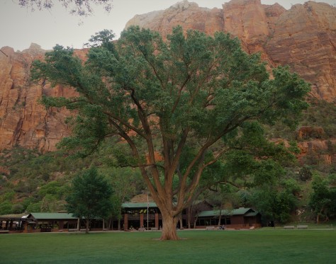
This huge Fremont Cottonwood tree at the Zion Lodge is over a century old.  As big as it is, it pales in comparison to the height of the canyon walls.  From the lodge, we hiked across the river to Lower Emerald Pool.

IMG_1988 (2)

From the bridge, it is apparent how swift the river was running.  Due to trail damage, the trail didn’t go beyond Lower Emerald Pool.

IMG_2013 (2)

Still, the view from here was amazing.

IMG_2021 (2)

The trail continued behind the waterfall…

IMG_2025 (2)

…to the place where the rockfall occurred.  This isn’t Disney, folks.  Glad no one was on the trail when this happened!

IMG_2037 (2)

When we got back to the bridge, we had a bit of a traffic jam.  Still another example of the different ways to enjoy Zion.

Once back at the lodge, we headed up the Grotto Trail.

IMG_2046 (2)

This cabin was built in 1924 to house the park museum.  It now is housing for the artist-in-residence, and is the oldest building in Zion.

IMG_1985 (2)

The Grotto was also a good place to see wildlife, including this bluebird.

From there, we went to Weeping Rock, which is a formidable wall of dripping sandstone.  The thing that stood out at this location was not so much the wall itself, but the view of the canyon the trail afforded.

IMG_2056 (2)

This is one of the best overall views of the valley that doesn’t require a significant vertical hike.  Had it not been for others wanting to see this same view, we could’ve stood here all day long.  🙂

To round out our visit, we continued on to the shuttle stop at the Temple of Sinewava, a place we had visited the day before with Nancy and Bill.  Our reason for this visit was because we had heard there were California Condors frequenting the area.  You may recall that we had been trying to see them at the Grand Canyon.  While we did see some large birds soaring here, we determined them to be turkey vultures.  Will we ever see a condor? Obviously not here, but what we did notice was the traffic jam 900 feet up on the Angel’s Landing trail.

IMG_2062 (2)

At this point, the trail is only a few feet wide and it drops off the same distance on the other side.  Note that there isn’t a railing, only a chain to hang on to…and it is a two way trail.  Again, this isn’t Disney, folks….although this hike would definitely be considered to rival Space Mountain.

IMG_2070 (2)

This fellow observer was as interested at the spectacle far above as we were.  We had no plans to join in that fun, but we did view a friend’s outstanding video afterwards where they hiked Angel’s Landing in November a few years back.  In it, Jim had a GoPro mounted above his head looking downward that shows just how narrow this trail is…including the shuttle stop I took my photo from.  You can access their YouTube video by following this link: Vertigo Inducing Video of Angels Landing Hike in Zion National Park .  Again, this trail is not for someone with a fear of heights.  Jim and Barb picked a great time to do it, in that it wasn’t crowded that day.

Our path to Zion was worth the effort it took to get there, and we will make it a point to return to this amazing place someday. The place the Native Americans call Mukuntuweap is one of our favorite destinations on this trip.

Next up:  Our trip plans get shuffled, due to another run-in with altitude sickness.  More on that in our next post, so be sure to stay tuned for that.  Until then, safe and happy travels to all!

Heading to Bryce Canyon

After establishing in Torrey that we weren’t going to be taking Route 12 to go to our next destination at Bryce Canyon, we selected a series of roads that ran west of the Grand Staircase instead.  The first north/south portion of this journey took us along Utah Route 62.

IMG_2442 (2)

This road runs a little over 40 miles down a wide valley until it joins up with US-89.  We literally saw only two other vehicles over that distance…both heading in the opposite direction.  I couldn’t help but think of the 1960’s TV series, The Big Valley as I motored along.  It was a scene that spoke to the vastness of this part of the country.  It was also noticed while we were planning this route that the Mormon pioneers laid out their towns in the same way.  Known as the Plat of Zion, each village uses a grid system with a north/south Main Street and an east/west Center Street.  The town of Loa is a prime example of this.

IMG_2147

The streets are wide and the blocks are large.  The streets use the same numbering system, based off of the ones in Salt Lake City, which begin at Temple Square.  For instance, E 200 S Street is the second street south of Center, on the east side of Main.  There are four 1-1/4 acre parcels within each block.  The original settlers would determine what parcel they would receive by lottery.  It made it pretty simple for us when navigating these communities, once we realized they were all laid out the same.

Once on US-89, we broke up the trip by stopping at the town of Circleville.  This little burg was the childhood home of the legendary bank robber and outlaw, Butch Cassidy.

IMG_1718 (2)

The log cabin he grew up in still stands along the highway.  There are several interpretive panels that tell a bit about him and his time on this small ranch.

IMG_1717 (2)

I found this video camera amusing, in that banks use these now to thwart robberies.  Maybe Butch would’ve had second thoughts on his career choice, had this monitor been here a century earlier.  🙂

IMG_1719 (2)

This was our view out the rear window of our fifth wheel in Circleville.  Utah certainly received its share of snow this past winter!

From there, we headed into the mountains to Bryce Canyon National Park.  Once set up at Bryce Canyon Pines RV Park, we made a quick trip to the Visitor Center to grab our Junior Ranger books.  We were alerted to the fact that they were difficult by Ranger Keith, with him quipping that they were PhD level.  He wasn’t kidding.  It was probably the second most difficult program, coming in just behind John Day Fossil Beds in Oregon.  Not wanting to wait any longer, we buzzed out to Sunrise Point for a peek at the hoodoos that this park is famous for.

IMG_1734 (2)

Photos of them would have to wait, as my camera trained on a herd of mule deer descending into the formations.  This trio leading the pack were alerted to something in their path.

IMG_1740 (2)

Turns out it was a line of horses and mules coming up the trail.  There was a bit of excitement when this lead horse spotted the deer, but the experienced rider quickly regained control of his stead.

That evening, we attended a program called Things That Go Bump in the Night, led by the same Ranger Keith who gave us out Junior Ranger books.  It was at that event where we met a longtime friend for the first time.  How is that possible?  We will tell you in a bit.  The program itself was fantastic, reminding us of the wonderful programs that Ranger Mariah would present while we worked with her in Prineville, Oregon.

The next day found us heading back into the park to see the hoodoos.

IMG_1746 (2)

What a gorgeous place!  Bryce is technically not a canyon, as it is not carved by a river. It is rather a series of amphitheaters that look east over the Colorado Plateau.  These formations are at the top of the Grand Staircase, which steps down all the way to the bottom of the Grand Canyon.

IMG_1759 (2)

Our visit that day saw a mixture of sun and clouds, with brief periods of snow.  Rainbow Point, the highest point on the Scenic Drive, tops out at 9115 feet.  I actually had issues with the altitude in this park, as I was finding it difficult to catch my breath.

IMG_1796 (2)

This massive anvil cloud rose near the town of Escalante in the distance.  We revisited there during our visit to Bryce to become Junior Rangers at Grand Staircase-Escalante National Monument.  It’s to be noted that we got their well before closing time this go-around.  🙂

IMG_1785 (2)

The stunning scenery at Bryce, such as Natural Bridge, produce an interesting phenomenon:

IMG_1790 (2)

The hoards of tourists witness most of it through a viewfinder.

IMG_8151 (2)

No one is immune to it…not even yours truly. 😉

As you can see in this last photo, there seems to be a bit more snow than in the previous Bryce images.  That is because we awoke one morning to the following scene:

IMG_1835 (2)

Yikes!  These sea-level Floridians aren’t used to dealing with this!  Knowing it would likely soon melt, we headed into the park to take in the view.

IMG_1849 (3)

The sprinkling of white on the top of each spire added depth to them, bringing definition to the scene before us.

Due to the strong winds, cold temperatures and snow that we had while we were there, our hiking was limited for this visit.  We did take one short and easy walk out to Mossy Cave, one of the wettest spots in the park.

IMG_1814 (2)

Yessir….its a cave with moss in it!

IMG_1805 (2)

Along the trail, this pretty waterfall appears to be the idyllic natural scene.   It is anything but.  Carved out by Mormon pioneers with picks and shovels over a century ago, this river is part of a canal known as the Tropic Ditch.  Since it was completed in 1892, the creek has provided the communities of Tropic and Cannonville a near steady flow of irrigation water.

Returning to our reference to a longtime friend that we mentioned earlier in the post.  At the evening program on Tuesday, we met Gaelyn from Geogypsy in person for the very first time.  We have followed each others blogs for a long time, with Diana discovering her journal in early 2014.  On Friday evening, we met for dinner.

IMG_2481 (2)

Gaelyn is a veteran NPS Ranger, having begun her career with the U.S. Department of Interior at Mount St. Helens in the mid 1990’s.  She is the person who inspired us to seek out the Junior Ranger programs at the parks we visit.  With our constant commenting back and forth on our blogs, our conversation over dinner was as natural as the outdoors we all three love so much.  It was truly a joy to finally get to meet her in person.

Oh, and that PhD Junior Ranger badge?

IMG_2148 (2)

We got ’em!  Definitely worth the effort.  🙂

IMG_1824 (2)

Bryce Canyon National Park is surely on our ‘return to’ list.  We thoroughly enjoyed our introduction to this scenic Utah beauty.

Next up:  we head southwest to the westernmost point of this trip, Zion National Park.  Along the way, we find a little gem of a park that most people pass by on their way there.  We also spend the day with friends we last connected with in South Carolina. Stay tuned for all of that in our next post.  Until then, safe and happy travels to all!


“Best Plan B Ever”

Some days call for a switch to Plan B.

On May 4, we arrived in Torrey, Utah to rain and thunder.

IMG_2430 (2)

Once the storm headed east, we received our traditional rainbow after a family member arrives in heaven.  This tradition began in 1980 with my aunt requesting one from my grandfather and has continued without fail ever since. Thank you for the sign, Uncle Bob!
The next day, after a stop in the visitor center at Capitol Reef National Park, we headed into the preserve to do some exploring.

IMG_1664 (2)

Our starting point was located in the former Mormon settlement of Fruita.  In that community, there is a pull-off along Utah 24 that has some amazing petroglyphs.  A boardwalk leads along the rock wall they are carved into.  We spent a good half hour viewing these drawings, attempting to decipher what they meant.  While we were there, a large group of Italian tourists stopped, all marveling in their own language at what they were seeing.  After returning to the parking lot, we saw that they had not been traveling on a tour bus.  Quite to the contrary…

IMG_1669 (2)

…they were exploring in a line-up of Class C motorhomes.  They sure seemed to be having a great time.  🙂

Our next stop was to Gifford House, just south of the visitor center.

IMG_1673 (2)

This is a former farmhouse that now doubles as a museum and store.  Diana purchased one of their small pies, and I got some homemade ice cream and a couple of gluten free cookies.  Delicious!

Capitol Reef’s claim to fame is the 100 mile long “waterpocket fold” that runs from Thousand Lake Mountain south to Lake Powell.  The fold is basically a fault in which the uplifted rock traps pockets of water behind it. The long, slender park is filled with hikes through slot canyons and over sandstone ridges.  We drove the 8 mile paved Scenic Drive, looking over possible hikes as we went.  At the end, a dirt road to Pleasant Creek continued onward.  This route was recommended to us by one of the rangers at the visitor center.

IMG_1674 (2)

It was at that point that the weather turned against us, as looming dark clouds rolled over the mountains.  Again, the rain fell and the thunder rolled.  The last thing we wanted to do was hike on ridges or slot canyons, or be driving on a road that followed a wash when a storm was imminent.  We scooted back to Torrey without delay.

On our way back, we came up with a Plan B, which was a 65 mile drive to Escalante along Utah Scenic Byway 12.  I had previously discussed this route with our friend Jodee, who recommended it as a beautiful drive, just not in an RV.  Definitely a great road to explore in the Escape.  We grabbed a cup of java in Torrey at Castlerock Coffee, where the barista confirmed we were about to take one of America’s most scenic highways.  Off we went!

IMG_1677 (2)

Climbing 3000 feet out of Torrey, the road was gorgeous.  We encountered rain which quickly turned to snow.  We drove on, hoping the other side of the mountain was sunny and dry…

IMG_1678 (2)

…which it was!  We were greeted with a completely different viewpoint than we had been seeing on the roads within Capitol Reef, as we were now far above the ridges.

IMG_1680 (2)

Deep canyons were carved through the desert floor below us.

IMG_1685 (2)

Domes of sandstone rose in the distance.  What would time and erosion turn these sentinels into over the next millennia?  Whatever they would become, the scenes would most likely be equally as grand as what we were currently witnessing.

IMG_1686 (3)

At each viewpoint, we continued to be amazed at the beauty of the landscape before our eyes.

IMG_8134 (2) (1)

While we did see one ‘brave’ RVer in a 40 foot motorhome towing a car on this route, sections such as this confirmed Jodee’s recommendation to leave the fifth wheel in Torrey.  🙂  One wrong move would’ve sent us tumbling a thousand feet down either side.

IMG_1687 (2)

It was at this vista that we met a gentleman from Palm Bay, Florida, just across the Indian River from our winter home of Melbourne Beach.  He was also thrilled with what he was seeing.  When we told him that this was our Plan B for the day, he came up with the quote of the trip:  “Best Plan B ever!  We parted ways with him and his brother, maybe catching him and his 1960 jet black Chevy at a car show next winter.  🙂

We got to Escalante, just as the visitor center at Grand Staircase-Escalante National Monument was closing.  We ran inside to a weary ranger waving her hands at us, yelling “WE ARE CLOSED!”  I told her we only needed two Junior Ranger books, as we knew we would be visiting again from the other direction when we were at Bryce Canyon.  A gentleman working alongside her gave us the books.  As we headed out the now-locked door, one of the other visitors laughed and said, “That was the nicest question they had all day…’Can we just have our Junior Ranger books?’ ”  Our apologies to the ranger…we’ve been there and we appreciate your efforts.

IMG_1690 (2)

Heading back north, we could see the clouds still looming over Torrey and Capitol Reef.

IMG_1695 (2)

Climbing to the top of the mountain pass, we took one last look across the amazing landscape before descending down the other side.

IMG_8137 (2) (1)

As we drove along, we passed several mule deer, who were quite comfortable with us stopping next to them along the roadway.

So while we weren’t able to explore Capitol Reef the way we wanted to, our trip along Utah Scenic Byway 12 definitely lived up to the man from Palm Bay’s description:

“Best Plan B ever!

Next up: We head south to Bryce Canyon to meet up with a longtime friend for the very first time.  Seriously! 🙂  Stay tuned for that and more as we continue our journey around the American southwest.  Until next time, safe and happy travels to all!