
When the word ‘pothole’ is mentioned, the thought of a crater in a late winter road comes to mind. At the western end of the Porcupine Mountains Wilderness State Park, there is a very different kind of pothole to be explored.
Tuesday morning, we headed to the Presque Isle River. The name is of French origin, meaning “almost an island”, and refers to the peninsula/island at the mouth of the river. On the way to our destination for the day, we were treated to a very healthy black bear bounding across South Boundary Road in front of us. The Porkies have a large population of black bears, which are seldom seen by humans. Unfortunately, we didn’t get a picture, as the bear didn’t stick around to pose for the blog. 🙂
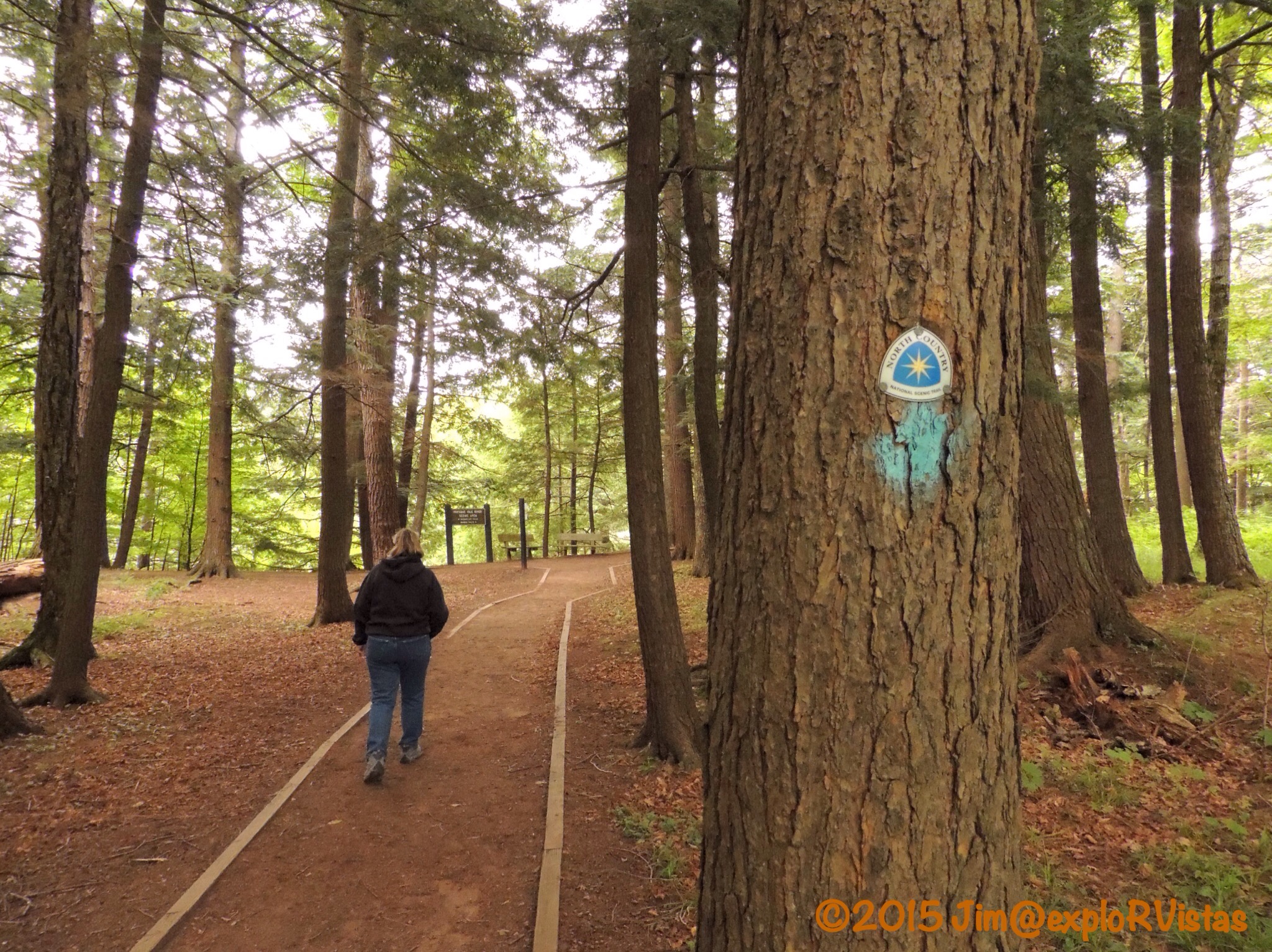
We arrived at the river a short time later. From the parking area, the North Country Trail heads towards the river. The river runs through a mixed old growth forest, which leaves the forest floor fairly wide open.
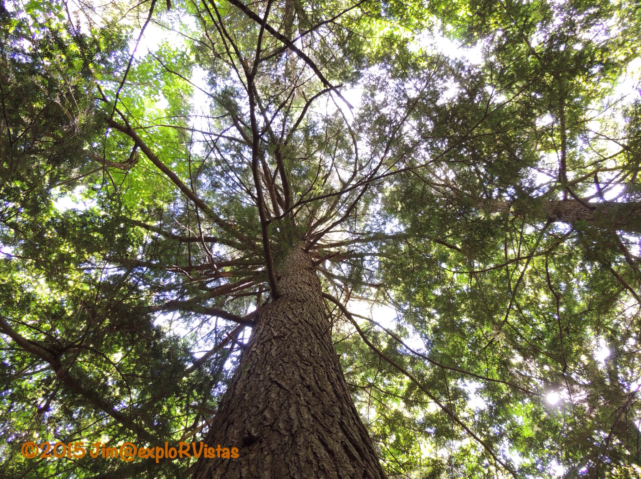
And some of the trees are huge! This giant is an Eastern Hemlock.
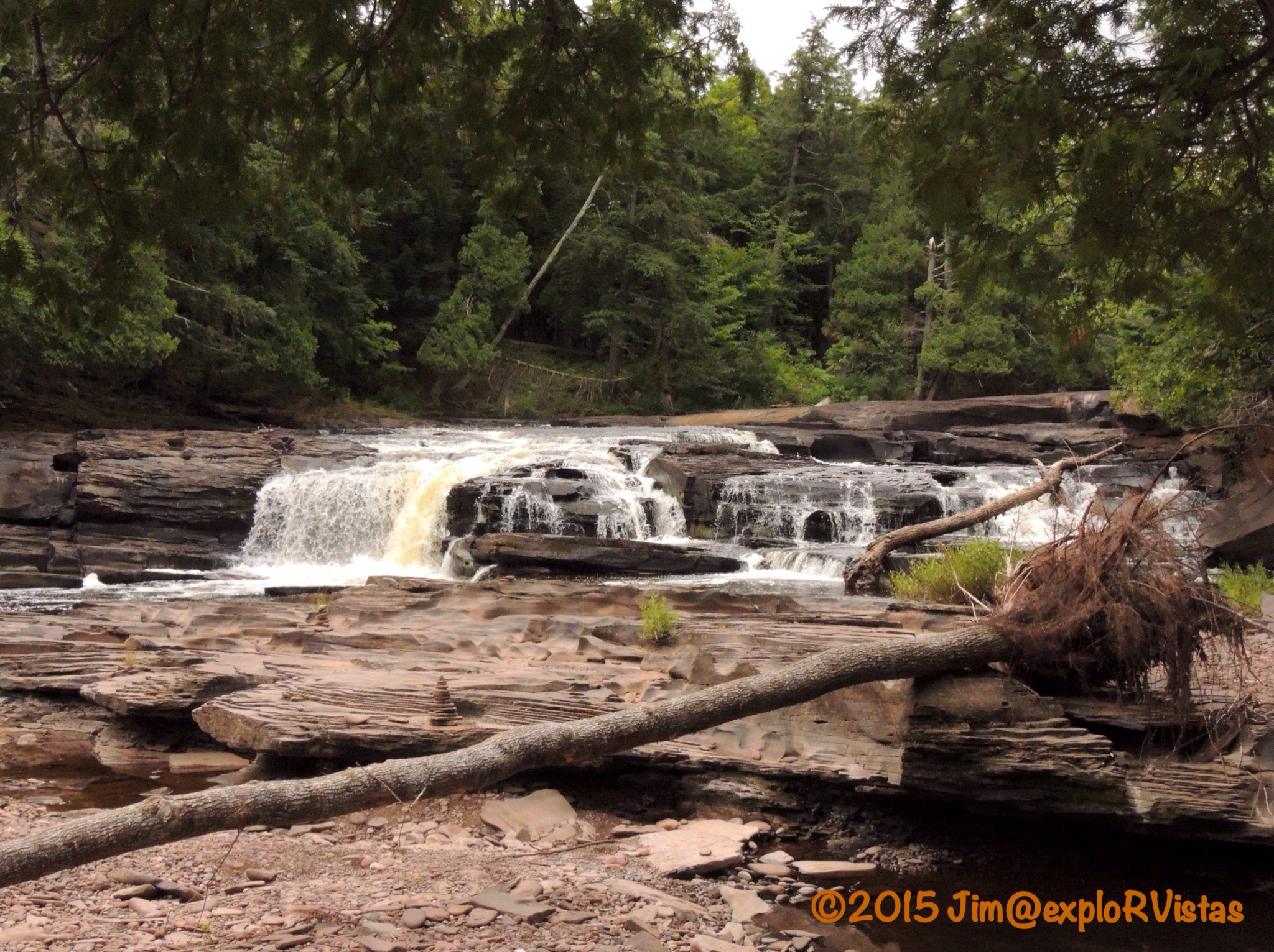
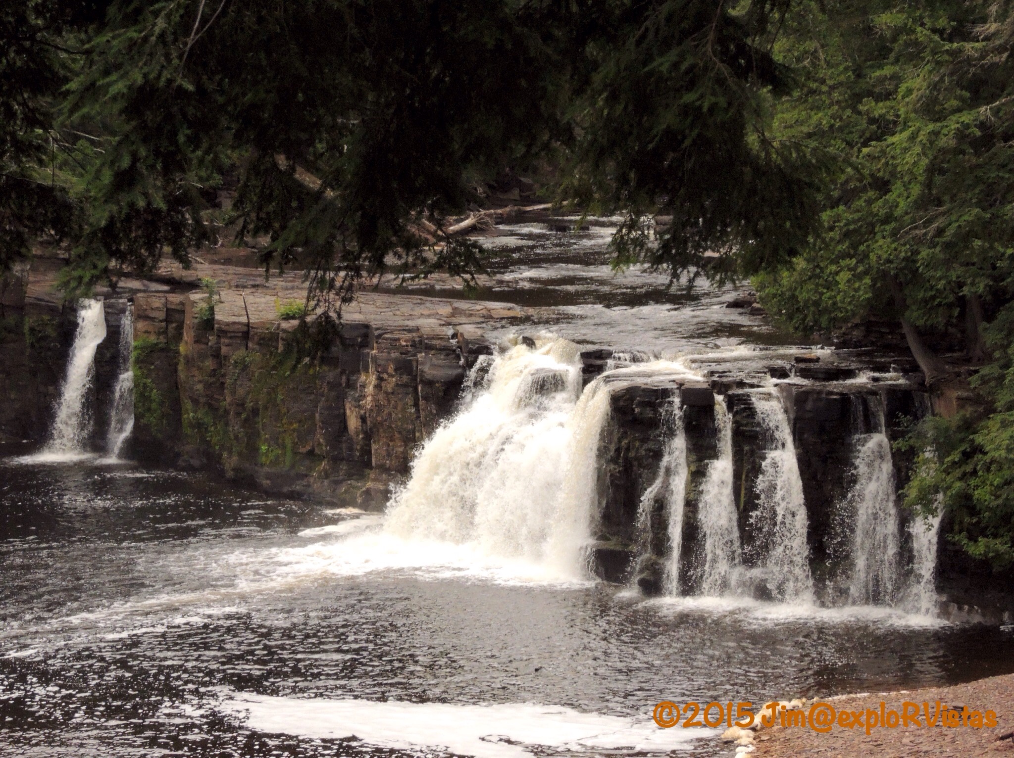
The riverbed is comprised primarily of sedimentary rock, referred to as Nonesuch Shale. The uplift of the shale has created numerous waterfalls along the way. The water itself is stained with tannins from decaying vegetation upstream, giving it a tea coloring and creating foam in the eddies below the falls.

And there are those potholes we were talking about!

They are created as the water swirls smaller rocks in a low point in the riverbed, resulting in a circular hole. It is amazing how razor sharp and perfect the edges are!

The river continues it’s march toward Lake Superior. Boardwalk and stairs follow the western shore, making access for visitors fairly easy.

Near the mouth of the river, a suspension bridge crosses the active channel to the ‘presque’ isle. This bridge is actually part of the North Country Trail.

On the far side of the island, the trail crosses the dry riverbed. In the springtime, the flow of the river is high enough to cover this portion of the riverbed.
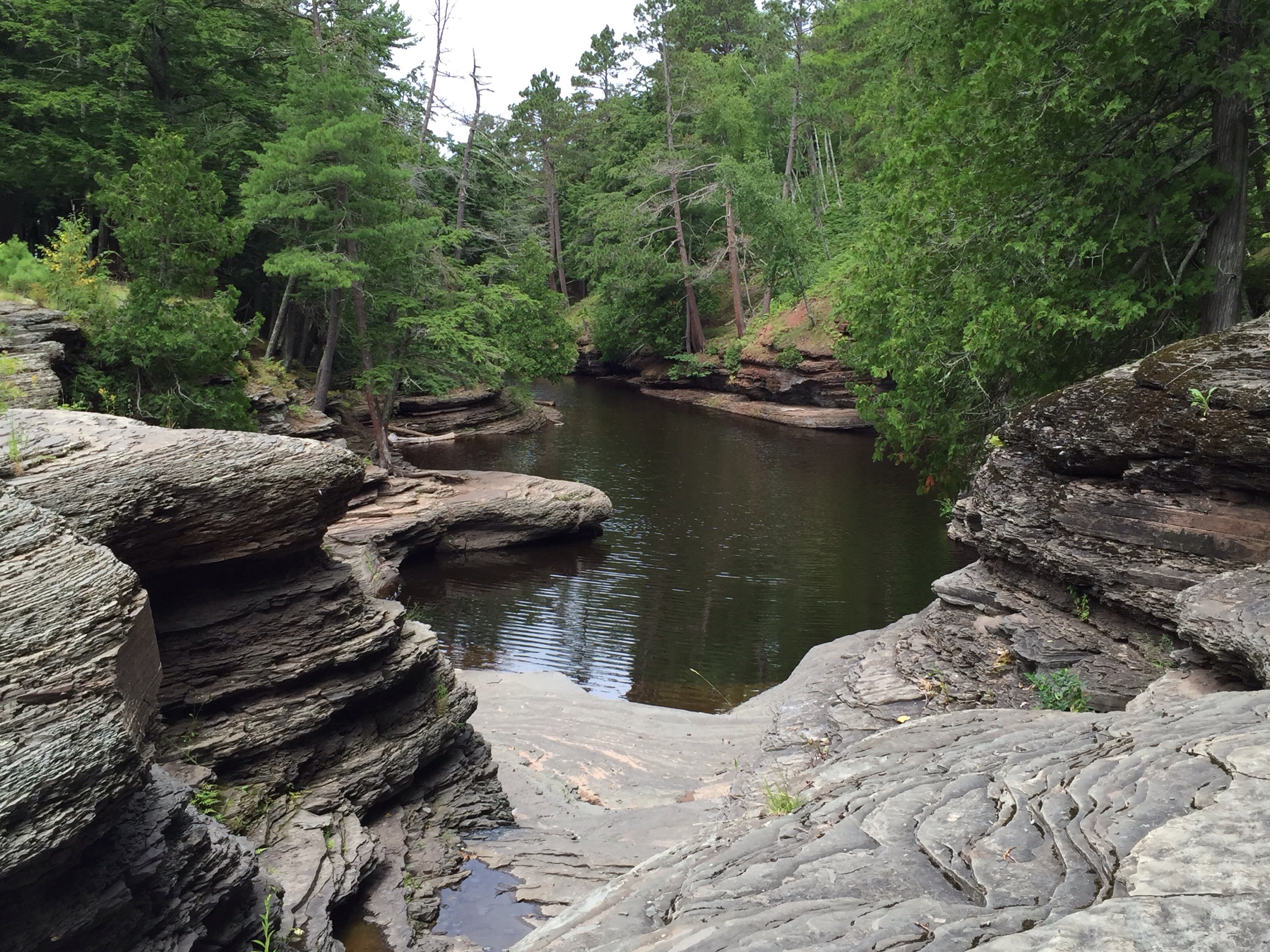
Below that point, the river water is ponded until the next spring.

A young girl pointed out this turtle in one of the small pools. It appears to be a baby snapping turtle. There were also tadpoles swimming around.

Where the pool meets Lake Superior, there is a sandbar between the east riverbank and the presque isle. In the springtime, that bar is breached, thereby creating a true island. The sandbar is a great place for rock hunting.
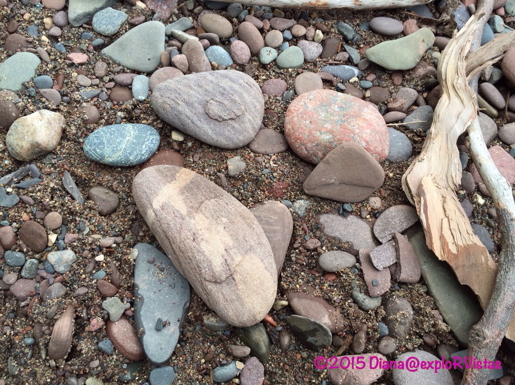
I kept handing rocks to Diana, saying “Look at this one!” She finally set them all down and took a picture of them. 🙂
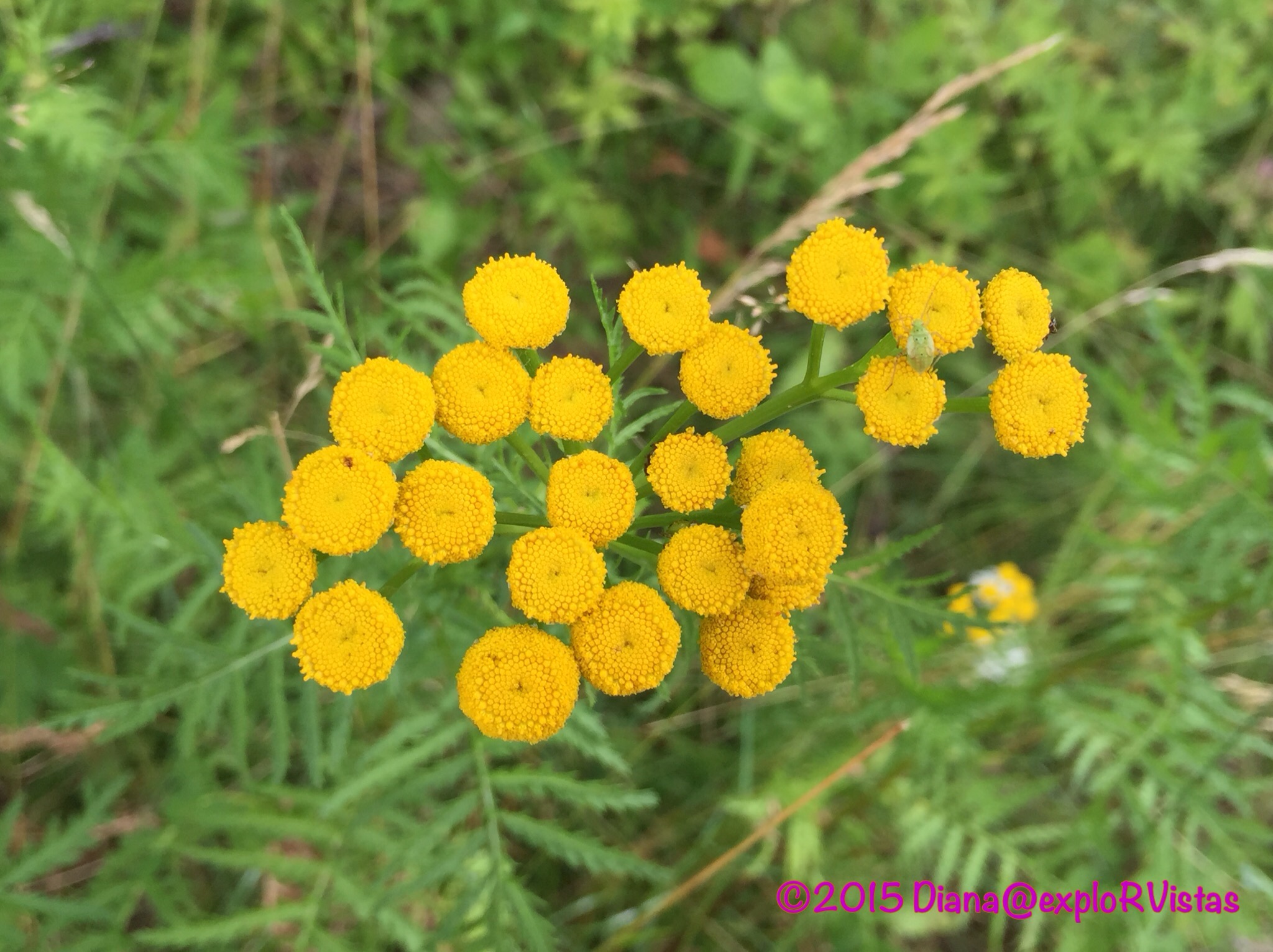
There were also several varieties of wildflowers to be found along the riverbank. Here are a bunch of Common Tansy.
The Presque Isle River is definitely a great place to spend an afternoon! Just remember one thing…

Watch out for the potholes! 🙂

Beautiful and unique land. I seem to already be running our of time this summer needing to return to CO mid September. We’ll need to stick to our plan this year but are already making a list for another season. Thanks for letting us know about this UP gem.
LikeLike
If you get a chance, Google Image ‘Porcupine Mountains Autumn’ and see what this place looks like in late September, Ingrid. I really would love to see it then. So many hardwood trees!
LikeLike
Thirty years ago, hubby and I visited Mackinac Island in September. The drive from Indiana up through MI was absolutely gorgeous. So I have no doubt the Porkies would be stunning in Sept 🙂
LikeLiked by 1 person
What a beautiful river! I would love to go there with my camera and tripod and do some slow-water-effect photos. The water seems perfect for it! I have seen similar pot holes in Maligne Canyon in Jasper, fun what water can create.
LikeLike
It really is a gem, Inger. We have found so many beautiful things up here, we are going to have quite a supply of blog material! Stay tuned for more in the coming days!
LikeLiked by 1 person
Bring it on! 🙂
LikeLiked by 1 person
I find the potholes so amazing. They are always so perfect. The rocks along Lake Superior are so beautiful. I couldn’t resist bringing back a few:) Sure looks like a very nice hike. How were the mosquitos? They weren’t bad in Augist last year.
LikeLike
Mosquitos aren’t an issue at all this time around, but I did get stung by something today on my thumb. Man, did it hurt! That will be in a post in a few days, as we are lagging behind. 🙂
LikeLike
Beautiful and as rock junkie loved the layers of rock and the potholes!! Great pics as always.
LikeLike
The geology of the Great Lakes is so varied from shore to shore. Lake Superior is vastly different than any of the other lakes. We also noticed how much better the roads are up here, as the aggregate is much better in the asphalt. It is all a byproduct of the iron and copper mining that goes on up in these parts. 🙂
LikeLike
I love how you include details like that in your blog Jim …I always feels smarter (as well as entertained) after reading one 😀
LikeLike
Thanks, Tracy! That is a very nice compliment. :). Diana and I always look forward to your posts. You provide a tone of great information, and Lee cracks us up!
LikeLiked by 1 person
The potholes are truly incredible. I love that about the great lakes : the geology around is fascinating !
LikeLike
It really is, Gin. We are really having fun checking it all out!
LikeLiked by 1 person
You could leave your cellphone on a selfie stick in hopes that one of the bears might oblige you with a photo? eh?
I love those shale potholes!
LikeLike
You sound like a Yooper, eh? The people up here are great!
LikeLiked by 1 person
They sure are, yeah hey!
LikeLiked by 1 person
Those pot holes are a fascinating phenomenon. We saw something similar in Shelbourne Falls Massachusetts. They call them glacial potholes. Don’t you just love discovering Mother Natures surprises?
Bonnie
LikeLike
Sure do, Bonnie! That area is so vastly different than the rest of Michigan. And it is really strange for a lifelong resident of the Lower Peninsula to think that the Presque Isle River is longitudinally west of Madison, Wisconsin!
LikeLike
Great pics! I’ve always wanted to visit that part of the country – so glad I have great blog posts (like yours) to refer to when planning our time there!
LikeLike
FYI…Before August, the bugs can be an issue, Kelly. We had very few problems with them, except a bee sting on my thumb!
LikeLike