Category Archives: State Parks

Lake Placid and the Adirondacks

June 25 – July 1, 2018 – Adirondack Park, New York

One of our first vacations as a married couple was a 1985 trip to Lake Placid and the Adirondacks in upstate New York.  This was before we started our series of trips to Maine, which began a year later.  Since it had been so long, one of our goals this year was to return to the Adirondack region to reacquaint ourselves with the area.

Adirondack Park covers 9,375 square miles, about 1/5 of the entire state of New York.  It was created in the late 1800’s to keep the wilderness from being over developed.  The preserve includes over 100 towns, making it different than a traditional state park.  It is overseen by the Adirondack Park Agency, which puts limits on what can and can’t be built within the park boundaries.  The state’s highest peak, Mt. Marcy, is found here along with a number of other tall mountains.

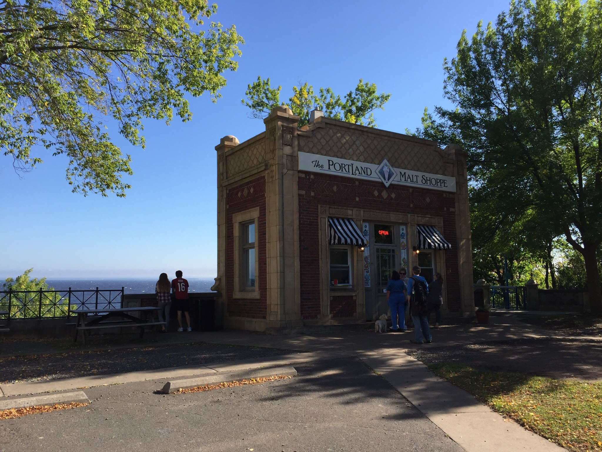
One of the most popular communities is Lake Placid.  Home to both the 1932 and 1980 Winter Olympic Games, this village has established itself as a training mecca for Olympic athletes. It is also a tourist destination, as the outdoor recreational possibilities seem endless.

1932 Rink

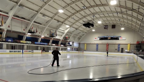
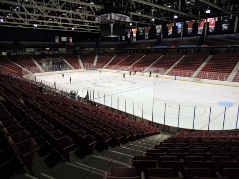
This is the 1932 Olympic rink.  Not a lot of room for spectators!  We were enjoying watching the workers prepare for an upcoming figure skating event.  That brought back a lot of memories for me, as I worked as a Zamboni driver while I was in college.

1980 Rink 1

Next door is the 1980 rink, now known as Herb Brooks Arena.  This is where the US hockey team beat the Russians, then went on to win the gold medal by defeating Finland.  As you enter the rink, the sign above the door states “Home of the Miracle on Ice – Site of the Greatest Sporting Event of the 20th Century”.  Some may debate that last part, but it certainly was right up there.  A personal side story to that: The night the US team beat the Russians, our Western Michigan University hockey team was also hosting a game.  My friend and fellow Zamboni driver, Mike, and myself were watching the college game from the stands. You have to remember, this was during the Cold War and although hopes were high, no one thought the US stood much of a chance against the Russian team.  Our pro shop manager came up in the stands to tell the public address announcer that the US team had won, but stopped to tell us first. After a little quick thinking, we instead returned to the pro shop and grabbed a piece of poster board and wrote “FINAL – USA 4, USSR 3” on it.  We rolled it up, grabbed some hockey tape and headed to the Zamboni.  Our lead driver, John, didn’t see us sneak into the Zamboni room and tape it on the front of the machine.  After the period ended he backed onto the ice and started circling the rink, and the place went absolutely wild!  It was like a wave as the crowd saw the sign as he went around and rose to their feet, roaring far louder than they had for Western scoring a goal. The look on his face was priceless, as he never had been cheered for doing his job.  As he stopped by the guy pulling the net pins from the ice, he was told to look at the front of the machine.  He climbed down, looked at the front and thrust both arms in the air.  The crowd lost it.  🙂

Zamboni at Lake Placid Olympic Ice Center

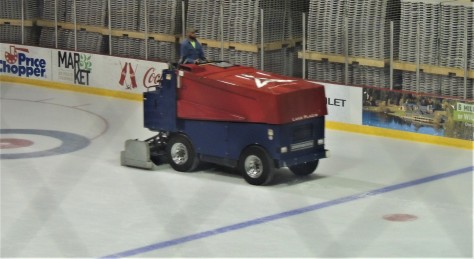
Attached to the back of the 1980 Olympic arena is a third rink.  This is where the curling events took place.  It was interesting to see that it wasn’t a dedicated facility, in that it also could be used for hockey and figure skating.  It sure would be fun to be up in that Zamboni driver’s seat again!

Inside the arena complex, we toured the Lake Placid Olympic Museum.

Torches from several Olympic games over the years.

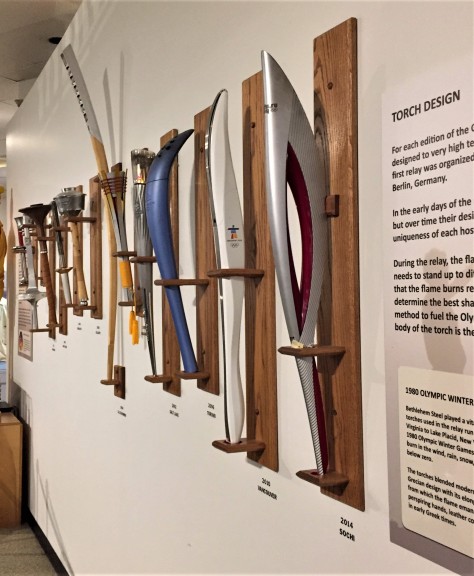
We found this collection of Olympic torches to be interesting…

Uniforms from the US Olympic teams from the Winter Olympics over the years.

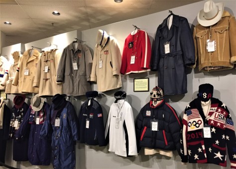
…as were the uniforms worn through the years by the US athletes at the opening and closing ceremonies.  There were other items that had to do mostly with the two Olympics that took place in Lake Placid.

Lake Placid Olympic Speed Skating Oval

Across the street from the arena complex is the outdoor speed skating oval.  This is where Eric Heiden won his five gold medals in 1980.  We were surprised that it was outdoors, as the newer Olympic venues are all inside.  What a view!

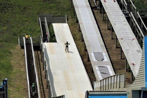
Just down the road in the town of North Elba is the Ski Jumping Complex.

Lake Placid Olympic ski jumps

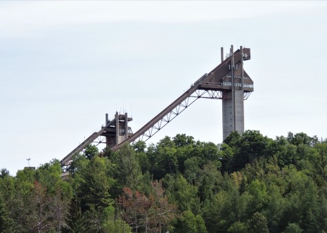
The 90 and 120 meter hills are easily seen from most places in the Lake Placid area.

Lake Placid ski jumps from the new event center at the bottom

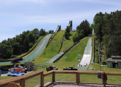
This is the view from the deck of the new Intervale Lodge at the base of the jumps.  This entire complex is being constantly updated and is used year round.

Installing the summer jumping surface on the ski jumps

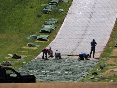
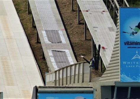
In the summer months, jumpers use an artificial surface to ski on.  In the photo above, workers can be seen attaching the plastic material to the hill, similar to the method shingles are attached to a roof.

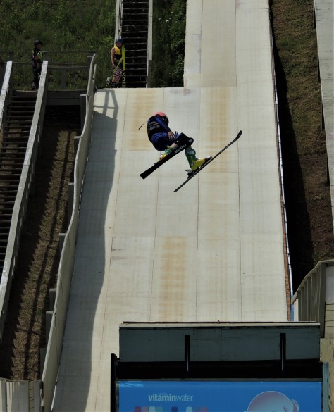
Immediately to the left of the ski jumps is the summer freestyle training facility.

Freestyle skier coming down the ramp

Here is a young man headed down the hill now!

Freestyle skier doing a backflip

Look at that….a back flip!  But where is he going to land in the summer, you ask???

Freestyle skier entering the pool

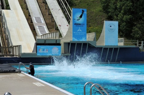
Why that would be into a 750,000 gallon pool!  Bet that feels good on a hot day.  🙂

Freestyle skier twisting off the jump

We watched from the stands for quite awhile as these daredevils twisted and flipped off the takeoff ramps into the water.  For all we know, we could have been looking at future Olympians.  It was very entertaining, to say the least.

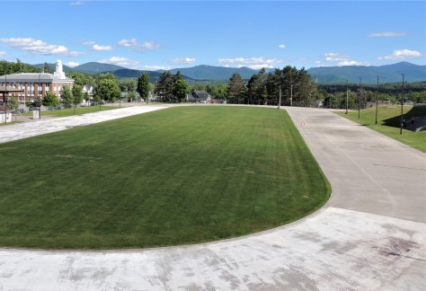
Just across the road from the jumping complex is the place where the opening ceremonies for the 1980 Games was held.  It is now the home of the Lake Placid Horse Show.  Seeing that there appeared to be a big event going on, we decided to check it out!

Horse entering a jump at the Lake Placid Horse Show

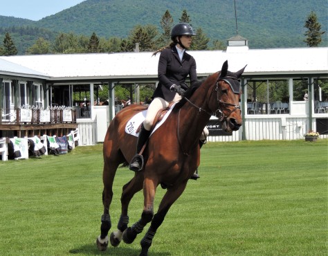
What a treat to be able to see the horses and rider as they navigated the series of jumps.

Horse airborne at the Lake Placid Horse Show

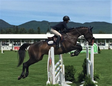
It was a thrill to see them airborne!  Pretty remarkable to see an animal as big as this leap that far.

While we walked the grounds, we noticed this:

Cauldron from the 1980 Winter Olympics, Lake Placid

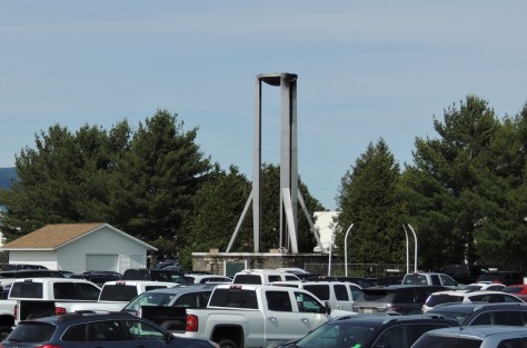
There’s the cauldron from the 1980 Winter Olympics!  It looked so much bigger on TV.  🙂

Another place we visited in the area was High Falls Gorge.  This 22 acre privately-owned attraction deserves a mention not only for its beauty, but also for what can happen when a natural feature ends up in private hands.

High Falls Gorge

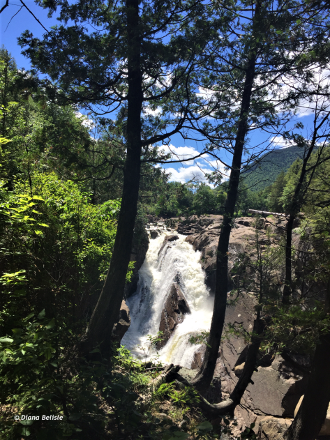
Here is upper part of the cataract on the Au Sable River that appears in it’s pristine state.

High Falls Gorge with ramps

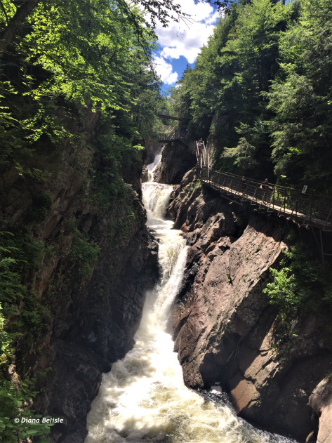
To reach the lower portion, the company has built ramps, platforms and bridges within the gorge.  To us, this tarnished the beauty of the falls.

Ramps at High Falls Gorge

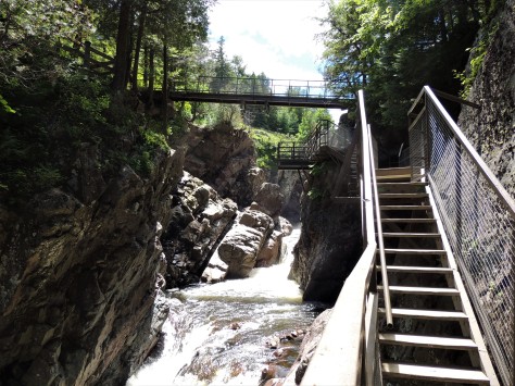
And with it being private, the admission fee is right up there.  It seemed a bit odd that this was in the middle of the Adirondack State Preserve, but it’s been a private attraction since the 1890’s.  Nature’s creations deserve better stewardship, in our opinion.  While the falls themselves were beautiful, we felt that a state or national agency would have provided a more natural visitor experience.  In a much broader sense, this is why we feel that our public lands should not be allowed to fall into private hands. It cost us $11.95 each, plus 8% New York state sales tax for a total of $25.81. In comparison, our annual National Park Pass, which covers over 400 sites, is a bargain at $80.00.

Another thing we found in the area was the John Brown Farm.  You may recall us talking about him in our post from Harpers Ferry, where he led a raid that resulted in his being executed. At the time we noticed his farm was in North Elba, NY, but we had no idea where that actually was.

Ski jump from John Brown's grave

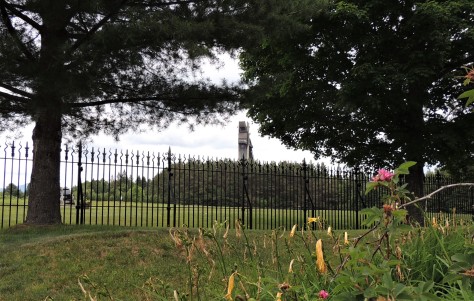
Well, standing next to his grave, the back of the 120 meter ski jump is easily seen.  Now we know where North Elba is.  🙂

John Brown statue

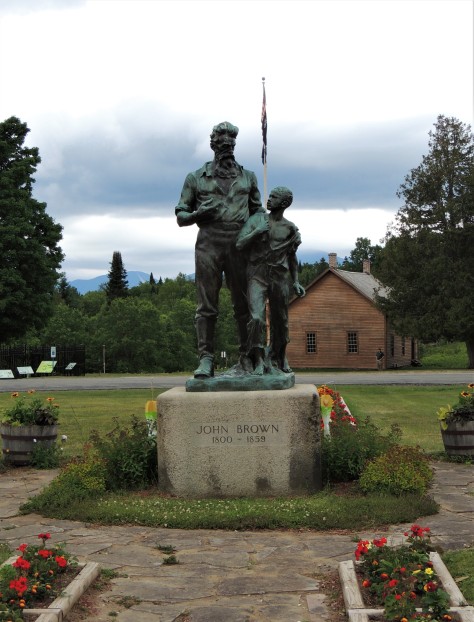
John Brown, who used violence to further the efforts to abolish slavery, is a controversial figure in US history.  Some travel here each year to show their respects on his birthday, others feel he was a bit of a zealot. The building behind the statue is his farmhouse.  The inscription under the figures’ feet says, “His soul goes marching on”.  That is a reference to the Civil War era song, John Brown’s Body, which was rewritten at a later date to become The Battle Hymn of the Republic.  In the former version, the lyrics start out “John Brown’s body lies a moulderin’ in the grave.”

John Brown's grave

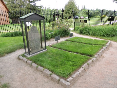
Well, here is that grave he is a moulderin’ in, along with several of his followers who fought with him at Harpers Ferry.  That event is seen as one of the sparks that led to the Civil War.

John Brown Barn

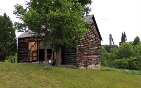
Behind the house and grave is the barn.

John Brown Barn Basement

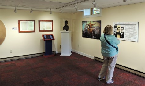
The lower level houses a nice display dedicated to the story of John Brown as an abolitionist.

John Brown Barn Main Level

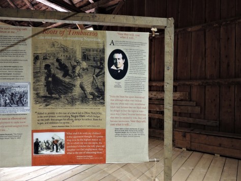
The upper level speaks to the area’s role in the Underground Railroad.  Gerrit Smith, a wealthy landowner and politician who was a leader in the abolitionist movement, gave away 120,000 acres of North Elba land in 50 acre parcels to black families from the south. Being a property owner gave them a right to vote, as well as a means to becoming self-sufficient.  John Brown had purchased some of that acreage to help teach the former slaves how to work the land.  Unfortunately the area conditions weren’t conducive to farming, and the experiment failed. We found the entire farm to be fascinating, and it really tied in well with our visit to Harpers Ferry.

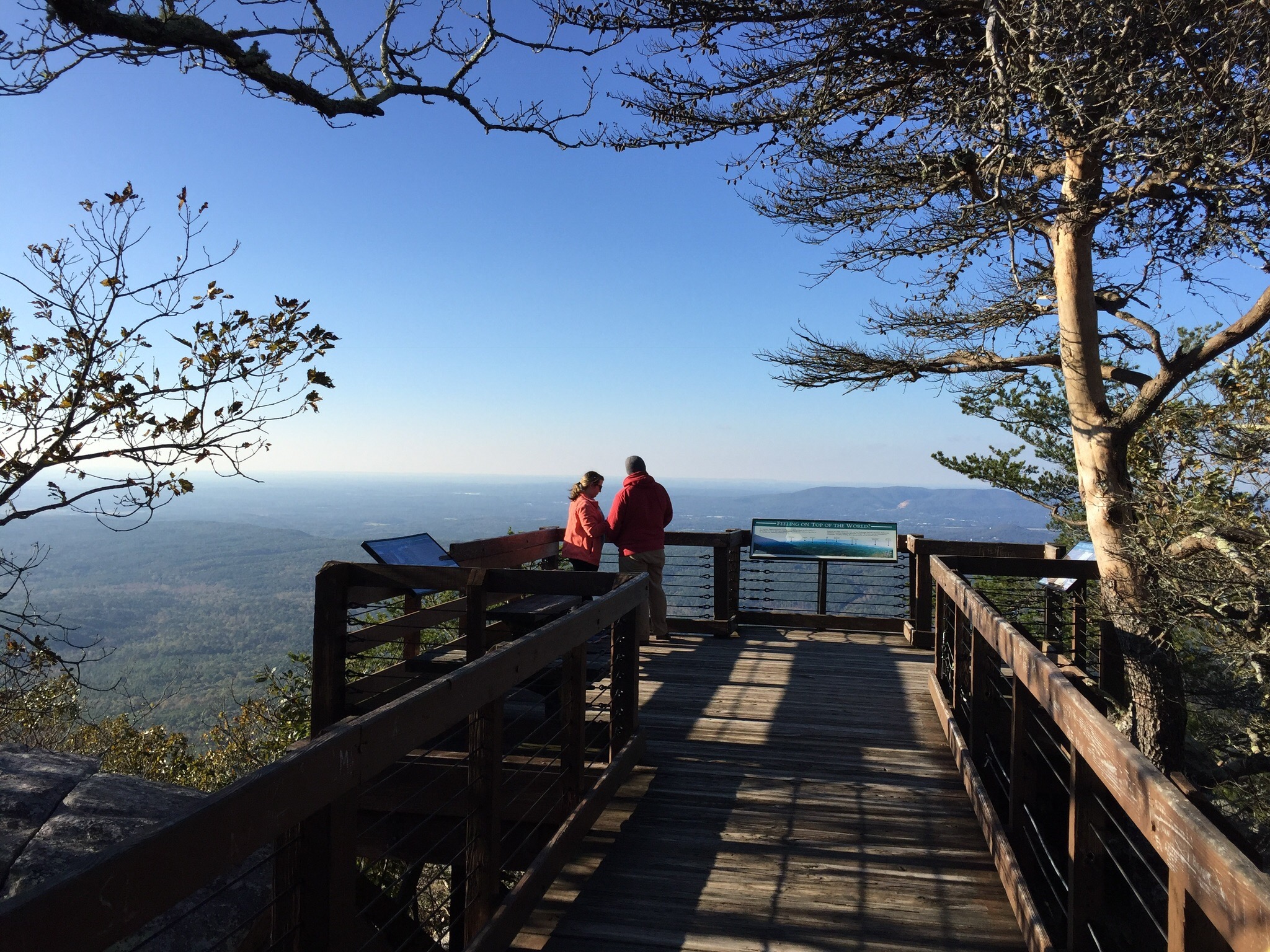
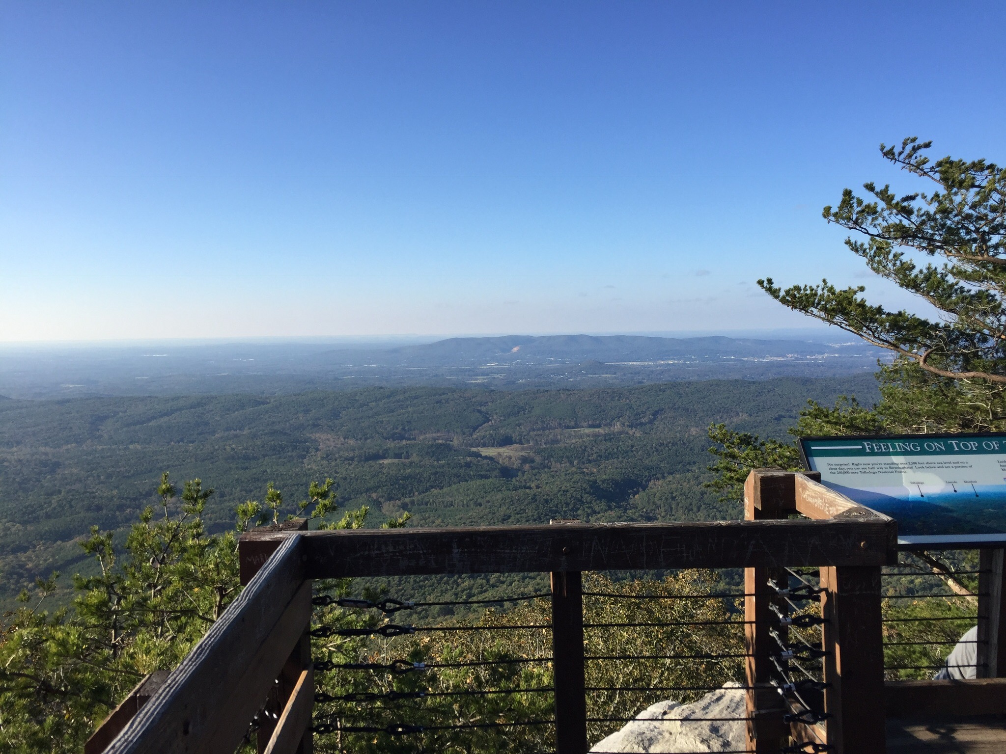
The other place we visited in the area was the top of Whiteface Mountain.

Diana and Jim on Whiteface Mountain, with Lake Placid in the background

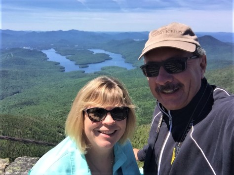
Our last trip here was in a 1981 Chevette.  I remember that well, as we had to turn the air conditioning off to make it up the hill.  🙂  This is a great place to view Lake Placid from.

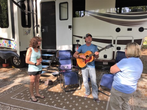
Leaving Lake Placid, we spent a few days in the Lake George area, at the southern end of Adirondack Park.  The weather turned hot, so we limited our activities to taking care of errands and celebrating my 60th birthday!  Our friends and fellow RV-Dreamers, Bonnie and Fred, have their home base in the area so the four of us met for a wonderful steak dinner at the Log Jam Restaurant.  We hadn’t seen them since March of 2017, so we had a lot of catching up to do.  As a result, we completely forgot to take photos.  They are going to spend the winter just down the road from us in Melbourne Beach, so I’m sure we will get some photos then.  🙂

That wraps up our time in the Adirondacks!  Next up, we move west through New York State to visit some of my childhood idols.  Be sure to check back here to see what that is all about.  Until then, safe and happy travels to all!


Serendipity Along the Grand Strand

Have you ever been put somewhere by what seems like sheer luck?  Maybe it’s that, or maybe it’s meant to be.  We had that situation last May when we were put in a campsite next to a guy who I had a Facebook friend request into for ages, as we had 11 friends in common.  Turns out our now great friend Rick wasn’t big on checking his Facebook account.  🙂  Neither of us had any connectivity at the campground we were at on the Oregon coast, and our mutual friend Tracy (who figured out we were both there) was frantically trying to get in touch with us.  By the time she did, Rick had met us…even though we hadn’t made the mutual friends connection yet.  Thinking back, it was as if we were supposed to be there.

Such was the case on April 16th at Myrtle Beach State Park in South Carolina.  We really didn’t have any plans for what we were going to do once we got there, only that we wanted to see what the place known as the Grand Strand looked like.  We pulled in and got ourselves set up and prepared to settle in for the evening.  As I kicked back in my recliner, I could see a Bighorn fifth wheel passing by.  A few minutes later, I saw the back of it peeking out from behind the motorhome next door.  The woman that was helping direct the rig back looked really familiar to me.  I thought ‘Hmmmm….that looks like Sharon’, a fellow RV-Dreamer who we had yet to meet.  Before I could totally grasp that thought, her husband David popped into view.  Neither of us had any idea the other was going to be coming to Myrtle Beach. Here were two people that we had long wanted to get to know, placed just two campsites away from us.  We had been following their blog Two Lanes of Freedom for years, as they had with ours.  Dumb luck?  We choose to think it was more than that.  We were out of the rig and headed over to meet them in a flash!

They recognized us right away.  🙂  We talked for a bit and then called it a night, as we were all tuckered out from traveling. The next day, they invited us to go to Brookgreen Gardens with them, as they were meeting longtime RV-Dreamers, Bill and Nancy there.  Oh my goodness…two more people we had wanted to meet!

z4

Here we are gettin’ cozy on a park bench.  We slowly wound our way through Brookgreen’s trails, admiring the sculptures, landscaping, and animals.  All the while, we were learning more about each other.  🙂

z7

Here’s David admiring the gardens from the shade of a huge Live Oak tree.  Nancy and Sharon are in the background.

z6

This red fox had other plans for the lazy afternoon.

z9

Diana, Nancy, and Sharon are headed towards a sculpture of…

z8

Diana of the Chase.  This amazing work was created by Anna Hyatt Huntington in 1922.  She and her husband, Archer Huntington, founded Brookgreen in 1931 on four former rice plantations.  Close to 1500 works are displayed throughout the gardens.

z1

Their former winter home, Atalaya Castle, is located across US-17 in what is now known as Huntington Beach State Park.  Anna had an indoor and outdoor studio in the home.  She kept live animals in the courtyard, so she could study their muscle structure as they moved about.  What an amazing day with Bill, Nancy, David, and Sharon!

The next day was a beach day for Diana and I.  The temperature climbed above 80, which was perfect for putting our toes in the sand….except when the wind would shift and the cooler ocean air would roll in. David and Sharon stopped over for a bit, and we made plans for a campfire that evening.

z2

They were wondering who the couple was all bundled up on the beach, when they realized it was US!  Hey, our Michigan blood has thinned to a Florida viscosity.  🙂  That night we enjoyed a nice campfire and some excellent company, complete with several songs from David and his guitar.

The next morning was our travel day, but not before a sunrise meetup on the beach.

z5

I spotted them taking photos, so I took a few of my own.  We all headed back to camp, and Diana and I packed to leave. As we stopped by to say our farewells, David greeted us with his guitar.

z3

He sang us one of his ballads to see us on our way.  What a fitting and perfect ending to our time together.  Travel safely friends, we will see you down the road!


Timucuan Preserve and Jacksonville

On Tuesday, March 27th, we packed up and began our journey towards Maine and then Michigan.

a3

It took a little bit, as we had so many ‘see you in the fall’ goodbyes!   We will miss seeing everyone and look forward to next winter. We did manage to hit the road before noon.  🙂

Our first stop was Jacksonville, Florida, to take care of some errands and to do a little sightseeing. Diana tried out her new Moose membership to get us a nice little camping spot for two nights.  Wait…what?  Moose membership???  Let’s back up a step.  On Sunday, we met Diana’s sister Cheryl and her hubby Doug for lunch at the Beach House at Patrick Air Force Base.

a2

They are also fulltime RVers. Cheryl mentioned to us that she was a Moose member and how Moose International was not only a great fraternal organization, it also allowed RV parking.  We decided to have Diana join first to see if the membership is something we will use.  We met them next night at a local Moose lodge and with Cheryl as a sponsor and $35, she signed up!

a4

Long story short, we ended up with a last minute overflow spot at a lodge in Jacksonville.  For $15 a night we has access to electricity, water, and a dump station….perfect!

First order of business was to get our mail in Green Cove Springs and head over to the DMV to renew our Escape and trailer plates.  We have always been impressed with our adopted hometown, in that they embrace having thousands of their residents be fulltime RVers, marine cruisers, and military.  Many of those folks never see the town after the first initial contact, but we like making an appearance at least once a year.  Tuesday was our second time through this season, and I have to say they outdid themselves.  We pulled into the parking lot at our mail forwarding service at 4:30 PM and grabbed the mail.  We then drove two miles to the DMV and were in and out by 4:45 PM.  That’s 15 minutes to take care of both items. Impressive, to say the least!

So that left Wednesday free for us to explore the area around Jacksonville. Looking for anything that fell under the National Park Service auspices, Diana found Timucuan  Ecological and Historic Preserve (pronounced tee-moo-kwan). This vast area encompasses several national and state sites, not far from a major city.  It was donated in the 1960’s by a man named Willie Brown.  He was offered millions of dollars by developers, but he wanted it saved as an unspoiled wilderness for future generations. On this particular day, we chose three locations.

First up was Fort Caroline National Memorial.

z2

This is where the main visitor center for the entire preserve is located. Inside, the story is told of  this place where the waters of the Atlantic Ocean and St. Johns River meet.  There is evidence of over 5000 years of human habitation that has been unearthed in the area.  The first people here were the Timucua, a broad group of several tribes of natives. Sustained by the marine life found in the salt marshes, and also by plants and animals of the land, these people thrived here for centuries.

z9

This wooden owl was found in the preserve and is estimated to have been carved in the 1400’s.  It is the largest wooden effigy ever discovered from an archaeological site in the Americas.

z10

This yellow pine dugout was also unearthed here.  These canoes were the mode of transportation used on the St Johns waters by the Timucua.

In 1562, a French expedition, led by Jean Ribault, landed here and claimed the land for France.  Ribault left 50 settlers to establish an outpost and returned to France.  In 1564, the French built a triangular fort and named it ‘le Caroline’.

z3

The French did not do well in this new land and were facing starvation when Ribault arrived with help from their homeland. The relief increased the population, and also caught the attention of Spain.  The Spaniards soon established a claim to the south at St Augustine, with the intention of dislodging the French to their north.  Ribault sailed south to attack the Spanish post, only to encounter a hurricane that disrupted his ships and he beached too far south.  Admiral Pedro Menendez seized the opportunity and marched north to Fort Caroline.  His men massacred 140 French people, sparing women and children. 40 to 50 French escaped and were able to sail back to France. He then marched south and found the shipwrecked men.  The French pleaded for mercy to no avail.  Menendez killed 350 of them…all but those professing to be Catholics or musicians. That site became known as Matanzas, a Spanish word meaning ‘slaughter‘.  After driving out the French, the Spaniards took over Fort Caroline and renamed it San Mateo.  In 1568, the French returned for the sole purpose of seeking revenge. They killed most of the Spanish at the former French outpost, except for a few who escaped to St Augustine.  After burning the fort, the force returned to France.

From Fort Caroline, we drove northeast to  Kingsley Plantation.

z11

Along the way, Edsel 2 took his first ferry ride!  As you can see, Diana is sporting her Fort Caroline Junior Ranger badge.  🙂

z4

Kingsley Plantation was built in 1798 and is the oldest surviving plantation house in Florida.  No small feat, considering it’s exposure to hurricanes, termites, fire, and humidity.  The story is told here of plantation life, with the owners fortunes amassed at the expense of slaves’ labor and freedom.

z6

Located on the St Johns River, the farm was perfectly situated to transport its goods via water.  Cotton was king here, as was indigo, and sugar cane.

z7

Near the entrance to the property were the remains of the slave quarters, laid out in a semi-circle.  These 23 structures housed 60 to 80 men, women, and children.  They are made of tabby. This construction material is oyster shells cooked with water and lime, and then mixed with sand to form cement. The horrors of slavery were well portrayed here, serving as a reminder of this disturbing time in American history.

Our last stop was Ribault Club.

z8

This was a millionaires resort built in the 1920’s.  During the depression, membership declined and the building fell into disrepair.

z12

The State of Florida acquired the property in 1989, and through a partnership with the National Park Service and the City of Jacksonville, restored the club in 2003.

z13

The building is used mostly for weddings and events, and is open for the public to view at other times.

We really enjoyed discovering Timucuan Preserve on what turned out to be a beautiful day.  We left several sites to explore at a future time, making sure we thoroughly soaked in the beauty and history the areas we visited.  Be sure to follow along to see our next adventure as we head north along the eastern coast.

Cheaha State Park

Sometimes the hidden gems are found when you take your time…

For so many of our working years, our focus on the Michigan/Florida route was to get there…which involved only two overnights.  To us, Alabama was mostly flat, as we slid down I-65 to Montgomery, then down US-231 to the Florida line.  We knew there were many portions of the state we were missing, and that we were going to want to experience those at some point.  We had the time on this trip, so ‘some point’ had arrived!

We pulled out of Huntsville on Saturday, October 28th and headed south on US-431.  The first portion of the route took us through some beautiful waterside views of Guntersville Lake, which is actually the dammed-up Tennessee River.   The remainder of the highway to our next stop in Oxford passed through a secession of towns that had grown together to become a bit more congested than pretty.  Still, we found it far more interesting than I-65!  😊

We set up at CWGS (an acronym for Camping World / Good Sam) campground in Oxford, which is located right next door to the local Camping World.  Our first intention for this two night stop was to grocery shop, do laundry, and sit out the rainy, cold day that was forecast for Sunday.  With all tasks accomplished early in the day, and with clearing skies, we set out to do a little exploring.   Just south of Oxford, the southern end of the Blue Ridge Mountains terminates in Cheaha State Park.  This is Alabama’s highest point, a spot recently visited by our friends Debbie and Steve, on their quest to climb each state’s tallest peak.

After setting the GPS, we headed straight south out of Oxford.  Several miles up the mountain, we came to a cable across the dirt road.  Hmmm….it looks like Greta Garmin needs an update. Back down the mountain we went.  We found the correct road, a 13 mile scenic route off of US-431.

The first turnout revealed that this was going to be a pretty drive!  We continued on up to the top of the mountain and found a historic stone lookout tower, along with a sign declaring we were at Alabama’s pinnacle. 

The tower was constructed in the 1930’s by the Civilian Conservation Corps, along with most of the parks buildings, bridges, and trails.  They even constructed the dam that forms Cheaha Lake.  There is a museum adjacent to the tower devoted to the CCC, and the tower itself is open to visitors.  I asked the volunteer in the museum where the official benchmark was located…

…and it turns out that we had practically stepped on it on our way inside.  😎

From there, we checked out an accessible boardwalk out to Bald Rock.  

This very popular pathway parallels the old CCC trail that runs out to one of the best viewpoints in the park. Every so often, a stairway leads down to the original route.  

Coming around the corner toward the viewing platform, we catch our first glimpse of this amazing vista!

The view is absolutely stunning!  And the fact it is accessible to all just makes it that much better.

Even though we were chilly, we thoroughly enjoyed our afternoon at Cheaha State Park!  Be sure to stay tuned to see what we find on our next stop!

———-

Search and shop our exploRVistas Amazon link HERE !

———-

explorRVistas is a participant in the Amazon Services LLC Associates Program, an affiliate advertising program designed to provide a means for sites to earn advertising fees by advertising and linking to Amazon .com. Shopping through our link does not add anything to your cost, but it does help support this blog. Thank you for shopping through exploRVistas!

Across the Middle of Minnesota

As we headed east into Minnesota from North Dakota, we made the decision to head towards Michigan’s Upper Peninsula, as opposed to dropping through Chicago and under Lake Michigan.  Having some time to spare, we meandered our way across the Land of 10,000 Lakes and found some interesting surprises along the route.  

The first gem we stumbled upon was the Minnesota State Park system.  While they were most likely packed during the summer, they were pleasantly uncrowded and peaceful this time of year.

From our site at Buffalo River State Park, we watched as several deer munched on the vegetation.

We took a stroll along several of the park’s hiking trails.

We also discovered this unique swimming hole (available in the summer) that pumps in filtered river water.  It has a coarse sand bottom and a accessible ramp for people having difficulty walking over the sand.

The next day, we headed north a bit to Itasca State Park.  Our goal was to see the headwaters of the Mississippi River.

After setting up camp, we followed the signs to the visitor center.  From there, it is a few hundred yards to what is accepted as the source of the Mississippi River.


It was here in 1832 that Henry Schoolcraft declared that he had found the source of the mighty stream.  Of course, it was an Ojibway chief who brought him here, so Hank really wasn’t the first.  😉   The headwaters…which is the outlet of Lake Itasca…was ‘improved’ in the 1930’s to allow visitors a pleasant experience.  Previous to that, it was a muddy, mosquito infested area.

We waded across and didn’t even get our knees wet!  Definitely a fun place to visit…but something I saw on Google Maps had me wondering: is it the true source of the Mississippi?  After the river leaves Itasca, it flows into and out of several natural lakes.  That fact begs the question: are there any inlets flowing into Lake Itasca?  Well, as a matter of fact, there are two of them at the opposite end of the lake .  One comes in from Elk Lake, and the other comes in from Nicolet Lake.

Looking on Google Maps, the outlet from Nicolet Lake into Lake Itasca is listed as the Mississippi River!  What gives?  That’s upstream from the headwaters marker! And down below Nicolet Lake, there is a small inlet flowing into it.  Could that be the true source of the Mississippi?  My thought is that Mr. Schoolcraft didn’t paddle far enough upstream.  A quick internet search reveals that I’m not the only one to think that.  😊  Nonetheless, the fact that we were able to wade across the Mighty Mississippi was pretty darned cool.

From Lake Itasca, we continued on to Duluth. We spent a few nights there to do some laundry, grocery shop and check out the town.  We had been there several years ago when we were on a Lake Superior Circle Tour.  At that time, we toured the retired and meticulously restored freighter William A. Irvin.  

© en.wikipedia.org
The ship is still there, just as beautiful as ever.  We also spotted the Edward L. Ryerson on the other side of the harbor in Superior, Wisconsin.

© Duluthshippingnews.com
The Ryerson has long been known for its astetically pleasing lines, and is always a crowd favorite when it comes into port.

© Boatnerd.com
It also had an unusual situation when it was built in that it was too long to make the turn in Manitowac Harbor to get out.  They ended up having to carve out 50 feet of the sea wall to allow it to make the corner.  🙂   It was good to see this ship again, as I hadn’t seen it since I was a teenager in Detroit.

We also checked out some of the cool architecture in town.

The local Corps of Engineers building was beautiful…

…as was this old gas station turned ice cream and malt shoppe.

There were several young guys taking turns jumping off of this old structure into Lake Superior.  When someone asked one of them if the water was cold, he responded “It’s warmer than it was in May.”  That’s one way of looking at it.  😊

We also walked under the iconic Aerial Lift Bridge near the entrance to the harbor.  The 900 ton center span of this structure can be raised to provide 180 feet of clearance for the big lake freighters to pass under.  Many sailors have seen this structure as a beacon of hope as they come off the big lake in a raging storm.  If any structure is synonymous with Duluth, this is it.

We had an amazing time in our short dash through Minnesota!  We would definitely like to spend more time there in the future.  Next up, we arrive in our home state of Michigan.  Stay tuned to see what we find!

———-

Click HERE for a free Kindle Unlimited edition of Ka-Ka-Ska-Ska (Headwaters to the Gulf – in a kayak), along with anything else imaginable through our exploRVistas Amazon link!

———-

explorRVistas is a participant in the Amazon Services LLC Associates Program, an affiliate advertising program designed to provide a means for sites to earn advertising fees by advertising and linking to Amazon .com. Shopping through our link does not add anything to your cost, but it does help support this blog. Thank you for shopping through exploRVistas!