Category Archives: National Parks

Arches and Canyonlands

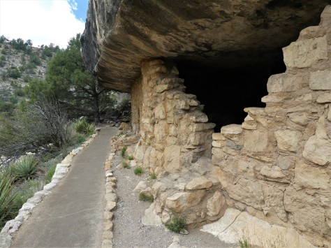
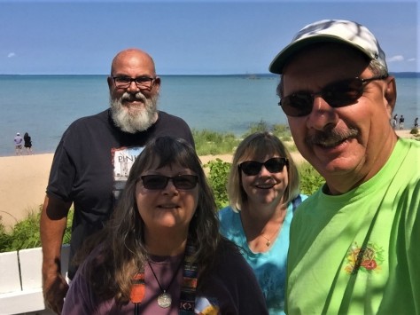
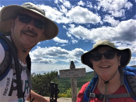
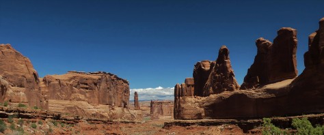
Surrounding the town of Moab, Utah are two very different national parks: Arches and Canyonlands.  The former concentrates on formations that soar above the park visitors and the latter focuses on an expansive area that is carved out below them.  After working our way north from the Grand Canyon, we were looking forward to seeing these two geologic gems.

Pulling into Moab, the first thing we noticed was how busy the town was.  This community not only supports the two national parks, but also the surrounding public lands that are enjoyed by the off-road and mountain biking communities.  Despite the congestion, the city worked well for us while we were there.

Our first full day found us in Arches National Park.

IMG_1461 (4)

This preserve is known not only for its soaring spans of rock, but also its towering sandstone formations, such as this one named Park Avenue.  Not quite New York City, but we could see where they were coming from when they named it.  🙂

IMG_1476 (2)

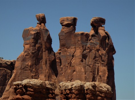
The groupings of rock each took on their own personalities. This one is referred to as Three Gossips. I pictured this chatty trio as being from Ancient Egypt.

IMG_1481 (2)

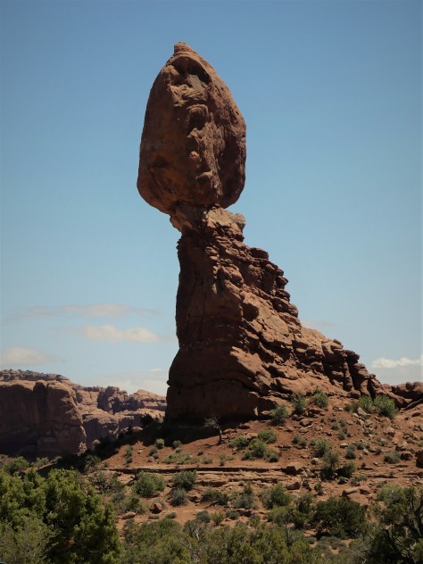
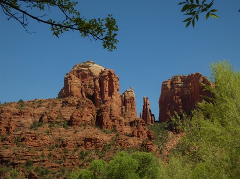
Some, like the 120-plus foot tall Balanced Rock, had us wondering when they might topple over…especially with them being made of sandstone.

IMG_1487 (2)

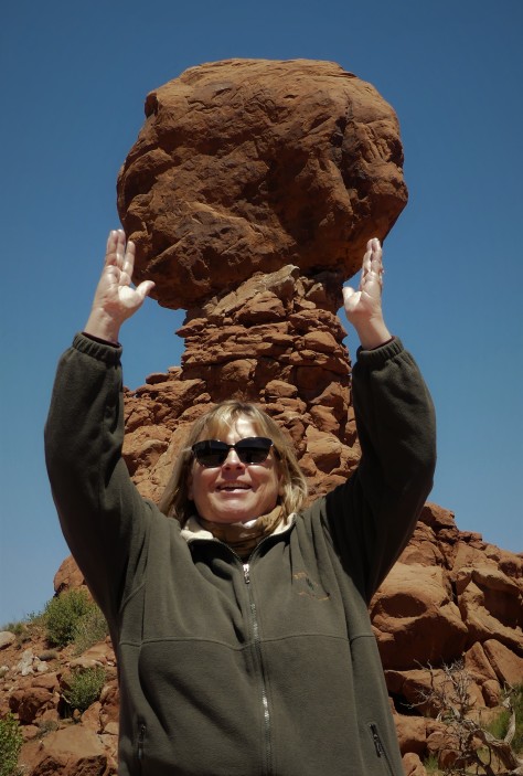
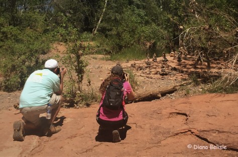
Diana decided to see if she could steady this one for a few seconds.  🙂  Eventually it will come tumbling down, as her arms were getting tired.

IMG_1511 (2)

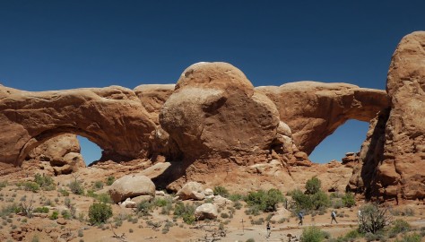
These two beauties are called North and South Window.  

IMG_1493 (4)

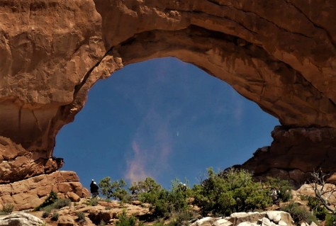
While we were talking with another couple about how beautiful the park was, this whirlwind spun up within North Window.

IMG_1494 (2)

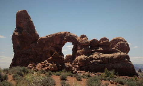
Behind us was another formation referred to as Turret Arch.  We hiked over to check it out.

IMG_1521 (2)

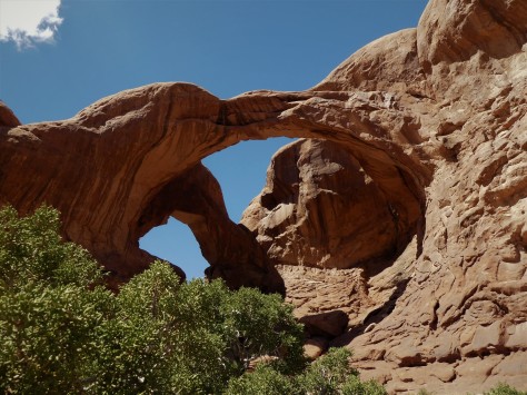
From there, we walked over to Double Arch.  The water stains on the rock are evident from the previous evenings rains.

IMG_1508 (2)

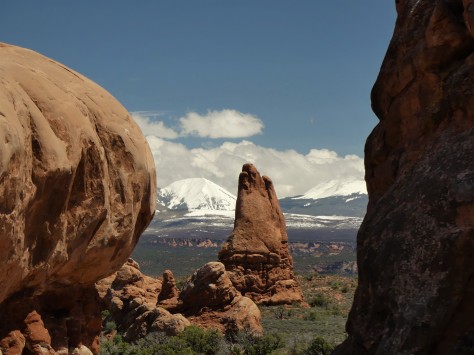
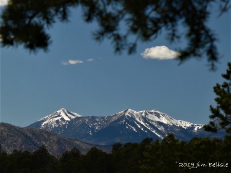
The amazing snowpack on the ever-present La Sal Mountains provided an interesting contrast to the red rocks and green sage of the desert.

IMG_1530 (2)

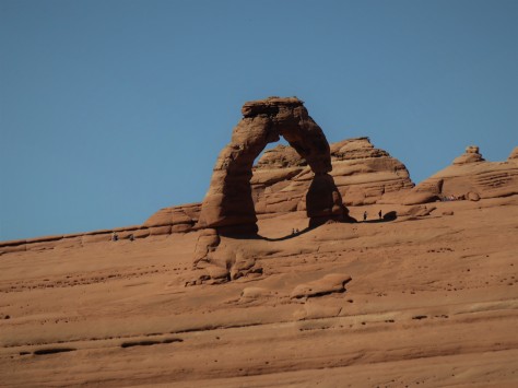
We also hiked to the upper viewpoint for Delicate Arch, leaving the three mile trail to the formation for a future visit.  Note that people in the photo are plumb; the entire landscape slopes upwards at 6 degrees.  If this was our RV, we’d be hauling out the leveling blocks, for sure.

Our final spot for the day was a trek out to Landscape Arch.

IMG_1555 (2)

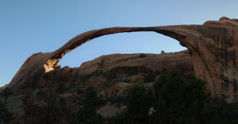
Looking at this 290 foot long span, we think the people who named it should have called it Delicate Arch.  It appears ready to fall at any time.  As a matter of fact, visitors in 1991 witnessed a 60 foot chunk fall off, after which the trail underneath was permanently closed.  Two more chunks fell off in 1995, so plan to see this beauty soon…before its too late!

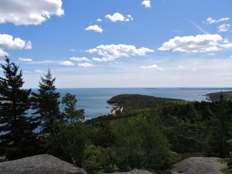
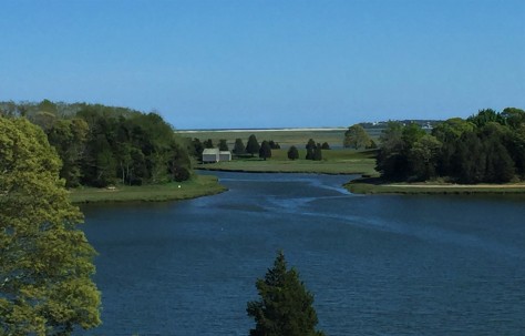
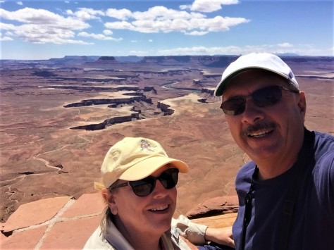
Our second day in Moab saw us heading out to Canyonlands National Park.  This place was enormous! Below is a photo of the Green River.

IMG_1579 (2)

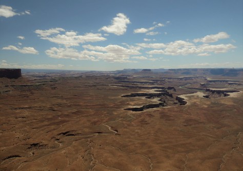
Within this same chasm the Green River flows into the Colorado River, heading south to Lake Powell and eventually the Grand Canyon.  Almost like a canyon within a canyon, it was difficult to imagine how a set of rivers could have formed this.

IMG_1590 (2)

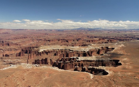
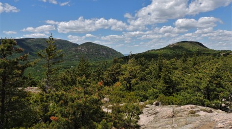
Many of the spires below us were similar to the towers we viewed the day before at Arches.

IMG_1563 (2)

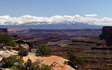
With the La Sal Mountains as a backdrop, the cataract took on an otherworldly appearance.

IMG_1573 (3)

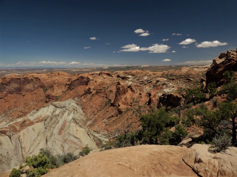
One of our hikes while we were there was to Upheaval Dome. Geologists aren’t sure of it’s origin, thinking that it was possibly caused by a meteor strike.  The upward folds in the rimrock point to that possibility.

IMG_1601 (2)

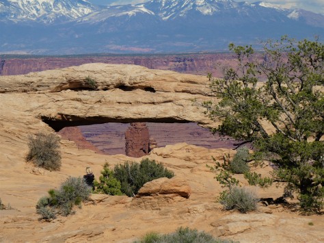
We also hiked to Mesa Arch, which sits right on the edge of the canyon.

IMG_1604 (2)

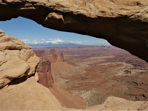
Inching up closer, the drop off becomes quite evident.  Don’t worry, I was safely back on solid ground, extending my camera out for this shot.  🙂

IMG_2392 (2)

We also earned our Junior Ranger badges for both parks while we were at Canyonlands.  It was a great day!

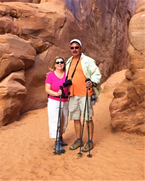
Our final day in Moab started out with us doing laundry and grocery shopping, as we had no idea the level of services in the towns ahead.  Once that was completed, we headed back to Arches.

IMG_2421 (2)

Here we are at the beginning of the trail to Sand Dune Arch.

IMG_1633 (2)

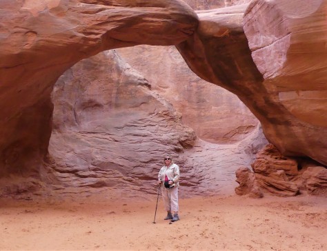
Appropriately named, the floor beneath this span is all soft sand.  In fact, one family brought their beach toys.  Tempting as it was, it was not us. 😉

IMG_1643 (2)

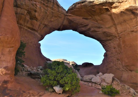
From there, we took a 1.3 mile round trip hike to Broken Arch, which rounded out our time in this beautiful area.

IMG_1657 (2)

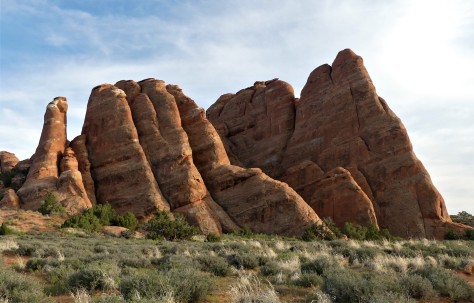
As the sun began to set on the fins of sandstone in the northern portion of the park, we said farewell to this area.  We promise to return in the future.

Next up: we move further into Utah to explore more of this beautiful state.  Our weather forced us to execute Plan B, and what a wonderful surprise that was!  Stay tuned to find out more on that adventure.  Until then, safe and happy travels to all!


Grand Canyon – Southern Style

Some places are so grand, they require two separate locations to access them from.  Such is the case with Grand Canyon National Park, with its North and South Rim units.  Even then, the canyon extends well beyond the park boundaries into Native American lands for a total of 277 miles in length.  In this post, we will detail our visit to the Grand Canyon National Park South Rim unit.

Diana was at the park in her youth, and I flew over it once on our way to Las Vegas.  From 32,000 feet, it looks a bit flat.  That was not the case this time.

IMG_1269 (2)

We were awestuck as we walked up to the rim for our first glimpse.  The words I was trying to use to describe it would not come out of my mouth.  They certainly were not needed, as Diana was feeling every bit the same as I was.

IMG_1231 (2)

The depth and enormity of what we were seeing was breathtaking.  We were not alone in feeling that way.  People from all over the world were there to take in the enormous vistas.  No matter what language they were speaking, their excitement was being expressed with the same excited tone.  🙂

IMG_1364 (2)

It is difficult to comprehend that this grandest of canyons was carved by a river.

IMG_1262 (2)

The clouds moving overhead made for a constantly changing scene, as their shadows moved across the canyon floor.

IMG_1387 (2)

At the eastern end of the park, Desert View Watchtower marks the beginning of the uplift that the Colorado river had to carve through to create the cataract.

IMG_1406 (2)

California Condors are known to frequent the area, as are turkey vultures.  It was difficult to identify which of the two this bird was, but it was fun to watch it take advantage of the updrafts and soar through the sky.

IMG_1415 (3)

In all, we walked more than 5 miles along the south rim; sometimes alone and other times with people we had just met.  We had never seen so many people from so many cultures who were just really glad to be in a particular place.

IMG_1403 (2)

No matter the viewpoint, the scenery before us was outstanding!

IMG_1221 (2)

Some people scrambled beyond the barriers for a closer view.  This activity isn’t recommended, and has actually turned deadly on more than one occasion already this year.  Hopefully these kids made it back safely.  Even behind the railings, we found ourselves staying back a step.  That’s a long way down!

At this point, I want to recognize the recent passing of Diana’s Uncle Bob.

IMG_0236 (2)

Uncle Bob was always a pure joy to be around.  Any story that he delivered usually had us in stitches.  He was a huge supporter of us being on the road and he loved to hear about our travels, telling us how much he’d liked to have done what we are doing.

IMG_1322 (2)

Well, this one is for you, Bob.  You would love it here. Hop up in the front of my new Ford and enjoy the ride.  It is going to be Grand!

Next up:  We head on up to Utah to explore the many parks in that state.  There is quite a bit that we plan to explore, so be sure to stay tuned.  Until then, safe and happy travels to all!

There Really IS an Arizona

A number of years ago, we visited the Rock and Roll Hall of Fame in Cleveland, Ohio.  As we walked into the lobby, my country music-loving sweetheart heard the guest artist Jamie O’Neal performing her country hit There is no Arizona.  Diana was giddy, to say the least, to hear a country artist performing in the shrine to artists like Lennon, Dylan, the Rolling Stones and so on.  As we waited in line for tickets to the museum, the lyrics and melody filled the atrium:

There is no Arizona

No Painted Desert, no Sedona…

Well, after what we’ve seen over the course of this last week, we beg to differ, Jamie. 🙂

IMG_2301 (2)

From the moment we arrived in Springerville, Arizona for a one night stopover, we knew it was going to be a great week.  Looking back east from a fairly nice sunset revealed this surreal moon rise.

We continued on to Petrified Forest National Park where we spent a few nights.  We scored a nice campsite at the Crystal Forest Museum just south of the park that gave us 30 amp electric for only $10 a night.

IMG_1017 (2)

At first glance, the old cars with the flat tires in the parking lot gave us pause.  We found out they parked them there a long time ago to make the place look busy.  I guess its time to either update the cars or at least air up the tires.  🙂

IMG_0897 (2) (1)

Petrified Forest was outstanding.  The southern end of the park was filled with logs that had been turned to stone after being buried for millions of years.

IMG_0902 (2)

This particular one was huge!  There is a photo in the visitor center with Albert Einstein and his wife standing next to it.

IMG_0933 (2)

Although the outside of the tree looks like bark, that is actually stone.

IMG_0953 (2)

Halfway through the park, we came to Blue Mesa.  Taking the trail, we hiked down into an area that appeared very much like the painted hills we saw in Oregon a few years ago.  Not quite blue, but very interesting to look at!

IMG_1013 (3)

At the north end of the park is the Painted Desert Inn.  This is a restored Civilian Conservation Corps era building that is very interesting to tour.

IMG_1010 (2)

Behind it is…you guessed it…the Painted Desert!  Guess Jamie O’Neal was wrong about that one!  Wow…it was absolutely beautiful.  It seemed like it went on forever.

From Petrified Forest, we moved on to Meteor Crater.

IMG_1029 (2)

This giant hole in the ground was caused by a 150 foot long meteorite that hit here 50,000 years ago.  It was estimated to have been travelling at 26,000 miles an hour.  Pretty impressive, to say the least.  Equally as impressive was the interactive visitor center.  This entire facility is privately owned, and kudos to the owners for offering a prime visitor experience.

While at the adjoining Meteor Crater RV Park, we drove back into Winslow to visit one of Rock and Roll’s other shrines…

IMG_1066 (2)

…the corner, from the Eagle’s song Take it Easy.

IMG_1059 (2)

Its my girl, my lord, by a flatbed Ford, taking a good long look at me!

IMG_1048 (2)

We also checked out the La Posada Hotel.  We had a fabulous lunch in the hotel’s Turquoise Room.

IMG_1050 (2)

The lobby was pretty, but the ‘death art’ on the walls was a bit much.  Turns out the hotel owner is the artist.

IMG_2993 (2)

I did my best to plunk out Hotel California….

From there, we moved west to Flagstaff for a few days.  The town got its name when some men stripped the branches and bark from a Ponderosa pine tree in 1876 and flew an American flag from it.

IMG_1081 (2)

We visited two parks in the area while we were there.  The first was Sunset Crater National Monument.  This cinder cone is part of a chain of volcanic features that dot the area. IMG_1086 (2)

This feature was called a squeeze up, which occurred when the molten rock was squeezed out of the earth like Play Dough.  As it cooled, it sagged under its own weight.

IMG_1124 (2)

We also visited Walnut Canyon National Monument.  This park features a trail, seen above, that descends into the canyon.

IMG_1114 (2)

Once down there, the path winds past several ancient cliff dwellings.  It was interesting to see the protection the overhanging rock offered.

eZy Watermark_25-04-2019_06-36-56AM (2)

From the rim, there was a nice view of Humphrey’s Peak and it’s neighbors.  Humphrey’s is the tallest peak in Arizona.

On our final full day in Flagstaff, we headed south to meet fellow blogger Ingrid from Live Laugh RV. We have followed her blog since 2014.  She has a similar camera to mine, and she offered to drive up from Phoenix to meet us and give me a few camera tips.  We met in…

IMG_1143 (2)

…Sedona!  Again, we’ve proven Ms. O’Neal wrong.  🙂

IMG_2985 (2)

While Ingrid and I were shooting photos of the scenery, Diana was shooting photos of us.  🙂

IMG_2984 (3)

Here we were taking photos of the cairns near Budda Beach.

IMG_1176 (2)

I managed to focus on this fly sunning itself on top of one of the cairns.

IMG_1191 (2)

I learned a lot about my new camera, thanks to Ingrid.  Hopefully that translates to better photos in the future!  It sure was a pleasure to finally get to meet her in person.  🙂

And Sedona?  It was beyond words.  We were amazed at every bend in the road.  We are happy to report that there IS a Sedona, a Painted Desert and most importantly, an Arizona.  All are beautiful and a pleasure to explore.

Next up:  The Grand Canyon South Rim!  Until then, safe and happy travels to all!

Shipwrecks and Lifesaving on the Manitou Passage

One of the consistent statements we hear from visitors to Sleeping Bear Dunes National Lakeshore is that Lake Michigan’s Manitou Passage looks like the Caribbean.  When the sun shines on these crystal clear waters, the deep blue and turquoise colors are breathtaking.

IMG_0972

Peaceful scenes such as the 1000 foot freighter American Spirit steaming past the North Manitou Shoal Lighthouse in the distance are common here in Leelanau County.  Looking at this, it’s difficult to imagine the fury the lake can unleash…often within a matter of minutes.  Many a mariner has been caught unaware in these waters, and their ships have been wrecked near these shores.

manitou-passage-chart

This chart shows the ideal route that ships aim for as a dotted line.  By going this direction a vessel can shave 60 miles off of their trip between Mackinac and Chicago, as opposed to going west of the islands.  This archipelago can also act as protection from strong westerly winds.  During a fierce gale in 1913, the steamer Illinois found refuge in South Manitou Island’s crescent-shaped harbor by nosing into the beach and keeping the engines running forward for 50 continuous hours.  It was at that point that the wind subsided enough for a crewman to go ashore and secure the ship to a large tree, so they could power down the ship.

Back in late 1800’s and early 1900’s, there weren’t any decent roads in northern Michigan and the lakes were considered a highway.  It wasn’t unusual for 100 vessels to be in the Manitou Passage on a given day, as it was also a major fueling station.  Wood was the fuel of choice back then for steamships, and these shores had plenty of it.  All of that traffic, combined with the occasional storm, brought about many shipwrecks. Over 100 vessels were known to have run aground, with many of them being refloated and saved.

IMG_0684

Over 50 were left in place to be dismantled by the power of Lake Michigan’s waves.

CwbWSDbXUAA8qhs (2)

One such ship was the Walter L. Frost, which ran aground along South Manitou Island’s shore in 1903.  It wasn’t too many years until nothing remained above the lake’s surface.

IMG_0101 (1)_LI

In 1960, the Liberian freighter Francisco Morazan grounded on South Manitou Island after losing power, running over the subsurface remains of the Frost (blue arrow) in the process.

IMG_0751

Today, the remains of the Morazan are a visible reminder of just how brutal this lake can be to a ship….

1176 (1)

…and a flyover will reveal many of the other wrecks in the passage.

We had an excellent example of the moodiness of Lake Michigan this past week.

IMG_0930

This is a photo of the 620 foot long Mississagi, heading south through the fog towards Muskegon on Thursday.

IMG_0959

On the ship’s return northward on Friday, it was met with 50 + MPH gusts coming from the northwest.  As a reference, this photo was taken on the east side of the Manitou Islands, so the ship was not experiencing the high waves that were occurring out in the open lake on the west side.

IMG_0098

But look what the captain did once he was past Leland and North Manitou Island.  With the full brunt of the gale hitting them broadside, he choose to turn the bow northwestward and head across the lake to calmer waters along the Upper Peninsula shore.  Once there, he turned northeastward and headed towards the Straits of Mackinac.  As he passed Mackinac Island, he witnessed the only shipping casualty of that day’s storm. The tug and barge Defiance/Ashtabula had run aground.  Once the gale subsided, that ship was able to be freed from the clay bottom with little damage.  The storm was strong enough to not only close the Mackinac Bridge to high profile vehicles but also the Soo Locks.  That rarely happens.

Nowadays, rescues are performed by the Coast Guard with helicopters and enclosed motor lifeboats.  Back when the Illinois sought shelter in South Manitou Harbor in 1913, the U.S. Life Saving Service (USLSS) had other equipment at their disposal.

IMG_0477 (1)

For the wrecks that were farther than 500 yards from shore, the USLSS would use an open surfboat to rescue stranded sailors.  The Sleeping Bear Point Life Saving Station performed 5% of their rescues in this manner.  But since most wrecks occurred along the shore, a beach apparatus was employed to bring the crew to safety.

g01aRESIZE

That consisted of several lines, a breeches buoy, and a cannon (called a Lyle Gun) to fire the initial line over the ship.  The breeches buoy was nothing more than a pair of pants (britches) attached to a life ring.  What this apparatus amounted to was similar to a modern day zip line.

Here at Sleeping Bear Dunes National Lakeshore, we perform a daily demonstration (summer months only) of the beach apparatus using young volunteers from the audience as surfmen.  This program is called Heroes of the Storm.

IMG_2834

Here is Captain Diana with her crew, Raggedy Ann and Andy, calling for help from her stranded ship.  A simulated Lyle Gun fires a projectile with a line out to the ship, which allows the captain to drag out the heavier rescue lines.

temp (24)

Here is Captain Jim on another occasion sending Ann towards the shore in the breeches buoy.

A special treat occurs on Thursdays, right after the Heroes program.  That is the day an actual Lyle Gun is fired.  This cannon is the only gun invented by the U.S. Army to save lives instead of take them.

temp (25)

An 18-pound projectile, similar to the one I am holding here, is loaded into the Lyle gun.  A 200-yard long shot line is tied to the end of it.  That is fired out into Sleeping Bear Bay each week.  Once the line is hauled back in, it is hung along the station’s picket fence to dry.  Once dried out, it is the park volunteer’s job to ‘fake’ the line into what is called the faking box.

IMG_2833 (1)

Here is Diana winding the rope around the faking box pegs.

IMG_2832 (1)

And here we are with 200 yards of faked rope.  There is a lid that is put over this afterwards. Once at the beach, the whole thing is turned over and the rope is slid off the pegs and into the lid.  Hopefully it doesn’t tangle when they fire the gun!  Let’s find out in this slo-mo video.  This took place the day we faked the rope:

Lyle Gun video: CLICK HERE

So there you have it.  That brought a smile to our faces!

temp (22)

Until next time, safe and happy travels to all!


The Finest Hours

“You have to go out; you don’t have to come back” 

Unofficial Coast Guard motto


September 8, 2018

A few months back, you may recall that we stopped into the Old Harbor Lifesaving Station while we were visiting the Cape Cod National Seashore.  One of the reasons for that visit was to see how a tour of a maritime museum is conducted.  Our tour guide, a National Park Service volunteer named David, inspired us with his ability to portray what life in the U.S. Life Saving Service was like.  While we were there, he gave us a tip to go see a famous Coast Guard boat that was docked in Rock Harbor, some 30 miles to the south.  It was the subject of a movie called The Finest Hours.

This turned out to be a case where history stared us right in the face and we didn’t catch it.

The next day, we set off to explore Cape Cod’s elbow, first visiting Chatham, and then Rock Harbor.  At Chatham, we parked in front of the Coast Guard station and lighthouse. This complex overlooks the Chatham Bars, a series of sandbars that extend out into the ocean.

DSCN5270

We were a bit more focused on this shack constructed along the shore, but we did note how far out the waves were breaking on the ever-changing sand bars.  Shortly after taking this photo, a driving rain came in off of the ocean, so we failed to photograph the station and lighthouse.  Instead, we headed up to Rock Harbor to see the boat that David had mentioned.  Once at the dock, we were greeted by this sign:

temp (18)

Still not familiar with the story or the film The Finest Hours, we descended to the lower dock to examine the boat.

DSCN5263 (1)

Obviously well restored and impressive to look at, the CG-36500 was tied up with little explanation to it’s storied past, short of the fact that it was a gold medal boat that had saved 32 men.  Not knowing much about Coast Guard history, we focused on how impeccable this boat was and not much else.

DSCN5264

The fittings on the craft were impressive.  Still, we were somewhat more interested in the U.S. Life Saving Service on this trip than the Coast Guard, so this small beauty’s story didn’t fully grab our attention.  We left the dock with the intention to see the movie and to research the boat’s story.  One thing led to another, and that didn’t happen.

Fast forward to our boat museum in the former Glen Haven Canning Company building at Sleeping Bear Dunes National Lakeshore.   When we started our stint as volunteers here at the beginning of August, it was hard not to notice the largest boat in the museum as being similar to the CG-36500 we saw in Massachusetts back in May.

IMG_0725

Turns out it was not only similar, but built from the same blueprint.  Our boat, the CG-36527, had been stationed at Duluth, Minnesota.

IMG_0068

Both crafts, along with the 128 sister TRS 36-foot motor lifeboats, were built by hand at the Curtis Bay Yard in Maryland.

IMG_0724

Not being in the water, it appeared much larger than it’s fleetmate out on Cape Cod.  The boat is self-bailing, self-righting, 10 tons and its motor will run upside down.  Solid as a stone and virtually unsinkable.  It is rated to carry a crew of four and up to twelve survivors.

IMG_0827

The ‘pudding’ bumper on the front is a work of art.  Visitors comment that it resembles a mustache.

IMG_0378

Standing on an easel by the front of the craft, this poster is displayed.

There’s that movie we failed to see…

So we watched the movie, then read the book of the same title.  The story goes like this:  A ferocious winter storm off the coast of Cape Cod in February of 1952 caught two World War II era tankers in its grip.  Both ships split in two between their bows and sterns.  The Fort Mercer was able to get a distress call off, and the Coast Guard sent most of their boats to assist in rescuing that ship’s crew.  The Pendleton wasn’t able to get an SOS off before it broke up, and it wasn’t until they were noticed on radar that the Chatham stationmaster Daniel Cluff went into action.  He ordered Boatswain’s Mate Bernie Webber to gather three other men and head out in the CG-36500 to see if there were any survivors.  Doing so meant they had to cross the dangerous Chatham Bars that we mentioned earlier.  Those sandbars have been known to rip boats to pieces in mild seas, and the waves that afternoon were upwards of 60 feet high!  Most of the locals considered it impossible.

“You have to go out; you don’t have to come back.”

Crossing the bar meant timing the waves, gunning the throttle on the upside and switching to full reverse throttle down the backside…so as to keep from driving the bow into the sand.  The ship’s compass was ripped loose and lost overboard almost immediately and the windshield was shattered.  Miraculously, they made it past the bars, but they were now running purely on Webber’s knowledge of the currents and the winds.  They somehow found the stern of the Pendleton, which was still afloat.  On deck were 33 men, anxious to get off.  (It was discovered later that the bow section had partially sank, killing the captain and crew that were in it.)

Remember, the CG-36500 is rated to carry a crew of four and up to twelve survivors.

Suddenly, a Jacob’s ladder was thrown over Pendleton’s stern and the men started down.  Webber brought the little lifeboat in close to get each man, backing away in between to keep from smashing into the tanker’s side.  Men were packed into the survivor’s cabin and onto every available space on deck.  The only man that didn’t make it was Tiny Myers, the ship’s 300 pound cook.  He fell into the sea and a wave threw the lifeboat into him, killing him.  Once everyone was on board, Webber pointed the CG-36500 back towards shore, hoping to beach it somewhere.  The tide had risen and they were able to cross the bars rather quickly.  As luck would have it, they ended up at the mouth of Chatham Harbor and were able to come directly into the dock with their soaked and freezing survivors.

IMG_0066 (1)

All four crew members were awarded the Gold Lifesaving Medal for their efforts.  They tested CG-36500’s limits, which in turn performed beyond its intended purpose for them.  The mission is considered to be the Coast Guard’s greatest small boat rescue ever.  The craft continued to serve until it was decommissioned in 1968.  It was donated to the Cape Cod National Seashore with the intention that it would be displayed in a museum.  Funds never materialized, and the boat was left to rot in a storage yard, totally exposed to the elements.  The Orleans Historical Society acquired it in 1981 and restored it to the operational beauty it is today.

PENDLETON RESCUE (FOR RELEASE)

In 2002, the crew was reassembled for the 50th anniversary of the rescue, and they were able to take the CG-36500 out for a tour of the harbor with Webber at the helm..  That would have been a sight to see. Clockwise from the front:  Andy Fitzgerald, Richard Livesey, Charles Bridges (Pendleton crewmember who later joined the Coast Guard), Ervin Maske and Bernie Webber.

DSCN5261 (1)

If you find yourself on Cape Cod, be sure to stop in Rock Harbor and view this wonderful piece of history.  Maybe rent the movie or read the book. Or if you find one of the 15 or so remaining 36 footers that grace our nation’s maritime museums, take a moment to imagine that night in 1952 when the Coast Guard witnessed their finest hours.

Until next time, safe and happy travels to all!

Sleeping Bear 2018

July 29 – August 14, 2018

We are happy to be back in Leelanau County, Michigan for the months of August and September.  We will be volunteering for Sleeping Bear Dunes National Lakeshore.   As we did for Oregon State Parks, we will be working as Interpretive Volunteers throughout the park.  Our duties include working in the two maritime locations, the visitor center, and as narrators on bus tours of Pierce Stocking Scenic Drive.

Campsite

As compensation, we are given a campsite at D.H. Day Campground.

We came in a few days early and camped at Leelanau Sands Casino, just north of Suttons Bay.  In order to stay there, we had to sign up for a Players Club card.  First time cardholders are given $10 in free slot play.

Leelanau Sands

I had a pretty lucky night.  The machine I was playing started going wild!  The guy next to me was laughing, as he thought I was doing pretty good for a 30 cent bet.  When I informed him I was playing on the casino’s money, his jaw hit the floor.  By the time we walked out, I was over $180 in winnings.  Not bad for someone who doesn’t frequent casinos!

Before we headed to Sleeping Bear, our friends Linda and Steven came and stayed next to us at Leelanau Sands.

Linda and Steven

We all went to Patti and Lane’s house for dinner, along with Rod and Mary.  We also went out to eat a few times and checked out Peterson Park.

Peterson Park

We love the view from up there, as it’s possible to see four islands on a clear day.

We also went kayaking on Little Traverse Lake with Lane and Patti.  Here they are heading back out after we had to get ready to go back to our camp.

Patti and Lane

Pretty soon, it was our first day on the job….which also happened to be out 36th anniversary!

First day Sleeping Bear

Here we are in the Cannery, which is a fruit processing plant turned boat museum.

Cannery

The boat I am sitting in front of is identical to the one from the movie, The Finest Hours.  It is self-righting, self-bailing, practically unsinkable and the diesel engine will run upside down.

The other maritime location is the 1902 lifesaving station.  The boathouse is said to be the most completely equipped station in the United States.

Boathouse

Here I am letting one our visitors feel how heavy the Lyle gun projectile is.  That particular gun would shoot a line over a disabled ship in order to establish a lifesaving zipline, then called a breeches buoy.  The Lyle gun was the only cannon ever developed to save lives, instead of taking them.

Surfboat

We also have two open surfboats on display.

Heroes

And every afternoon, the park puts on a program called Heroes of the Storm, a reenactment of how a Lyle gun rescue works.  Seven children are pulled out of the crowd to serve as surfmen.  The sailors they save from the ‘ship’ are Raggedy Ann and Andy.  It’s really fun.  🙂

And on Thursdays, the park fires off a real Lyle gun.  It is a sight to see!

Lyle Gun 1

The initial blast…

Lyle Gun 2

…pushing out the flame and the projectile.

Lyle Gun 3

As the projectile gets dragged by the shot line coming out of the blue box, it turns around and heads out over the water….

Lyle Gun 4

…eventually landing 200 yards out, dragging the shot line behind it.  The surfmen back in the day could launch the projectile up to 600 yards.

We also worked at the Port Oneida Fair, which is a celebration of the early 20th Century rural culture. Living history activities were held at several of the historic farms, as well as the school house, that are a part of Sleeping Bear Dunes National Lakeshore.

Laundry 2

Diana worked at the washtub station, teaching children how to do laundry.

Laundry

When the local TV station started filming, we  decided to watch the news that night.  Not only was she on there…

Corn Sheller

…so was I, teaching kids how to run a corn sheller.  🙂

Dulcimer

One gentleman was even teaching youngsters how to play a hammer dulcimer.

Blacksmith Shop

And who is that in the Blacksmith shop?  Well that is Diana, providing lunch relief for the blacksmith and keeping the fire going, while explaining the role of the blacksmith in the town of Glen Haven.  🙂

Northport

We also were visited by our friends Jodee and Bill!  Here we are at Music in the Park in Northport.

Gravels and Belisles

We also checked out Sleeping Bear and the Old Mission Peninsula with them….

Tessa selfie

…and their sweet fluffy dog Tessa.  🙂

Our last night with them, we managed to get tickets for The Accidentals.  We have been following this trio for several years now.  Their latest album Odyssey has been played in our CD players from Oregon to Florida to Maine and back to Michigan.

The Accidentals

Diana and I have seen them perform twice in the past at outside venues, but it was great to see and hear them inside an auditorium.   The four of us were blown away, hooting and hollering throughout the show.  If you ever have the opportunity to see them, don’t miss it.

Well, that gives you an idea of what we’ve been up to the past few weeks.  Stay tuned for our next post as we continue to find new adventures to share with you.  Until then, safe and happy travels to all!


Acadia 2018 – Week Two

June 9-13, 2018 – Acadia National Park, Maine

Our second week at Acadia brought us more beautiful weather, so we made sure to take advantage of it.  Quite honestly, we had no idea what to expect for early June when we booked our reservations earlier this year.  We were pleasantly surprised, to say the least!

On June 9, we headed to Gorham Mountain.  This trail is the first in a series of trails leading to the peaks in the southeastern part of the park.

Z15

We didn’t have to climb very far for the views to open up.  This view looks south towards Otter Point.

Z16

Diana spotted this beautiful buck as he crossed the trail ahead of us.

Z1

And here is the summit!

Z17

Back in the 1990’s, we continued on to the next peak (Champlain Mountain) from this point with our golden retrievers, Kate and Dakota.  In between, we dropped down to a small mountain lake called The Bowl where they enjoyed swimming.  Then we retraced our steps back to the car. That was a full day!  While this day wasn’t near as long, it was still a challenging climb.  On our way back down, we met an ornithologist who works in the park.  We were able to interview him right on the trail to fulfill our junior ranger requirements!  His favorite thing in Acadia?  Birds.  🙂

On June 10, we thought we would give ourselves a little break, so we went to the Abbe Museum in Bar Harbor.  This is actually a second location for them, with the first being within Acadia National Park boundaries.  Founded in 1926 by Dr. Robert Abbe, a prominent New York physician, this affiliate of the Smithsonian Institute showcases the Native American people of the region.

Z4

The area is unique in that several tribes banded together in order to better deal with the incoming European settlers.  They called themselves Wabanaki.  It is interesting that their tribal boundaries don’t coincide with the international boundaries, so that presents a whole host of challenges even to this day.

Z2

One of the things we found fascinating was their collection of root clubs.  These were carved from the lower portion of small trees.

Z3

And while they are intricate and quite beautiful, one has to think how much it would hurt to get a clunk on the head from one of these!

From Abbe Museum, we went to Thuya Gardens in Northeast Harbor.  To get there, we had to climb Asticou Terraces, a 200 foot high path sculpted into the side of Juniper Hill.

zzz1

From the top, a commanding view of Northeast Harbor can be seen.  It is considered a pleasure harbor, even though there are a number of lobster boats here.

zzzz

Set back from the terraces is Thuya Lodge, the summer home of Joseph H. Curtis.  He was a Boston-based landscape architect.  He designed the terraces after finishing the home in 1916.  The interior is much the way it was when he died in 1928, including the furnishings.  The gardens that now sit behind the home were actually an apple orchard he had planted.  His friend Charles Savage completed the gardens at a later date.

zzzzz

This is the lone surviving apple tree from the Curtis orchard.

zzz2

Not a lot was currently in bloom, but the space was peaceful and green.

zz10

Definitely a nice place to spend a little time.

Next, we visited one of Savage’s other creations, Asticou Gardens.

zz6

It sits down at road level, not far from the Asticou Terraces.

zz7

There was a lot more in bloom down there!

June 11 started out rainy, so after taking care of paperwork at home, we went down to the Bar Harbor waterfront and ate dinner at Geddy’s.  We noticed that they had some gluten free offerings on their sign out front, so that was what attracted us.  Imagine my surprise when the waiter told us that all their fryers and breading were gluten-free (made with rice and other flours instead of wheat, barley and rye), as it was just easier for them to do that than to have to be careful about cross contamination.

zz5

That is the first deep fried fish I’ve had since 2011…and it was outstanding!  Washed down with an Omission GF lager, of course!  Note:  We came back later in the week to try their pizza.  Pat’s…another pizza joint in town… is better and FAR cheaper.

June 12 brought us another new Acadia experience.  All the years we’ve been coming here, we had no idea that the park has a bona fide waterfall.  We set out on John D. Rockefeller’s carriage roads to find it.

Z7

This is the bridge that spans the creek below the falls.

Z8

Climbing down into the creekbed, you are able to see how Rockefeller had the arch built off-perpendicular to the roadway.

Z9

His reasoning was so that the arch itself framed the cascade.  While it wasn’t flowing much, it still was beautiful.

Instead of retracing our steps down the carriage road, we opted to take the trail that runs along the creek bed.

Z11

Plenty of tree roots, rocks, ferns, pine needles and the forest scent that we love so much.  We did not see another soul on this trail.  🙂

When we returned to the car, we drove to the Abbe Museum location that is in the park.  Our admission for both locations was covered by our North American Reciprocal Museum membership.

Z12

This is one of only two independent trail-side museums in the national parks.  The other is at Glacier Point in Yosemite National Park. This location opened in 1928.

On June 13, we decided to go see Thunder Hole, the chasm that rumbles and sprays seawater everywhere when conditions are right.  We knew there was a strong southerly wind, so there was a chance we would be in luck.  For reference, Thunder Hole is on the southeast shore of Mount Desert Island.

Z13

This is so typical of what most tourists think of Acadia.  Buses pull up bringing throngs of people off of the cruise ships to see a few attractions.  Conditions weren’t right, so Thunder Hole was quiet…yet these folks all were waiting for something to happen.  I could see off in the distance across the bay that waves were breaking on Schoodic Peninsula’s southwest shore.   So off we went for Otter Point, just to the south of Thunder Hole.

zz2

As we’ve so often found, a short distance can bring solitude at Acadia.  Those buses are about a quarter mile back around to the left.  🙂

Z14

The farther west we walked, the bigger the surf was.

zz1

This trail is called Ocean Path, and it has quite a few elevation changes.

zzzzzz

And there is what we came for!  We love to see that water splashing up off the Maine coast.  🙂

That wraps up our time heading up the Eastern Seaboard.  Next up, we head inland towards New Hampshire.  That turns into more of an adventure than we bargained for, so be sure to stop by for our next installment to see what happened.  Until then, safe and happy travels!


Acadia 2018 – Week One

June 1-8, 2018 – Acadia National Park, Maine

If there is one place in the United States that speaks louder to us than all the others, Acadia National Park is it.  This was our tenth visit here since 1986.  Even after two weeks of exploring the park, we found it difficult to leave. In our February 2015 post, Acadia National Park – Throwback Thursday, I stated  “Diana and I chuckle when we meet people who tell us that they spent the day there and ‘saw everything there was to see’. We have yet to become bored with Acadia, and we discover another layer each time we go.”  We are happy to report that we still were able to uncover even more of Acadia’s layers.  With this being our longest visit to date, we are going to divide our stay into two posts.

As is most often the case for us, our base was at Mt. Desert Narrows Camping Resort.  Located on Thomas Bay, it gives an incredible view of the areas twelve foot tides.

z22

This photo was taken from our campsite at low tide.  The entire bay empties out for several hours…

z21

…only to have the water return a few hours later. 🙂

After picking up our park literature and Junior Ranger books, we started reacquainting ourselves with the park.  On June 2nd, we drove up to the summit of Cadillac Mountain.

z10

This peak sits at 1530 feet above sea level, and offers tremendous views of the area.  We climbed this mountain back in the 1990’s with our dogs, Katie and Dakota.

z2

The benchmark for the true peak is not the Summit Trail where they send the tourists.  It is actually up the hill behind the gift shop on the South Ridge Trail.

From there, we drove down to Jordan Pond House, a restaurant within the park boundaries.  This is the place where the elite used to come for afternoon tea and popovers on the expansive lawn.

z19

To our surprise, the ‘lawn’ was in the middle of a major restoration!  Oh well…maybe next time.  They actually are slated to have the project completed by the end of June.

Behind Jordan Pond House is a trail head that leads down to Jordan Stream.  Taking that short trail is probably the best example of how easy it is to find solitude in this well used park.  As you walk down through the pines, the sound of the people at the restaurant fades away quickly.  After crossing one of the park’s motor-free carriage roads, the human voices are replaced with the sounds of the stream.

z20

We’ve taken this trail multiple times, always with that same result.  On a sidenote, that bridge is the beginning of the hike up Penobscot Mountain, the path we took on our 25th wedding anniversary in 2007.  🙂

On June 3, we returned to one of our favorite climbs, South Bubble Mountain.

z11

This is the first trail we did at the park back in 1986.  This vista looks south over Jordan Pond, a body of water we have kayaked several times.  It was a tad nippy for us to put them on the lake this time.

z12

Along the east side of the mountaintop is Bubble Rock, a glacial erratic that was deposited here at the end of the last ice age.  While it looks like it is going to fall, it is actually quite stable.  The rock it is made of came from strata nearly 40 miles to the north.

z1

As always, South Bubble summit brings a smile to our faces!  One note on this trail:  The park has improved the mid-section of this path since our last visit.  If you were here in the past, you will find this hike a lot easier than it used to be.

On June 4, we drove the remainder of the Park Loop Road.

z18

Sand Beach had plenty of people on it, despite being on the frigid waters of the North Atlantic.  The beach is actually made up of fine pieces of granite and is the only ocean beach in this area of Maine.  This spot is usually the place to be on a hot August day.

z13

While we were standing there, one of the cruise ships that frequent Bar Harbor could be seen leaving the port.

Further up the road, we stopped at the Precipice Trail.  It is currently closed because a pair of Peregrine falcons are attempting to nest there, as is quite often the case.  That challenging trail along the cliffs of Champlain Mountain was laid out by Rudolph Brunnow at the beginning of the 20th century.

z17

Brunnow was a well-to-do Princeton professor back then  He built this ‘cottage’ below the trail for his English fiancee, who was coming to America to marry him.  She unfortunately never saw it, as she booked passage to the United States on the Titanic in 1912.

June 6 took us to the western side of Mount Desert Island, commonly known as the ‘quiet side’.  Most of the parks activity is found on the east side of the island, so its nice to see the little fishing villages over here.  We did some shopping in Southwest Harbor, a quaint town on a working harbor.

z15

This is also where Bass Harbor Head Lighthouse is located.  This is a tough photograph to get, as that spruce tree to the right of the light has grown quite a bit over the years.

z3

On the way back, we stopped at Atlantic Brewing Company.  Since the last time we were here in 2010, they’ve partnered with Mainely Meat BBQ.  We were stuffed by the time we left!

The next day, we took on a new-to-us hike.  This was a relatively easy walk on a carriage road along the west side of Eagle Lake, followed by a rock scramble up the side of Conner’s Nubble.  A quick word about the carriage roads:  John D. Rockefeller donated and supervised the construction of over 50 miles of these paths on Mount Desert Island.

z14

His roads are beautiful.  They are open to hikers, horses and non-motorized bikes.

z7

These sign posts can be found at path intersections.  The numbers on the bottom of the posts correspond with the numbers found on the carriage road map.

z4

The path up to the top of Conner’s Nubble was one of the toughest we had seen in the park.  It didn’t seem to be heavily traveled, so maintaining it must not be a priority.

z5

But check out this view above the trees!  That is Eagle Lake, looking north.  Our car is parked at the far end, for reference.

z23

Retracing our steps, we passed under one of the beautiful stone bridges that grace the carriage roads.

On June 8, we did another trail we had never done before; Great Head.

z9

This is a fairly easy path that runs along the backbone of Great Head, just to the east of Sand Beach.  There are some nice coastal views from the summit, including this one over the rock called Old Soaker.

z16

This is also one of the best places to see Egg Rock Lighthouse, short of being on a boat.  Schoodic Peninsula can be seen in the distance.

z8

These smiles are beginning to become a theme here!  No doubt about it, the trails at Acadia make us very happy. 🙂

From there, we drove up to the top of Cadillac Mountain again to catch a sunset.  While sunrises are popular from up here (its the first place to see the sun in the U.S. each morning), we prefer the other end of the day.

z6

As usual, the sunset from Blue Hill Overlook was beautiful.  If you ever come for a sunset here, come early (to get a parking spot), dress warm, and stay a half hour after the sun actually sets.  If there are wispy clouds, the entire sky lights up at that point.

That’s our first week at Acadia National Park!  Be sure to check in next time when we discover several other new places undiscovered on previous visits.  Until then, safe and happy travels!


Captivating Cape Cod

May 24-28, 2018 – Cape Cod, Massachusetts

If you ever find yourself running north through Bishop, California on US-395, just past the Upper Crust Pizza Parlor, you will see a sign for US-Route 6.  That is the western terminus of one of the longest highways in the United States.  The eastern end is the subject of this post: Cape Cod, Massachusetts.  Far different from the desert landscape out west, this forested peninsula juts into the Atlantic Ocean, only to curl back towards the Massachusetts mainland it came from.  It somewhat looks like the left arm of the Notre Dame fighting leprechaun.  🙂

Cape Cod was our next stop after our stay in Rhode Island.  We allowed ourselves five days to explore the area, which was a nice amount of time to get a feel for this unique place.  Our base camp was in Eastham, about halfway up the forearm, so to speak.  We stayed at Atlantic Oaks RV Resort, which was conveniently located on the Cape Cod Rail Trail, a 22-mile long asphalt path between South Dennis and Wellfleet.

z13

As you can see by our truck, we were inundated with pollen.  🙂  That has been the downside of following the blooming dogwood trees all the way up the coast.  The weather has been decent, though!

z1

And check out that beautiful bike path.  This was one of the best marked trails we had ever been on, with motion sensors at many of the road crossings to alert the drivers.  When it crossed busy Route 6, it was either by dedicated bridge or tunnel.  Plenty of pretty views along the way.  We rode portions of this route three separate times, as the weather allowed.

z2

Any chance for us to get out on the trikes is sure to put smiles on our faces!

The area is also home to Cape Cod National Seashore.  This park covers 40 miles of Atlantic coastline, and is just above 43,000 acres in size.  It was created in 1961 by President John F. Kennedy.  When not on the rail trail, we could be found in the park!

z3

This is the view from the visitor center.  While this looks like an inland lake, it is actually a salt water pond that is subject to the ocean tides.  It is aptly named Salt Pond, and it is smack in the middle of the Cape.

z4

With the miles of coastline comes a multitude of lighthouses.  This is Nauset Light, which was fairly close to our campground.

z5

And near that were the relocated Three Sisters lights.  These were originally fixed light beacons, built long before the lenses rotated.  Ships could tell where they were by the fact that there were three of them lit.  When the National Park Service restored them, they only rebuilt one lantern room.

z6

Farther up the coast is the Highland Lighthouse.  This 1857 structure was moved 400 feet back from the sea in 1996.  International Chimney Corporation of Buffalo was the contractor responsible for the work, three years prior to their similar accomplishment at Cape Hatteras.

We also visited the Edward Penniman House, which was the home of a very successful whaling captain.

z11

Our guide, a former builder from New Jersey, has been giving tours of the home for over twenty years.  While the home itself lacked furniture and was in need of repair, he was able to tell the story of the family that lived here.  It was nice to see such a dedicated volunteer.  🙂


z7

We also visited the Old Harbor Life Saving Museum.  This structure is at the north end of Cape Cod.  The plywood on the windows covers blown out windows from winter storms earlier in the year.  As are many of the structures along this coast, this building was in danger of falling into the sea.  It was moved here from further down the shore by barge in 1977.  This museum is maintained exactly as it would have been when it was a lifesaving station, right down to the living quarters.  We wanted to see this place, as we are going to be volunteering in a similar building in Michigan later this summer.

z8

Our tour guide gave us a very detailed description of what occurred at this facility.

z10

Room by room, David explained at length the day-to-day life at this remote outpost.  The men who worked here never had a chance to become bored, as they were constantly practicing for a possible shipwreck rescue.

z12

He inspired us for our upcoming experience, and we will using some of what he taught us in our tours.  We’ll just have to be careful not to call a harbor a hah-bah. 🙂

That wraps up our enjoyable stay on Cape Cod!  We had a great time exploring this special place.  Next up, we make a couple of nice stops in New Hampshire and Maine as we move north towards Acadia National Park.  Be sure to stay tuned for that.  Until then, safe travels to all!


Take note that we have added a Disclosure and Privacy Policy page immediately below our header, to bring us in compliance with GDPR.  Many thanks to Gaelyn at Geogypsy for alerting us to the need for it, Ingrid at Live Laugh RV for help in setting it up and Nina at Wheelingit for a wealth of information on the subject. 


Pocahontas – Did Disney Get it Right?

April 30, 2018 – Jamestown, Virginia

Some of us might remember the 1995 Disney movie Pocahontas, in which the young Powhatan Indian maiden is romantically involved with one of the founders of Jamestown, Captain John Smith.  It followed 1994’s The Lion King, so you may still have had the latter VHS tape in your VCR and missed it.  We did a little digging to find out just what happened at this historic village, and if the young native really had a thing for the dashing Englishman.

Jamestown is the first successful English settlement in North America.  Captain John Smith was aboard a three-ship expedition that established James Fort on what is now known as the James River.  It lies a mere 3 miles from the center of Williamsburg, Virginia, which we visited in our last post.  They arrived in late April of 1607, finding a place they thought was graced with fresh water.  That was later known to be the result of snow melt, with summer revealing the area’s water to be brackish.  They were agriculturally ill-equipped, and 80% of them perished the next winter during a period known as the Starving Time.  It didn’t help that the settlers weren’t getting along with the natives, either.  According to Smith he was captured by the Powhatans and nearly executed at one point, only to have Pocahontas throw herself across his body to save him.  Pretty romantic, but not the complete story.  More on that in a bit.

Following those difficult first years, Jamestown flourished and was the capital of Virginia from 1616 to 1699. Eventually it was known as James City.  In 1698 the capitol building burned, so the decision was made to move the seat of power to Williamsburg.  The little settlement by the James River eventually disappeared, except for the brick church tower that the colonists had built.  The property changed hands a few times and was eventually donated to the Association for the Preservation of Virginia Antiquities in 1893.  That non-profit organization is now known as Preservation Virginia.  It was believed that the original townsite had eroded into the river.  The organization received federal assistance to build a seawall to protect what was left.

On April 30, we went to check this place out.  We weren’t quite sure where to go, as there are two locations that are administered by three organizations.  Bear with me on this. The Commonwealth (state) of Virginia owns a recreated living history museum called Jamestown Settlement just downriver from the original site.  We chose not to visit there, opting to instead see the actual place where the colony existed.  The Preservation Virginia site is immediately adjoined upriver by New Town, the direction Jamestown grew as it developed.  New Town is administered by the National Park Service, and was excavated beginning in the 1930’s.  Those digs are considered to be complete. It is confusing that those two sites are presented together as Historic Jamestowne.  With Preservation Virginia’s involvement a separate $5 per person fee was charged, over and above our annual NPS pass. There is no choice to go only to the National Park.

z11

Upon entering the park, we were greeted by this large monument that commemorates the founding of Jamestown.  We decided to join in on the archaeologist’s tour, which met in the shadow of the obelisk. So if the original townsite was washed into the river, what are they digging for?  Well, in 1994, a man by the name of Dr. William Kelso convinced Preservation Virginia to let him dig and see what he could find.

z7

Our tour guide, Danny Schmidt, explained to us how they found the impressions of the fort’s posts in the soil.  He joined Kelso right at the start of the project when he was just 16 years old and has been digging ever since. He bolstered his on the site experience with official degrees, and is now Senior Staff Archaeologist. He repeatedly commented that he was in the right place at the right time and feels very lucky to have spent his career in this location learning from Dr. Kelso.

z6

It is very clear where a trench was dug and where the posts were placed.  When the posts rotted, the impressions in the soil left a different color.  The walls of the fort were quickly reestablished, finding that only a small portion of the structure had washed away.

z8

Looking down this wall to the point in the river where the far wall would intersect, shows how tiny that lost section is.  Danny took us through the discoveries he and the team made, explaining how the dried up wells and basements of burned structures were used as dumps.  As they found them, thousands of artifacts were brought up to help tell the story of Jamestown.  Comparing what they were finding to historical accounts from the colonists, the archaeologists were able to even identify some of the human remains that were buried there.  Schmidt was very interesting to listen to, telling about the times he met George W. Bush and Queen Elizabeth II, along with how the archaeology team determined what each found object was telling them.

z9

The group is currently excavating the earth under the brick church that was originally built in the 17th century.  This version is from the 1920’s, although the attached tower is said to be original. Also, there is a museum on the property which displays many of the artifacts found since Kelso started digging.

z10

This armor was found in one of the wells.  It is still in pretty good shape, considering it is 400 years old!

z2

This tag was probably affixed to a crate of supplies that was brought from England.  The old English spelling had it listed as Yames Towne.  This tag flew on the space shuttle Atlantis to commemorate the 400th anniversary of the settlement.  It logged a lot more miles on that trip than it did on it’s first one!

z1

And this guy is Captain Bartholomew.  They determined it by his bone structure, the staff he was buried with, and the location and direction of his grave.  Schmidt even explained that they can determine what area of England a person would have come from, as the water in each place leaves different markers on the bones.  Amazing stuff.  They also found the bones of a young girl that was cannibalized during the Starving Time.

So back to our Disney story.  Danny told us about how they ended up finding the original church, along with the graves of four people from the settlement.

z5

He even showed us the spot where Pocahontas was married to….John Rolfe.  Huh?  What happened to John Smith?  He had left town in late 1609.  As far as our young Powhatan maiden, it turns out that she was captured and held for ransom by the English in 1613.  She converted to Christianity and married Rolfe in 1614.  He was the person who introduced tobacco to the New World as a cash crop.  Pocahontas bore their son in 1615 and the three set sail for England in 1617.  She died soon after of unknown causes at the young age of 20 to 21 years old.  She is buried in the church in Gravesend, England.

z4

Here are our feet on the exact spot that the Rolfes would have taken their vows.  Pocahontas would have been wearing pink laces.  🙂

z3

A selfie after the ceremony and we were on our way to discover the third corner of the historic triangle: Yorktown.  We will take a look at that in our next post, so be sure to stay tuned.  We found some nifty little tidbits while we were there.  Until then, don’t forget to “paint with all the colors of the wind” in your travels! (We still love a little Disney now and then!)   🙂

As stated earlier, there is an additional $5 per person charge to enter Historic Jamestowne, even if you hold an annual NPS pass.  Preservation Virginia also asks for donations during the Archaeologist Tour and again upon entering the museum, even though the first additional fee goes to them.  In addition, this was the first park we had ever seen that charged for a Junior Ranger book.  While it was only $1, we were concerned that some parents would forego having their children participate in the activity, thereby putting a roadblock into what Preservation Virginia and National Parks are trying to accomplish.  Perhaps they will rethink that in the future.

Jamestown Settlement is a completely separate location that charges its own fee. It is a recreated living history museum owned by Commonwealth (state) of Virginia. We did not visit this location.