
June 1-8, 2018 – Acadia National Park, Maine
If there is one place in the United States that speaks louder to us than all the others, Acadia National Park is it. This was our tenth visit here since 1986. Even after two weeks of exploring the park, we found it difficult to leave. In our February 2015 post, Acadia National Park – Throwback Thursday, I stated “Diana and I chuckle when we meet people who tell us that they spent the day there and ‘saw everything there was to see’. We have yet to become bored with Acadia, and we discover another layer each time we go.” We are happy to report that we still were able to uncover even more of Acadia’s layers. With this being our longest visit to date, we are going to divide our stay into two posts.
As is most often the case for us, our base was at Mt. Desert Narrows Camping Resort. Located on Thomas Bay, it gives an incredible view of the areas twelve foot tides.
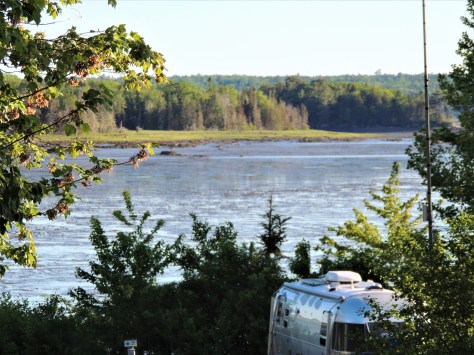
This photo was taken from our campsite at low tide. The entire bay empties out for several hours…
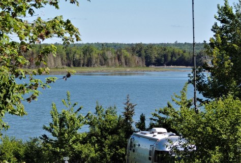
…only to have the water return a few hours later. 🙂
After picking up our park literature and Junior Ranger books, we started reacquainting ourselves with the park. On June 2nd, we drove up to the summit of Cadillac Mountain.
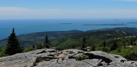
This peak sits at 1530 feet above sea level, and offers tremendous views of the area. We climbed this mountain back in the 1990’s with our dogs, Katie and Dakota.
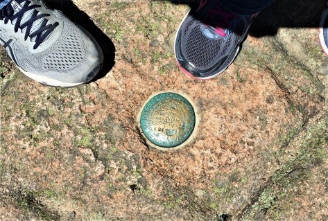
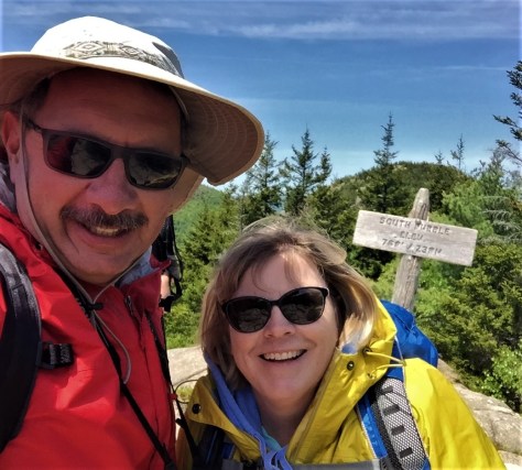
The benchmark for the true peak is not the Summit Trail where they send the tourists. It is actually up the hill behind the gift shop on the South Ridge Trail.
From there, we drove down to Jordan Pond House, a restaurant within the park boundaries. This is the place where the elite used to come for afternoon tea and popovers on the expansive lawn.
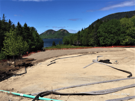
To our surprise, the ‘lawn’ was in the middle of a major restoration! Oh well…maybe next time. They actually are slated to have the project completed by the end of June.
Behind Jordan Pond House is a trail head that leads down to Jordan Stream. Taking that short trail is probably the best example of how easy it is to find solitude in this well used park. As you walk down through the pines, the sound of the people at the restaurant fades away quickly. After crossing one of the park’s motor-free carriage roads, the human voices are replaced with the sounds of the stream.
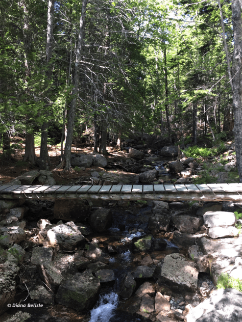
We’ve taken this trail multiple times, always with that same result. On a sidenote, that bridge is the beginning of the hike up Penobscot Mountain, the path we took on our 25th wedding anniversary in 2007. 🙂
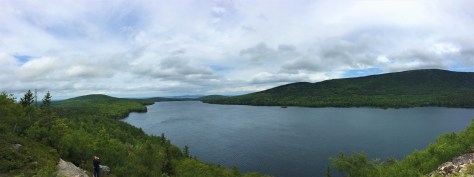
On June 3, we returned to one of our favorite climbs, South Bubble Mountain.
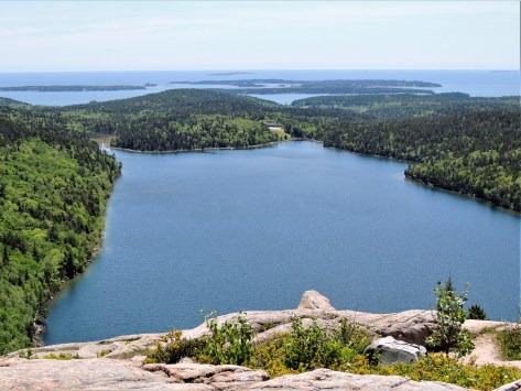
This is the first trail we did at the park back in 1986. This vista looks south over Jordan Pond, a body of water we have kayaked several times. It was a tad nippy for us to put them on the lake this time.
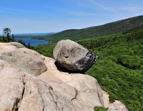
Along the east side of the mountaintop is Bubble Rock, a glacial erratic that was deposited here at the end of the last ice age. While it looks like it is going to fall, it is actually quite stable. The rock it is made of came from strata nearly 40 miles to the north.
As always, South Bubble summit brings a smile to our faces! One note on this trail: The park has improved the mid-section of this path since our last visit. If you were here in the past, you will find this hike a lot easier than it used to be.
On June 4, we drove the remainder of the Park Loop Road.
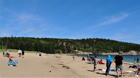
Sand Beach had plenty of people on it, despite being on the frigid waters of the North Atlantic. The beach is actually made up of fine pieces of granite and is the only ocean beach in this area of Maine. This spot is usually the place to be on a hot August day.
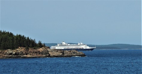
While we were standing there, one of the cruise ships that frequent Bar Harbor could be seen leaving the port.
Further up the road, we stopped at the Precipice Trail. It is currently closed because a pair of Peregrine falcons are attempting to nest there, as is quite often the case. That challenging trail along the cliffs of Champlain Mountain was laid out by Rudolph Brunnow at the beginning of the 20th century.
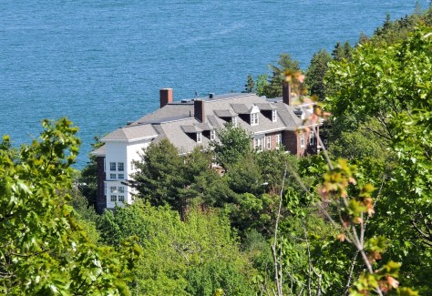
Brunnow was a well-to-do Princeton professor back then He built this ‘cottage’ below the trail for his English fiancee, who was coming to America to marry him. She unfortunately never saw it, as she booked passage to the United States on the Titanic in 1912.
June 6 took us to the western side of Mount Desert Island, commonly known as the ‘quiet side’. Most of the parks activity is found on the east side of the island, so its nice to see the little fishing villages over here. We did some shopping in Southwest Harbor, a quaint town on a working harbor.
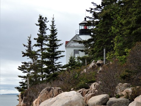
This is also where Bass Harbor Head Lighthouse is located. This is a tough photograph to get, as that spruce tree to the right of the light has grown quite a bit over the years.
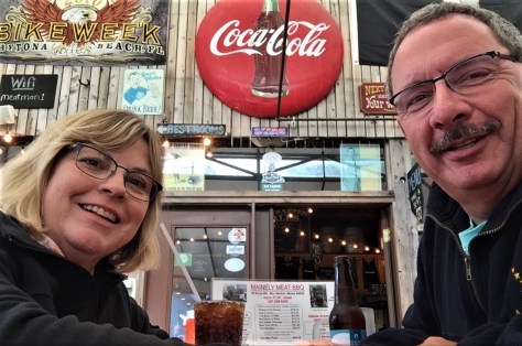
On the way back, we stopped at Atlantic Brewing Company. Since the last time we were here in 2010, they’ve partnered with Mainely Meat BBQ. We were stuffed by the time we left!
The next day, we took on a new-to-us hike. This was a relatively easy walk on a carriage road along the west side of Eagle Lake, followed by a rock scramble up the side of Conner’s Nubble. A quick word about the carriage roads: John D. Rockefeller donated and supervised the construction of over 50 miles of these paths on Mount Desert Island.
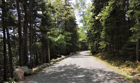
His roads are beautiful. They are open to hikers, horses and non-motorized bikes.
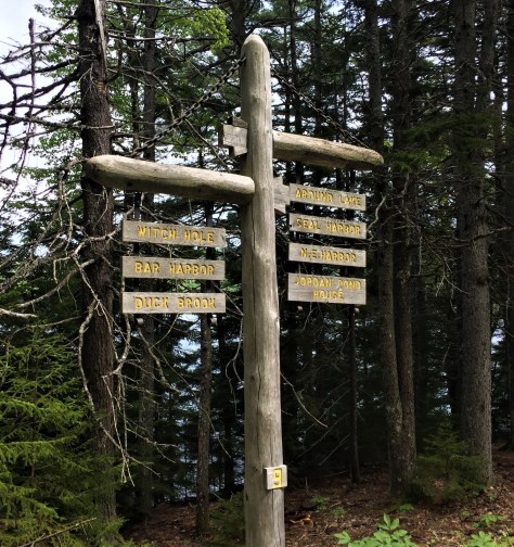
These sign posts can be found at path intersections. The numbers on the bottom of the posts correspond with the numbers found on the carriage road map.
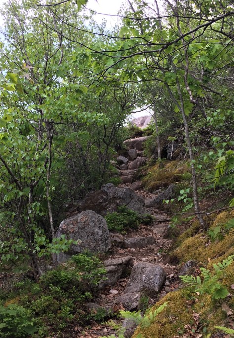
The path up to the top of Conner’s Nubble was one of the toughest we had seen in the park. It didn’t seem to be heavily traveled, so maintaining it must not be a priority.
But check out this view above the trees! That is Eagle Lake, looking north. Our car is parked at the far end, for reference.
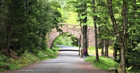
Retracing our steps, we passed under one of the beautiful stone bridges that grace the carriage roads.
On June 8, we did another trail we had never done before; Great Head.
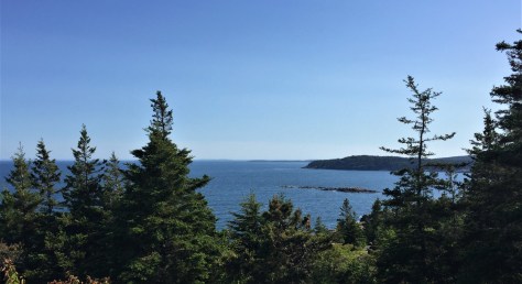
This is a fairly easy path that runs along the backbone of Great Head, just to the east of Sand Beach. There are some nice coastal views from the summit, including this one over the rock called Old Soaker.
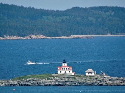
This is also one of the best places to see Egg Rock Lighthouse, short of being on a boat. Schoodic Peninsula can be seen in the distance.
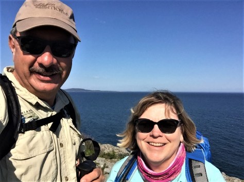
These smiles are beginning to become a theme here! No doubt about it, the trails at Acadia make us very happy. 🙂
From there, we drove up to the top of Cadillac Mountain again to catch a sunset. While sunrises are popular from up here (its the first place to see the sun in the U.S. each morning), we prefer the other end of the day.
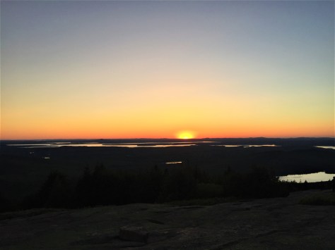
As usual, the sunset from Blue Hill Overlook was beautiful. If you ever come for a sunset here, come early (to get a parking spot), dress warm, and stay a half hour after the sun actually sets. If there are wispy clouds, the entire sky lights up at that point.
That’s our first week at Acadia National Park! Be sure to check in next time when we discover several other new places undiscovered on previous visits. Until then, safe and happy travels!
