All posts by exploRVistas

We are full time RVers on a mission to find America's story. We feel that by moving our house to a location and living among the locals for a bit, we allow ourselves the opportunity to understand that area's people. Our motto is "Don't just see it...BE it"©

Big Bend N.P. – The Mountains

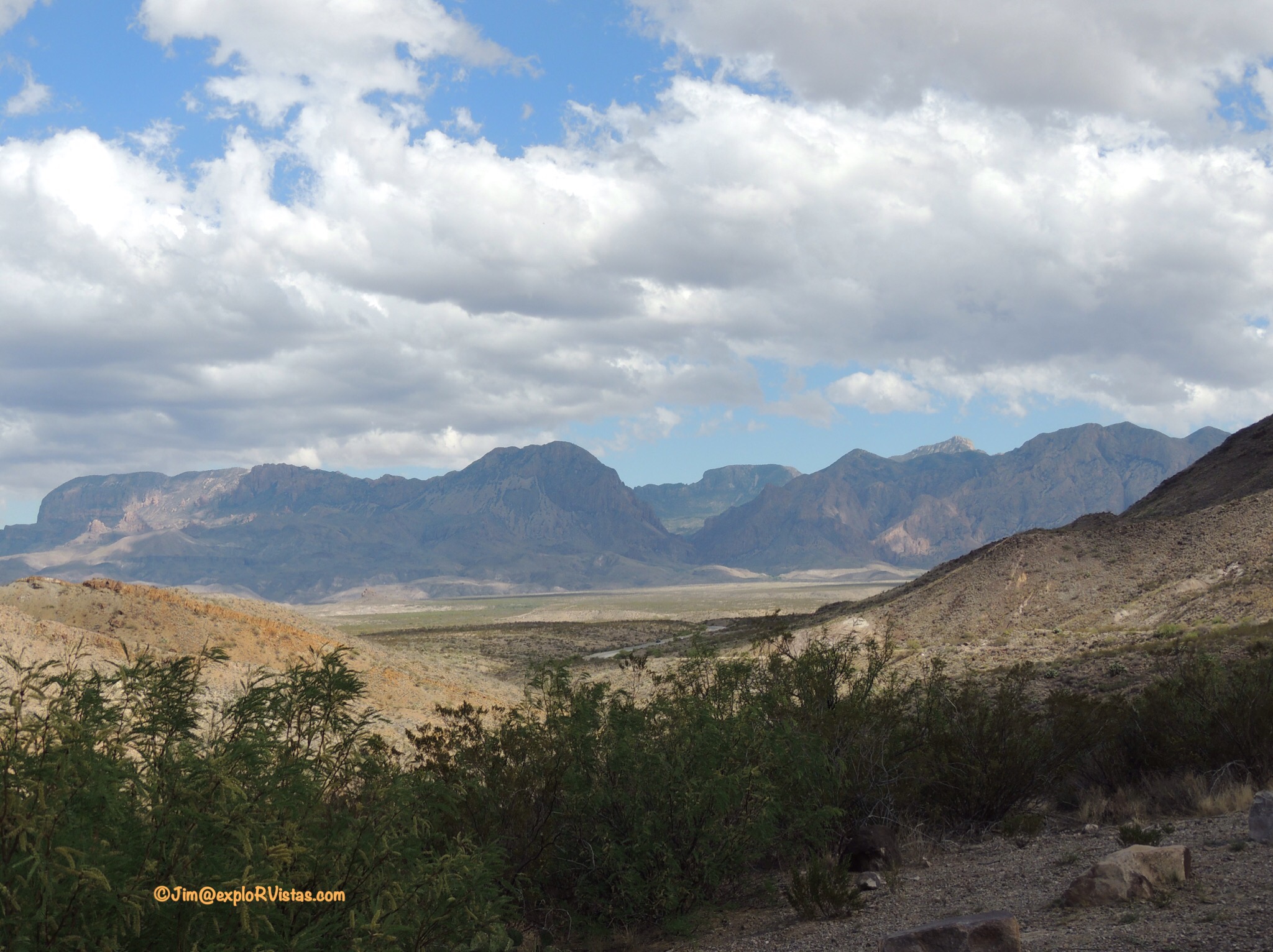
Most of Big Bend National Park is dotted with various mountains, mesas and buttes, primarily covered with desert vegetation.  The exception to that is the Chisos Mountains.  It is here that the plants of the outlying Chihuahuan Desert share space with pines and hardwoods usually associated with places much farther north.  Animals such as black bears, mountain lions, and javelinas can be found in the hillsides.  Temperatures are often much cooler than the neighboring landscape.  And the hiking trails are scenic and challenging!

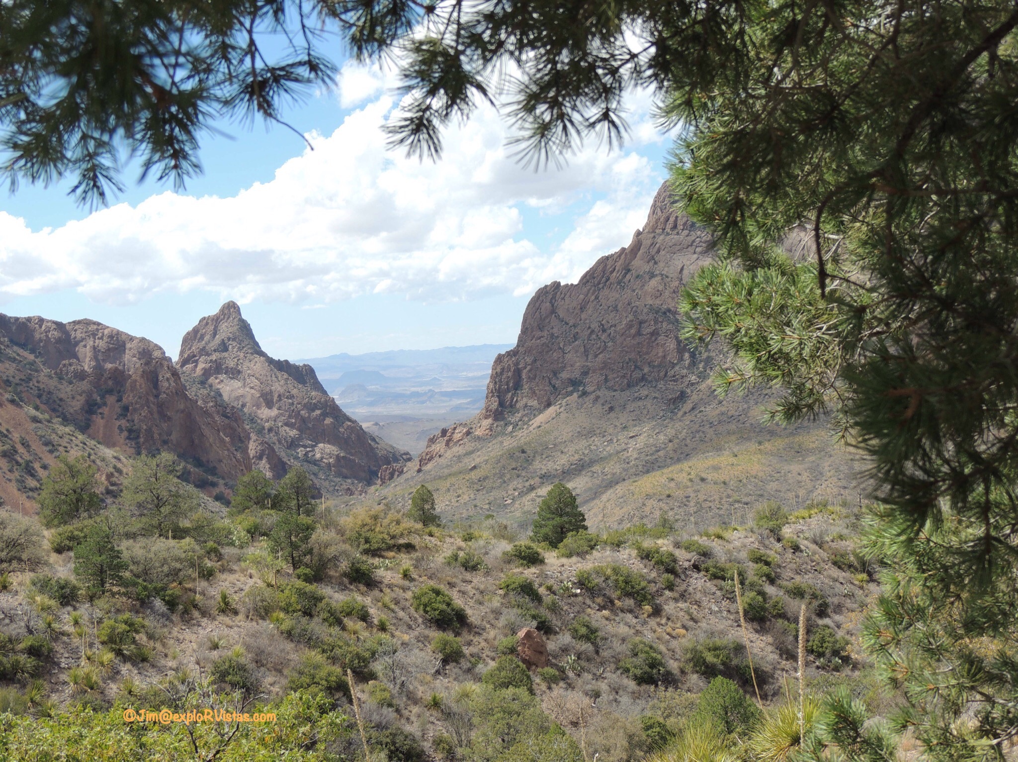
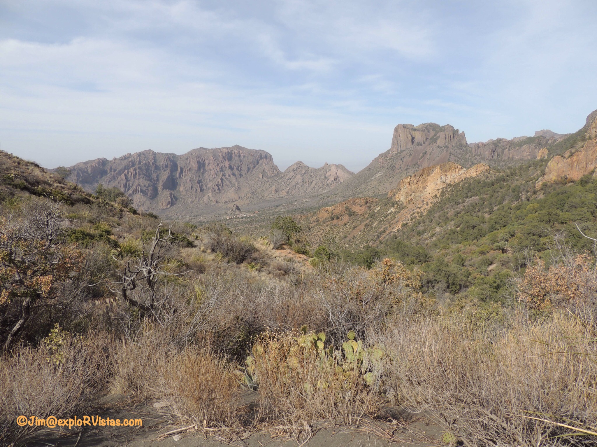
To paint a picture of this stand of mountains, it is actually the remnants of an ancient volcano.  The Chisos Basin is the collapsed caldera of that volcano, and that is where the lodge, campground, and visitors center are. Most of the mountain hikes originate from the basin and go up into the mountainsides around it.

Our first mountain hike actually stayed in the basin.  This was the Windows View trail, and it is paved and ADA compliant. At one third of a mile, it is more of a stroll than a hike.


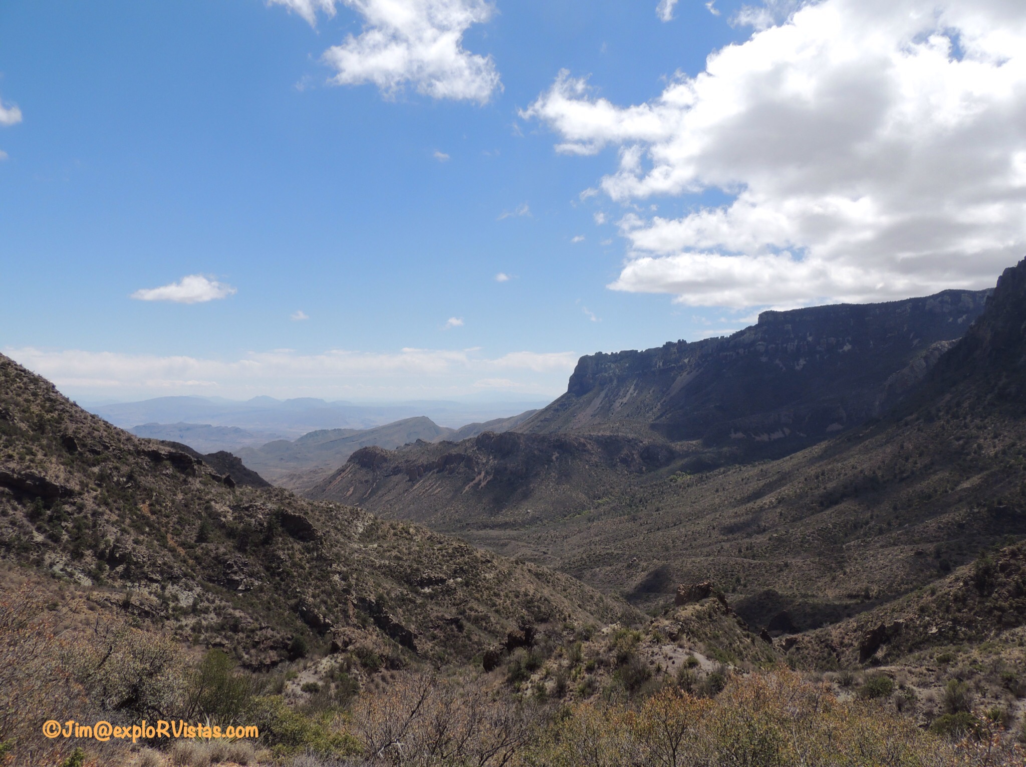
This trail loops to the northwest of the lodge, providing an outstanding view of the V-shaped pouroff through the mountains referred to as The Window.  Appropriately named, this geological feature offers a stunning vista of the desert floor outside of the mountains.  Depending on the time of year, it can also act as a frame for a spectacular sunset photo!  There is also a trail which runs directly to the brink of the pouroff (don’t get too close, as it is a 250 foot drop!)  We did not have time to explore it this trip, but we would consider it in the future.

Our second hike in the mountains was the Lost Mine Trail.


This 4.7 mile round trip trail is rated as difficult, and has an 1122 foot altitude gain.  It begins a little ways up the basin road from the lodge at the foot of Casa Grande, seen in this photo.


Here is Diana, ready to head up the trail!


The trail had numbered viewpoints, but there were no booklets at the beginning of the trail.  I had read that getting to #10 was a ‘must’, and here is the view from that point.  The mountains in the distance are in northern Mexico.


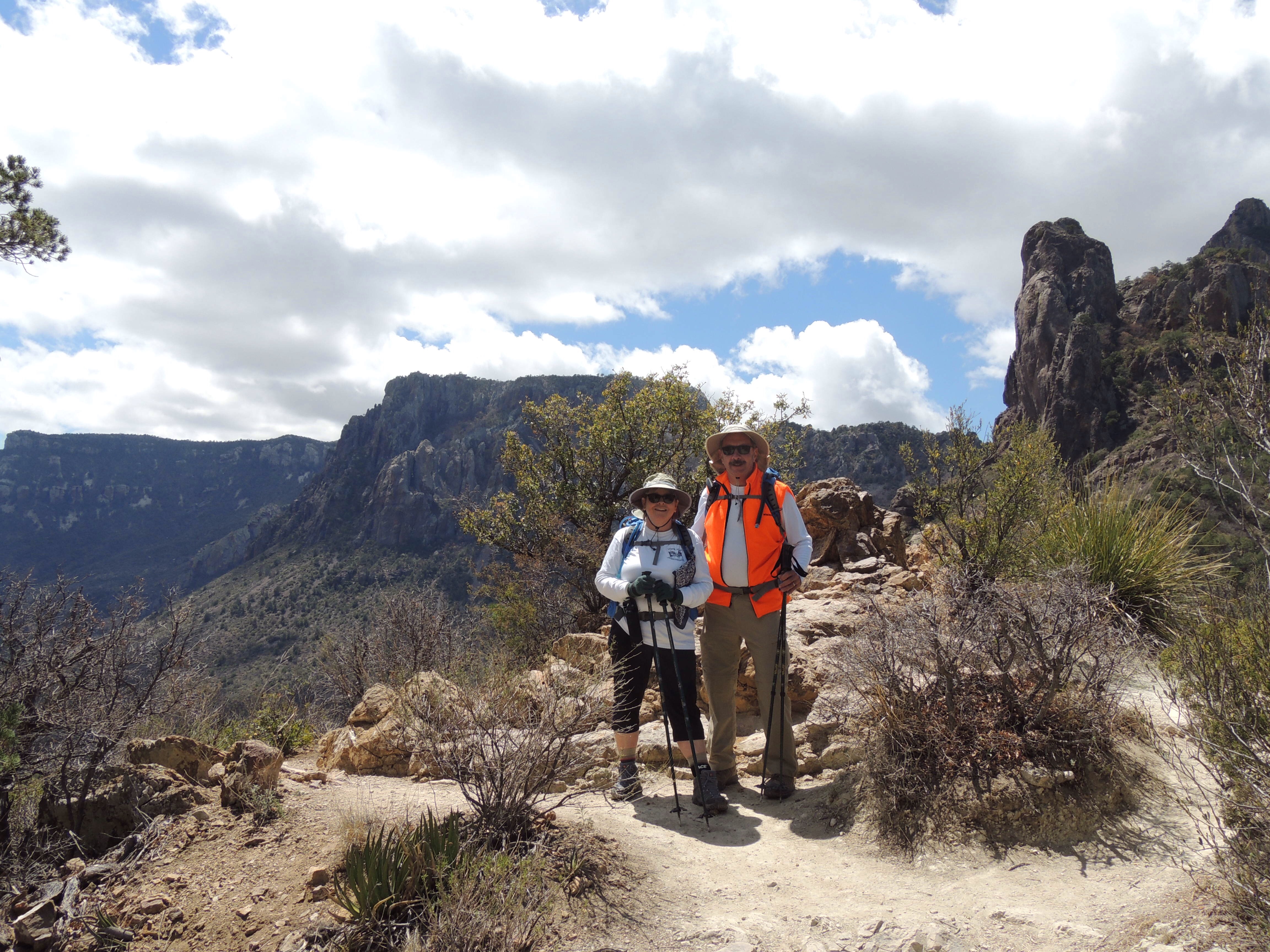
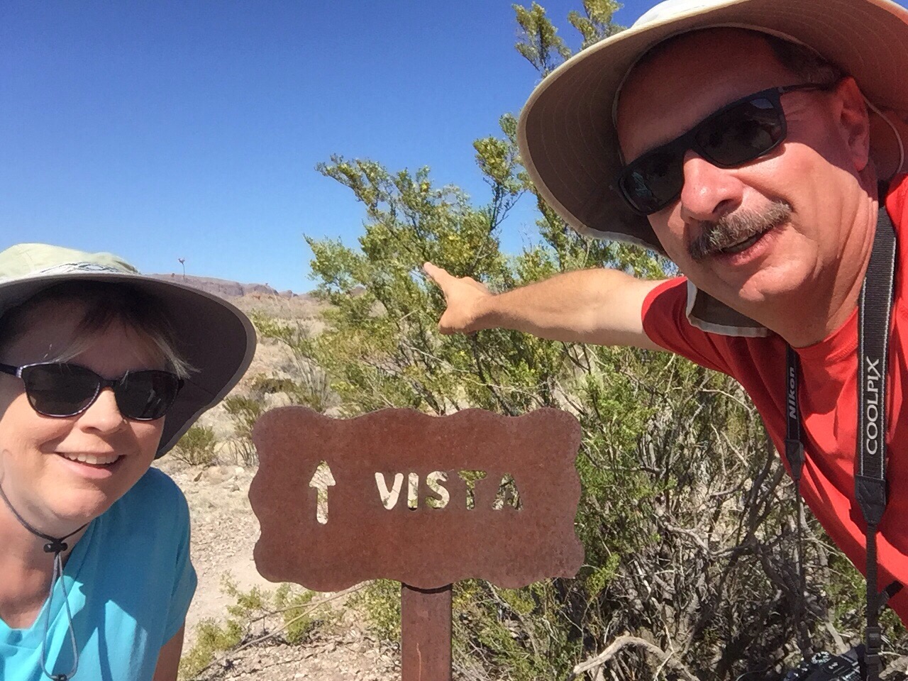
A fellow hiker was kind enough to snap a photo of us at that viewpoint.


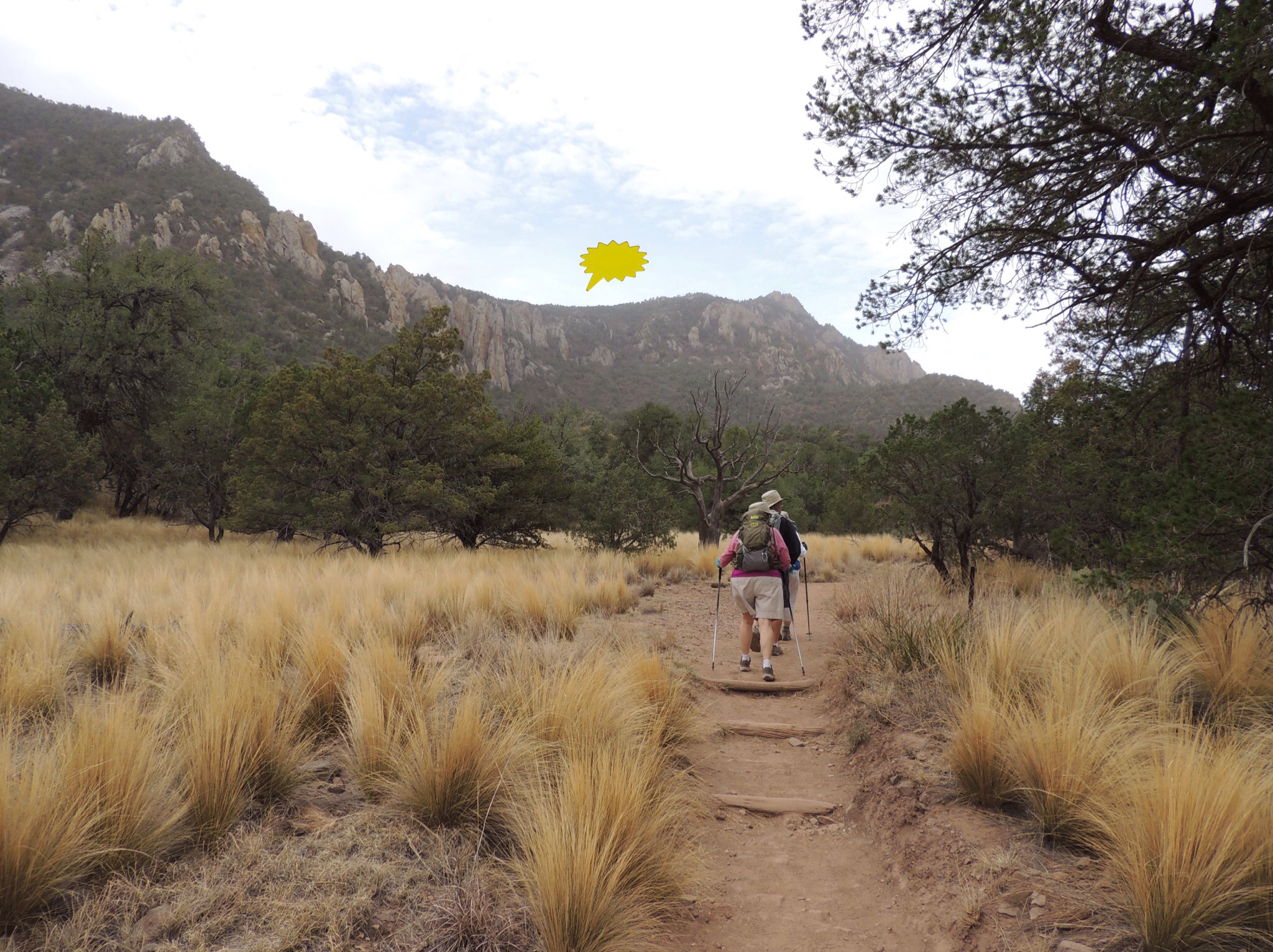
This is another 20 or so minutes up the trail.  Not long after this, we talked to someone coming down that said we had another 45 minutes to go to get to the top.   As this was a warmup for a much longer hike we had planned later in the week, we turned back.  Diana developed plantar fasciitis this winter and is nursing a very sore heel, so we didn’t want to overdo it.  We found out afterwards that the hiker misinformed us, as the end of the trail was much closer.  Not to worry, as that leaves us a reason to come back in the future!  One thing to note on this trail:  even though we didn’t see any, the volunteer at the visitor center told us afterwards that there were three black bears sighted on the trail while we were out there.  Also, mountain lions can be an issue in Big Bend, especially along this trail.  Javelinas also roam the park, and can be aggressive.  And did I mention rattlesnakes?  🙂

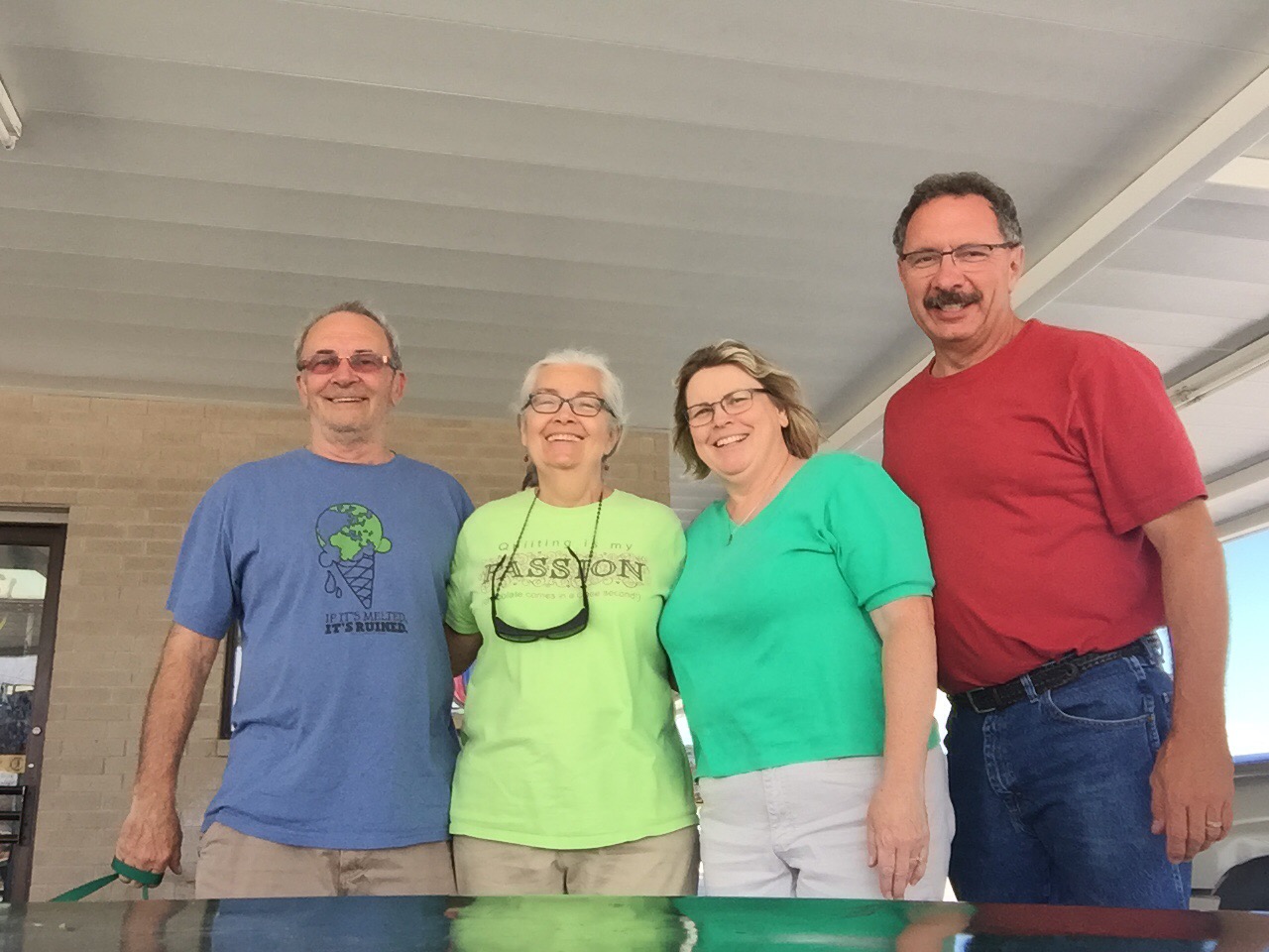
On Wednesday, April 6, we joined Nancy and David on an all day hike to the South Rim.  This was the primary reason we came to Big Bend, and has been the focus of our winter’s worth of training.  This hike is a 12 mile loop with a 2395 foot altitude gain and is rated as strenuous.  I’ll tell you what, y’all…they ain’t kiddin’.  🙂   While this would be right up some of our fellow bloggers’ alleys, this was quite the challenge for us!


We started out driving to the basin  from our campsite in Study Butte before dawn.  This beautiful sunrise greeted us on our way east.


At the trailhead, I made a feeble attempt at a four person selfie.  Let’s get hiking!


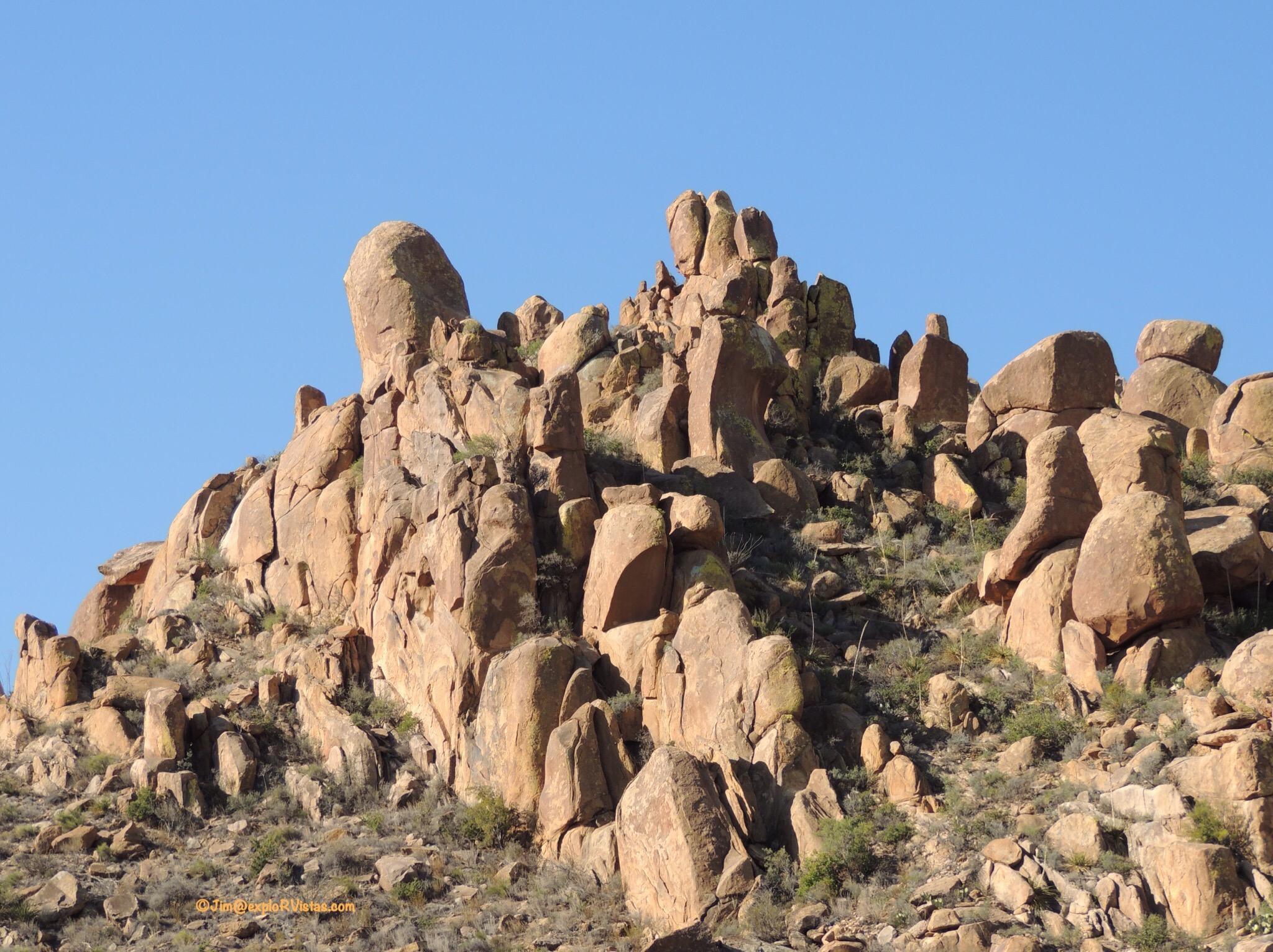
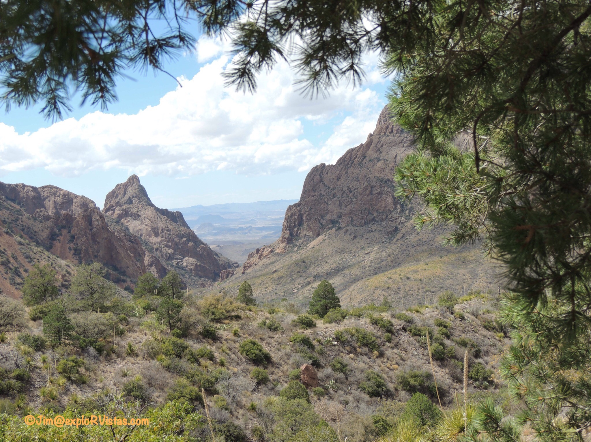
The pointer shows our first obstacle: the Pinnacles.  A good portion of our elevation gain occurred getting to the top of that ridge.


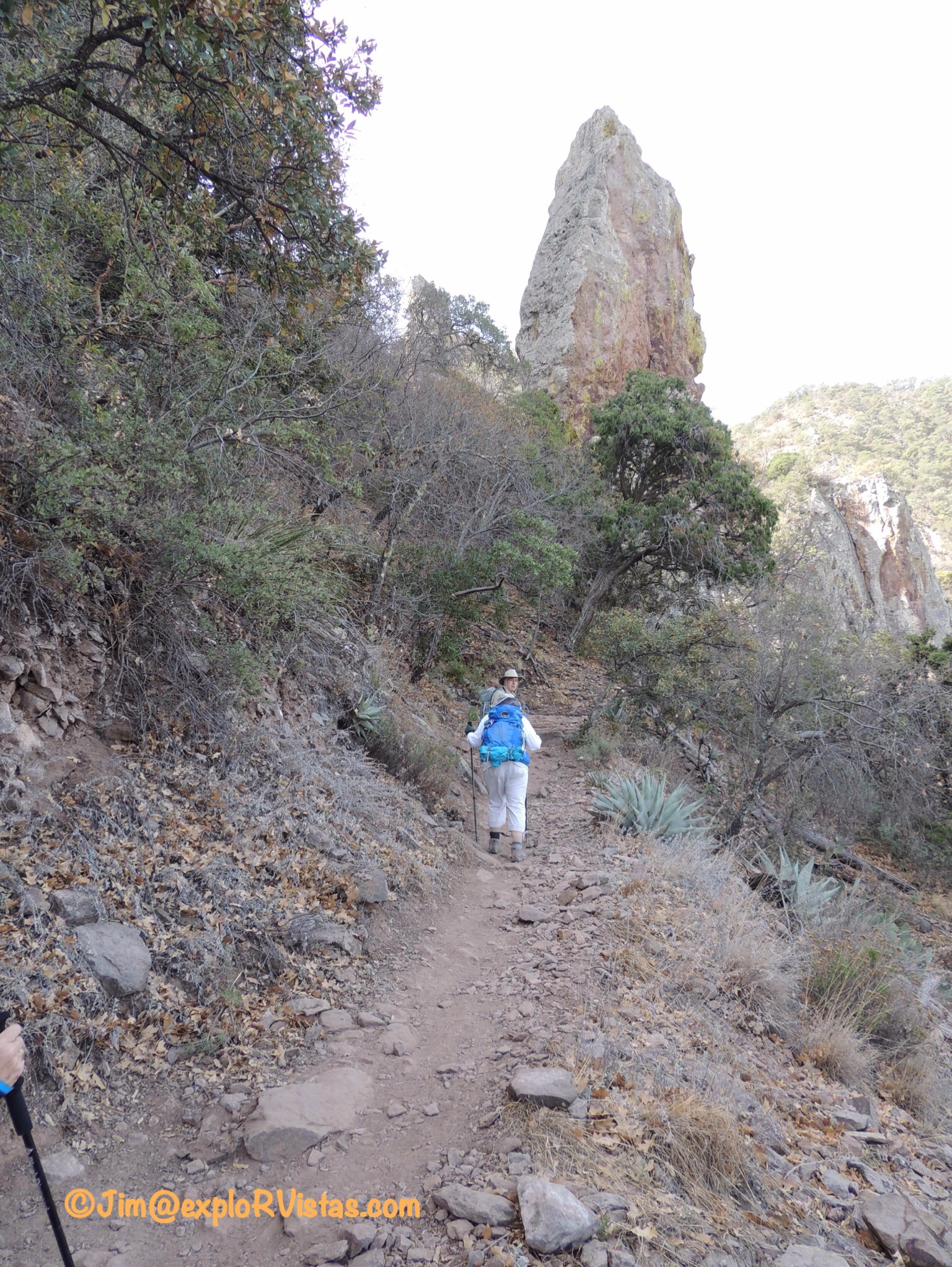
Switchbacks were the order of the day, along with some fairly high steps.  These jagged rocks were typical of the surface we walked on throughout the day.


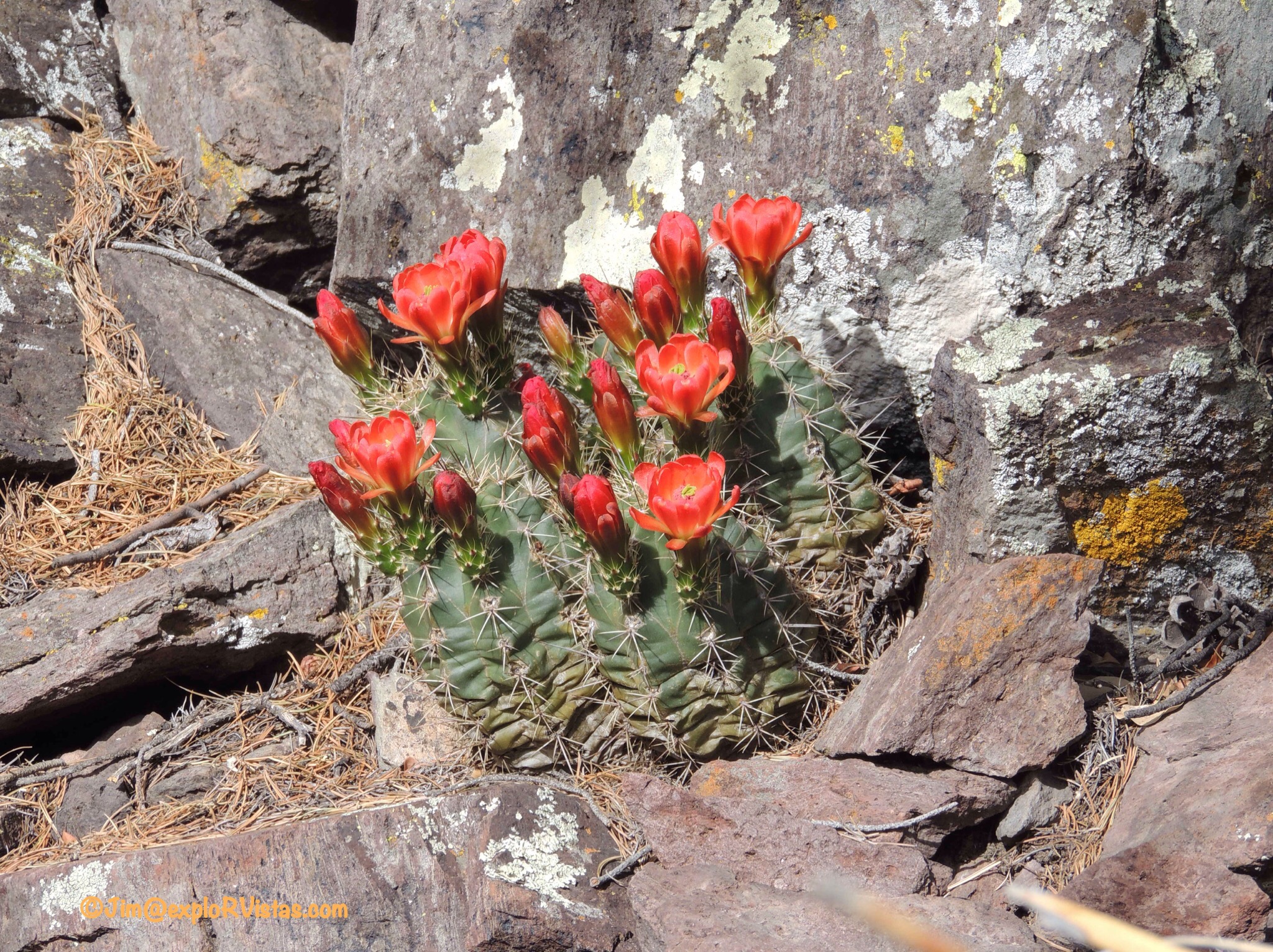
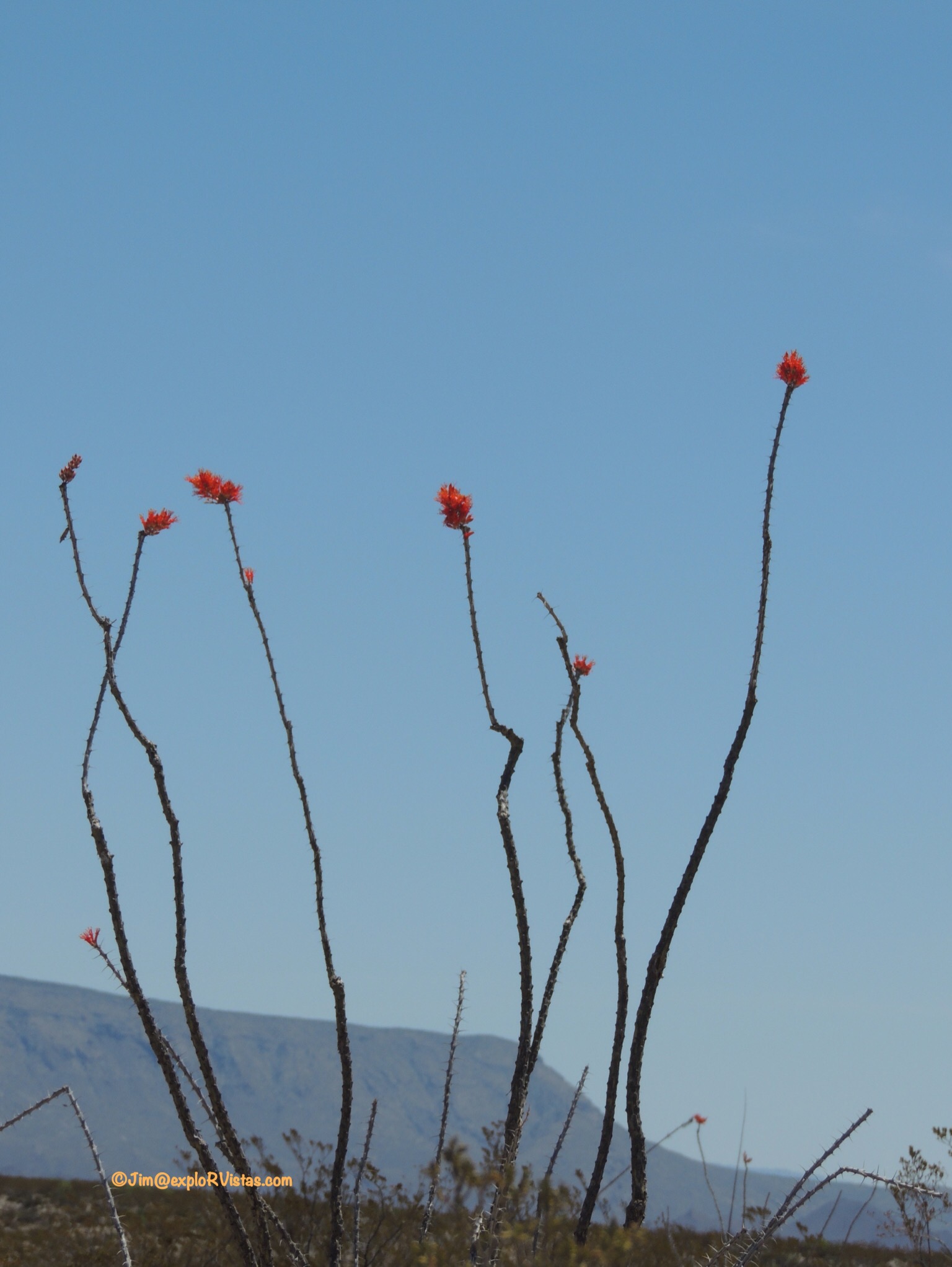
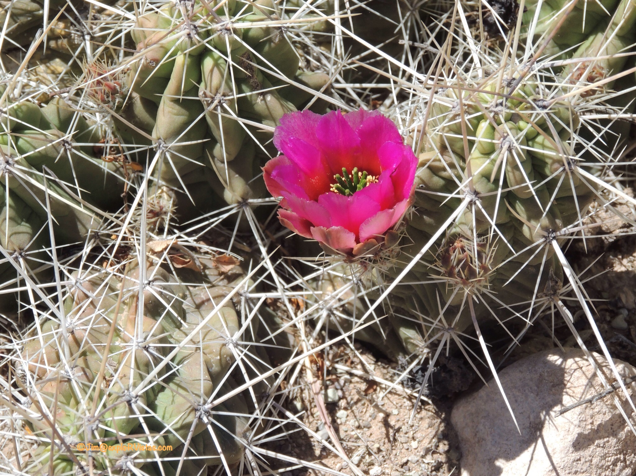
We saw several Claret Cup cactus blooming along the path.


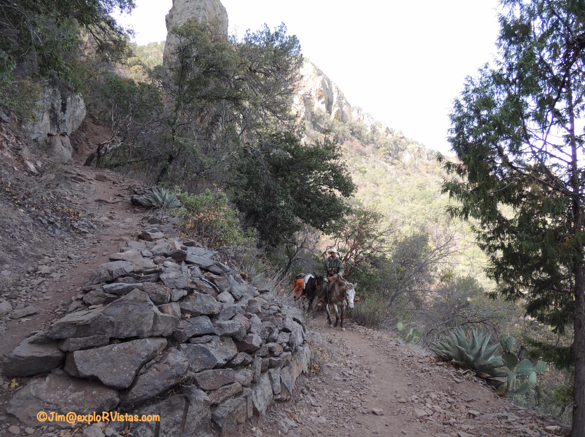
Further up, we stepped aside to let this worker pass on his horse.  His trailing mule was hauling supplies to trail workers farther up in the mountains.


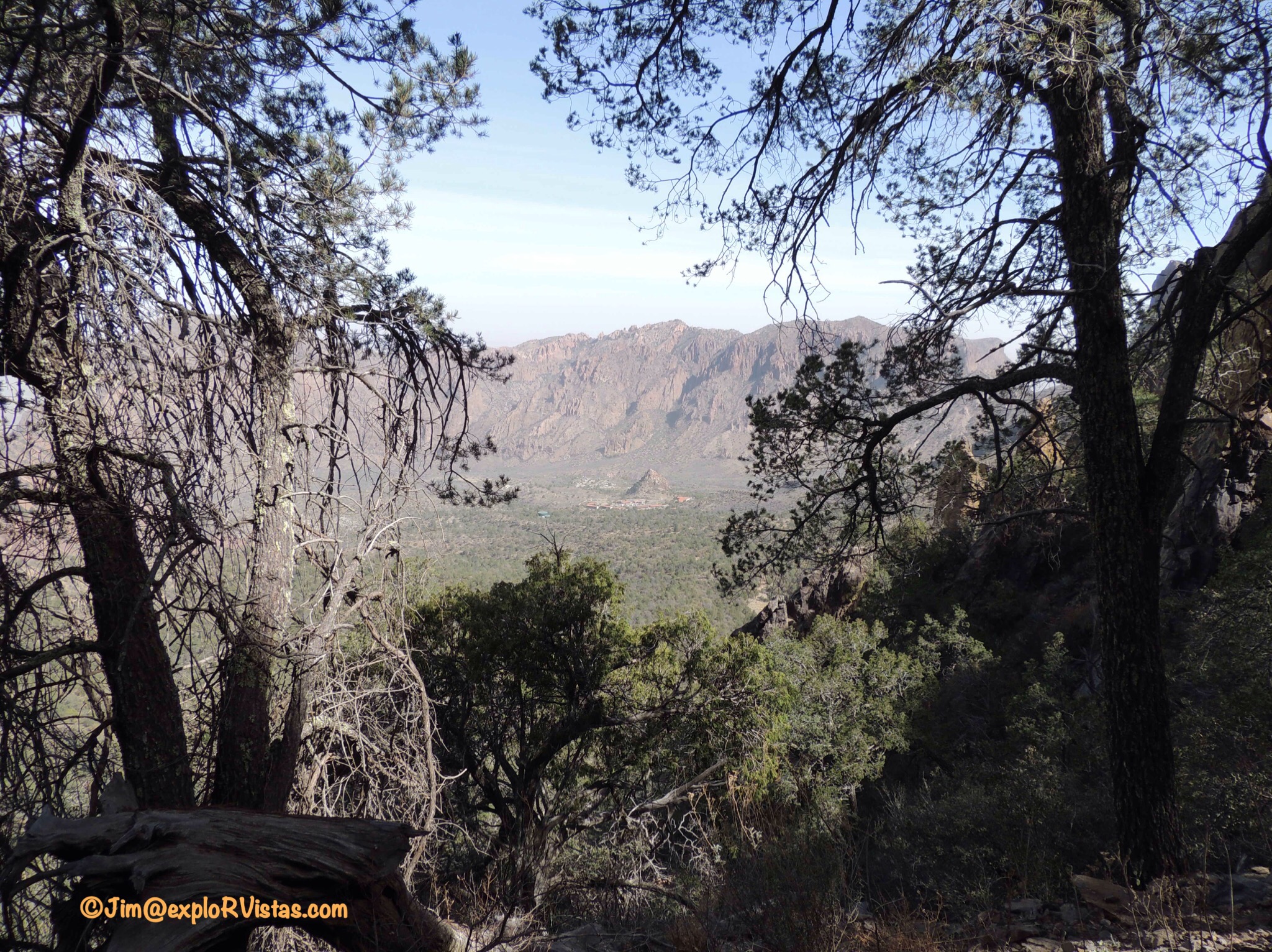
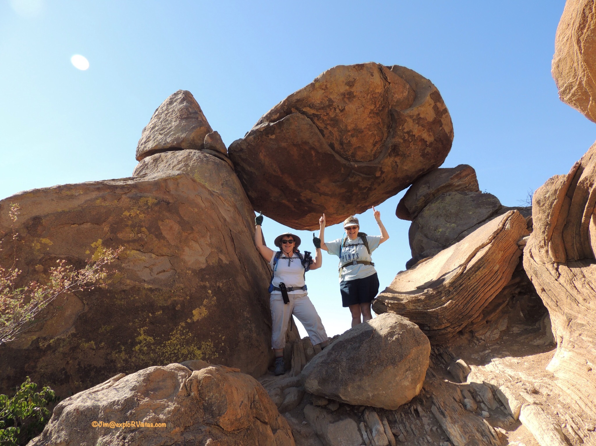
Finally, we made it to the top of the Pinnacles.  Here is a view back down into the basin.  We started down by the buildings near the cone in the center.  3.5 miles under our belts at this point.


This Gray Breasted Jay greeted us at the top.  It didn’t show much fear, as I was just a few feet away from it.

We continued along the Boot Canyon trail for 2.8 miles towards the South Rim.  


As we were hiking, we met Ian.  He is practicing for an attempt at completing the entire Pacific Crest Trail this summer.  He was heading into the mountains here for three days with his pack and a total of 9 liters of water.  Really nice young man.  We wish him well!


As we hiked, the spire that gave Boot Canyon it’s name came into view.


The pathway hugged the edge of the canyon most of the way.


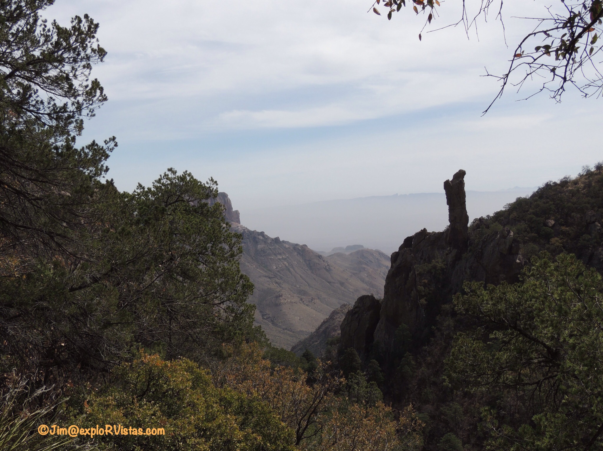
Finally, we could sense that the South Rim was about to come into view.


Woo-hoo!  We made it!  When we chose the day we were going to hike, we decided on the coolest day of the week.  Unfortunately, it was also the haziest.  This is normally considered to be the best view in Texas, looking many miles south into Mexico.  The cliff we were standing on is hundreds of feet high, so we stayed back just a touch.  🙂


Even with the haze, we could see a long way!


And someone upstairs was happy we made it also, and sent us a halo around the sun. 🙂


We found a shady spot and settled in for lunch.


After lunch, we headed west along the rim.  The trail eventually turns to the north, continuing along the outer edge of the Chisos Mountains.  By this point, we were starting to feel the effects of those sharp rocks.


The western slope is gentler than the Pinnacles/Boot Canyon route.  The South Rim trail eventually meets up with the Laguna Meadows trail.


This is a gorgeous valley running back towards the Chisos Basin.  On a clear day, these views would be breathtaking.


Not long after we were on the Laguna Meadows trail, the basin came into view.  That was deceiving.  We continued walking and met a young man walking UP the trail… which was surprising, as it was getting late.


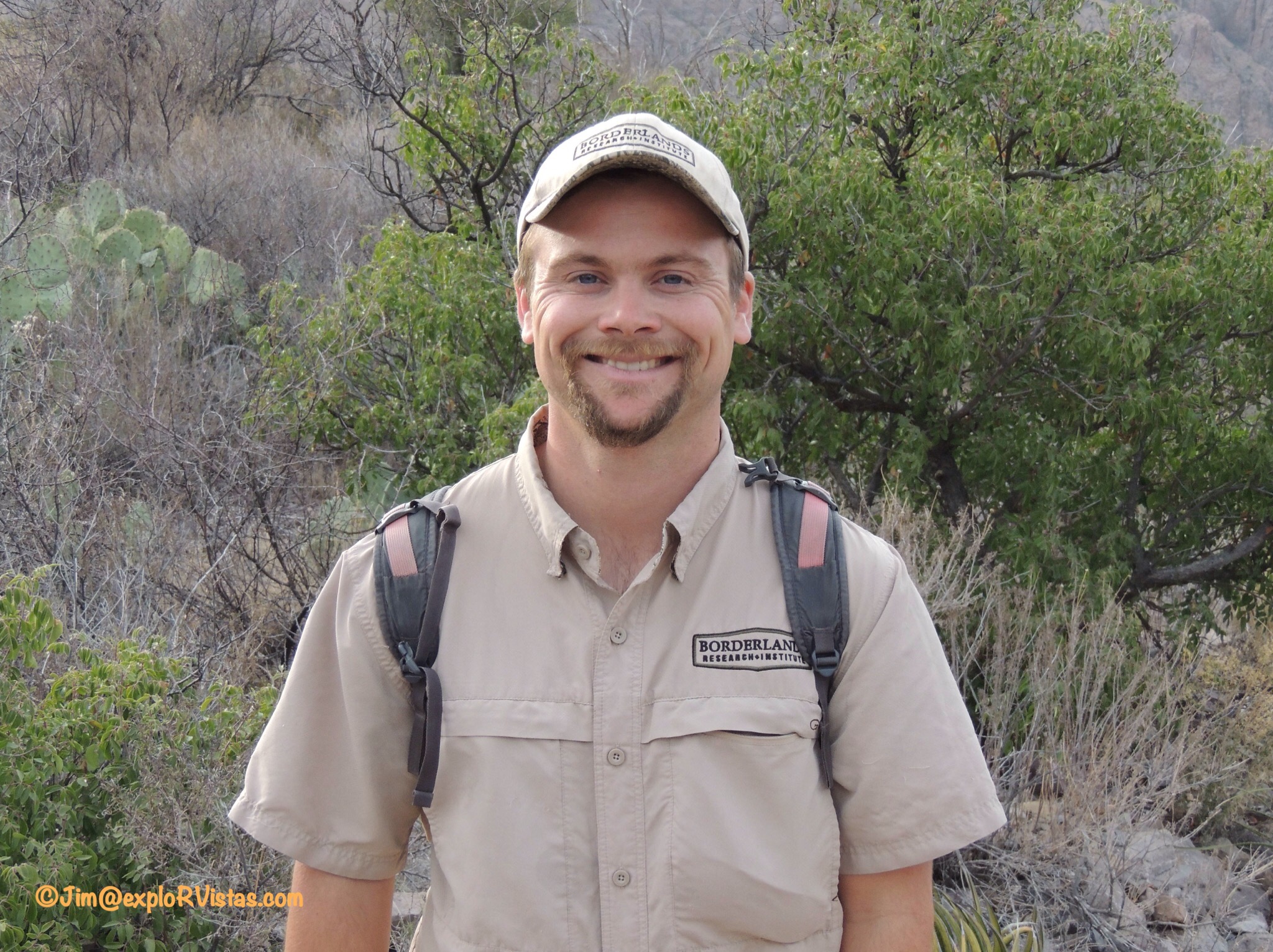
His name was Price Rumbelow, and he works with the Borderlands Research Institute.  He is a graduate student at Sul Ross State University, and he’s studying the potential for mountain lion/human conflict in the park.  A half hour later, he came back down behind us after retrieving a trail counter, as he was counting humans today.  As we walked, this young gentleman stayed with us, explaining that we actually had farther to go than we thought.  That was good to know, as the trail was starting to seem long at this point.  All the while we walked with him, we had a very informative dialogue about wildlife in the park.  Particularly interesting was the process of installing a tracking collar on a lion. Once the cat is chased up a tree by dogs and darted with a sedative, Price must climb the tree to put a rope on the lion and lower it to the ground.  The trick is to wait long enough for the cat to be asleep…yet not too long that it falls out of the tree!  Every answer was followed with a sir or ma’am.  His parents and community obviously raised him properly.  Meeting young people like this definitely gives us faith in the future.  🙂


We made it to our starting point!

We definitely learned a lot on this hike, and we are very glad we did it.  12 miles, while possible for us, is longer than we prefer….especially with elevation gain and loss.  By the end of the hike, our feet were begging us to get off the trail…which somewhat defeats the purpose of being out there to enjoy each other and nature. We carried a gallon of water with us, as recommended by the park service, and we used just about every drop. We will be able to gauge our water needs on future hikes, as a result.  If anyone were to ask our opinion about doing this hike, we would recommend breaking it into two days and staying a night near the rim in a tent…taking into account that it would require carrying more gear and water.  There are several campsites available that you can reserve. Being miles from any artificial light, the stars would be fantastic.

That wraps up our mountain experience at Big Bend.  Next up:  the Rio Grande River!
***————————————–***

Search and shop our exploRVistas Amazon link HERE.

——————————————–

explorRVistas is a participant in the Amazon Services LLC Associates Program, an affiliate advertising program designed to provide a means for sites to earn advertising fees by advertising and linking to Amazon .com. Shopping here doesn’t add anything to your cost, but it does help support this blog. Thank you for shopping through exploRVistas!

Big Bend N.P. – The Desert

One of the first things we did when we arrived at Big Bend was to go to the Visitor Center at Panther Junction.  We always feel that it is a good idea to do that at any park, just to get the lay of the land.  After speaking with the ranger about the trails, wildlife concerns and such, we watched the movie about Big Bend.  In that movie, they summarized Big Bend as desert, mountains, and river.  What a great way to organize our posts on this vast wilderness! 

Today we begin with the Chihuahuan Desert.  This expanse covers 140,000 square miles of western Texas, southeastern Arizona, southern New Mexico and northern Mexico.


Being from the midwestern United States, I was amazed at how much plant life was growing out of what appeared to be hard packed gravel.  We really enjoyed walking through the arid landscape and identifying the different plant species.

In the southwestern portion of the park is the Ross Maxwell Scenic Drive.  We explored this road on Sunday, April 3. As the road meanders towards Santa Elena Canyon and the Rio Grande River, it passes a couple of ranches that were here before the park was established in 1944.


This is the Homer Wilson ranch.  Once the largest ranching operation in the region, all that remains are a few buildings and a corral.

Not too far down the road is the Sam Nail ranch.


Sam and his brother Jim worked this land with Sam’s wife Nena.  Not much is left here but a couple of windmills…one of which is still working and pumping water…and the remains of the house.


The ranch sits in a low spot in a valley, and the trees growing in the irrigated soil make a cool oasis.  The blooming honey mesquite bushes that surround the ranch were teeming with bees, and the buzzing from their wings filled the air.

 
After following the drive to the river, we came back the Old Maverick Road.  This was 17 miles of dusty, rutted gravel road, and the Escape took it on like a champ!


I was busy watching the road, but Diana spotted this jackrabbit resting in the shade.  She has the eyes of a hawk when it comes to spotting animals!  🙂

On Monday, we hiked to Cattail Falls with Diana’s cousin Nancy and her husband David.  A friend of Nancy’s from Austin, Margaret, was also here visiting Big Bend and joined us on the hike.


While the park service doesn’t advertise this hike on the map or trail guide (due to the fragile ecosystem at the end), the trail is well marked at the beginning.


The trail winds through desert landscape for over a mile through the foothills of the Chisos Mountains.  


Here I am at the end of the trail, scrambling up the rocks to see the payoff.


This is where the waterfall normally is.  Even though there was just a trickle of water coming off the mountain, the drainage was lush with vegetation.  The shade from the trees was welcome relief from the hot sun.

On Tuesday, we met up with Nancy and David for a hike up to Grapevine Hills and Balanced Rock.


This path leads out through the desert for two miles, and is a fairly easy hike until the end.


The last 1/4 mile is up this outcropping to Balanced Rock.


Nancy and David, surveying the surrounding landscape.


We even had a lizard join us for this climb!


And here is Balanced Rock!  Diana and Nancy are giving it a little help, just in case.  🙂

After we returned to the trailhead, we made the journey to Dagger Flats.  This is more of a drive than a hike, but it features a wide variety of desert flora. A $1 guidebook at the beginning of the trail identifies the plants on this drive.


Here is a nice example of a Strawberry Pitaya.  When blooming, this cactus features magenta blooms on the ends of the spines.


The yellow blooms on the Huisache were in full swing.


The Ocotillo were sporting their red blooms, but had yet to show their green leaves on their branches.


There were several Thomson’s Yucca along the drive.


This is the marker plant for the Chihuahuan desert, the Lechuguilla. This member of of the agave family can only be found here.


At the end of the drive is an impressive stand of Giant Dagger yuccas.  When blooming, these plants sport a showy cream plumage from the top.


Here is some of the wildlife the ranger had told us to be concerned about.  I think they referred to this species as the Maximus Davidus.  🙂


Not to worry, as Nancy found another type of Giant Dagger!

Every national park seems to have a town nearby that visitors flock to after a day of exploring.  Big Bend’s version of Bar Harbor and Gatlinburg is Terlingua Ghost Town.


While there are a few shops here, there’s  not the wall-to-wall crowds that are usually seen in national park border towns.


Terlingua has one of the most weathered cemeteries we had ever seen.  Most folks here died from disease, mercury mining accidents, or gunfights.


And the town is home to the Starlight Theatre.  This restaurant/bar is named after the incredible night sky that puts on a show most nights over the region.


We ate here three times over the course of the week.  With there being so few choices for places to eat out here, we were thankful that their food was good and atmosphere is fun.

That wraps up the desert portion of our Big Bend adventure.  Next up is the mountains!

—————————————–

Search and shop exploRVistas’ Amazon link HERE

—————————————–

explorRVistas is a participant in the Amazon Services LLC Associates Program, an affiliate advertising program designed to provide a means for sites to earn advertising fees by advertising and linking to Amazon .com. Shopping here doesn’t add anything to your cost, but it does help support this blog. Thank you for shopping through exploRVistas!

Big Bend N.P. – First Impressions

Last year, Diana’s cousin Nancy and her husband David invited us to come to Big Bend National Park in Texas to do some hiking with them.  We tentatively made plans to meet them in early April.  So since leaving Melbourne Beach on February 21, that has been our goal…and we made it!


Big Bend is named for the major change of course the Rio Grande River takes between Texas and Mexico.  It is extremely remote, and it boasts some of the darkest skies in the U.S.  Looking at an aerial view on Google Maps, the Chihuahuan Desert is apparent…


….but the wild and wonderful Chisos Mountains are not.  When we arrived and this landscape unfolded before us, we were awestruck!  As a bonus, the desert was starting to bloom!


The prickly pear were beginning to show off with their red and yellow flowers.


The Eagle Claw cactus with their magenta blooms. 


The Ocotillo with their red clusters popping out at the ends of their branches.  There is a large expanse of them as you enter the park from Study Butte.

Big Bend National Park is massive, covering 1251 square miles.  The Chisos Mountains, the remnants of an ancient volcano, are contained entirely within the park.  A good portion of the park’s hiking trails originate in the Chisos Basin, which is the caldera of that volcano.  The remaining trails are scattered throughout the surrounding desert and along the Rio Grande River.

There are several gravel roads that lead to the remote areas of the desert.


Before we left Michigan in December, we outfitted the Escape with a set of all terrain tires, in anticipation of the rugged roads we planned on encountering. Edsel still looks good in his red paint scheme.  With all the dust in Big Bend, that would most likely not last.  :). We didn’t plan on any high-clearance roads, but any that were labeled ‘4 wheel drive’ were deemed ok for us.

Up in the basin, there is a lodge, campground, restaurant, visitors center and store.  There is not a gas station there, but there is one not far away at Panther Junction.  The temperatures in the basin are cooler than on the desert floor, and are cooler still at the top of the mountains surrounding the basin.


When experiencing views like this, it is hard to believe we are in Texas!

With Big Bend being so…well…BIG, we will be writing several posts on our time here.  Stay tuned as we explore the vistas of this wonderful place!

  
———————————————-

Search and shop the exploRVistas link to Amazon HERE

———————————————-

explorRVistas is a participant in the Amazon Services LLC Associates Program, an affiliate advertising program designed to provide a means for sites to earn advertising fees by advertising and linking to Amazon .com. Shopping here doesn’t add anything to your cost, but it does help support this blog. Thank you for shopping through exploRVistas!

Thar’s a reason they call it Junction, pardner…

Junction, Texas is a charming community with a western vibe.  Located in the hill country a few hours northwest of San Antonio, the town sits just to the south of Interstate 10.  Founded in 1876, the town was named for being the place where the north and south branches of the Llano River meet.  It is the seat of Kimble County, but it has a laid back, cowboy feel to it that belies its official status. Not a lot of famous folks come from Junction, other than Coke Stevenson (35th Governor of Texas) and Les Cox, who went 0-1 in the two games he pitched in for the 1926 Chicago White Sox.

We not only found Junction to be a meeting place for two rivers, but also a meeting place for several members of our RV-Dreams family.  When I sent out a Facebook post showing that we were in Port Arthur, Tracy contacted me to arrange a meetup with her and her husband Lee. She is a fellow blogger and RV-Dreamer. We had been in contact through our blogs, the RV-Dreams forum, and on Facebook over the past year or so. We went to separate RV-Dreams rallies in 2014, so we had never met in person. We had reservations at Morgan Shady RV Park, and it worked out that Lee and Tracy were able to land there the night before us. 

  
What a great meeting it was!  We immediately hit it off, sharing stories of how we got to where we are now.  Tracy made a yummy spaghetti dinner and salad for us, which was a thoughtful touch after a day on the road.  🙂

  
The two of them telling the story of how they became fulltime RVers was entertaining and had us cracking up!  🙂

Tracy’s Camper Chronicles blog is an honest view into the emotional aspects of these two empty nester’s lives as they take to the road.  Anyone who has done what we are doing will tell you straight up that while it may seem that we are on a constant vacation, the minutiae of life still happens.  People still get sick and have to find health care, have to get their hair cut, pay bills, grocery shop….each time having to find a new place to do those things.  Tracy really does a marvelous job of showing all sides of the journey…from the joys of new discoveries to the pain of major vehicle issues.  Definitely worth the effort to peruse her work, if you haven’t already.

After Lee and Tracy left on Wednesday morning, we met up with fellow Fall 2014 RV-Dreamers, Keith and Jeanne.  They were headed west to Fort Stockton and stopped for lunch.

  
This charming couple was camped next to us for a week during the rally, and we had been hoping to be able to meet them again on the road.  Lo and behold, that took place at the Junction Sonic.  🙂   Jeanne had noticed that we were in Texas through the blog and reached out to us by email.

  
We sat out front at Sonic so their dog Umber could be with us.  We had to get our doggie fix.  🙂   We talked for over two hours!  It was great to see them and to know they are both doing well.

  
After lunch, we returned to Morgan Shady and walked the park.

  
It’s a quaint little campground, and the ‘shady’ comes from the many pecan trees that grace the property.

It was at that point that we received a message from another RV-Dreamer couple, Pam and Red.  Like Lee and Tracy, they attended the Spring 2014 rally.  They are near Junction, working on a relative’s house.  We’ve never met, so we decided to clear that little detail up!  We couldn’t make it happen this stay, but we will be returning to Junction soon and are going to get to know them at that time.  We never knew when we attended that rally in Goshen, Indiana that we would develop so many friendships on the road….or that so many of them would be nurtured in Junction, Texas!
————————————————–

Search and shop through exploRVistas link to Amazon HERE.

————————————————–

explorRVistas is a participant in the Amazon Services LLC Associates Program, an affiliate advertising program designed to provide a means for sites to earn advertising fees by advertising and linking to Amazon .com. Shopping here doesn’t add anything to your cost, but it does help support this blog. Thank you for shopping through exploRVistas!

San Antonio Missions

“We’re on a mission from God”

Elwood Blues

With the arrival of Easter weekend, we were on a mission to see a mission…FIVE of them, to be exact!  We made our way to San Antonio on Saturday and met up with Bob and Kathrun, fellow RV-Dreamers who we got to know at the Fall 2014 Rally. Like us, they sold their home, disposed of most of their possessions, bought an RV, and hit the road. (There is much more to their story, but it is their song to sing.  Once Kathrun’s blog is up, we will provide a link.) After we settled into our site, we headed into town to see the Alamo.

This was Diana’s and my first trip here  together since 1982…not long after we were married.  We were living on a shoestring in Austin at the time and had come here with our college friend Betsy who was visiting us from Michigan.  We shared the following story of that trip with Bob and Kat:  Wanting to spend the night in town, Betsy, Diana and I inquired on a whim at the Hyatt Regency to see if they had any rooms available.  They had one with two queen beds…at $45 a night.  Even in 1982, that was cheap… especially for a Hyatt on the Riverwalk in San Antonio.  We asked what was wrong with it, and the clerk said “oh, it probably doesn’t have a view”.  We got to the room and I ducked into the bathroom.  I could hear Diana and Betsy talking as they looked out the window, delighted that we actually did have a view.  I heard one of them say “oh look….there’s a Spanish mission!”  When I joined them at the window, a mere one block away was an unobstructed frontal view of the Alamo.  🙂

On this visit, we weren’t the only ones with Easter plans.  🙂   While very crowded, the line to get in moved quickly.

For anyone who has yet to visit this historic place, the Alamo is no longer the Texas outpost it once was.  The city of San Antonio has surrounded it like so many of Santa Anna’s men.

Kathrun stepped across William Travis’ line in the sand (now bronze in stone).  Be careful, Kat …that didn’t end well for the first people who did that!  🙂

From the Alamo, we found our way to the Paseo del Rio…otherwise known as the San Antonio Riverwalk. This is a series of walkways through the city that line both sides of the river. Originally a Works Project Administration project from the 1930’s, the Riverwalk has sprouted a multitude of unique eateries and shops, and has become Texas’ # 1 tourist attraction.

Here is the four of us at dinner at a riverside Mexican cafe.

The river boats were full, and everyone was having a great time.

The Arneson Theater along the riverwalk.  The venue is unique in that the seats are across the river from the stage. This site is used for all sorts of plays, Mexican dances and mariachi bands. The five bells in the arches are meant to represent the five missions of San Antonio.

On Easter Sunday, we decided to search out the other four missions, all part of the San Antonio Missions National Historical Park.  While the Alamo is maintained as a memorial to those that lost their life in the battle, the other four missions are active parishes of the Roman Catholic Church.

To touch on the overall history of the San Antonio missions, these enclaves were established by Franciscan missionaries to convert the local people to Catholicism and the Spanish way of life.  They became safe havens from Apache attacks, so many people accepted the trade-off out of sheer need for survival.  Bob stated that the missions were generally located a day’s travel from each other.  My, how times have changed.  🙂

DSCN1964

First up was Mission Concepcion. This stone church was dedicated in 1755.

Many of the original paintings still exist on the interior walls of the peripheral rooms of the enclave.

We saw this stone in the walkway near the grotto, most likely put there to remind us what state we were in.  We definitely aren’t in Florida anymore. 🙂

Next was Mission San Jose. The grounds of this compound were absolutely beautiful. This church was dedicated in 1782.

The surrounding walls of the mission were restored by the WPA in the 1930’s, creating this expansive courtyard.

The interior of the church was well restored; something we wouldn’t have guessed by the rugged exterior.

Our next visit was to Mission San Juan.

The buildings at this location are replicas, being built by the WPA in the 1930’s.  The doors of this church were locked, so we do not have photos of the interior. We took a walk on a nice trail to the San Antonio River behind the mission.

Our last stop was Mission Espada.

This church dates back to 1756, but the mission itself was established in 1690…thereby making it the oldest of the five.

The interior was simple and had plenty of natural light.  It was a very pretty and intimate space.

If you have the opportunity to journey to San Antonio, be sure to build in enough time to visit all five of the missions.  There even is a paved bike trail that links them together.  We feel it is worth the effort to seek out these beautiful places, and the history that speaks from within their walls.


_______________________________________________________

Search and shop Amazon through our exploRVistas link here

explorRVistas is a participant in the Amazon Services LLC Associates Program, an affiliate advertising program designed to provide a means for sites to earn advertising fees by advertising and linking to Amazon .com. Shopping here doesn’t add anything to your cost, but it does help support this blog. Thank you for shopping through exploRVistas!

Shangri La Botanical Gardens

Moving west out of Florida, we drove through Alabama and Mississippi in quick succession.  After spending a few nights in Livingston, Louisiana, we headed to Port Arthur, Texas.  We found the Beaumont/Port Arthur/Orange tri-cities area to be very industrial, with most of the business centered on oil production and refining.  While the port cities are an important cog in the big American wheel, they are not exactly what we would call a naturally inviting place to spend a few days.  But our campground was decent, so we thought we would check the area out.  A lot of famous people are from this region:  Singers Janis Joplin, Mark Chesnutt, Tracy Byrd, George Jones, Clay Walker, and Edgar & Johnny Winter are from here.  Athletes Babe Zaharias, Bubba Smith, Frank Robinson, Bruce Lietzke, and Detroit Lions standouts Mel Farr (superstar!) and Jerry Ball all hail from the area.  Surely there must be something more than oil here.  We set out to look for a little culture and nature.

The first place we went to was Cattail Swamp, in search of the elusive roseate spoonbill.  This area is actually a man made retention area that is the last step of the town’s sewage treatment plant.  We had to pass through a gate that had a sign that said “Warning: Aggressive Alligators”.  Hmmm….the ones we saw in the Everglades seemed pretty content, perhaps these weren’t as happy with their surroundings.  :). We stayed for a few minutes and saw a fair amount of birds and ducks, but no spoonbills or ticked-off gators.  Diana had another place that we could check out, and it ended up being a winner!

Shangri La Botanical Gardens is a privately owned preserve in Orange, Texas.  H.J. Lutcher Stark, a local business leader, began the gardens in 1942. It is now overseen by he and his wife’s foundation.  The gardens are a member of the American Horticultural Society’s Reciprocity Program, so we toured for free using our Meijer Gardens membership. It was a great way to get out and stretch our legs after a morning of doing paperwork.


The entrance to the grounds was very inviting.  It is interesting to note that this facility is the first in Texas to achieve LEED Platinum status, the highest level possible through the U.S. Green Building Council.  This area contains a wetlands demonstration garden; a series of ponds that take in water from an adjacent lake and filter the waterfowl waste from it.  It demonstrates how man-made wetlands can have a positive impact on nature.


The grounds were planted in more of a formal pattern than was the case at McKee Botanical Garden in Vero Beach, Florida. Most of the major plants were well identified.  


This Stephanie Dwyer sculpture, Dancing Sisters, marks the entrance to the interactive children’s garden.


Shangri La also has a series of greenhouses.  This one was featuring Easter lillies, which were also present in other areas of the gardens. It definitely smelled like spring!


This greenhouse featured orchids.


Diana really liked this yellow variety…or, since we are in Texas, this Amirillo variety!

Two of the greenhouses were also set up to feature their current butterfly exhibition.  Three varieties were present:


The Monarch…


…the Julia…


…and the Zebra Longwing.


Look at the bloom on this red Hibiscus!

From there, we followed the trail into the outdoor portion of the gardens.  


This turtle lineup was there to greet us.  🙂

David Rogers series of wooden sculptures entitled Big Bugs currently are featured in the outdoor gardens.


Yikes!  A 15 foot high Praying Mantis!


This is an Assasin Bug.


Here is a parade of three giant ants headed our way!

On our way out, Diana spotted a flash of wings to our left, as a large bird landed in a tree.  


Turns out it was a hawk.  He stuck around long enough for me to get a photo of him.  🙂

We really enjoyed our time at Shangri La Botanical Gardens.  If you find yourself in the Greater Beaumont area, be sure to check it out. We also can’t say enough about the value of the American Horticultural Society’s reciprocity program, both for us and for the participating gardens. We’ve seen a lot of places we might not otherwise have chosen to see, and the venues are able to showcase themselves to visitors from other areas of the country. Shangri La certainly was a bit of paradise in this very industrial area.

—————————————–

Search and shop Amazon through exploRVistas link here
explorRVistas is a participant in the Amazon Services LLC Associates Program, an affiliate advertising program designed to provide a means for sites to earn advertising fees by advertising and linking to Amazon .com. Shopping here doesn’t add anything to your cost, but it does help support this blog. Thank you for considering shopping through exploRVistas!

Florida Fun

Since our last post at the Edison/Ford Winter Estates, we have covered a lot of ground.  We spent a couple of days at Dunedin, going to Honeymoon Island one day and to one of our favorite lunch spots…Kelly’s For Just About Anything…the next. After that, we spent a day in Lakeland, where we were able to catch our first-ever spring training game!  My beloved Detroit Tigers were taking on the Pittsburgh Pirates. 


Any day that I can see Miguel Cabrera play baseball is a good day.  🙂   To add some excitement,  J.D. Martinez hit a home run over the center field wall with one of the most perfect swings I’ve ever seen.  The Tigers looked very good, ending the day with a 3-0 shutout win.  I am very hopeful that this will be a good year for the team.

Following Lakeland, we spent four days back at Recreation Plantation near The Villages.  


While there, we caught up with Diana’s brother and our niece and her family.  We also drove up to Gainesville, as we wanted to see Devil’s Millhopper State Park.  We had read about this place on several blogs, so we drove an hour and a half north to see it.  Unfortunately, we found out when we got there that it was closed on Monday and Tuesday. Hmmmm…we have never heard of a state park being closed on ANY day of the week, but we will be sure to put that on our list of things to check before heading out the door next time.  🙂  Moving to Plan B, we drove back to Payne’s Prairie near Micanopy.  This preserve is the huge wildlife area that I-75 bisects between Gainesville and Ocala.


We wanted to get some mileage in for some upcoming hiking we are planning, so this looked like a good place to start!


First we climbed a tower and saw the preserve’s wild horses in the distance. Then we passed through the gate and into the wildlife area.  We only saw horse manure (along with bison scat) on the perimeter road.  Our hike took us about a mile and a half until the trail narrowed and we thought better of trying to go any further. The signs warn of alligators and snakes. There were also plenty of red ant hills to avoid.

Our next stop was for one night at a favorite place of ours: Golden Acres Ranch near Monticello, Florida.


You may recall our Harvest Hosts post from a year ago that can be accessed here.  This stay was just as nice as the last, although the many Guineafowl weren’t quite as vocal as our previous visit.  We purchased more of their amazing Mayhaw jelly as a thank you for letting us stay.  🙂


They sure are funny looking birds!


The Great Pyranees dogs were happy to see us!

From there we drove to the Pensacola area.  We stayed in a little campground in Holt named Eagle’s Landing.  It was neat as a pin and it had great wifi.  I was able to use it to finish our taxes, so that made us happy campers!  We also drove out to Fort Pickens and met up with our friend Diane, who was down from Michigan visiting her daughter and grandchildren.  You may recall we had lunch with her and her husband Terry earlier this winter in Orlando. This day, she brought the boys out to the fort, as they like to explore the tunnels and passageways.


It’s always good to see them!

Fort Pickens sits at the entrance to Pensacola Bay.  We were drawn here by a series of recent posts by fellow blogger, Wandering Dogs.  The white sand of the surrounding Gulf Islands National Seashore looked like snow in Beth’s post, and we had to see it for ourselves.


It was in service from 1834 to 1947, and was occupied by Union troops throughout the U.S. Civil War. The Apache chief Geronimo was held here during the Indian Wars from October 1886 to May 1887. 21.5 million bricks were used to build the structure, and a major portion of it was destroyed by an 1899 fire that reached a magazine, resulting in a massive explosion.


The wind and rain are slowly taking their toll on the remaining sections of the fort.


Not only does the sand look like snow, it drifts like it!  

Sea level rise will most likely bring about the fort’s ultimate demise, as the barrier island it sits on already is seeing closures during high surf events. Campers have been stranded in the campground near the fort recently, and this road has been flooded several times over the past few years.

With our visit to Fort Perkins complete, we headed west out of Florida.  Thinking back to all of the places we’ve visited, we realize just how large the state is. Tallying up our miles, we covered over 1600 miles with the RV. That doesn’t include our trip to St. Augustine, our drive to Port Charlotte to see Diana’s cousin, our day at Cape Canaveral, our drive to Tampa for the RV show, or the trip to see my sister and brother-in-law in Bonita Springs…all which were done with the Escape.  That was an additional 2000 miles. To put that in perspective, we could have traveled from Grand Rapids, Michigan to Flagstaff, Arizona and back and not have covered that many miles! Even though we have visited Florida many times in the past, we discovered a multitude of places that were new to us. It has left us wanting more, and we look forward to returning soon!

——————————————–

Search and shop Amazon through exploRVistas here

explorRVistas is a participant in the Amazon Services LLC Associates Program, an affiliate advertising program designed to provide a means for sites to earn advertising fees by advertising and linking to Amazon .com. Shopping here doesn’t add anything to your cost, but it does help support this blog. Thank you for considering shopping through exploRVistas!

Edison/Ford Winter Estates

Thomas Edison and Henry Ford are two of the most influential people of the last couple of centuries.  They became close friends later in life, often deferring to each other for ideas in their respective areas of expertise.  Nowhere is their friendship more evident than at the Edison/Ford Winter Estates in Fort Myers, Florida.  We visited these grounds using the American Horticultural Society’s reciprocity program, which is included with our Meijer Gardens membership back in Grand Rapids, Michigan.  Admission is normally $25 each, so gaining access to the estate for free was a nice bonus.  We opted for the guided tour, which was an additional $5 each.


Mr. Edison purchased this land along the Caloosahatchee River in 1885.  He and his wife Mina had this home, which they named Seminole Lodge, built the following year. He was 39 years old at the time.  To put things in perspective, Henry Ford was 23 years old in 1886 and 10 years away from building his first automobile.  There wasn’t much happening around Fort Myers at that point in history. The town of 349 people was simultaneously being incorporated, the road in front of the estate was a cattle path and the railroad was 12 years away from finding its way to the area. 


In 1916, Henry and Clara Ford purchased this Craftsman style home next door to the Edison estate.  It had been built 5 years earlier by Robert Smith.  Over time, Mina and Clara transformed the grounds of their estates into a combined horticultural oasis. The variety of species is remarkable, and everything is labeled…to our delight!  🙂

After World War I, Thomas Edison began to explore alternatives to the imported raw materials for rubber.  He was concerned about the United States’ dependency on foreign suppliers.  He built a laboratory on the grounds across the street from his estate, and he partnered with Henry Ford and Harvey Firestone to come up with a solution.


This is a single banyan tree that Mr. Edison planted in the late 1920’s. It has since grown into this giant, covering well over an acre. Edison was hoping that the tree would be a source of rubber, a hope that didn’t pan out. He also tried a multitude of other source including goldenrod.  Eventually, synthetic, petroleum-based rubber became the choice of domestic manufacturers.


The interior of the lab is very well organized.  Flasks, test tubes and beakers on one side, and a machine shop on the other.  It was interesting to think back to my visits to Edison’s Menlo Park lab at Greenfield Village in Dearborn, Michigan and see the similarities.

Next door to the lab is a small museum.  A couple of interesting pieces caught my eye.


This was a phonograph that Edison had one of his workers build a wooden frame around.  The inventor was totally deaf in one ear and 90% deaf in the other. To ‘hear’ the record, he had to bite the frame to feel the sound through his jaw.
  

Another was this Barcalo offset box end wrench.  I own one of these in a 3/4″ – 13/16″ combination.  It was passed down to me from my paternal grandfather, and it is probably one of the most useful wrenches in my collection.  In essence, the card in the display case needs updating, as some Ford owners still do use this wrench on their Fords!

Back over at the Edison estate, we were able to look inside through the open doors and windows at some of the rooms.


Mr. Edison sat at the head of this table, using this chime to call everyone to dinner.  The seat has a commanding view of the Caloosahatchee.

  
A pergola seperates the main house from the sleeping quarters.  Edison seperated the two for fire reasons, as kitchens were a source of most home fires.  He also installed a fire suppression system.

  
Here is Thomas and Mina’s bedroom.

  
The main house has this beautiful wrap-around porch.

  
Next to the house is his study.  Mina had a small garden off this building, so she could be near Thomas while he worked.

  
Between the river and his study, he had this pool built.  The high dive was supposedly built after Fort Myers took ownership of the property and is not historically correct.

Over at the Ford estate, the home had more of a ‘cottage’ feel to it.

  
This fireplace commands the one end of the living room.

  
The home featured a cypress ceiling, which lent a certain coziness to it.

  
I’m sure Hank used this a few times!   🙂

  
Out back, there is a display with three Ford vehicles:  a Model T, a Model A, and a 1917 Model TT truck.

  
Near the river, this large Brown Wolly Fig shades the lawn.  The root system on it was very unique.

  
Here I am with a statue of Henry Ford.  I grew up 3 miles from Ford headquarters and the Rouge plant, so my childhood was heavily influenced by what this man had accomplished in the first half of the 20th century.  By mass-producing affordable cars and paying high wages, he essentially created the middle class.  He was far from perfect. We watched an hour long biography of him in the museum that was truly fascinating. 

We spent 7 hours at the Edison-Ford Winter Estates.  Most people wouldn’t take that long, but we were soaking it all in. After the hour long historian led tour, we wandered the grounds and explored buildings that weren’t included in the tour. We also enjoyed lunch with a view of the river at Pinchers, which we were able to walk to from the property. The estates are definitely worth the visit, if you happen to be in Fort Myers.  We thoroughly enjoyed it!
Henry Ford: A Biography is available here for your Kindle through exploRVistas and Amazon for $2.99…or free to Kindle Unlmited members.

The Florida Keys

Somewhere in the middle of the Seven Mile Bridge, he said “Bella do you want to see the rest?”

She said “I haven’t a care, Lenny, just take me there” and they drove all the way to Key West…

Jim Buffett – Conky Tonkin’


For most people, the Florida Keys embody a wonderful image of laid back island life.  There’s no doubt that they are laid back and wonderful, but there is also the reality that there is a very busy road that runs through the middle of them.  That brings in hoardes of people…including us….looking for a place to chill.  Tooling south on U.S. 1 through Key Largo on Tuesday, it quickly became clear that our chillin’ was going to take place with lots of new friends!  No worries, as we always have managed to find a way to seek out some of the less traveled spots.  We also love to jump right into the crowds and have a good time.  🙂

When we went to the Tampa RV Show earlier this year, we stopped at the Grassy Key RV Resort booth.  They were running a special of ‘buy three nights – get the fourth night free’.  Granted, it still wasn’t cheap…but we knew that any accomodations in the Keys were going to be pricey.  Looking on the web, we knew it was going to be nice.   


We were certainly not disappointed.  Even though space is at a premium in the Keys, we didn’t feel like we were wedged too tightly into our spot.  The resort faces the Gulf side, and sports it’s own marina. They also have a pool, which we took advantage of.


The first night there, we caught a nice sunset off the dock. They also had a luau potluck which we attended later in the week.  Very fun, and we met a lot of nice people there.

Wednesday morning, we headed southwest through Marathon to do a little biking on the old Seven Mile Bridge.  This structure is part of industrialist Henry Flagler’s railroad that was completed in 1912.  Why would someone go to the expense of building a railroad to Key West? Well, the tiny island was the closest deep water port at the time to the about to be completed Panama Canal. Flagler’s theory was that it could be a coal refueling stop. Technology quickly improved steamer efficiency, so that need went away. The bridges were converted to highways after a 1935 hurricane destroyed portions of the railroad that they carried.  


For reference, imagine those parking blocks not there and a center line where Diana’s left tire is.  That’s a narrow bridge!  This is the northeastern two miles of the structure.  These roads were used until 1982, when the parallel highway was constructed. My parents took my sister and I partway to Key West on this bridge when we were kids.  I’m fairly certain the width of the spans was part of the reason my dad turned back. 🙂
  

Still, it was pretty cool to be riding on this historic road!  Take a look at the guard rail:  it is the original rail from Mr. Flagler’s railroad.


Two miles southwest of Marathon, the Florida highway department has removed a section of the bridge to prevent people from going any further.  Some of the roadway is in pretty rough shape beyond here.

On Thursday, we made the 55 mile trip from Grassy Key down to Key West.  Amazingly, we found a free parking spot on a side street.  Woo-hoo!  🙂


Our first goal was to find the Green World Gallery, owned by Artist Koz.  Diana and Steve Koslowski hail from the same hometown of Ortonville, Michigan.  We ended up buying one of his small paintings for our rig, and a Howard Livingston from Mile Marker 24 Band “Sell your stuff-keep the dog-live on an island” sweatshirt for Diana. Very nice store!

From there, we walked a few blocks to Ernest Hemingway’s home for a tour.  


We will freely admit that we have yet to read his work, but we’ve been intrigued by his northern Michigan connections.  Our tour guide Chris was fantastic, painting a portrait with his words as to the interesting character Ernest Hemingway was.  And, yes…I’ve downloaded my first Hemingway novel.  🙂


This is his writing studio where it is estimated that 70% of his literary works were penned.  That small stool to the left of the barometer in the left side of the photo is a Spanish birthing chair.  There are several of them throughout the home, as he liked to collect them.   Some people collect baseball cards; Ernest Hemingway collected birthing chairs!


Here is a decendent of Hemingway’s six-toed cat, Snow White.  There are 40 to 50 very well cared for cats on the property.  Chris stated that it was never his intention to learn the cat’s names, but know them he did!

After that, we grabbed lunch at Off the Hook.


We both had fish tacos, which were excellent.  They are just one block off of Duval…totally worth the walk!


Key West is also famous for it’s free roaming chickens.  This rooster was strutting it’s stuff in front of a residence we walked past.

And no trip to Key West is complete without having your photo taken in front of the Southernmost Point marker!


There was a fifteen minute wait to do this, and the people who were in line behind the subjects ended up being the photographers. Everyone was having a great time. We were closer to Cuba at this spot than we were to Miami!

On the way back to Grassy Key, we took a little side trip to the National Key Deer Refuge on Big Pine Key.  This is home to the subspieces of the Whitetail deer known as the Key deer.  


There are only 600 to 800 of these animals left, and they can only be found in the Florida Keys.


Weighing between 65 to 85 pounds, they are smaller than a Great Dane.

Our time in the Keys was short, but we managed to relax and have a good time.  We definitely will be back, as there is a lot more to see that we didn’t have time for.  Our next post will be from locations north of here, as we can’t get any further south!  

Flamingo – Everglades National Park

“Progress came and took it’s toll – and in the name of flood control,

They made their plans and they drained the land – now the glades are going dry.”

John Anderson – Seminole Wind

Driving around the urban and agricultural areas of southeast Florida, it didn’t take long to realize that most of the land we were on was once part of the Everglades.  All of the farmland west of Miami was once part of the river of grass.  Even Miami International Airport was once home to gators, anhingas and sawgrass.  The maze of canals diverting the water coming out of Lake Okeechobee is staggering.  The Everglades we see today are but a small percentage of what existed prior to the 20th century….and the fresh water entering the current version of the glades is for the most part controlled by man.  Couple that with rising sea levels and salinity, it is easy to see that this fragile ecosystem is truly endangered.  Perhaps not ‘dry’, in the literal sense of the word, but certainly different from what it once was.

On the one hand, visiting the park left me with a sense of uneasiness for treading on the remaining portion of the Everglades.  But if you remember what I said about my preconceived notions regarding the ‘swamp’, I realize just how important it is for us to see this place firsthand.  On our trip into the lower glades to Flamingo on Sunday, it quickly became apparent that our visit to Shark Valley was merely an introduction to the novel that the Everglades truly is.

Entering the eastern side of the park from the city of Homestead, we stopped at the Coe Visitor Center.  Information on everything the National Park Service offers regarding the park is available there.  From Coe, we stopped at the Royal Palm Visitor Center.  This location is more about the attached trails than being a ‘visitor’ center, per se.

  
The first thing you notice are all these blue tarps on the cars.  It turns out that the vultures in the area have developed a taste for rubber windshield seals and wipers.

  
I pulled this photo from the web.  While we didn’t see any vultures munching on cars while we were there, we didn’t want to chance it.  We tarped the Ford.  🙂

The first of two paths we explored was the Anhinga Trail.

  
This beauty was poised along the side, smiling for the camera.  One interesting thing we found out about alligators is that while their bite can exert a tremendous amount of force, their muscles that open their jaws are quite weak.  Good to know if you ever find yourself in a wrestling match with one.  🙂


These bromeliad airplants were nestled in the branches of one of the trees along the trail. They are not attached to the tree; they merely use it for support.


Further down the path, I spotted this Morning Glory.


This Red-bellied turtle was checking out the tourists.


There were several Anhingas along the path.  This one was drying off after a morning swim.


A couple of birders we met identified this as an Eastern Phoebe.

The other trail in this area is the Gumbo-Limbo trail.


This stand of trees was decimated by Hurricane Andrew’s 150 mile per hour winds in 1994.  It has since rebounded nicely.


The path is named for the Gumbo-Limbo trees that grow here.  This unique tree is often referred to as the Tourist tree, as it sports a sunburned appearance.  It was used for a variety of purposes, from carousel horses to medicinal salves.

From Royal Palm, we drove 35 miles straight out to Flamingo.

   
This is where the river of grass meets Florida Bay.  There were thousands of birds on the tidal flats.


We spotted these American White Pelicans amongst the bunch.  These are some of the largest birds in North America, similar in size to Trumpeter Swans and California Condors.


There are several camping options available at Flamingo, including this nice trailer loop.  There is also a small visitor center.


This is a Swallow-tail Kite.  Tough photo to take, as they move really fast!

From Flamingo, we worked our way back, stopping at most of the overlooks and trails along the way.  We were hoping to see some Roseate Spoonbills…which we did not…but we did see plenty of other birds!


A Great White Egret, looking for something in the tall grass.


An Osprey hanging out in it’s nest.


I’m fairly sure this is a Raven and not a Crow. Definitely not a Patriot, Ram, Bronco … and certainly not a Lion.


A couple of Florida Vultures hanging around in the trees.

  A Great Egret in flight.

A big highlight of the day was Pay-Hay-Okee overlook.


The unusual name of this place means ‘grass river’…and what better place than this to view the endless miles of sawgrass.  I had difficulty photographing a blade of this unique plant, but here is an image from the web. 


It is triangular in structure, with upwards-facing serrations along it’s edges. Moisture is gathered in these serrations, thus feeding the plant.  Be careful…they are sharp!

As we walked down the ramp from the overlook, we heard an owl down in a thicket next to the structure.


We peered in and found this Barred Owl.


We showed it to other visitors on the deck, and everyone was really quiet and respectful of the bird’s space.

If you have never been to the Everglades, we hope you are able to see this fragile ecosystem in the near future.  The diversity of species here is astounding.  It’s amazing the Everglades still exist, with all that mankind has thrown at them in the past century.  Efforts are being made to restore a portion of the historic flow… but there are huge politics in play, so the outcome remains to be seen. We certainly hope the restoration happens.

——————————————–

Search and shop Amazon through our exploRVistas link here
explorRVistas is a participant in the Amazon Services LLC Associates Program, an affiliate advertising program designed to provide a means for sites to earn advertising fees by advertising and linking to Amazon .com. Shopping here doesn’t add anything to your cost, but it does help support this blog. Thank you for considering shopping through exploRVistas!