
In our last post about Kitty Hawk, we took you to one small slice of North Carolina’s Outer Banks. Today we show you the other places we visited on this ribbon of sand that extends for 200 miles along the Atlantic coast.
Commonly referred to as OBX, the area consists of the islands of Ocracoke, Hatteras, Pea, Bodie, and Roanoke, along with the peninsula known as Currituck Banks. Due to the shifting nature of the sand and the force of the storms that shape them, some of these islands come and go. What might be an island today could very well be a peninsula tomorrow. One of the most dynamic places along the chain is Cape Point, a corner of sand that moves continually south and west. Just to the north of that point is Cape Hatteras Lighthouse.
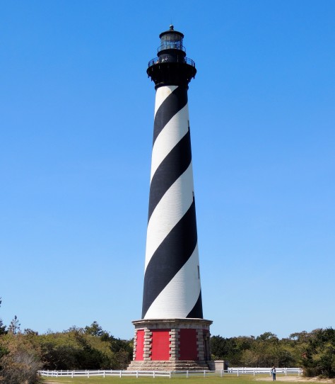
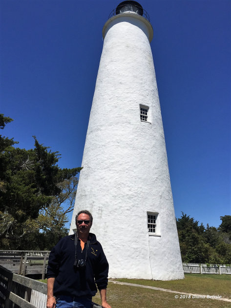
This sentinel has stood guard here since 1870 and is America’s tallest brick lighthouse. Well actually, not quite ‘here’, as remember…the island is moving. When built, the tower was 1500 feet from the shore. The ocean reshaped the island over time to where the structure was in danger of falling into the drink. That 1500 feet had become just 15 feet.
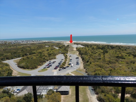
So in 1999, the National Park Service contracted to have the lighthouse moved 1/2 mile southwest to a point that is 1500 feet due east of the shore. The red arrow shows about where the lighthouse used to be. The move was considered an engineering marvel, as the tower is nearly 5000 tons and almost 200 feet tall!
As we climbed the steps, we noticed that the salt air is taking a toll on the lighthouse.
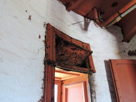
The iron window frames are either rusting or are missing. Not sure exactly why that is being allowed to happen, especially after putting so much effort into moving it. Hmmmm….
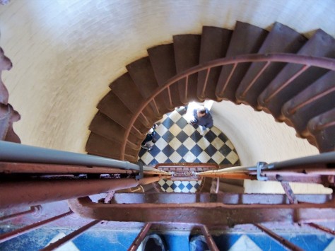
There are 257 steps up to the light itself, along with these beautiful black and white marble landings every 31 steps. It is a very long climb.
Not to worry; they were ready for us at the top.
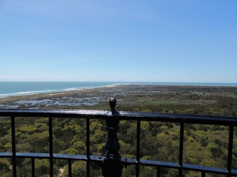
From the gallery, we could easily see Cape Point…
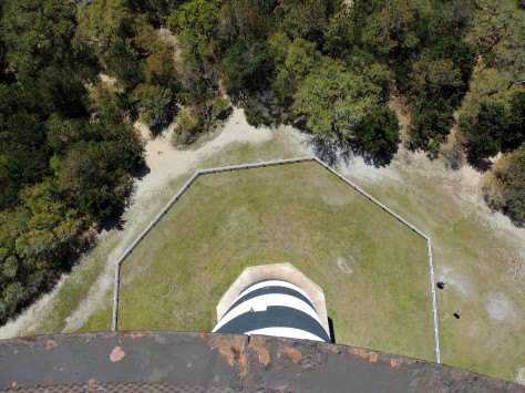
…and how far we were from the ground!
While we were on the Outer Banks, we also visited several other lighthouses.
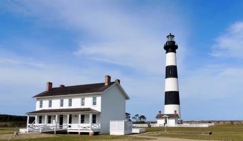
Bodie (pronounced ‘body’) Island Lighthouse stands 40 miles north of Cape Hatteras. This beauty still has its first order Fresnel lens, similar to the one we were responsible for at Heceta Head in Oregon last summer. Vandals destroyed the one at Cape Hatteras years ago, and it was replaced with an aircraft beacon.
We also visited Ocracoke Lighthouse, which was built in 1823. It is still operating! To reach it, we had to take a one-hour ferry ride from Hatteras Island.
While on Ocracoke Island, we visited their local historical museum. It had an interesting collection of items that show what living on this isolated island is like.
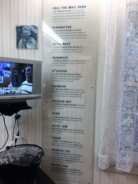
At the back of the museum was a video and a list of words that O’cockers (people raised on Ocracoke) use. It’s actually tough to understand what they are saying as they speak. One of the stories on the film was about some friends who flew to Las Vegas and brought their own oysters in Styrofoam coolers wrapped in duct tape to save a few bucks. The part about one of the packages splitting open on the luggage carousel was hilarious. 🙂
Farther north on the Outer Banks is Roanoke Island. This small piece of land actually sits inside the barrier islands, even though it is considered to be part of OBX. It was here that the Lost Colony of Roanoke once existed. In 1587, England attempted to establish a presence in North America at this location. More than 100 men, women, and children landed on the island and worked to build a colony. Their leader, John White, sailed back to England for supplies, only to be delayed in returning by a war that had erupted with Spain. When he returned in 1590, the colonists were nowhere to be found. Among them was the first European born in America, Virginia Dare. The county that OBX is located in is named Dare in her honor. What happened to the colonists? Many theories exist, but no one knows for certain.
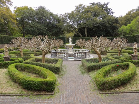
Next to the site where the colony was is the Elizabethan Gardens. We wanted to tour here, as the spring flowers are all in bloom!
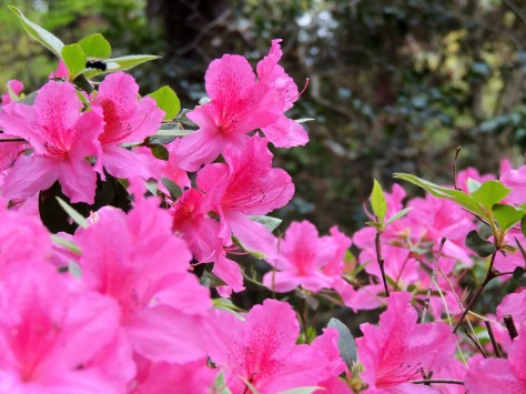
The azaleas were just gorgeous!
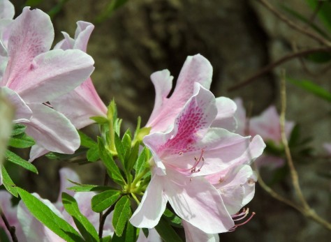
So much color and fragrance.
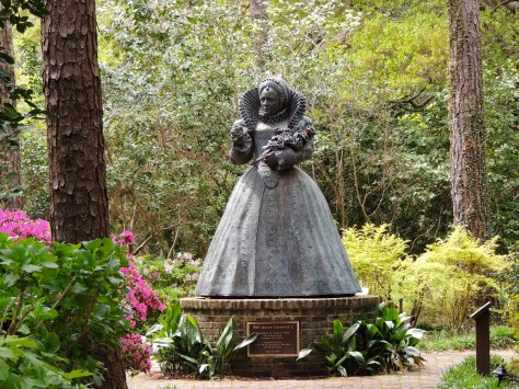
The garden’s namesake, Queen Elizabeth I, stands proud in the center of the property. She was responsible for sending the colonists to America.
And here is another fun fact while visiting the site:
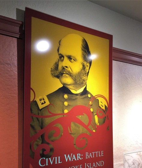
Roanoke Island was the scene of a Civil Was battle. This gentleman was a Union brigadier general by the name of Ambrose Burnside. It is his unique way of styling his facial hair that used a twist of his last name to describe it: sideburns. I always wondered where that came from!
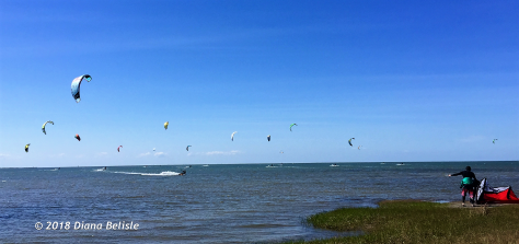
And no trip to the Outer Banks is complete without watching the kite boarders!
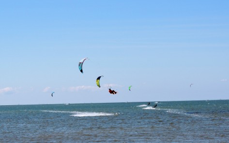
With the steady breeze, these people were having a great time.
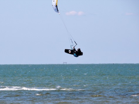
We even noticed several Michigan license plates on the vehicles in the parking lot. Still too cold on the Great Lakes to attempt this in April.
As mentioned at the beginning of the post, these islands are constantly changing. While crossing the bridge from Bodie to Pea Islands, we saw a curious sign:
Hey….what’s up with this??? Well, Pea Island was once part of Bodie Island, until a hurricane cut an inlet across it in 1846. The first ship to navigate through the new waterway was the Oregon, so that’s what they named the inlet after. Thought we were back on the west coast for a minute…
That wraps up our time in North Carolina. We move into Virginia next, as well as inland for a bit. Stay tuned to see what we find on our next adventure. Until then, safe travels to all!
