
On Monday, October 19, we decided to check out another one of Leelanau Conservancy’s preserves, Whaleback Natural Area.
To truly appreciate why mariners referred to this bluff as ‘whaleback’, you must first view it from Good Harbor Beach to the southeast. From that vantage point, it appears as a giant sea creature on the horizon.
The starting point for the trail is just south of the village of Leland, just off of M22. There is a spur trail that snakes between two private parcels of land to reach the 40 acre glacial moraine.
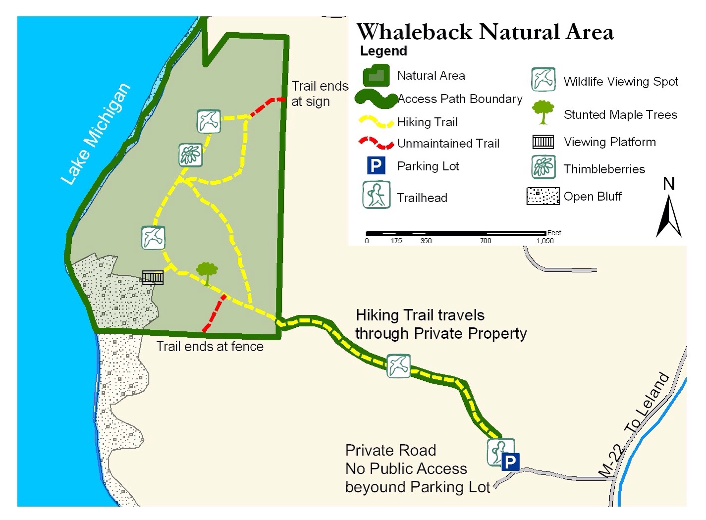
At 1.6 miles, this is not a tremendously long hike, although there is a steady elevation change as you crest the whale’s back.
Click here to see the wind whipping through the trees on our hike. We had a steady 30 mph breeze that day, coming straight out of the southwest.
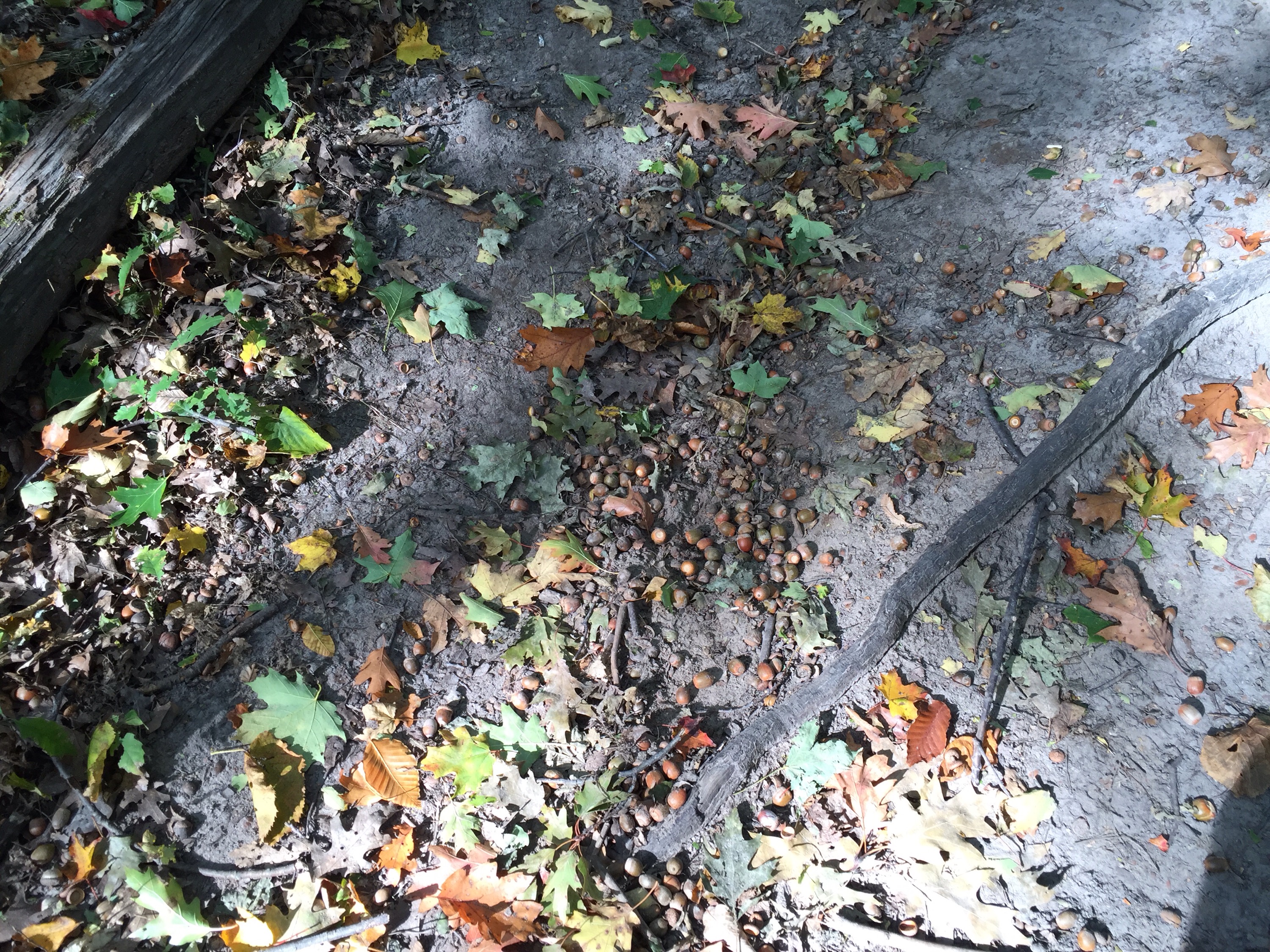
One of the challenges we faced on this hike was the amount of acorns on the spur trail. They were like walking on ball bearings! 🙂
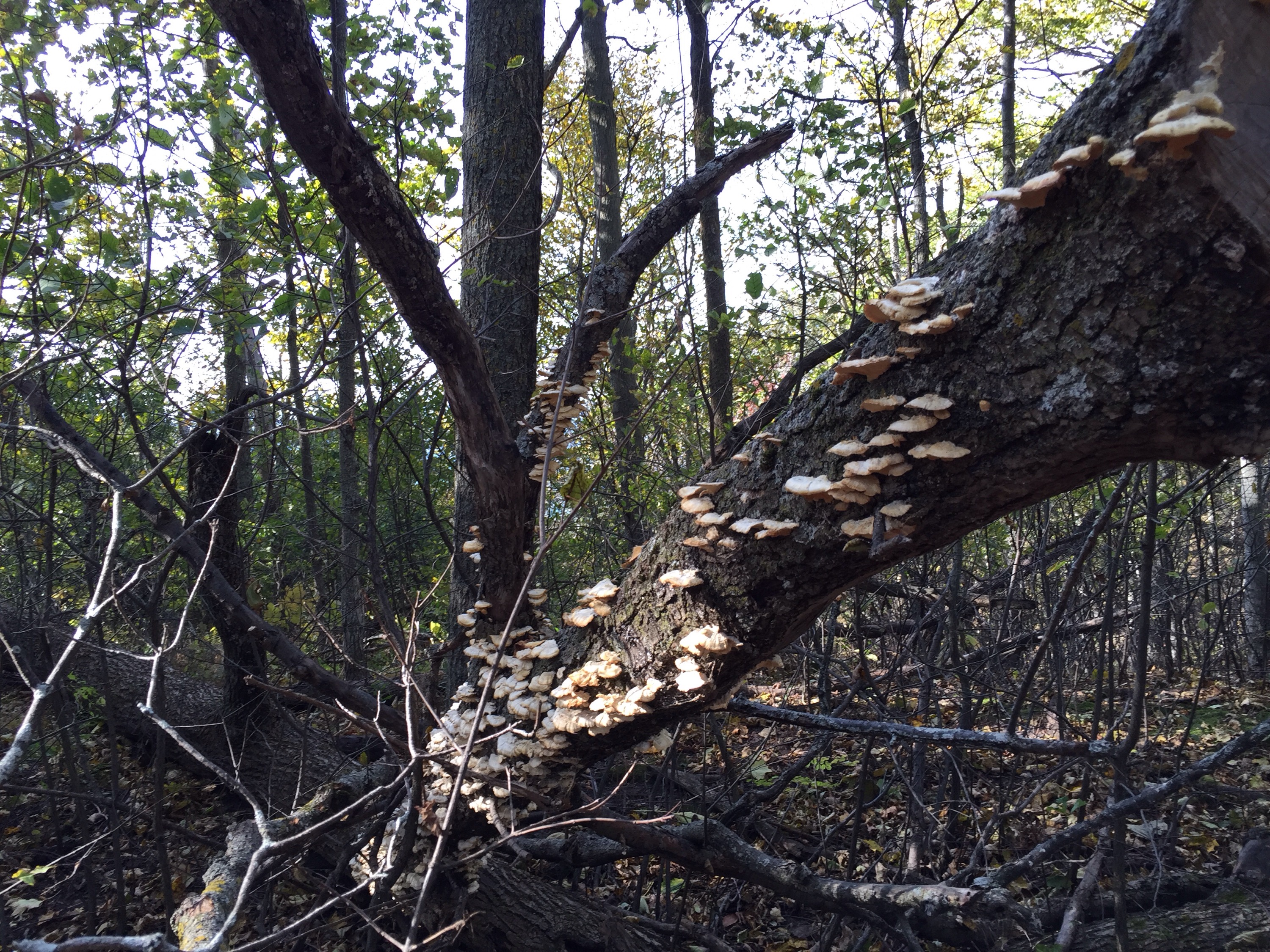
We passed this fallen tree that was covered with bracket fungi.
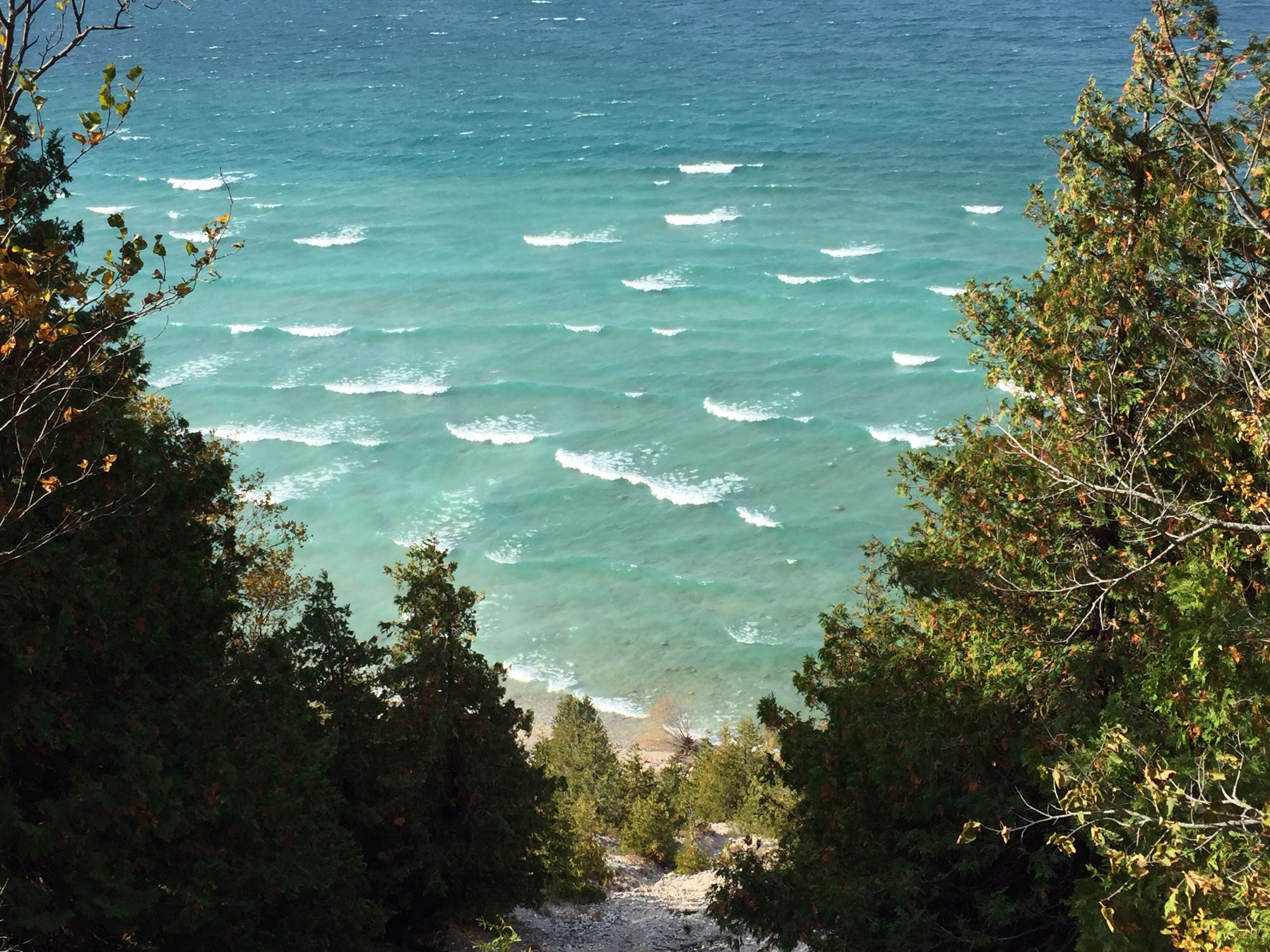
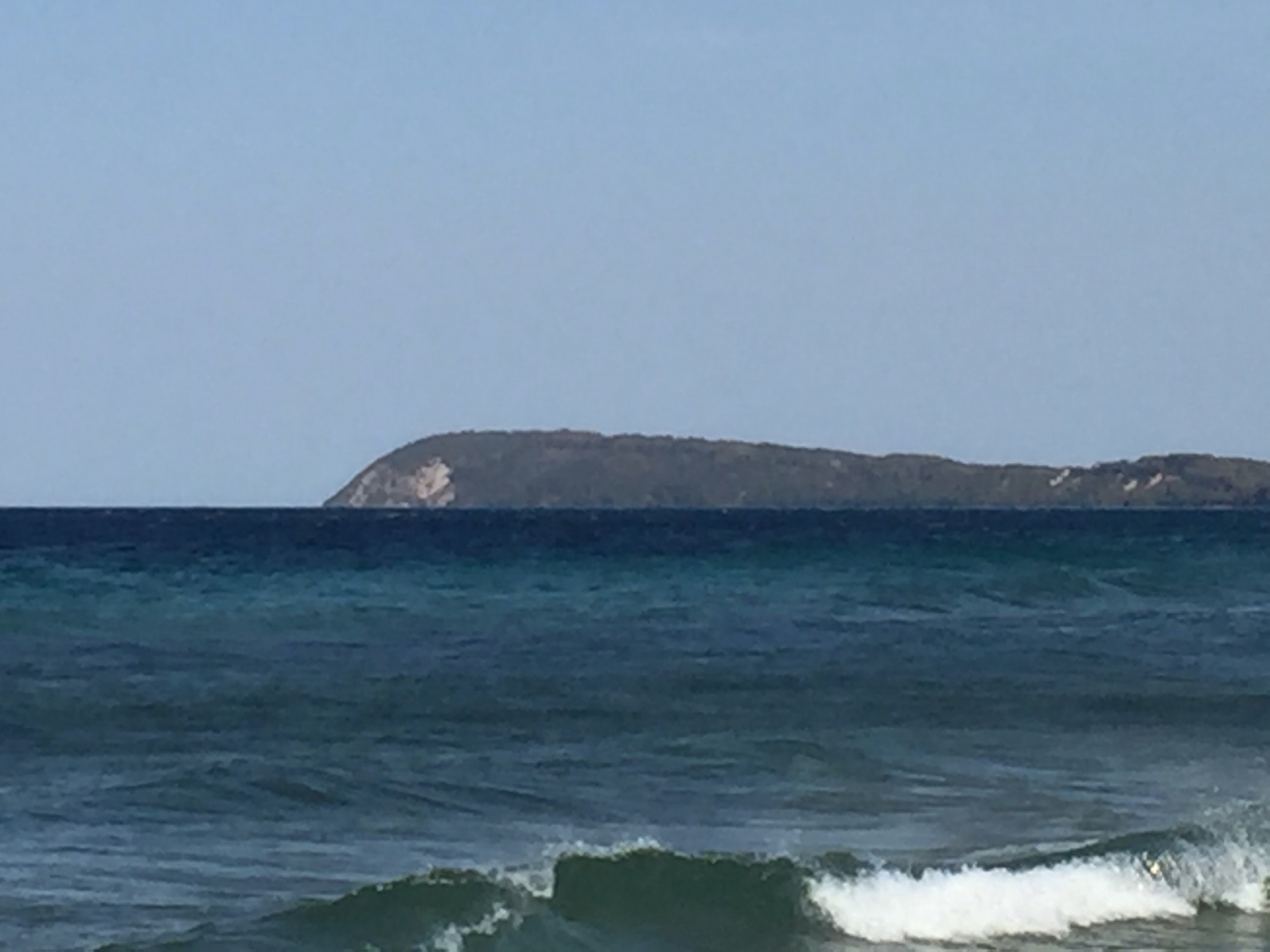
It wasn’t too long until we came to the Good Harbor Bay overlook. The wind was pretty much hitting us head on.
Click here to see a short video of the bay. We saw something in the distance across the water, but we couldn’t make out what it was. I suspected it was a freighter tucked into the bay to escape the wind and waves. More on that later…
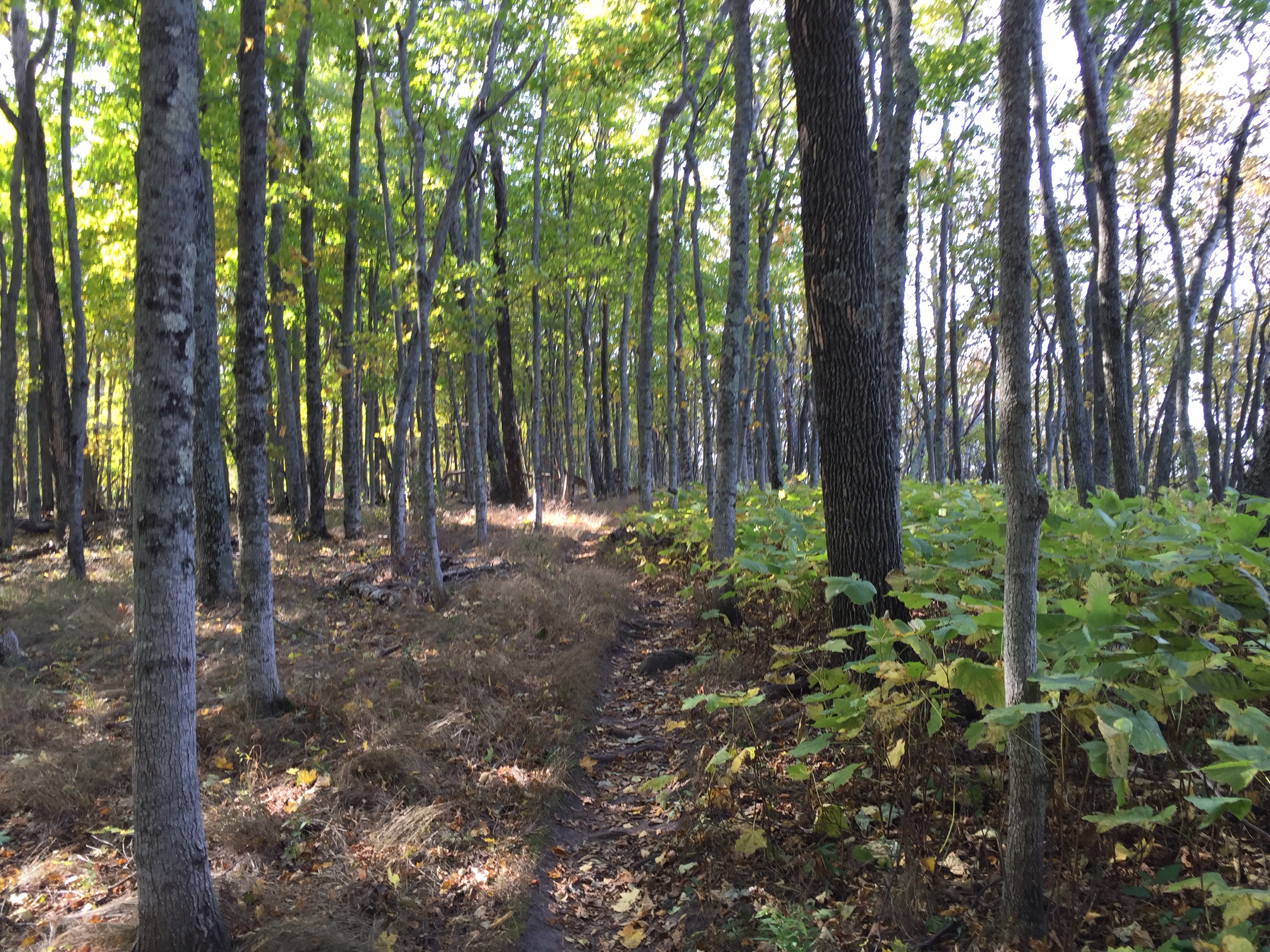
This photo is typical of the landscape on the crown of the bluff. The high canopy of the trees created a very pleasant space on the forest floor.
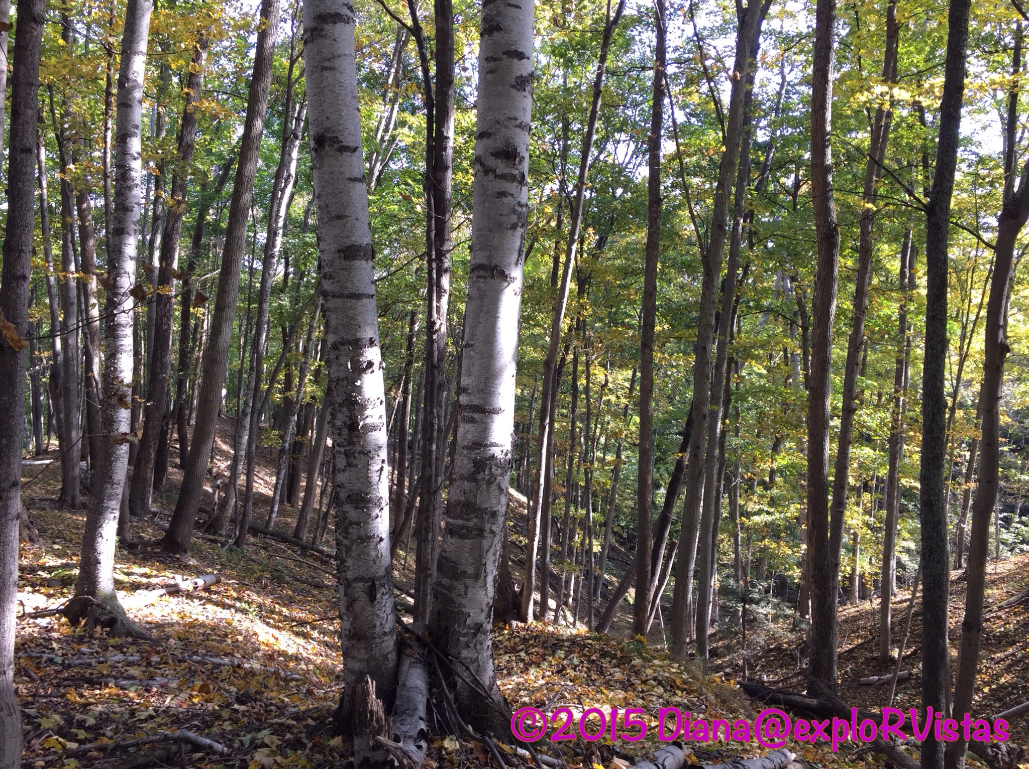
The ravines off of the summit were steep and were absolutely gorgeous!
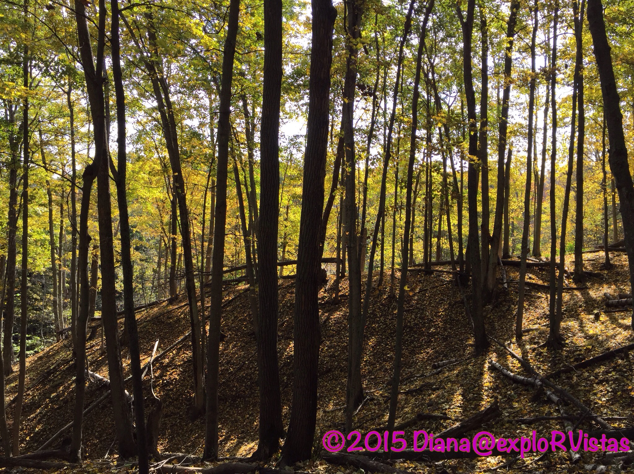
The sun through the trees created a surreal scene. 🙂
After we left the preserve, we decided to drive down to Good Harbor Beach to see if we could figure out if we were seeing a freighter or not.
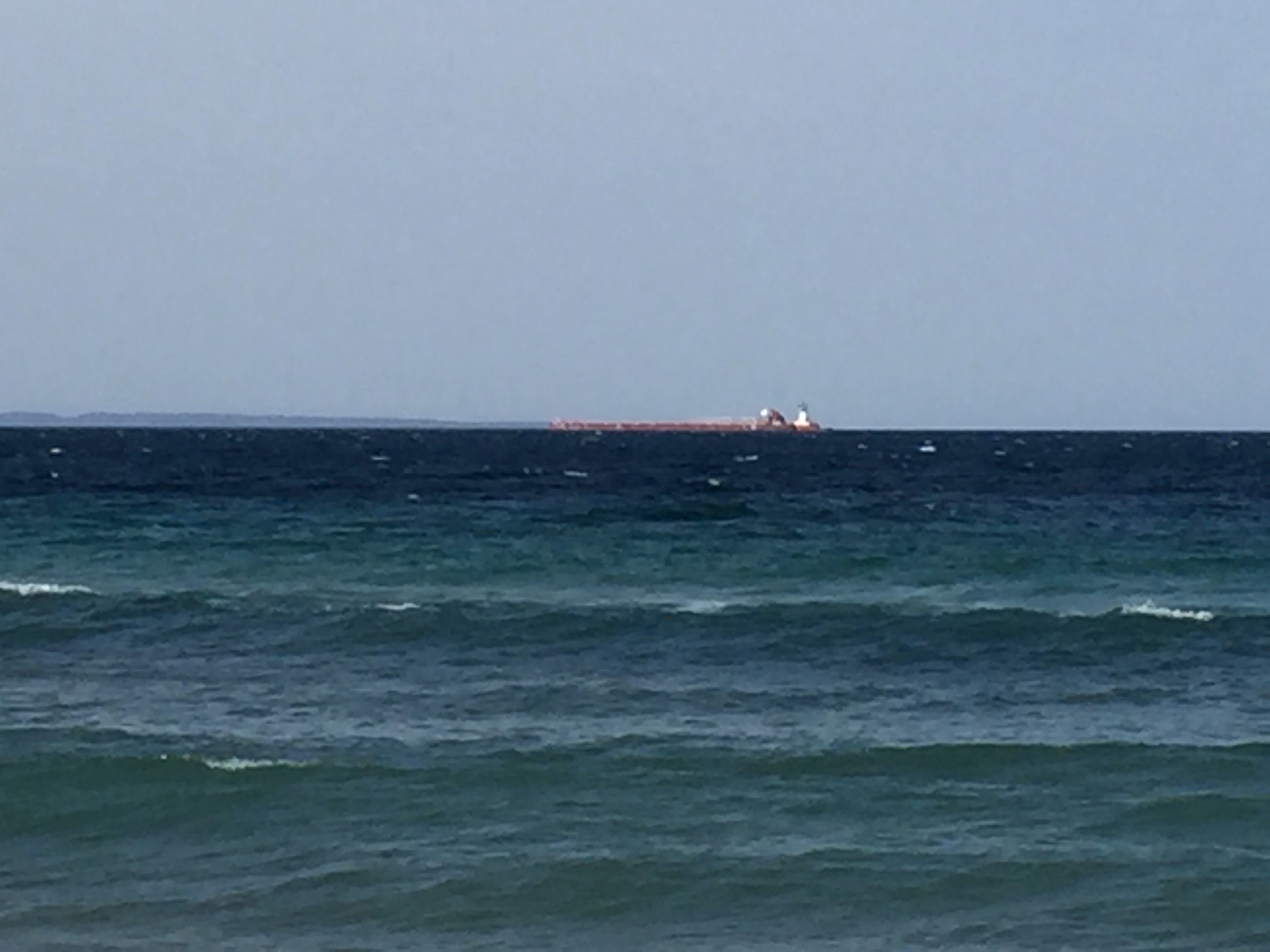
Sure enough, it was a sizable ship. I checked the Great Lakes Seaway and Shipping website and discovered it was the 844 foot tug/ barge combination Joyce Van Enkevort/Great Lakes Trader. Turns out, this wasn’t the only ship seeking refuge in the bays along Lake Michigan. I noticed another one on the website farther north in Little Traverse Bay near Petoskey. Even though were on the leeward shore of the bay, the wind was blowing the tops off of the waves, as seen in Diana’s video here.
Whaleback really was different than anything we had seen on the Leelanau Peninsula. If you are in the area and get a chance to hike it, we think you will enjoy it!

What a fun hike! Another for my list! Thanks for sharing:)
LikeLiked by 1 person
You’re welcome, Pam and John!
LikeLiked by 1 person
Our house in MKE had a pine tree of some variety with unusually small pine cones. Peg used to complain about how the pine cones were like ball bearings too. And they came down by the bushel! A couple times a year someone had to get out there with a rake and broom and get them off the sidewalk and grass. Talk about bringing back memories.
There’s a feature along the Lake Superior Circle Route called Nanibijou (SP?). It’s another of those low, peninsula formations that look — in this case — like a human laying prone. Our first ever vacation we did that circle route in a VW and I had been there years earlier with my parents. I kept pointing out formation after formation after formation to my then still new-ish wife as the object we were looking for, and kept being wrong. Half a day later we saw what we thought we’d been finding several times over.
Ever since, I’ve been a little skeptical about whether I ‘recognized’ natural formations. 🙂
LikeLiked by 1 person
I remember Nanibijou! I just refreshed my memory on Google…it looks like an Indian chief looking skyward. That circle tour is one of our favorite trips, and we definitely need to do it again.
LikeLiked by 1 person
YUP!
I love lake Superior, and the WaWa Goose, and the Big Nickel, and the Soo Locks. Such great memories.
LikeLiked by 1 person
Wow it really does look like a whale back! I love that you have included a map with the post.
LikeLike
Thanks, Sue! The map is Diana’s idea. 🙂
LikeLiked by 1 person