Category Archives: Oregon

Crater Lake

It all started with a big bang!

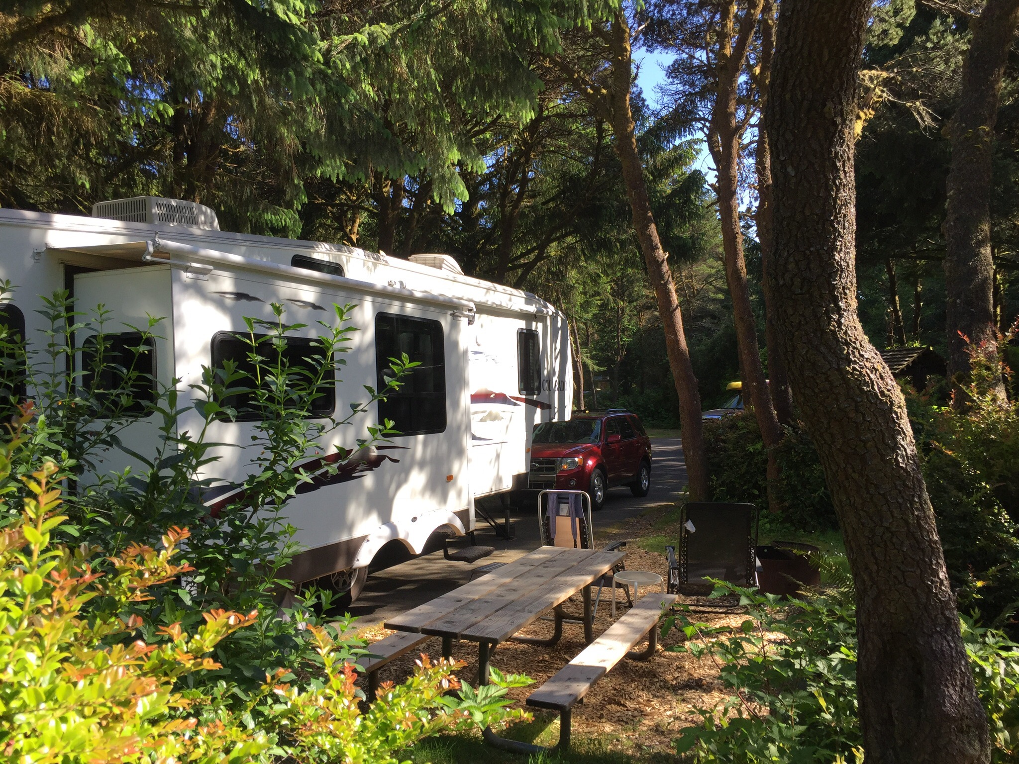
On June 22, we headed east from the coast to visit Crater Lake National Park.  We had visited this beautiful volcano-turned-lake in 1996 and have looked forward to seeing it again ever since.  Our friend Rick from On the Road with Maxine and Me had made the trek from Heceta Head a week before us and reported there was plenty of snow still adorning the park.  With temperatures at lower elevations topping 100 degrees, we knew we had to get over there soon if we wanted to see it dressed in white!

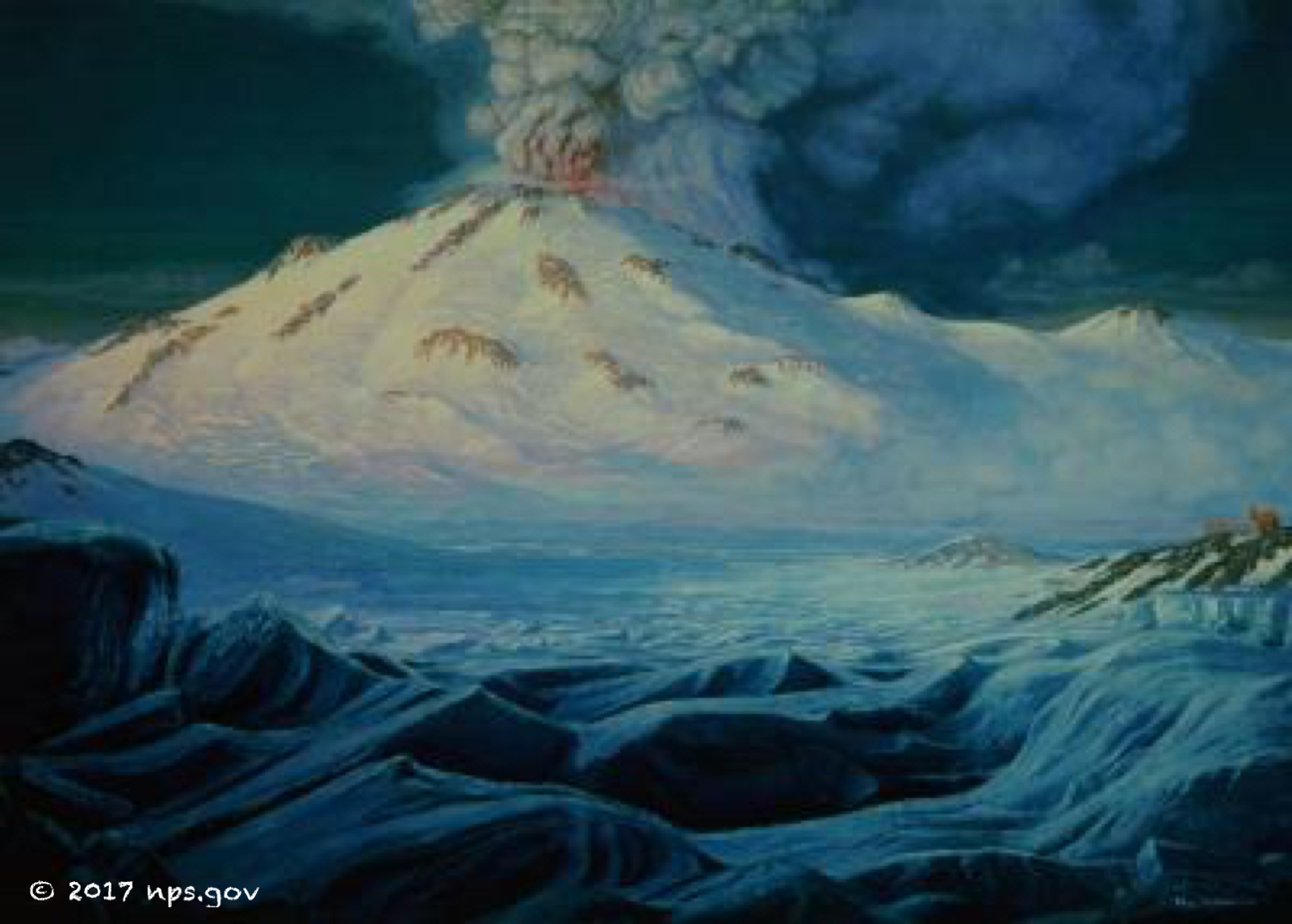
The 12,000 foot volcano that once stood where Crater Lake now is was named Mount Mazama.  Geologists estimate that it most likely had a similar appearance to Mt. Hood, which is further north in the Cascade range.  It took around 400,000 years to reach its full height. Sometime back about 7,700 years ago the volcano came to life, rumbling and releasing steam and ash.  Within a few weeks, the mountain erupted with such force that it emptied the magma chamber below it.  In what was estimated to be over the period of just a few minutes, the roof of the chamber collapsed and the top of the mountain fell into it.  It is thought that the force of the eruption was 42 times more powerful than the one at Mt. St. Helens in 1980.  Subsequent eruptions created small volcanoes within the crater, but nothing like the big bang that caused the mountain to implode.  Over the next several hundred years, rain and snowmelt filled the crater, creating the lake we see today.

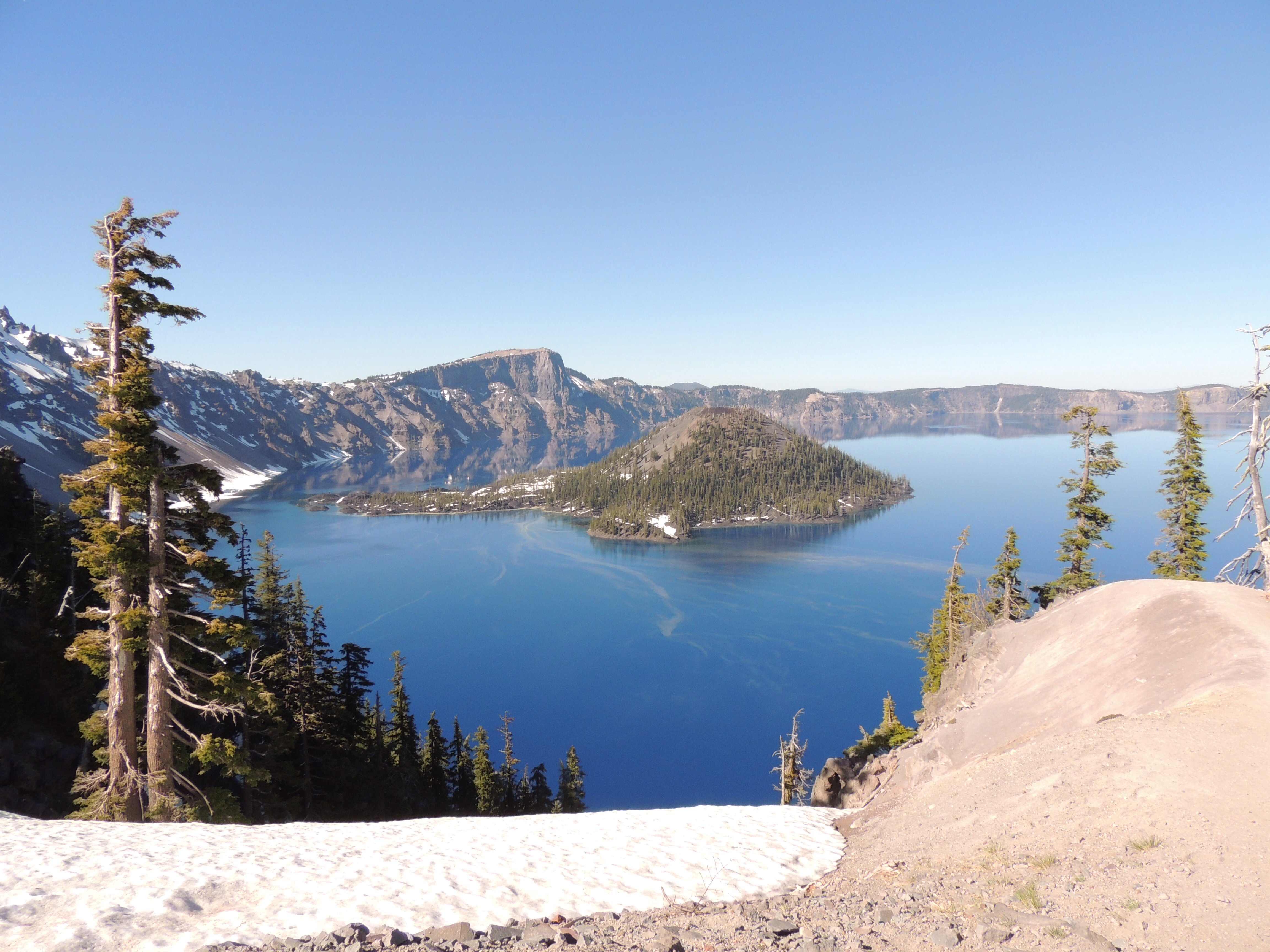
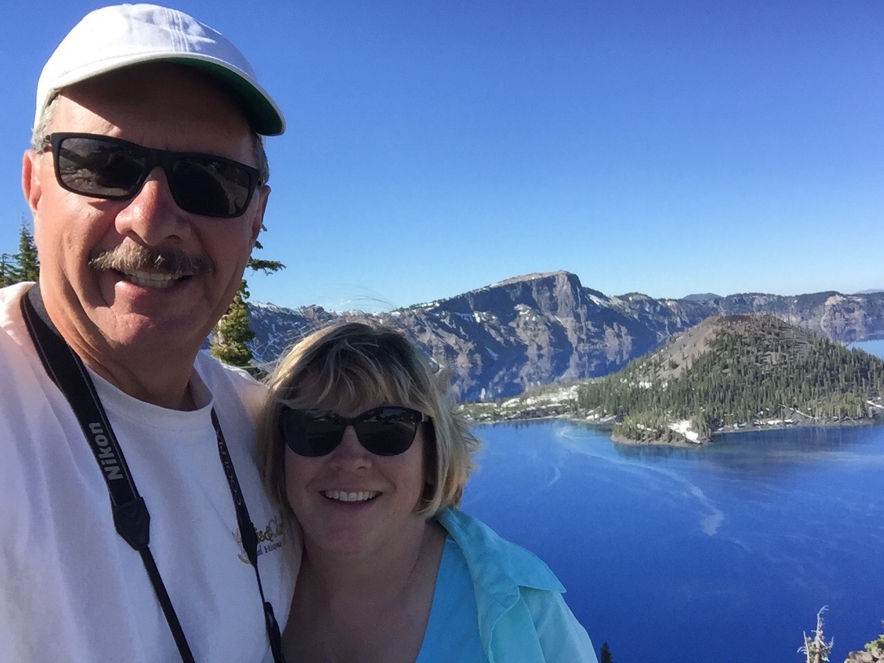
Above is Wizard Island, which is actually a volcano within the caldera. There are two of these cones in the lake, but one of them is 500 feet below the surface.  The lake is an incredible 1949 feet deep, the greatest depth of any inland body of water in the United States.  No tributaries feed the lake, and the only outflow occurs through seepage.  This keeps the water quality exceptionally pure.  We were happy to see that there was still quite a bit of snow, despite temperatures in the upper 70’s at the crater rim.  😊. The green streaks on the water are a layer of pollen.

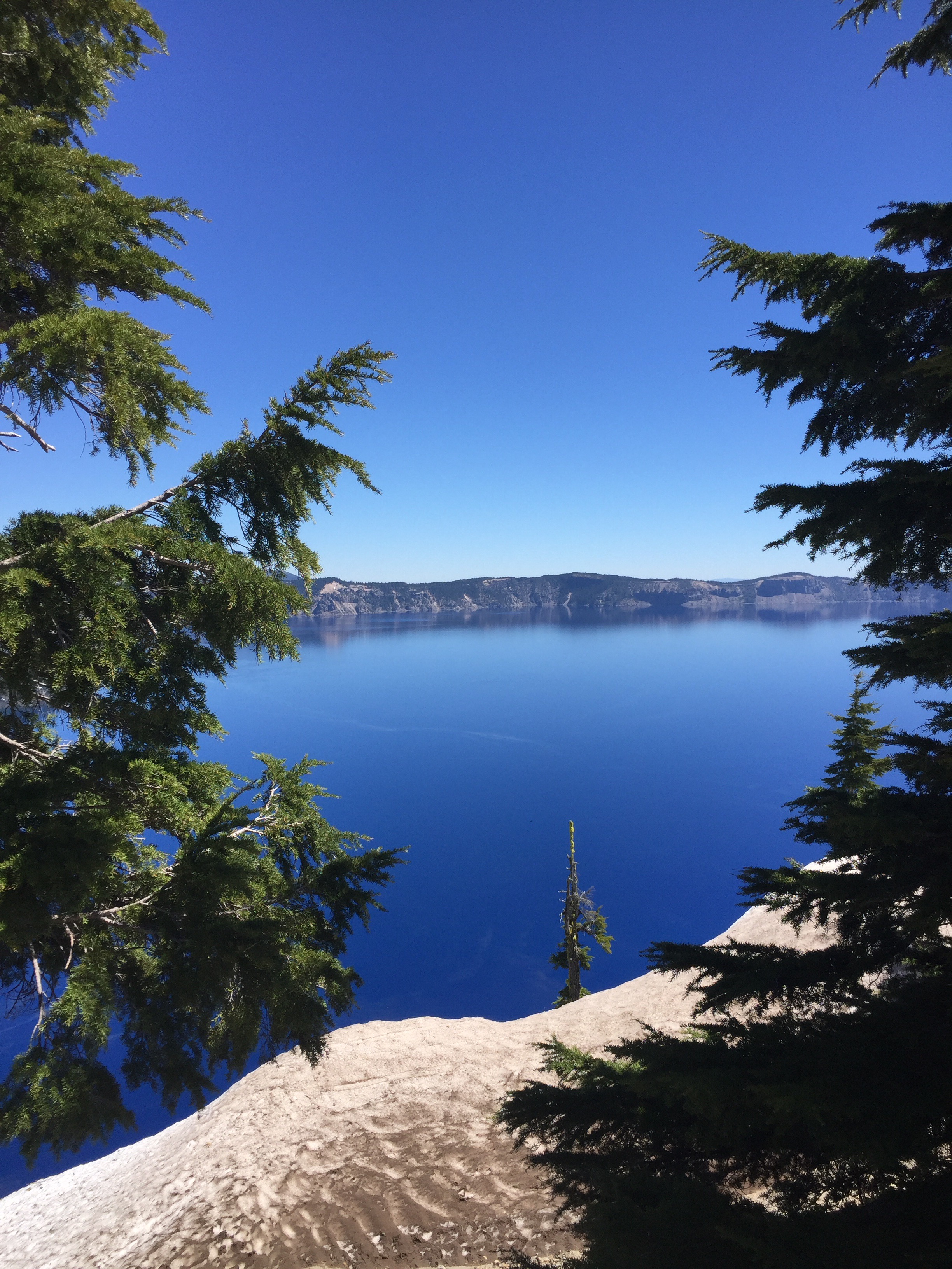
The lake gets its iridescent blue color from its massive depth and pristine water.

The drifts were still piled high against the visitor center, but almost all of the parks buildings were open for business.

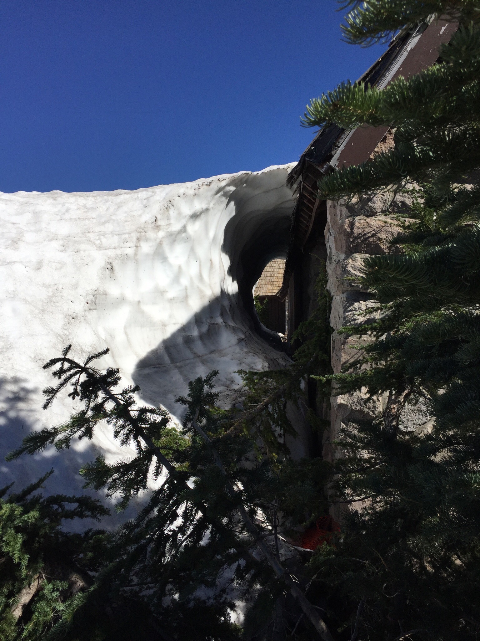
This viewpoint was one of the few structures yet to be accessed…

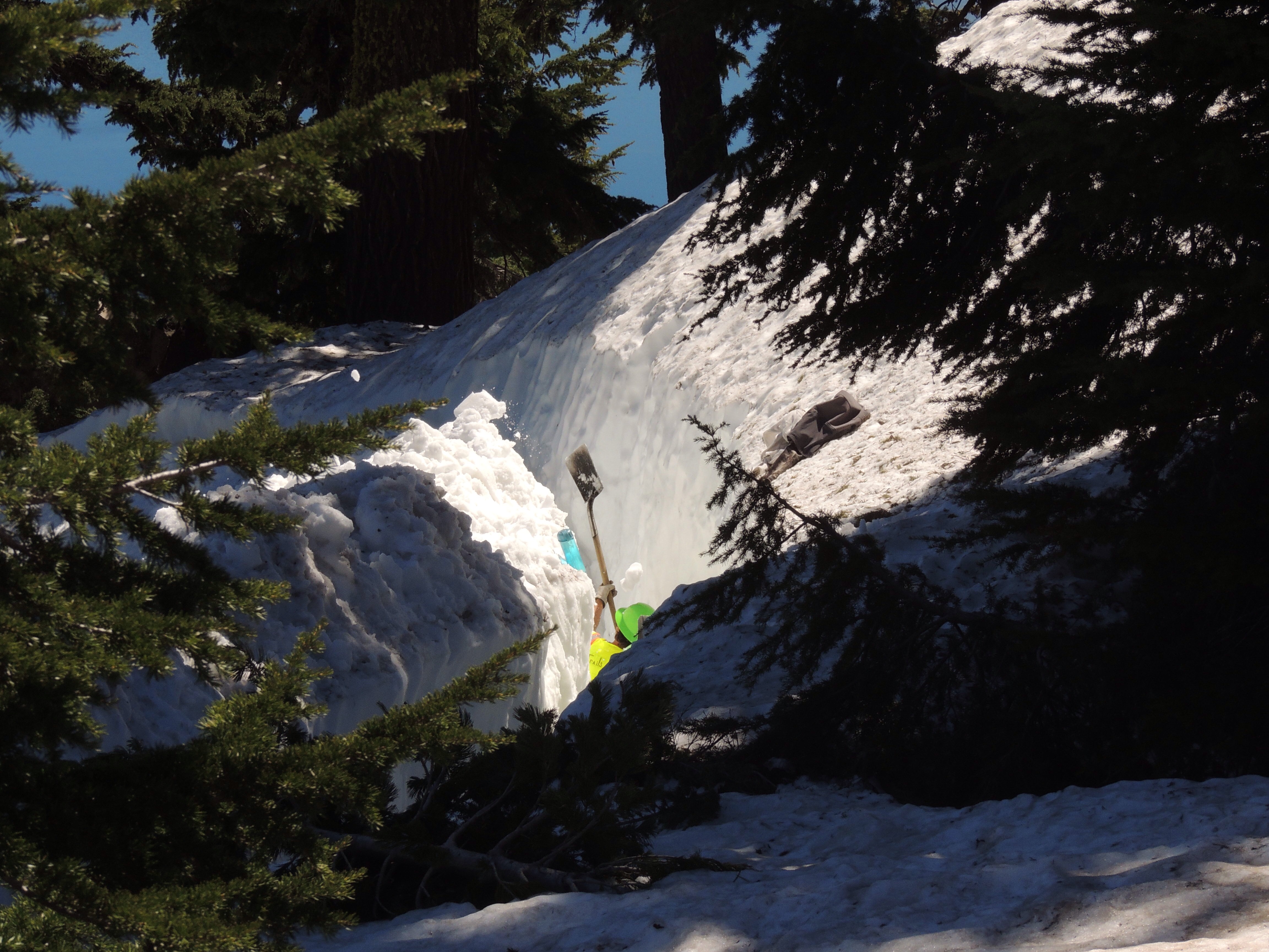
…but the park workers were working hard to remedy that!

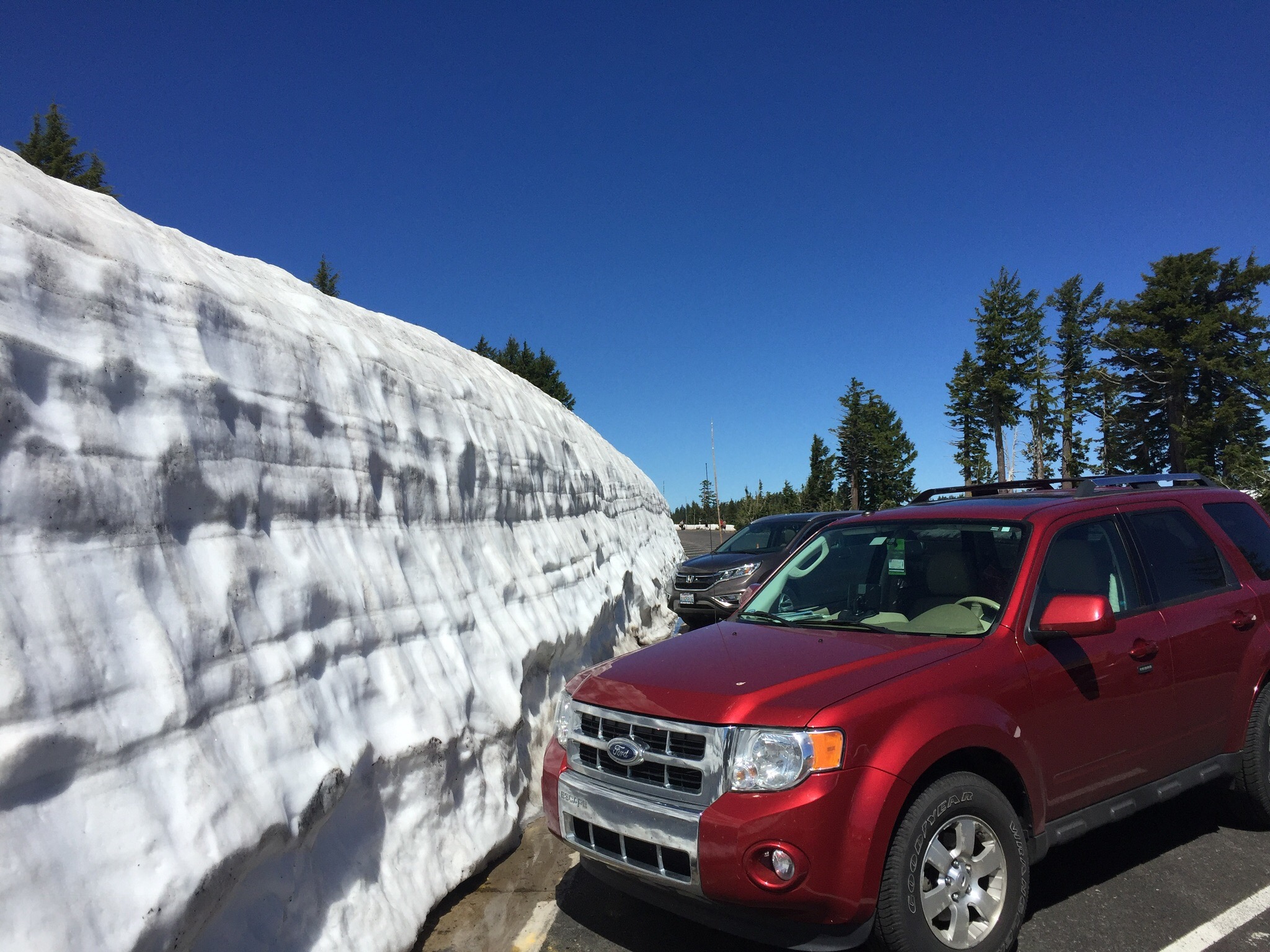
Edsel was dwarfed by this snowbank!  When we asked the ranger if there were any picnic tables in the park, she pointed to this massive drift and said “Under there”.  Guess we’ll eat in the Escape. 😉

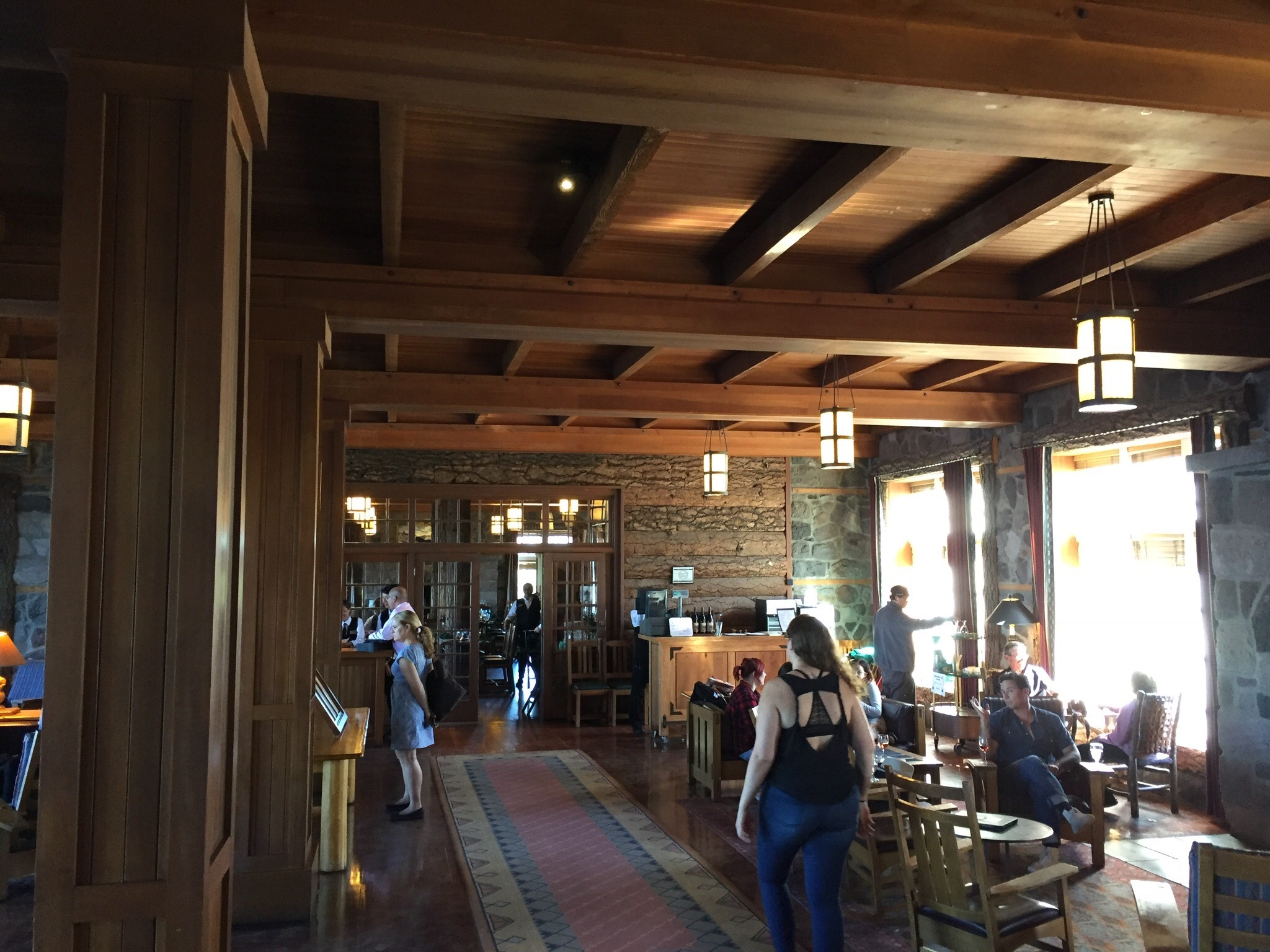
Crater Lake Lodge was hopping with visitors…

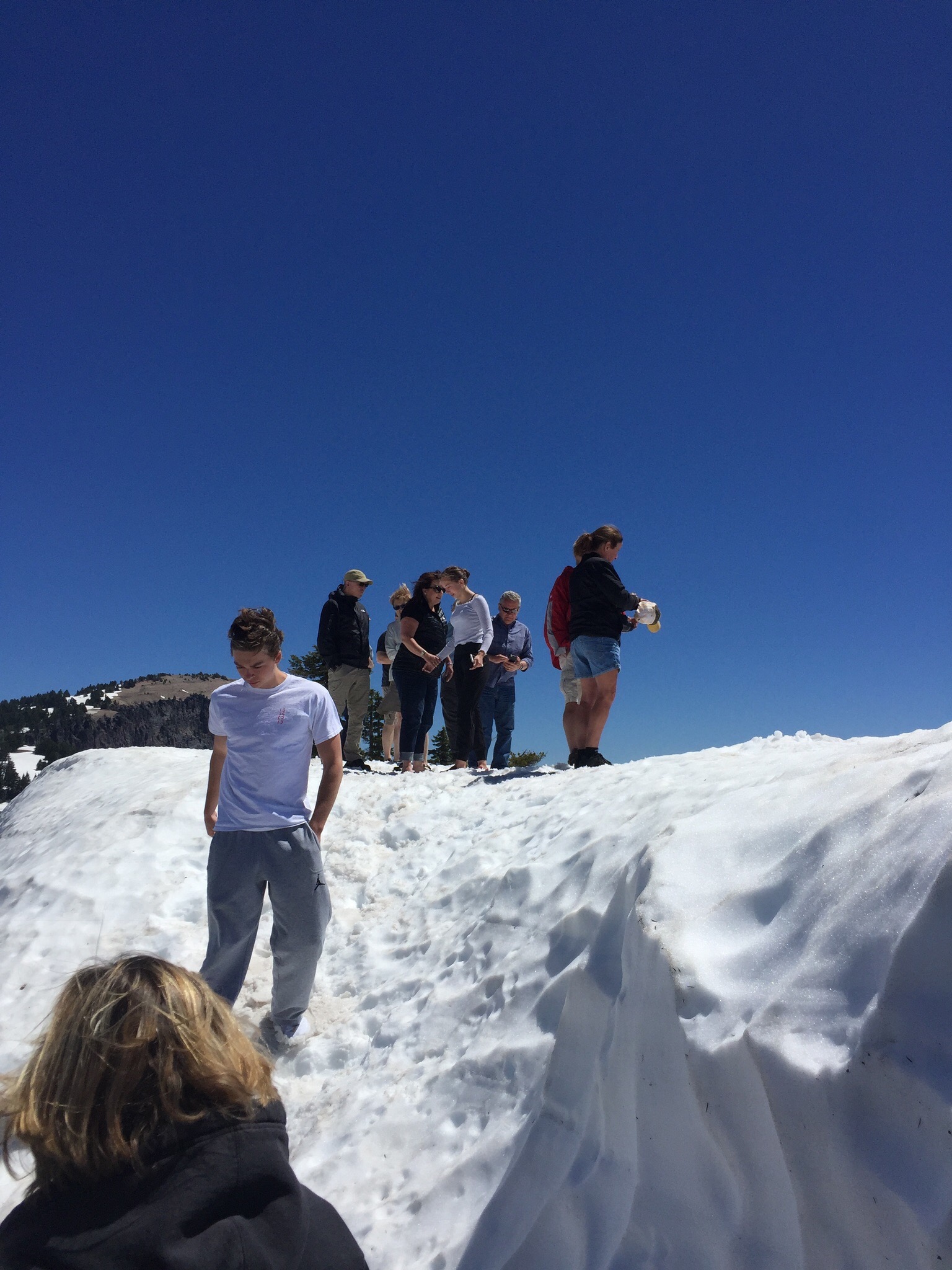
…as were the mounds of snow surrounding the rim of the lake!

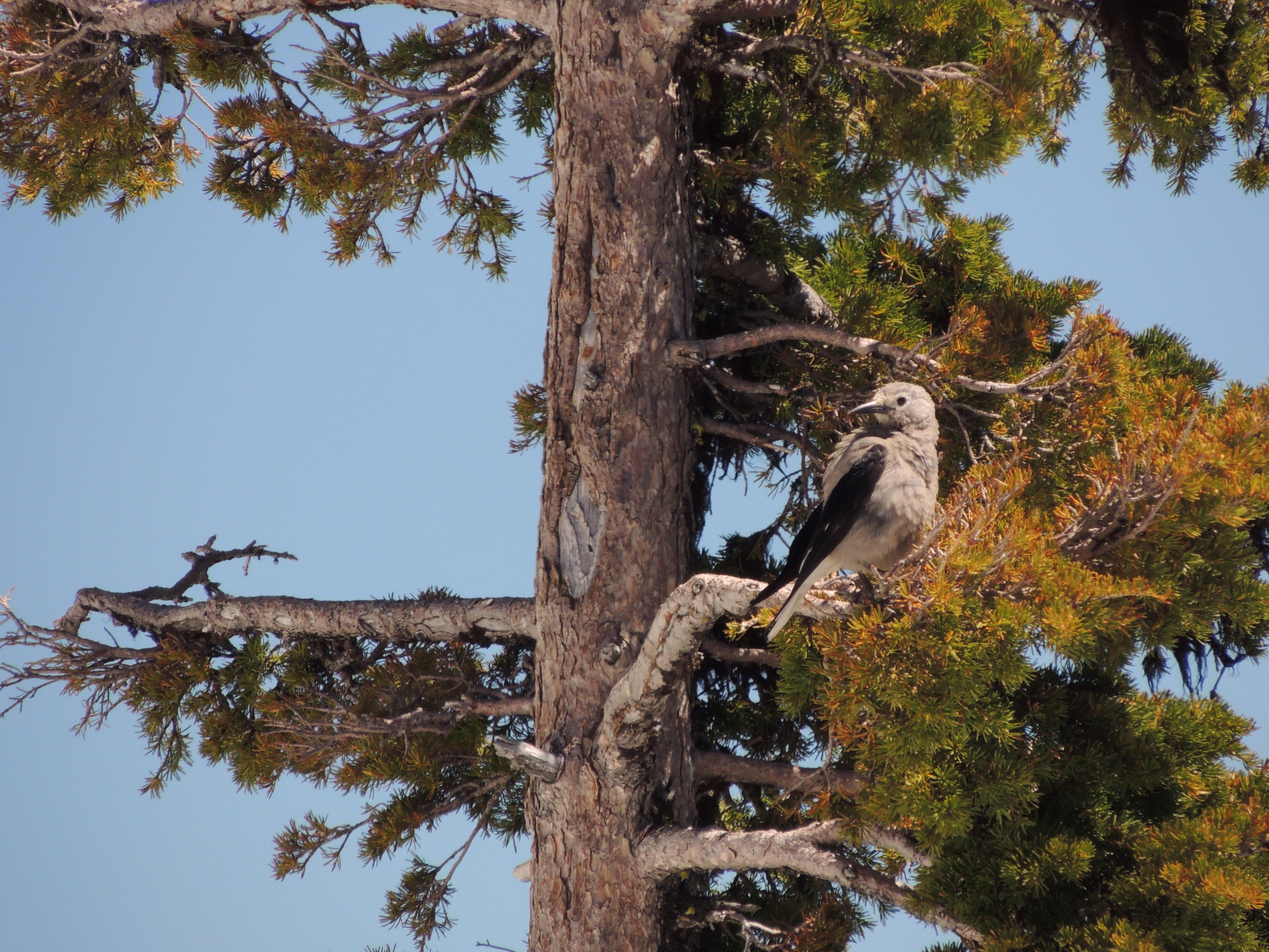
We saw several Clark’s Nutcrackers while we were there.  This species of bird was first described by William Clark on the Corps of Discovery expedition to the Pacific Ocean in 1805.  They are able to carry hundreds of seeds in a pouch below their tongues, which they bury in small caches to eat at a later time. Since they aren’t able to eat the thousands of seeds they store, many trees take root and thereby renew the birds’ food source.

Until this visit, we thought these little inhabitants of Oregon were chipmunks.  By completing our Junior Ranger books, we found out that they are actually Golden Mantled Ground Squirrels.  Chipmunks have a striped head.  Learn something new every day!

Little did we know back in 1996 that it would be 21 years before we returned.  Even though we are hoping to visit again later in the summer, it was difficult to leave this beautiful place this time around.  If you ever have the opportunity to visit Crater Lake, we highly recommend you do so!
———-*****———-

Crater Lake items, plus so much more available here on our Amazon link!

———-*****———-

explorRVistas is a participant in the Amazon Services LLC Associates Program, an affiliate advertising program designed to provide a means for sites to earn advertising fees by advertising and linking to Amazon .com. Shopping through our link does not add anything to your cost, but it does help support this blog. Thank you for shopping through exploRVistas!

The Mouth of the Columbia River

It is often said ‘Life is short…eat dessert first’.  

On June 15, we headed up to Astoria, Oregon to take in the western end of the Lewis & Clark voyage to the Pacific Ocean.  For a long time, we’ve had an interest in the route that the Corps of Discovery followed from 1804-1806.  Lewis & Clark and their team went on what could arguably be labeled as the greatest camping trip ever. During our vacation travels in the past through the northern plains, we’ve encountered several references to the expedition. In addition, we’ve seen many historical sites regarding their trip in our visits with our friends Jim and Sue in the area around Alton, Illinois and St. Louis, Missouri.  We can even date it back to our 1993 trip to Thomas Jefferson’s Monticello in Virginia, where Thomas Jefferson and Meriwether Lewis first researched the voyage.  This past March, our friends Fred and Bonnie from HappiLEE RVing urged us to read Stephen Ambrose’s Undaunted Courage… a historical biography of Meriwether Lewis…while discussing the subject on the beach in Florida.  They are planning on following the Corps of Discovery route this summer (follow them on their journey!), and it piqued our curiosity.  Having read bits and pieces over the years about the wet and miserable winter the expedition encountered in western Oregon, we had to see the area for ourselves! Our close proximity to the mouth of the Columbia River while we were working at Heceta Head Lighthouse made it possible.  Yes, we were eating dessert first, but we know from experience that life can indeed be short!

The Corps of Discovery sites around the mouth of the Columbia River include locations in Oregon and Washington State Parks, as well as the Lewis & Clark National Historical Park.  The first thing the group encountered was the area along the north shore of the Columbia that William Clark noted as “a dismal little nitch”, as depicted in the drawing above.  

It’s now a tight little bend in US-101 between the Astoria Bridge and a rest area.  Still, it’s easy to envision the expidition being holed up for several stormy days between the rocky shore and the mountainside.

The Corps moved from there to Middle Village.  There is a nice display of the canoes the Clatsop Indians used back then.  It’s not far down the river from Dismal Nitch, still on the Washington side of the Columbia.  It was from that base camp that they first ventured out to the shore of the Pacific.

This is the current view at Cape Disappointment, Washington, which is where Lewis & Clark first saw the mighty ocean’s surf.  Even with the jetties, it is easy to imagine the scene as they viewed it over 200 years ago.

Back at Middle Village, the Corps voted to cross the river into present day Oregon to find a suitable place to spend the winter of 1805-1806.  It was there on a small tributary that they built Fort Clatsop.

This building is a re-creation of the original fort.  The property includes a very nice visitor center that features a couple of movies on the expedition, along with several exhibits that detail the voyage.

There is also a trail from the fort to the canoe landing.  This was a protected area off of the Columbia tributary, now known as the Lewis & Clark River.  From there, the fort was just a few hundred yards away.

After seeing the fort, we drove down to Seaside, Oregon and found the location of the Salt Works.

Situated in the middle of a present-day neighborhood, the Salt Works was identified by a Clatsop Indian woman in the early 1900’s.  Her grandfather had told her of the site when she was a child.  This is where the Corps boiled seawater to get salt to preserve meat for their trip back east in the spring.

Just south of that was Haystack Rock.

Named for its resemblance to a farm haystack, this beach is where the dead whale washed ashore that Lewis, Clark, Sacajawea and several others came to get blubber and oil.  It is located at present day Cannon Beach, Oregon.

Even though the surrounding area was developed with modern buildings and roads, just being able to see the actual locations of the Lewis & Clark sites helps paint a visual image in our minds as to what they endured that winter.  Lewis was very descriptive in his journals and we had a good idea of what we were going to be seeing.  But no matter how good the description, there really is no substitute for putting ourselves on the same soil the Corps of Discovery occupied.  It has given us a desire to check out more of the Lewis & Clark Trail, and we hope to do so in the future!

———- *****

Click here for our exploRVistas Amazon shopping link!
———- *****

explorRVistas is a participant in the Amazon Services LLC Associates Program, an affiliate advertising program designed to provide a means for sites to earn advertising fees by advertising and linking to Amazon .com. Shopping through our link does not add anything to your cost, but it does help support this blog. Thank you for shopping through exploRVistas!

Heceta Head Lighthouse

As stated in our last post, we are spending the month of June volunteering for Oregon State Parks as interpretive hosts at Heceta Head Lighthouse.  Located between Florence and Yachats, this sentinel has been guiding mariners since it was first lit on March 30, 1894. 


Standing at just 56 feet high, the building’s stature could be considered somewhat short. 

It is the commanding position on the headland that gives the lighthouse the height it needs to send its beam out 21 miles to sea.  The curvature of the earth is the only thing that limits it from projecting further. The focal plane of the bullseye on the lens above mean (average) sea level is a whopping 210 feet!

Back in 1775, a Portuguese explorer named Don Bruno de Heceta was sent by Spain on a mission to chart the waters from San Diego north to the Arctic Circle.  When he reached the waters off of the headland where the lighthouse sits today, he noticed that there was a large shallow area several miles from the shore.  That ridge of seabed became known over time as Heceta Bank, and is actually a raised area on the edge of the North American Plate.  Subsequently, the headland itself became known as Heceta Head.

Fast forward 75 years to the Westward Expansion and the California Gold Rush.  With the surge in ship traffic up and down the coast, there was a need for reliable navigational aids.  The U.S. Lighthouse Service received congressional appropriations for lighthouses in California and Washington, but it took longer to fill in the dark voids along the Oregon shore.  The last area to be lit was from present day Newport down to Winchester Bay.  Three locations were chosen:  Yaquina Head Light at Newport, Umpqua River Light at Winchester Bay and Heceta Head Light, halfway between the other two. Construction on Heceta Head began in 1892.  Considering the rocky coast and the fact there was only a rough wagon road over the headlands to the site, the project was a formidable challenge.  Some of the materials were brought in by ship and unloaded into smaller surf boats and rowed ashore.  Others were brought around the headlands to the south at low tide on calm days.  Still others were brought over the wagon road. Considering those challenges, it is quite amazing to note that the lighthouse, the two oil houses, the keepers house and the assistant keepers duplex were all completed by 1894.  On March 30 of that year, the first keeper lit the kerosene lamp in the first order Fresnel lens and Heceta Head Lighthouse was officially in service.

The Fresnel lens that was used at the lighthouse was made by Chance Brothers in England.  Most lighthouse lenses in the United States came from France and were made out of silica based glass, which had a greenish tint to it.  Chance used a sulpher based glass which gave the optic a slight yellowish hue.  It was found that the Chance Brothers lenses actually had a higher candlepower, due to that color difference. At the time that Heceta Head used a kerosene lamp, the output of the lens was rated at 80,000 candlepower.  

The current 1000 watt bulb increases the output to 2.5 million candlepower, a full 500,000 units brighter than a comparable silica glass lens!  As a result, Heceta’s light is the brightest on the west coast.

When the lighthouse was first opened, the 4000 pound lens rotated one revolution every 8 minutes.  There are 8 separate panels of prisms, each radiating from a bullseye in the center of each panel.  As each bullseye would align between the light source and the mariner’s eyes, the entire panel would flash.  As a result, Heceta’s signature was one white flash every minute.  Each lighthouse has its own unique signature, so mariners are able to tell where they are at by timing the flashes.  When Heceta changed from a hand wound clockwork mechanism to an electric motor, the lens speed was increased to one flash every 10 seconds.

Touching on the original clockwork at the lighthouse, it was powered by a 200 pound weight that would descend from the lens to the watchroom floor.  That took 39 minutes to go that distance, and resulted in the keepers having to constantly climb the steps and rewind the mechanism.  A request was made to the Lighthouse Service for permission to cut holes in the watchroom, service room and first landing floors, so the weight could descend to the base of the tower.  Permission was granted and the modification was completed, which increased the winding interval to 4 hours. 

There were three keepers that worked rotating shifts to maintain the light at Heceta Head.  Their responsibilities included filling the lantern with kerosene oil, winding the mechanism, polishing the lens, painting and whitewashing the buildings and general cleaning and upkeep of the lightstation. Things began to change in 1932 when the Oregon Coast Highway was built, which passed within yards of the station.  Electricity came on the heels of the road in 1934, and the oil-fired lantern was replaced by an electric light bulb.  That eliminated the soot on the lens from the kerosene, which resulted in less cleaning. Following that, the clockwork was removed and replaced with an electric motor.  With the decreased workload, the Lighthouse Service eventually reduced the quantity of keepers from three to two.  The head keeper was moved into one half of the assistant keepers duplex. The main keepers home was sold for $10 with the stipulation that the buyer must dismantle and remove it.

With the onset of World War II, there were heightened concerns of Japanese attacks along the west coast.  Defenses were built all along the shore from Southern California to the Canadian border. Heceta Head became host to a bevy of Coast Guard personnel, along with what was described as several vicious guard dogs. Patrols originated from the station to the north and south.  A couple of barracks buildings had to be built where the former head keepers house was, and it was noted that perhaps they had removed the first structure a little too soon.  Once the war was over, the barracks were removed.

In 1963, the lighthouse was fully automated.  All of the windows below the lantern room were sealed over to prevent vandalism. Occasional maintenance was undertaken by the Coast Guard to change the light bulb, grease the rollers the lens rotates on and clean the windows.  In the 1960’s, the Coast Guard turned over the lighthouse to Oregon Parks and Recreation, except for the lens and one oil house.  Those were deeded to the state park at a later date.  The assistant keepers house is owned by the U.S. Forest Service and is leased as a bed and breakfast.

In 2012, a major restoration was undertaken to restore the lighthouse.  Today it stands proud on the headland shining its beam through the same lens it did 123 years ago.  Diana and I feel extremely fortunate to be able to showcase the beautiful sentinel this month, and to foster interest in the history of the location.  We have met people from all around the globe who have come to visit the beacon.  It’s that sort of curiosity and interest that ensures Heceta Head Lighthouse will still be shining brightly 123 years from now!

Redwoods and Rocky Shores 

Heading into Northern California on US-101, we were really impressed with how beautiful the region was.  The hills along the winding road soon were filled with progressively taller forests, eventually transitioning into groves of coastal redwoods.   We spent a night in Myers Flat to quickly explore the Avenue of the Giants, knowing we were going to be spending a full day at our next stop in Redwood National Park.  While checking out the visitor center at Humboldt State Park, we noticed the campground next door. 

When we walked in to take a look, we realized that it was the same place that our friends Lee and Tracy had hosted at back in 2015.

The next day, we drove up to Klamath and set up on a riverfront site at Klamath River RV Park.  We decided to do a little exploring, so we drove down towards the ocean.  One of the first things we saw was the entrance to the old US-101 bridge over the Klamath, which was washed out in 1964.  

The span featured these concrete grizzly bears on the railings, similar to the gold bears on the new span farther upriver.  Why are the bears on the new span gold?  Well it seems that back in the 1950’s, several friends were at a local bar discussing how the town needed to be spruced up.  They set out that night sweeping up the streets and washing windows on the businesses.  To top it all off, someone suggested they coat the bears on what is now the old bridge with some gold paint that he had in his shed.  When the California Department of Transportation saw them the next day, they sent workers with turpentine to remove the golden hue.  This went on back and forth several times until the state finally gave in and left the grizzlies as the townsfolk wanted them to be. 


When the new bridge was built, the highway department adorned the approaches with these bedazzled bruins as a tribute to the Golden Bear Club of Klamath.  😊

The other point of interest on our drive that afternoon was the old World War II era early warning radar station along the coast.

The trail down to the facility was not maintained, so we couldn’t get any closer. Disguised to look like a farmhouse and barn, the structures actually housed radar equipment, a generator, and two 50 caliber anti-aircraft guns.  This particular station is the last of 65 such stations that once were located up and down the entire coast.  If they detected any military boats or aircraft that didn’t belong, they sent out a warning. Having not heard of these defenses before, we wondered aloud, ” What sort of things like this exist today that we don’t know about?”

We drove to the national park visitor center in Crescent City the next day to get our bearings.  We had business to take care of that required good wifi, so we knew our time would be limited in the park. We made good use of the local library’s wifi, and checked out town before heading out to see the big trees.

Battery Point lighthouse sits just off the mainland.  There is a trail out to it that is accessible only at low tide.

From there, we drove up into a grove of trees northeast of town.

The height on the coastal redwoods can get quite a bit taller than sequoias, even though they aren’t as old or as big around.

Even after they’ve fallen, they are gigantic!

They are so rot resistant, large trees take root in them and grow to impressive heights before the nurse log has a chance to decay.  

After spending nearly a month exploring California, we arrived in Oregon on Tuesday, May 23rd. Our first stop was in Port Orford.  We drove out to Cape Blanco to check out the lighthouse and the westernmost point in the contiguous United States.

The wind was blowing so hard, we had trouble holding our footing!  It was incredible!

On Wednesday, we arrived at Carl G. Washburne State Park north of Florence, Oregon.

This is our campsite for the month of June, as we will be interpretive hosts just south of here at…

…Heceta Head Lighthouse!  This sentinel has held a special place in our hearts since we visited it during a special nighttime tour back in 1996. We will be giving tours until the end of June, when we will be moving on to a different adventure. Our internet is non-existent at our campsite, but we do get service in the day use and at the lighthouse. If we are slow to respond to comments, that’s why.   Please stay tuned as we explore the central Oregon coast over the next month!