Are You Ready For the Eclipse?

Ready or not….here it comes!

A lot has been written about the upcoming Great American Eclipse, coming up on August 21.  A seventy mile wide swath centered on a line starting at Depoe Bay, Oregon and exiting at McClellanville, South Carolina will see the sun totally blocked by the moon.  

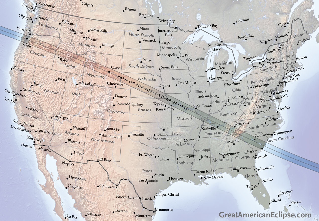
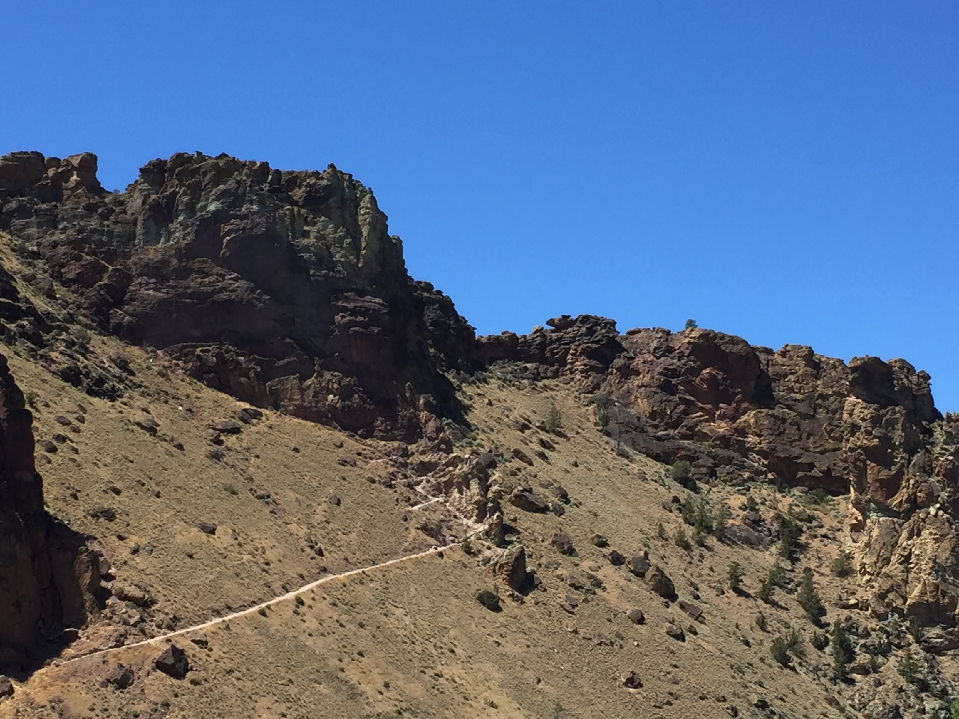
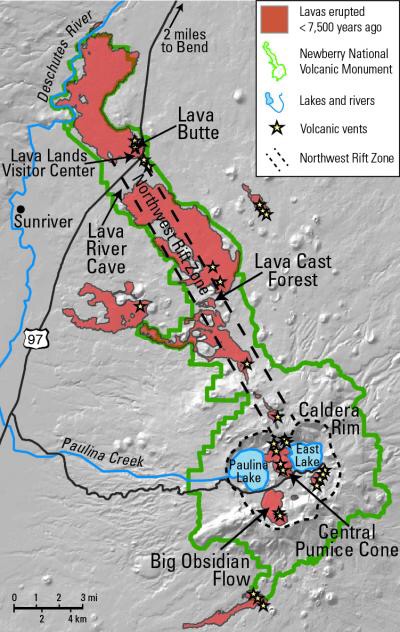
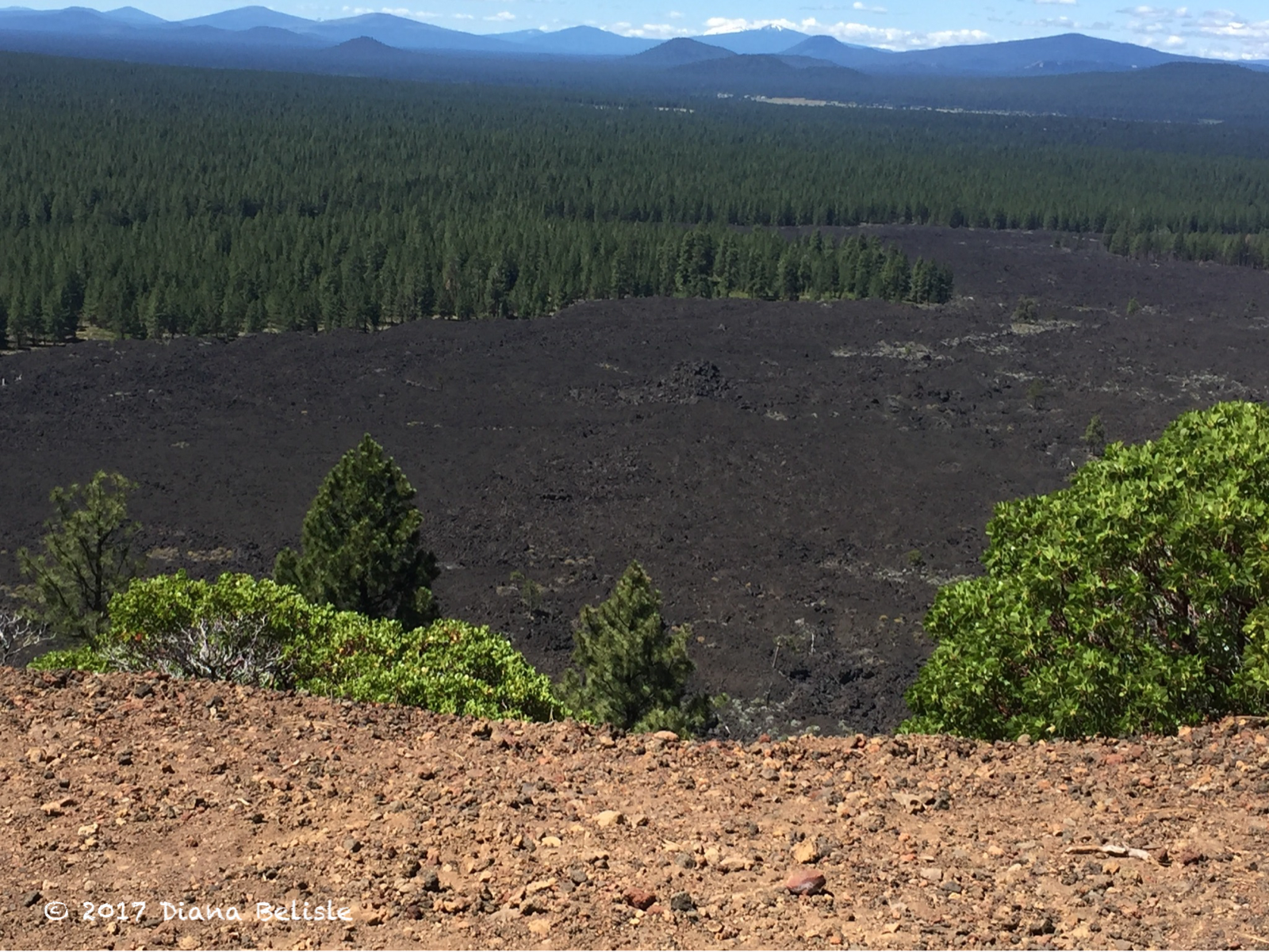
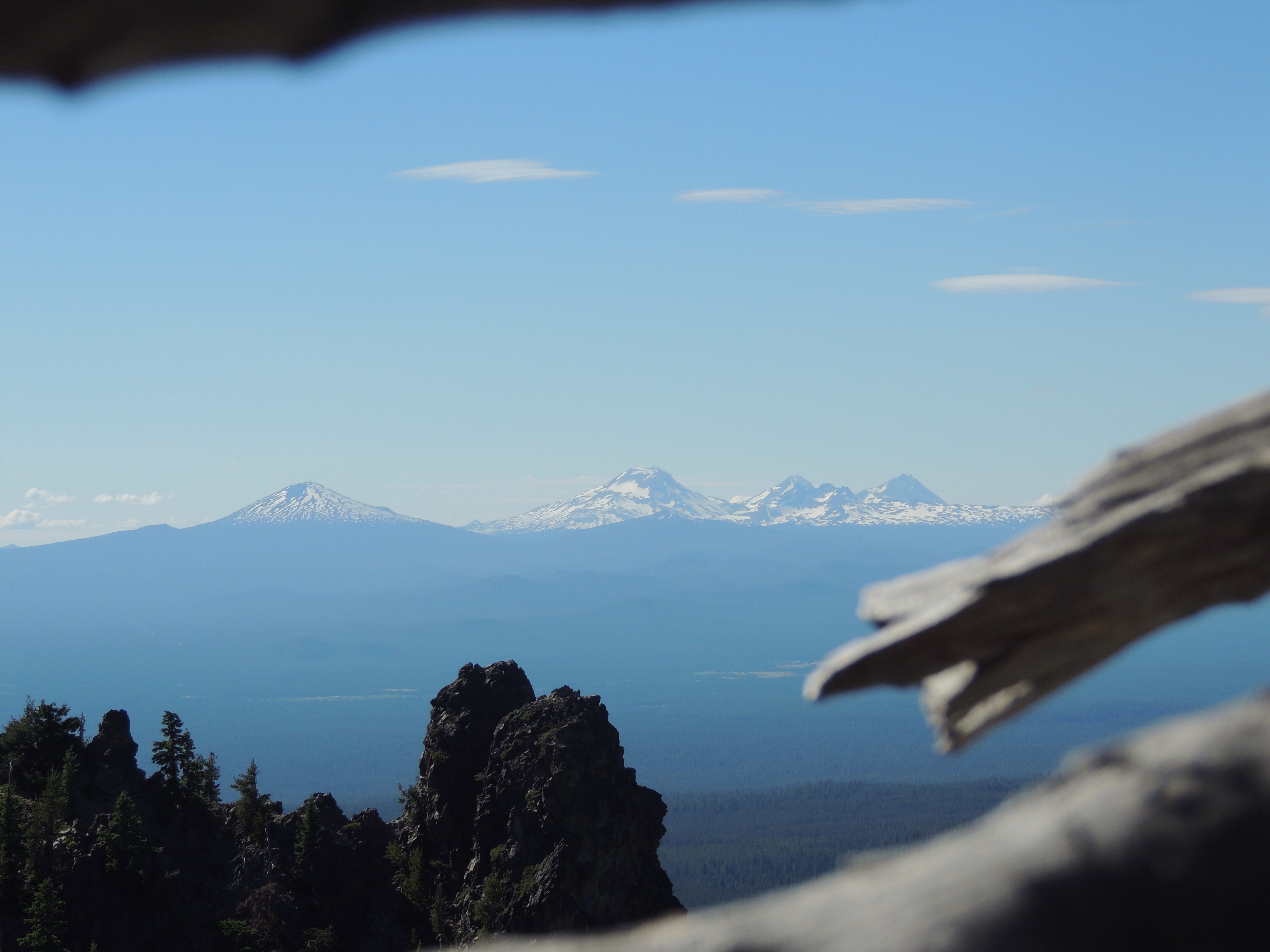
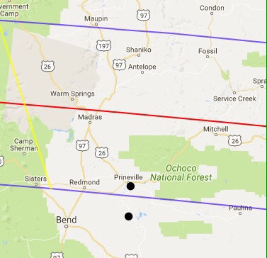
The entire journey of the shadow across our nation will take a mere 90 minutes.  Day will become night in the path of totality, with stars appearing when they normally wouldn’t.  Here at Prineville Reservoir, we are outside of the path of totality, but the city of Prineville to our north is within the path…as shown by the dots on the map below.

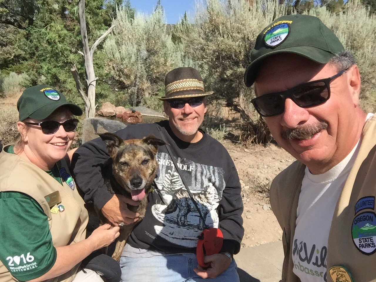
We plan on positioning ourselves in the path of totality and are still weighing our options. We’ll let you know how it all works out. The purpose of this post is to alert those of you who may not be aware of a few tips about the event, so as to prepare if you plan on trying to see it.  Experiencing this from Oregon, we will address it from that perspective. We completely understand that some people may have little interest in dealing with these crowds.

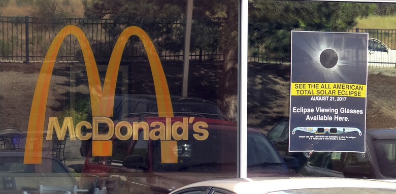
Our first awareness of the eclipse was when I read an online piece about it last year.  In it, I remember the author mentioning that NASA said the best chance in the nation at a cloudless sky was in the high dessert town of Madras, Oregon, about 20 or so miles up the road from Prineville.  The town of 6,000 has a nice airport with a 5000 foot and 2700 foot set of runways, a Safeway and a Thriftway, a KFC, McDonalds, and a Dairy Queen.  

Toss in four or five gas stations and a bevy of small businesses and that about sums it up.  US-97 runs north and south through the town, with a few smaller highways coming in from other directions.  Well, as awareness of the eclipse has grown, Madras began to prepare for the onslaught of visitors…as far back as 2015.  Estimates are for 100,000 people to descend on the town, but that number could be conservative.  The FAA has capped the airport at 400 planes, and those spots are long spoken for.  Many are reported to be famous folks flying up from LA. The normally uncontrolled field is even bringing in a portable control tower.  

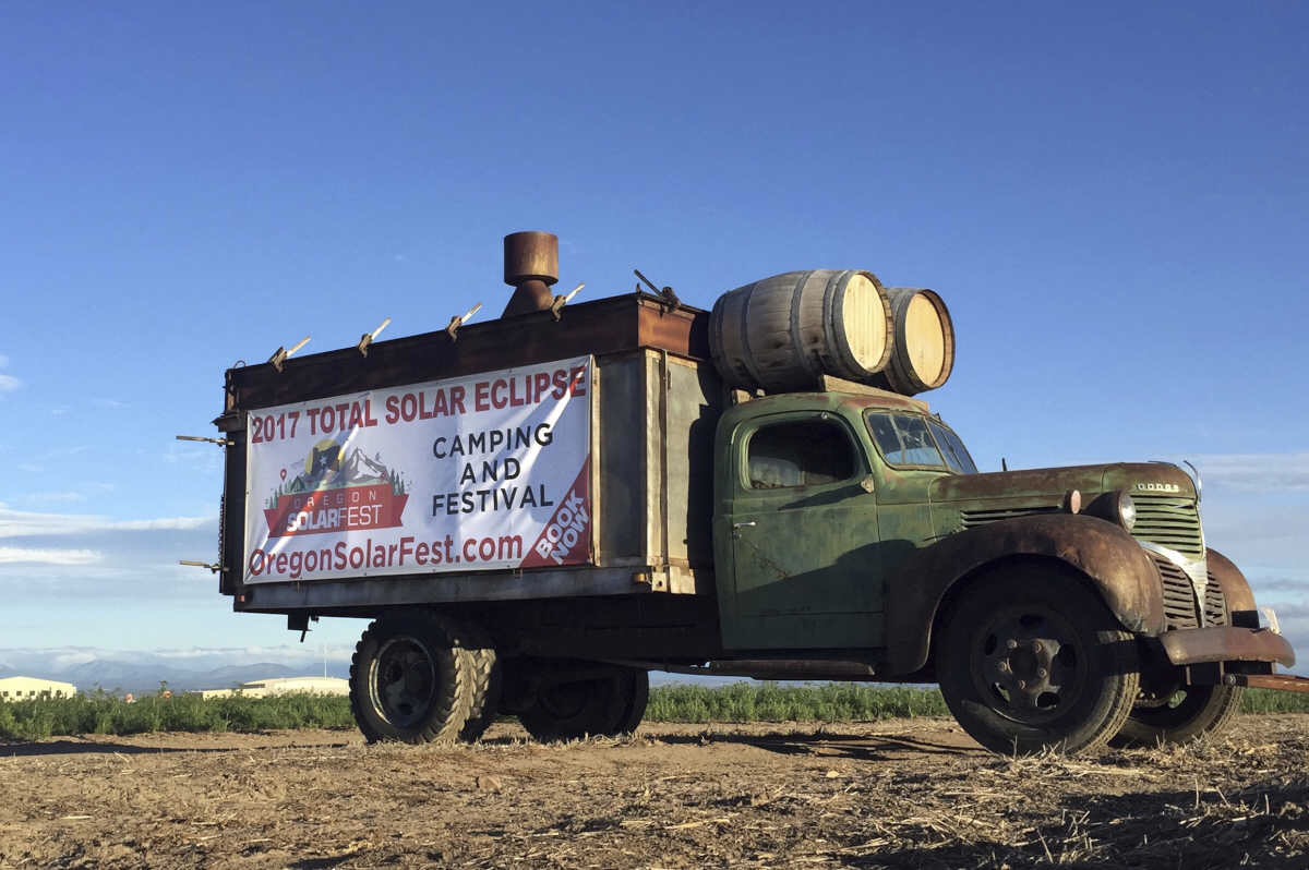
Farmers are mowing their fields and have reserved camping spots for well over $100 a night.  Prineville will be home to a festival that officials are capping at 30,000 people….and that’s just the festival.  Many more will be pouring into town from all over the world.  It’s going to be fun, crazy, scary, all rolled up in a few amazing days.  And once the sun comes back out, everyone is going to want to leave at the same time!

If you attempt to show up the day of the eclipse, you stand a good chance of ending up in a traffic jam and missing it. Campsites and lodging sites have been sold out for years.  Also, just pulling off the roads here is easier said than done.  

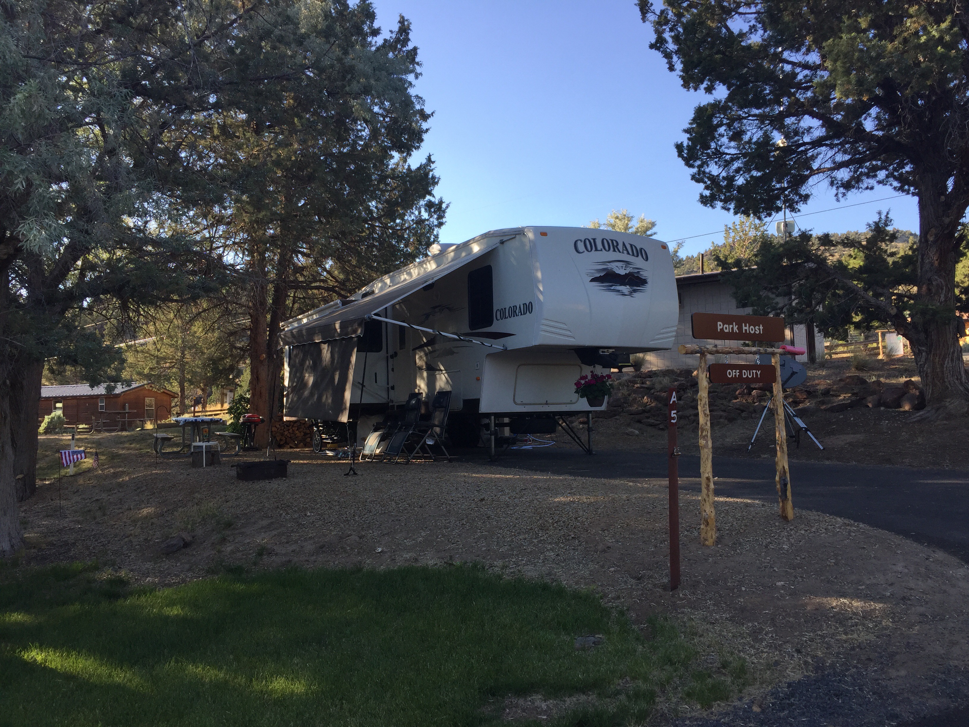
ODOT has trained workers in push, pull, drag training; meaning if someone is blocking the road, the road crew will move it by any method needed, so emergency vehicles can get through.  The roads around central Oregon have steep shoulders and drop offs, so pulling over isn’t a great option.  Parking in dry grass could start a wildfire, which is a huge concern in these parts.  Not only that, smoke from a wildfire could obscure the eclipse!  And watch where you step, as there are rattlesnakes here. Also, remember that services such as restrooms, groceries, gasoline, drinking water, and cell service will be overloaded, as will the power grid.  Self contained RV’s hold an advantage in this regard, so be sure to stock up your supplies and top off your fuel and water tanks way ahead of time.  Prineville officials are expecting people to start coming in on the 15th, but we’ve talked to one camper who is already here for the event.  The state is gearing up as if this will be a natural disaster, and for all intents and purposes, it could be!

Ok, so enough with the doomsday dialogue.  😎

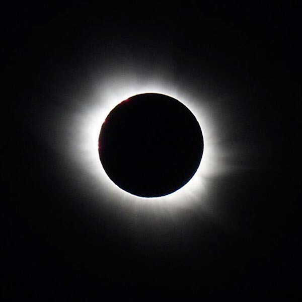
If the majority of people are patient and respectful of others, the Great American Eclipse promises to be an unforgettable experience.  Many of you will want to be as far away from this as possible…and that is perfectly ok and understandable.  But if this interests you and there is any way for you to get into the path of totality, by all means, do it. Veteran eclipse watchers say that close is not close enough!  If you are wondering what you could possibly see that would be worth all of the trouble, Eclipse2017.org explains it as being much more than the moon covering the sun.  It’s the veil of blackness that hits you at 3000 miles an hour, the 360 degree orange glow on the horizon, the air cooling, the stars and planets appearing, and the adrenaline rush of being a part of it all.  Many people who have seen one in the past say it is the most beautiful thing they have ever experienced.

Above all, have fun and if you’re up for an adventure, give it your best effort to get yourself into the path of totality!  This is going to be an amazing event…one you will remember for the rest of your life.

Where will  you be during the Great American Eclipse?

———-

ISO certified eclipse glasses and so much more on our exploRVistas Amazon link HERE!
———-
explorRVistas is a participant in the Amazon Services LLC Associates Program, an affiliate advertising program designed to provide a means for sites to earn advertising fees by advertising and linking to Amazon .com. Shopping through our link does not add anything to your cost, but it does help support this blog. Thank you for shopping through exploRVistas!

The Unexpected Upside of Fulltime RVing

The biggest surprise to us about fulltime RVing has to be the social aspect of it.  When we prepared to hit the road, we thought we might feel distanced from friends and family.  Social media, this blog, work camping positions, and being members of the RV-Dreams family have helped alleviate that concern and have greatly expanded our circle of friends.  And while the places we visit are the focus of our journey, it’s the people we meet in each locale that end up standing out in our minds!

On July 15, our RV-Dreaming buddy and fellow lighthouse host Rick and his dog Maxine came to visit us at Prineville Reservoir.  He will be beginning his journey east soon and wanted to see us again before he left Oregon.  Since we were working, we brought him along to the programs we were helping out with.

It was great to spend more time with these two!

Maxine felt totally at ease here.  She looked right at home perched outside Mariah’s office.  🙂   It was sad to see them go Sunday morning, but we will definitely see them again down the road!

On Monday morning, we took the rig north to Parkdale to see our friends Bob and Kat.  You may recall that we met at the Fall 2014 RV-Dreams rally, and we met up again in San Antonio and in Lake Leelanau.  They are working at Toll Bridge County Park as hosts.

They suggested this beautiful site, just feet off the east fork of the Hood River.  😊  They made us a yummy dinner, which was appreciated after a day on the road!

On Tuesday, we took a tour of the Columbia River from the Bridge of the Gods up to Maryhill and back.

Our first stop was Stonehenge, a World War I memorial put in place by Samuel Hill.  He was the person responsible for the beautiful Columbia River Scenic Highway on the Oregon side of the waterway.  He first tried to get the State of Washington to build it and when they refused, he approached Oregon with the idea.  Thankfully, they approved construction.

From there, we visited Hill’s Maryhill estate.  This grand structure was built using forms and poured concrete, employing the same methods that would be used in building a highway overpass.  It now houses an art gallery.

The museum houses more than 80 works by Auguste Rodin, including The Thinker.

After that, we ate lunch at Everybody’s Brewing in White Salmon, Washington.  

An outstanding meal with a beautiful view of Mt. Hood in the background!

We then crossed back into Oregon and checked out Vista House.

Looks like a good place to explore some vistas!  😎

From its’ perch high on the cliff, the building offers a commanding view of the gorge!

Our last stop was Multnomah Falls.

We had seen this beautiful set of waterfalls back in 1996, and they were just as pretty as we remembered them. It was a great way to cap off a really fun day with friends!

So whether it is family, old friends or new, this life on the road has been anything but solitary for us.  August 11 will be three years since we moved into our RV fulltime, and what a wonderful time it has been.  Here’s hoping we have many more roadiversaries and opportunities to spend time with others along the way!
———-

Our favorite ‘Friends’ sign and many more items available by clicking HERE on our exploRVistas Amazon link!
———-

explorRVistas is a participant in the Amazon Services LLC Associates Program, an affiliate advertising program designed to provide a means for sites to earn advertising fees by advertising and linking to Amazon .com. Shopping through our link does not add anything to your cost, but it does help support this blog. Thank you for shopping through exploRVistas!

Smith Rock State Park

On Tuesday, July 11th, we decided to take a little day trip to Smith Rock State Park, north of Redmond, Oregon, as we heard that people liked to hang out there….

….and we mean that quite literally! 😃   And while this outcropping is internationally known for its tremendous rock climbing opportunities, we also wanted to see the geology and the hiking trails available to those of us who prefer to keep our feet on terra firma. In addition we wanted to check out the volunteer opportunities available, as our friend Lisa and her late husband Hugh had worked at the visitor center a while back.

This volcanic gem sits on the northwest rim of the Crooked River Caldera….a recently discovered supervolcano that last erupted 29 million years ago and is considered extinct.  For reference, Prineville sits smack dab in the middle of that caldera, 19 miles south east of Smith Rock….so we are talking a very large crater.  The makeup of Smith Rock is volcanic tuff and basalt, and the geologic features are quite varied in their structure, which makes for good rock climbing.

We enjoyed watching the many people on the sheer rock faces that day…

…and we were glad that none of them had to use the equipment seen here that is provided by the state park!

We hiked a little ways on the Canyon Trail, then decided to cross the footbridge and check out the River Trail, which skirts the base of the mountain.  

It was too late in the day to attempt the four mile Misery Ridge Loop trail, but it certainly looks intriguing!  We talked to a Ranger at our park afterwards and he said, “It’s named Misery Ridge for a reason.”  We will have to think about this one.  😎

One thing is for certain:  the scenery was outstanding!  This photo shows Mt. Jefferson peeking through Asterisk Pass.  We never get tired of seeing the line of snow-capped stratovolcanoes hovering above the high desert landscape we are in.

Zooming in on the ‘asterisk’, we saw this hiker contemplating his next move.  It makes you wonder what is on the other side. 😊

We definitely enjoyed our afternoon at Smith Rock State Park.  With it being so close to our base at Prineville Reservoir, we would love to come back and do more hiking.  Stay tuned for that and more, as we continue to explore this beautiful slice of Oregon!

———-

Smith Rock Climbing Guide and anything else imaginable on our exploRVistas Amazon link HERE  😃

———-

explorRVistas is a participant in the Amazon Services LLC Associates Program, an affiliate advertising program designed to provide a means for sites to earn advertising fees by advertising and linking to Amazon .com. Shopping through our link does not add anything to your cost, but it does help support this blog. Thank you for shopping through exploRVistas

Newberry National Volcanic Monument

On Monday, July 10, we took a day trip southwest of Prineville to Newberry National Volcanic Monument.

At 1200 square miles, Newberry is the largest volcano in Oregon.  It is unusual in the fact that it sits east of the line of peaks that make up the Cascade Mountains, although it is very much a part of that chain.  Newberry Volcano is considered active, and with its proximity to the growing towns of Central Oregon, it is constantly monitored for geological changes.  Where most of the volcanos in the region are made up of one dominant mountain, this one is unique in the fact that it has over 400 smaller cones scattered around its main crater.  The main peak collapsed into its magma chamber, similar to what Mt Mazama (now Crater Lake) did.  Although both craters now contain bodies of water, they are very different from each other.  Newberry’s lakes are much shallower and are separated by a volcanic cone and rock that completely span the larger crater.  The national monument encompasses 54,000 acres and is administered by the U.S. Forest Service.

Since this was a day trip, it would have been a rush to hit every feature of this park.  We opted to skip Lava Cast Forest and the Lava River Cave on this visit, hoping to catch them later in the summer.  This allowed us to spend quality time at the other points of interest.

Our first stop was at Lava Butte.

This is a photo looking into the crater.  Lava Butte is a fairly symmetrical cinder cone that sits out on somewhat of a flat plain.  It erupted only once around 7000 years ago, spewing lava to the west. 

 That lava field remains free of vegetation, which really gives a clear view of the footprint of this small volcano.  Towards the end of the eruption, cinders built up around the vent and formed the 500 foot tall butte we see today.

The next spot we visited was the Big Obsidian Flow.

Talk about awesome!  This is a giant wall of black glass that oozed from Newberry Volcano just 1300 years ago.  We climbed the trail that ascends to the top of this geological wonder, being careful not to fall…as it would surely result in sliced skin!  

The hillside glistened in the afternoon sun.  Absolutely beautiful!

Here’s my sweetie with her Junior Ranger badge and obsidian ears!

While we were in that area, we checked out the two lakes in the caldera.  They were both very pretty with plenty of trees surrounding them.  Lots of people boating, fishing and swimming.

The last place we visited was Paulina Peak.  Named after Chief Paulina, the fierce Paiute warrior who defended these lands from settler encroachment, the 7940 foot mountain is the highest remaining point of the Newberry Volcano.

From the top, we had a 360 degree view of the area.  To the west, we could see everything in the Cascades from Crater Lake up to Mt. Adams in Washington. To the east, we could see Idaho and Nevada.  Now that’s exploring vistas!

While we were there, we spoke with this elderly gentleman. 

If you ever feel like you might be getting too old to hike, refer back to this post and this photo. The view from the parking lot wasn’t good enough for him…no, he needed to climb the extra 40 feet to the summit.  You just have to love this guy.   He had a sense of humor also, as Diana asked him what the large sandy area was in the woods off to our northwest.  His reply?  “Alien landing site.”  😉

We really enjoyed our day at Newberry National Volcanic Monument.  If you ever are near Bend, Oregon, be sure to check it out!

———-

Obsidian jewelry and other great items on our exploRVistas Amazon link HERE
———-

explorRVistas is a participant in the Amazon Services LLC Associates Program, an affiliate advertising program designed to provide a means for sites to earn advertising fees by advertising and linking to Amazon .com. Shopping through our link does not add anything to your cost, but it does help support this blog. Thank you for shopping through exploRVistas!
 

Prineville Reservoir State Park

As stated in our previous post, we are currently the interpretive hosts at Prineville Reservoir State Park, 17 miles south of Prineville, Oregon.  This is a high desert climate, with sage and juniper dominating the land.  Afternoons can get blazing hot and nights chilly, and the humidity is next to nothing. The Crooked River was contained by the Bowman Dam in the late 1950’s to create a 3000 acre lake that sits 3200 feet above sea level.  Quite a difference from our last location on the Pacific coast!

Our campsite is one of the nicest host sites we have ever seen.  We sit at the highest point in the tent loop, and we have a view of the lake from our patio.  The juniper trees provide us with plenty of shade most of the day, so the 100+ degree mid-day temperatures are not an issue.  

The Eagle’s Nest Amplitheater and Discovery Center complex is one of the two areas of the park where we help out.

We take care of a few critters in the Discovery Center, including a smallmouth bass, a gopher snake, and two fence lizards…one of which is seen here.

We assist the Interpretive Ranger Mariah with her educational programs.  She is enthusiastic and enjoys sharing her wealth of knowledge about Oregon’s natural resources.  It’s fun to watch her interact with park visitors!

Diana is enjoying helping with the park’s Junior Ranger program.  Here she is administering the oath to a new group of Junior Rangers!

We also run the star gazing programs at the observatory next to the beach.

This is the park’s 16″ deep space telescope.  It resembles a circus cannon!  We can easily see the bands on Jupiter with this.  We had 62 people attend a sky viewing on Saturday night!

We also have a 6″ Orion tracking telescope at our disposal.  We are going to be learning how to use the tracking feature sometime this week.

We’ve also met a lot of new people and learned a lot of new things!

Here we are with a woodland firefighter and Smokey Bear!  We’ve also met a pair of search and rescue specialists and we are going to go on a hike with a geologist this weekend.  

All in all, it promises to be a great couple of months here in Central Oregon!  Stay tuned to see what new vistas we find to explore!

———-

Smokey Bear gear and other great things on Amazon!
———-

explorRVistas is a participant in the Amazon Services LLC Associates Program, an affiliate advertising program designed to provide a means for sites to earn advertising fees by advertising and linking to Amazon .com. Shopping through our link does not add anything to your cost, but it does help support this blog. Thank you for shopping through exploRVistas!


A Memorable Month at Heceta Head

June 29th brought an end to our time on the Oregon coast and Heceta Head Lighthouse.  Never in our wildest dreams did we expect our time there to be as great as it was!  To give our personal history of this lighthouse, we have to go back to 1996. We were camped in Florence at the time, and Diana saw a flyer on a bulliten board in a grocery store for a special night tour of the beacon being offered by a graduate student that same night.  We took the tour, walking up the 1/2 mile path with flashlights in the fog to the building.  We all climbed the tower and when we came back down, the fog had lifted.  We could see the beams pinwheel 21 miles out to the horizon.  Having worked so hard for the previous 4 years to get Old Mackinac Point in Michigan reopened (which was still a long 8 years in the future), the sight of a working first order lens moved me to tears.  Yes, this job this summer meant a lot to us.

Right off the bat after our arrival on May 24, things clicked.  As I was setting up camp, a fellow host named Rick stopped by with his dog.  I caught that his name was Rick and that he was from Wisconsin…and that his dog’s name was Maxine.  I was a tad preoccupied, so it never clicked with me that I had seen his face before.  He thought he recognized me also, but didn’t mention it at the time.  As I tell this, keep in mind that none of us had cell or data signals at the campground.  Our mutual friend Tracy figured it out from her campground in northern Oregon and sent us both texts, but neither of us got them until we were in town the next day!  It turns out that Rick had attended the spring 2014 RV-Dreams rally and we had attended the fall rally later that year.  I had put in a friend request to him on Facebook a month before, as I had seen that we had 11 friends in common.  My first thought upon seeing that was ‘I need to get to know this guy’.  Well, as luck would have it, we now know him very well and are proud to call him a very good friend!

One of the benefits of Rick and us coming in before Memorial Day is that we got to meet the previous month’s hosts.

As you can see, we all hit it off right away.  😊. Thanks to Cary and Rick for this photo!  Five of the people in this image, including us, stayed on through June.  Not all of us were interpretive hosts at the lighthouse; some were campground hosts at Carl Washburne State Park.  Michael (in the blue hat) volunteered for U.S. Fish and Wildlife, using a scope and binoculars at the lighthouse to show visitors the various wildlife along the shore.

Along came June…and with it came several new folks.  Rick, Cary and Michael stayed on, and we added John & Linda as camp hosts, along with Neil, Beverly, and Lisa as lighthouse hosts.  A special shout out to the wonderful rangers at Washburne…especially Ben and Deb, as we worked closest with them. We really had fun with this crew!

We also were visited by our friends Jodee and Bill, who were camped in Florence for a few weeks.

Man, it was good to see them again! Here we are at dinner in Florence with (right to left) Rick, Jodee, Bill and (under the table) Tessa.  We had a couple of meals with them, including a fabulous lunch at a place Jodee suggested, Maple Street Grille in Florence. They also came up to Heceta and took one of my lighthouse tours.  Jodee, Bill and Fluffy Dog are simply wonderful to be with.  😀

We also spent a few days with our friends Tracy and Lee when they came to visit!

Here we are on a visit to the beach at Washburne.

And here is Tracy signing Rick’s copy of her new book, RV Living Cookbook.  We had bought the Kindle version, so we couldn’t get ours signed!

The last evening they were here, we all made the trek up to the lighthouse at night.  It is darn near impossible to photograph the beams of light coming from the sentinel, but it was pure magic to see Heceta’s lens doing its job again.  It took me right back to 1996.  Lee commented that it was one of the coolest thing he had seen since going on the road!  We had such a marvelous time with Tracy and Lee, and we plan on seeing them again this summer!

Beyond our friends and coworkers, we also became familiar with the towns of Yachats and Florence.  Not having phone or Internet at Washburne, we ended up using the libraries in both places….especially Florence.  We purchased a three month pass to their branch of the Siuslaw Library System for $15, which includes access to their online books.  We also were frequent visitors to the local Fred Meyer, to a point that we knew where most things were in the store.  We really enjoy this part of our lifestyle, as we get to experience how others live, whether good or bad.  We would rate life on the Oregon coast as very good, although the dampness and cloudiness would wear on us over a longer period.  Still, we thoroughly enjoyed our time there and we are glad we did it!

On our last day of work, we had one of the visitor’s snap this photo of Lisa, Rick and us.  We sure are going to miss working with them! With June in the books, we have now moved east across the Cascade Mountains to Prineville Reservoir State Park near Prineville, Oregon. As far as climate goes, we’ve done a 180 degree turn.  Temperatures have been near or just over 100 degrees, and it is sunny and dry!  We are working here as interpretive hosts, helping the interpretive ranger with her duties. This includes assisting with the Junior Ranger Program and the observatory.  The park is home to some of Oregon’s darkest skies, and we have a 16″ and 6″ set of telescopes at our disposal.  Talk about exploring vistas!   We will be here through Labor Day, so that puts us here through the total eclipse.  Be sure to stay tuned for more on that…it should be fun!  🌙

———-

A link to our favorite litter stick from the lighthouse, plus other amazing things on Amazon!
———-

explorRVistas is a participant in the Amazon Services LLC Associates Program, an affiliate advertising program designed to provide a means for sites to earn advertising fees by advertising and linking to Amazon .com. Shopping through our link does not add anything to your cost, but it does help support this blog. Thank you for shopping through exploRVistas!
 

Crater Lake

It all started with a big bang!

On June 22, we headed east from the coast to visit Crater Lake National Park.  We had visited this beautiful volcano-turned-lake in 1996 and have looked forward to seeing it again ever since.  Our friend Rick from On the Road with Maxine and Me had made the trek from Heceta Head a week before us and reported there was plenty of snow still adorning the park.  With temperatures at lower elevations topping 100 degrees, we knew we had to get over there soon if we wanted to see it dressed in white!

The 12,000 foot volcano that once stood where Crater Lake now is was named Mount Mazama.  Geologists estimate that it most likely had a similar appearance to Mt. Hood, which is further north in the Cascade range.  It took around 400,000 years to reach its full height. Sometime back about 7,700 years ago the volcano came to life, rumbling and releasing steam and ash.  Within a few weeks, the mountain erupted with such force that it emptied the magma chamber below it.  In what was estimated to be over the period of just a few minutes, the roof of the chamber collapsed and the top of the mountain fell into it.  It is thought that the force of the eruption was 42 times more powerful than the one at Mt. St. Helens in 1980.  Subsequent eruptions created small volcanoes within the crater, but nothing like the big bang that caused the mountain to implode.  Over the next several hundred years, rain and snowmelt filled the crater, creating the lake we see today.

Above is Wizard Island, which is actually a volcano within the caldera. There are two of these cones in the lake, but one of them is 500 feet below the surface.  The lake is an incredible 1949 feet deep, the greatest depth of any inland body of water in the United States.  No tributaries feed the lake, and the only outflow occurs through seepage.  This keeps the water quality exceptionally pure.  We were happy to see that there was still quite a bit of snow, despite temperatures in the upper 70’s at the crater rim.  😊. The green streaks on the water are a layer of pollen.

The lake gets its iridescent blue color from its massive depth and pristine water.

The drifts were still piled high against the visitor center, but almost all of the parks buildings were open for business.

This viewpoint was one of the few structures yet to be accessed…

…but the park workers were working hard to remedy that!

Edsel was dwarfed by this snowbank!  When we asked the ranger if there were any picnic tables in the park, she pointed to this massive drift and said “Under there”.  Guess we’ll eat in the Escape. 😉

Crater Lake Lodge was hopping with visitors…

…as were the mounds of snow surrounding the rim of the lake!

We saw several Clark’s Nutcrackers while we were there.  This species of bird was first described by William Clark on the Corps of Discovery expedition to the Pacific Ocean in 1805.  They are able to carry hundreds of seeds in a pouch below their tongues, which they bury in small caches to eat at a later time. Since they aren’t able to eat the thousands of seeds they store, many trees take root and thereby renew the birds’ food source.

Until this visit, we thought these little inhabitants of Oregon were chipmunks.  By completing our Junior Ranger books, we found out that they are actually Golden Mantled Ground Squirrels.  Chipmunks have a striped head.  Learn something new every day!

Little did we know back in 1996 that it would be 21 years before we returned.  Even though we are hoping to visit again later in the summer, it was difficult to leave this beautiful place this time around.  If you ever have the opportunity to visit Crater Lake, we highly recommend you do so!
———-*****———-

Crater Lake items, plus so much more available here on our Amazon link!

———-*****———-

explorRVistas is a participant in the Amazon Services LLC Associates Program, an affiliate advertising program designed to provide a means for sites to earn advertising fees by advertising and linking to Amazon .com. Shopping through our link does not add anything to your cost, but it does help support this blog. Thank you for shopping through exploRVistas!

The Mouth of the Columbia River

It is often said ‘Life is short…eat dessert first’.  

On June 15, we headed up to Astoria, Oregon to take in the western end of the Lewis & Clark voyage to the Pacific Ocean.  For a long time, we’ve had an interest in the route that the Corps of Discovery followed from 1804-1806.  Lewis & Clark and their team went on what could arguably be labeled as the greatest camping trip ever. During our vacation travels in the past through the northern plains, we’ve encountered several references to the expedition. In addition, we’ve seen many historical sites regarding their trip in our visits with our friends Jim and Sue in the area around Alton, Illinois and St. Louis, Missouri.  We can even date it back to our 1993 trip to Thomas Jefferson’s Monticello in Virginia, where Thomas Jefferson and Meriwether Lewis first researched the voyage.  This past March, our friends Fred and Bonnie from HappiLEE RVing urged us to read Stephen Ambrose’s Undaunted Courage… a historical biography of Meriwether Lewis…while discussing the subject on the beach in Florida.  They are planning on following the Corps of Discovery route this summer (follow them on their journey!), and it piqued our curiosity.  Having read bits and pieces over the years about the wet and miserable winter the expedition encountered in western Oregon, we had to see the area for ourselves! Our close proximity to the mouth of the Columbia River while we were working at Heceta Head Lighthouse made it possible.  Yes, we were eating dessert first, but we know from experience that life can indeed be short!

The Corps of Discovery sites around the mouth of the Columbia River include locations in Oregon and Washington State Parks, as well as the Lewis & Clark National Historical Park.  The first thing the group encountered was the area along the north shore of the Columbia that William Clark noted as “a dismal little nitch”, as depicted in the drawing above.  

It’s now a tight little bend in US-101 between the Astoria Bridge and a rest area.  Still, it’s easy to envision the expidition being holed up for several stormy days between the rocky shore and the mountainside.

The Corps moved from there to Middle Village.  There is a nice display of the canoes the Clatsop Indians used back then.  It’s not far down the river from Dismal Nitch, still on the Washington side of the Columbia.  It was from that base camp that they first ventured out to the shore of the Pacific.

This is the current view at Cape Disappointment, Washington, which is where Lewis & Clark first saw the mighty ocean’s surf.  Even with the jetties, it is easy to imagine the scene as they viewed it over 200 years ago.

Back at Middle Village, the Corps voted to cross the river into present day Oregon to find a suitable place to spend the winter of 1805-1806.  It was there on a small tributary that they built Fort Clatsop.

This building is a re-creation of the original fort.  The property includes a very nice visitor center that features a couple of movies on the expedition, along with several exhibits that detail the voyage.

There is also a trail from the fort to the canoe landing.  This was a protected area off of the Columbia tributary, now known as the Lewis & Clark River.  From there, the fort was just a few hundred yards away.

After seeing the fort, we drove down to Seaside, Oregon and found the location of the Salt Works.

Situated in the middle of a present-day neighborhood, the Salt Works was identified by a Clatsop Indian woman in the early 1900’s.  Her grandfather had told her of the site when she was a child.  This is where the Corps boiled seawater to get salt to preserve meat for their trip back east in the spring.

Just south of that was Haystack Rock.

Named for its resemblance to a farm haystack, this beach is where the dead whale washed ashore that Lewis, Clark, Sacajawea and several others came to get blubber and oil.  It is located at present day Cannon Beach, Oregon.

Even though the surrounding area was developed with modern buildings and roads, just being able to see the actual locations of the Lewis & Clark sites helps paint a visual image in our minds as to what they endured that winter.  Lewis was very descriptive in his journals and we had a good idea of what we were going to be seeing.  But no matter how good the description, there really is no substitute for putting ourselves on the same soil the Corps of Discovery occupied.  It has given us a desire to check out more of the Lewis & Clark Trail, and we hope to do so in the future!

———- *****

Click here for our exploRVistas Amazon shopping link!
———- *****

explorRVistas is a participant in the Amazon Services LLC Associates Program, an affiliate advertising program designed to provide a means for sites to earn advertising fees by advertising and linking to Amazon .com. Shopping through our link does not add anything to your cost, but it does help support this blog. Thank you for shopping through exploRVistas!