Hurricane, UT – May 11 through 14, 2019
The path to Zion is described by Miriam-Webster as a journey to a spiritual place or nirvana, in reference to Mount Zion in Jerusalem. Anyone who has ever been to Zion National Park in Utah can see what the Mormon pioneer Issac Behunin was thinking when he named the area. It is one of the most beautiful places we have ever seen, rivaling Yosemite Valley in California and Icefields Parkway between Banff and Jasper, Alberta. Our path to Zion took us on a southerly route into Arizona, as a late winter snowstorm had damaged the switchbacks on the Utah tunnel route on the east side of the park in March. Our original plans to stay in Mt. Carmel were changed to a campground in Hurricane, Utah at that time. The road has since been repaired, but our camping plans were set so we didn’t change them. Our hidden bonus was that we would get to explore Pipe Spring National Monument along the way.
Pipe Spring is a gem of a park, in that it keeps a piece of history alive that would otherwise be forgotten. It is here, along the vermilion cliffs that border Arizona Highway 389, that water flows from a hillside into an area that today seems to be otherwise devoid of moisture. Once an area of verdant grasses and plentiful wildlife, this thin length of land lies between the Grand Canyon to the south and the cliffs to the north. It is known as the Arizona Strip, as it is cut off from the rest of the state by the canyon. With the arrival of the Mormon settlers the delicate balance that supported the grasslands was disrupted, as their cattle overgrazed the area and destroyed the soil. When the Paiute Indians were kind enough to show the settlers the spring, the Mormons promptly built a fort over it to claim it for themselves.
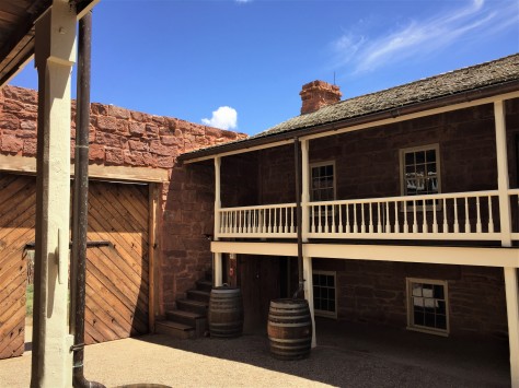
That stone fort still stands to this day. The park service has done an excellent job in preserving the building and interpreting what happened here.
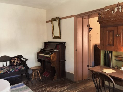
The spring itself bubbles up underneath the floor beneath this organ and is channeled via pipe to the other side of the fort. This allowed for indoor plumbing and, as the water from the spring ran under the floor, it cooled the home.
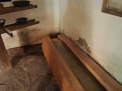
That pipe empties into this wooden trough in the basement of the building on the east side of the fort. This was a root cellar and had an area for making cheese. They had plenty of milk for making cheese, as the Mormons often paid their tithe with dairy cattle.
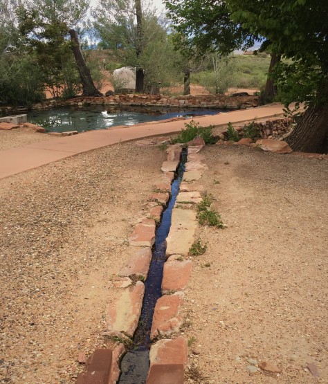
From there, it empties into a pond outside the walls. Since a 1933 agreement, the water flow from the spring has been evenly divided among the National Park service, the tribe, and private cattlemen.
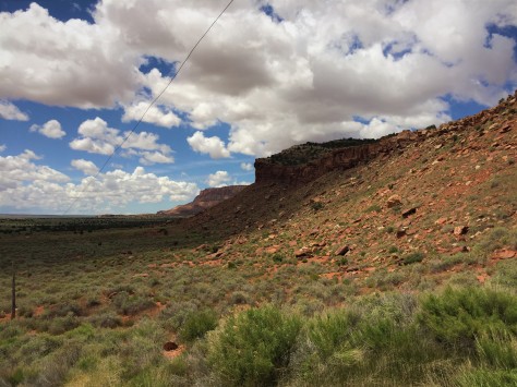
Another point of interest to note are the telegraph poles and wires outside the fort. Pipe Spring was the first telegraph office in Arizona.
Our visit, while short, provided a fascinating look into the struggles between the settlers and the native people. This park is well worth spending a few hours to explore, if you are passing through on this route. While the parking lot is large enough to support a couple of large RVs, consult a satellite view on Google Maps to decide for yourself whether or not to bring your RV there.
Once we reached Hurricane, we set up camp at WillowWind RV Park. As Midwesterners, it was divine to see real grass and trees again! They even allowed us to wash our vehicles, a rarity in this water-starved region. The town itself received its unusual name when Erastus Snow, the leader of a group of Mormon surveyors, had the top blown off his buggy by a strong desert wind. He declared the place to be named Hurricane Hill. We found it to be a great town to use as a base camp for visiting Zion National Park.
Our first priority was hooking up with our friends, Nancy and Bill.
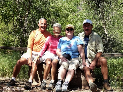
We were introduced to this charming couple by David and Sharon when we were in Myrtle Beach last year, and we hit it off right away. They offered to show us the east side of Zion in their Jeep, which meant we were going to see the tunnel after all!
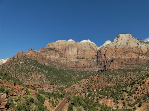
The road leading to the tunnel was beautiful. The native name for this area is Mukuntuweap, meaning either straight canyon or straight up mountains, depending on the source. William Howard Taft declared this to be Mukuntuweap National Monument, but the Mormons complained loudly and the acting National Park Service director at the time bowed to their pressure and changed it. No matter which name is used, either one describes this place perfectly.
Once we passed through the mile long tunnel, we came to one of Zion’s unique features…
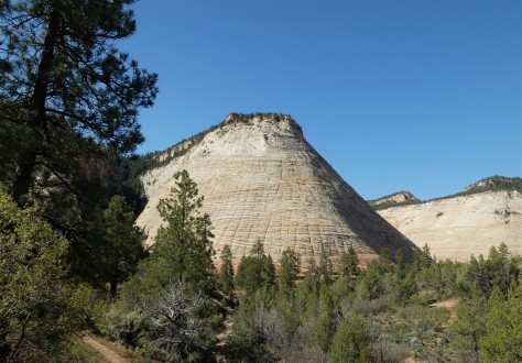
…Checkerboard Mesa. This sandstone hill is unusual in that it not only has its horizontal layering lines, but also has vertical cracks, believed to be caused by expansion and contraction.
After lunch, the four of us headed to the end of the canyon and hiked Riverside Walk, a trail that leads to the Narrows. That last trail was closed, as the water level was too high in the Virgin River.

Our mode of transportation to get there was the Zion Shuttle, a bus and trailer combination that is unlike any system we had seen at other parks. It was fast, efficient and rarely over-crowded. The tilted roof vents funneled the canyon air in, which kept us cool. The secret to their system is that they don’t have to compete with other vehicles, as the parks roads are closed to traffic during most of the year. There also is a lot of them, so there isn’t a long wait at the bus stop. Do take into account that we were there before Memorial Day; chances are that it is busier during the summer.
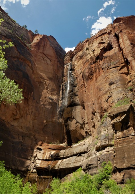
Nancy pointed out this beautiful waterfall at the Temple of Sinewava. This is an emphemeral waterfall, in that it only appears after a rainstorm. The following day, it was gone.
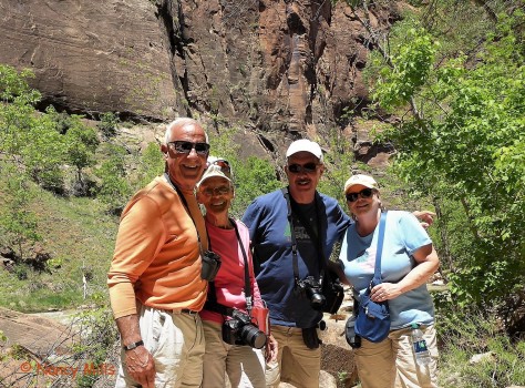
We thoroughly enjoyed our day with Nancy and Bill; we will see you two down the road. 🙂 Thanks for the Jeep tour and the great day!
Our next day saw us arriving early…a key to getting a space in the Visitor Center parking lot. From there, we used the shuttle to explore the rest of the stops in the canyon.
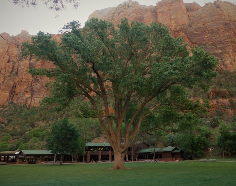
This huge Fremont Cottonwood tree at the Zion Lodge is over a century old. As big as it is, it pales in comparison to the height of the canyon walls. From the lodge, we hiked across the river to Lower Emerald Pool.
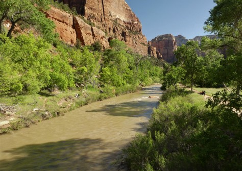
From the bridge, it is apparent how swift the river was running. Due to trail damage, the trail didn’t go beyond Lower Emerald Pool.
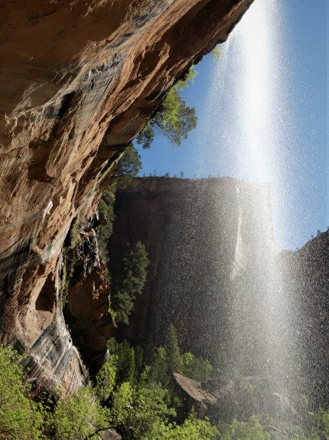
Still, the view from here was amazing.
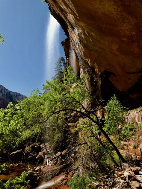
The trail continued behind the waterfall…
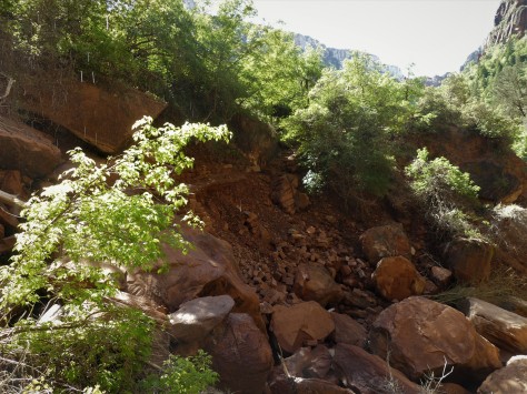
…to the place where the rockfall occurred. This isn’t Disney, folks. Glad no one was on the trail when this happened!
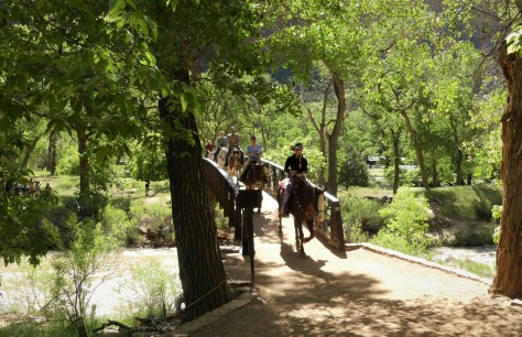
When we got back to the bridge, we had a bit of a traffic jam. Still another example of the different ways to enjoy Zion.
Once back at the lodge, we headed up the Grotto Trail.
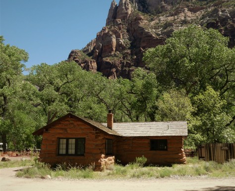
This cabin was built in 1924 to house the park museum. It now is housing for the artist-in-residence, and is the oldest building in Zion.
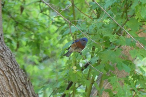
The Grotto was also a good place to see wildlife, including this bluebird.
From there, we went to Weeping Rock, which is a formidable wall of dripping sandstone. The thing that stood out at this location was not so much the wall itself, but the view of the canyon the trail afforded.
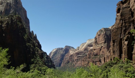
This is one of the best overall views of the valley that doesn’t require a significant vertical hike. Had it not been for others wanting to see this same view, we could’ve stood here all day long. 🙂
To round out our visit, we continued on to the shuttle stop at the Temple of Sinewava, a place we had visited the day before with Nancy and Bill. Our reason for this visit was because we had heard there were California Condors frequenting the area. You may recall that we had been trying to see them at the Grand Canyon. While we did see some large birds soaring here, we determined them to be turkey vultures. Will we ever see a condor? Obviously not here, but what we did notice was the traffic jam 900 feet up on the Angel’s Landing trail.
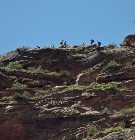
At this point, the trail is only a few feet wide and it drops off the same distance on the other side. Note that there isn’t a railing, only a chain to hang on to…and it is a two way trail. Again, this isn’t Disney, folks….although this hike would definitely be considered to rival Space Mountain.
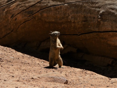
This fellow observer was as interested at the spectacle far above as we were. We had no plans to join in that fun, but we did view a friend’s outstanding video afterwards where they hiked Angel’s Landing in November a few years back. In it, Jim had a GoPro mounted above his head looking downward that shows just how narrow this trail is…including the shuttle stop I took my photo from. You can access their YouTube video by following this link: Vertigo Inducing Video of Angels Landing Hike in Zion National Park . Again, this trail is not for someone with a fear of heights. Jim and Barb picked a great time to do it, in that it wasn’t crowded that day.
Our path to Zion was worth the effort it took to get there, and we will make it a point to return to this amazing place someday. The place the Native Americans call Mukuntuweap is one of our favorite destinations on this trip.
Next up: Our trip plans get shuffled, due to another run-in with altitude sickness. More on that in our next post, so be sure to stay tuned for that. Until then, safe and happy travels to all!

By far one of our favorite parks, so many great hikes and the scenery is incredible. We really enjoyed the Angels Landing hike but you are right it was not as crowded as it seems like it has been this year. Next time we want to do The Narrows!
LikeLiked by 1 person
Be sure to check ahead on the Narrows trail, as the river was three to four times higher than the maximum depth allowed for people to walk the river bed, Jim. That was an amazing video you shot on Angels Landing!
LikeLike
Great post!! So glad we were able to spend a beautiful day with you two in a very special National Park:o)) Zion is way up on our list of favorites!! Since you are at the bottom of the canyon at Zion, it feels like the park is wrapping its arms around you. Such a very special GREAT BIG HUG!!! Thanks for the memories:o))
Safe Travels and Happy Trails……..
LikeLiked by 1 person
Loved getting to spend the day with you two, Nancy and Bill! What a special and amazing place. 🙂
LikeLike
Excellent post. So glad the crowds weren’t excessive as they can be. Won’t ever catch me on Angles Landing but I will forever hold fond memories of hiking the narrows.
LikeLiked by 1 person
Thank you! We aren’t planning on ever hiking Angels Landing either, Gaelyn. I’m glad Jim and Barb made that video, as it really shows how high up they were.
LikeLiked by 1 person
We loved this park with so many fabulous views and hiking trails. Steve wanted to do Angels Landing but it was wall to wall people…just crazy!
We met Bill and Nancy in 2011 at the Tampa RV Show and discovered we were both staying in the same campground. Great couple!
Safe travels!
LikeLiked by 1 person
Definitely a trail to do when it isn’t crowded!
LikeLike
Another great park! Love the hiking there! The Narrows are so much fun. Altitude Sickness, oh no!
LikeLiked by 1 person
We look forward to going back, Debbie!
LikeLike
I hiked Angel’s Landing about 25 years ago. The trail was soooo slippery where thousands of hikers had worn the rock surface to a glass-like smoothness. And it’s a long way down on either side, as you know. I wouldn’t do it again, mostly because there are too many people on the trail now.
So glad to see from your photos that the trails weren’t crowded! We would love to return to Zion, with hopes of hiking the Narrows. We’ll make sure to check that the water isn’t too high. Perhaps in the late fall next year.
LikeLiked by 1 person
Late fall would probably be a good time to hike the Narrows, Laurel. Have fun!
LikeLike
We missed so much of Zion because of the crowds – the wait for the shuttle was over two hours 😦 But what we did see we loved. How fun to hook up with Bill and Nancy! Recognizing them in the state park in Arizona in April was very funny as I recognized them from another blogger :-))) Great pics of the waterfall.
LikeLiked by 1 person
Hope you get to go back when it’s not crowded, Jodee!
LikeLike
Thoroughly enjoyed that – what stunning scenery (and excellent photographs, I may add). Nothing as grand as that over here! Interesting too; those settlers were a selfish bunch, weren’t they?!
LikeLiked by 1 person
In a lot of cases, yes. Quite often, the natives got the short end of the stick, Mike.
LikeLike
Zion is a great park. Too bad it is getting over loved and so darn crowded. We had the good fortune to spend an entire month hiking this area prior to the huge Visit the Big Five campaign Utah put on the following year. We were there for the month of March and there was no shuttle and no crowd. Hiking the West Rim trail is so much nice and higher than risking your life for Angel’s Landing. It will take you the base of Angel’s Landing but then you continue on off to the side on a beautiful trail. The east side of the park is so much more fun and less crowded. There are so many areas to create your own trail up the slick rock. Looks like you had a fun time.
Pipe Spring NM is a really interesting park. Not many stop, Glad you did.
LikeLiked by 1 person
That campaign sounds like it had similar results to what happened at Sleeping Bear after Good Morning America voted it the most beautiful place in America in 2011. Whether it was or not, people came to find out…in droves. We will be discussing another over loved place in our next post this Saturday, Pam.
LikeLike
So glad you got to see Bill and Nancy. Looks like you had a wonderful day and how lucky to experience the one day waterfall!,
LikeLiked by 1 person
It sure was great to see them again, Tracy!
LikeLike
Finally catching up with you guys! What a great couple of days in Zion! And how special to see Bill & Nancy!
LikeLiked by 1 person
It sure was fun, Kelly!
LikeLiked by 1 person