
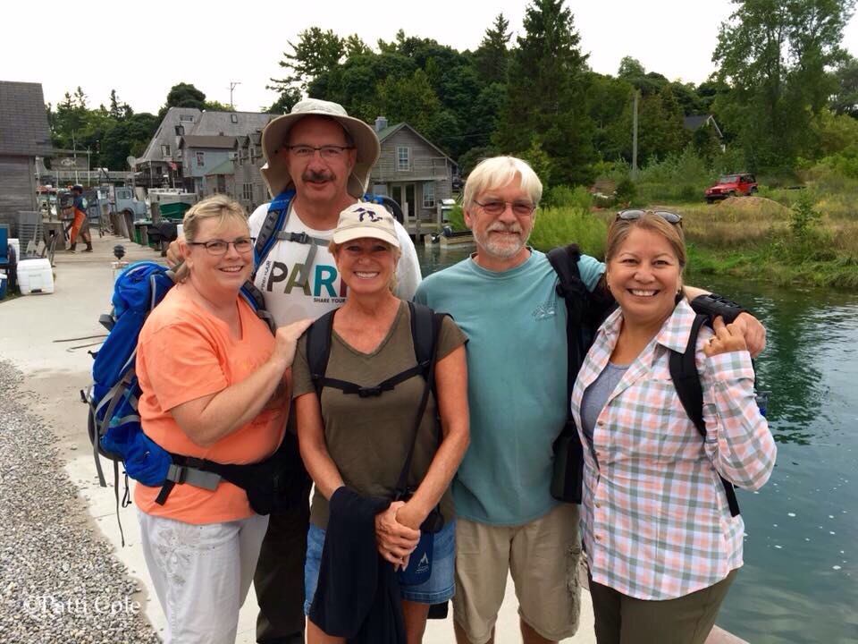
Approxametely 15 miles west of Leland, the Manitou Islands rise from Lake Michigan. This archipelago is a vital part of Sleeping Bear National Lakeshore, yet very few visitors ever get there. A few weeks ago, Diana discovered a trip that the Leland Historical Society was taking to both North and South Manitou Islands on the same day. Ferry riders normally get to choose between one or the other, and the transit schedule North Manitou requires overnight tent camping. This once-a-year trip offered both islands! Seeing that we had never been to either one, we decided to join the tour. Joining us would be our friends Camilla, Lane and Patti. The trip was supposed to take place on Tuesday, August 23, but it was delayed two days because of strong southwesterly winds. As luck would have it, that put the trip on Thursday, August 25th…the 100th birthday of the National Park Service!
We arrived at Fishtown in the village of Leland, ready for adventure! For those who have never been to Leland, Fishtown is the historic dock where Lake Leelanau empties into Lake Michigan. Some of the old fish processing shanties have been turned into a collection of gift shops, while others still house fisheries.
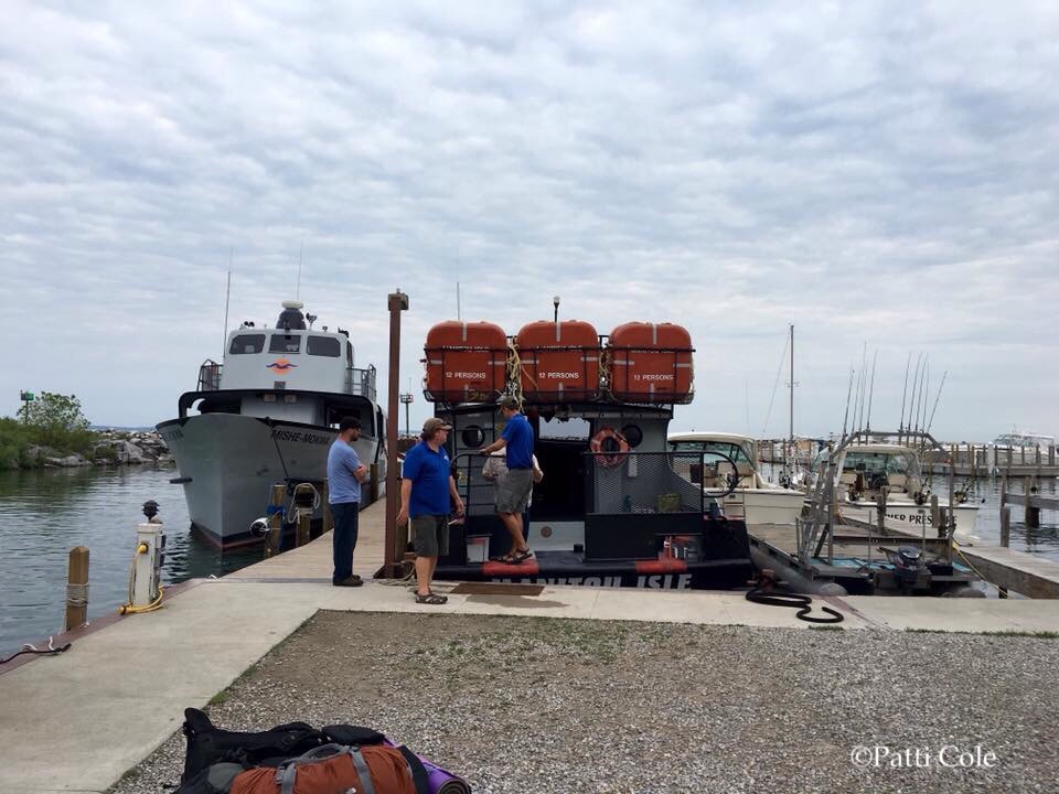
Our vessel for this special trip was the 52 foot Manitou Isle. Built in 1946, she has seen a lot of use in her 70 years. The larger and newer ferry on the left is the one that is used daily.
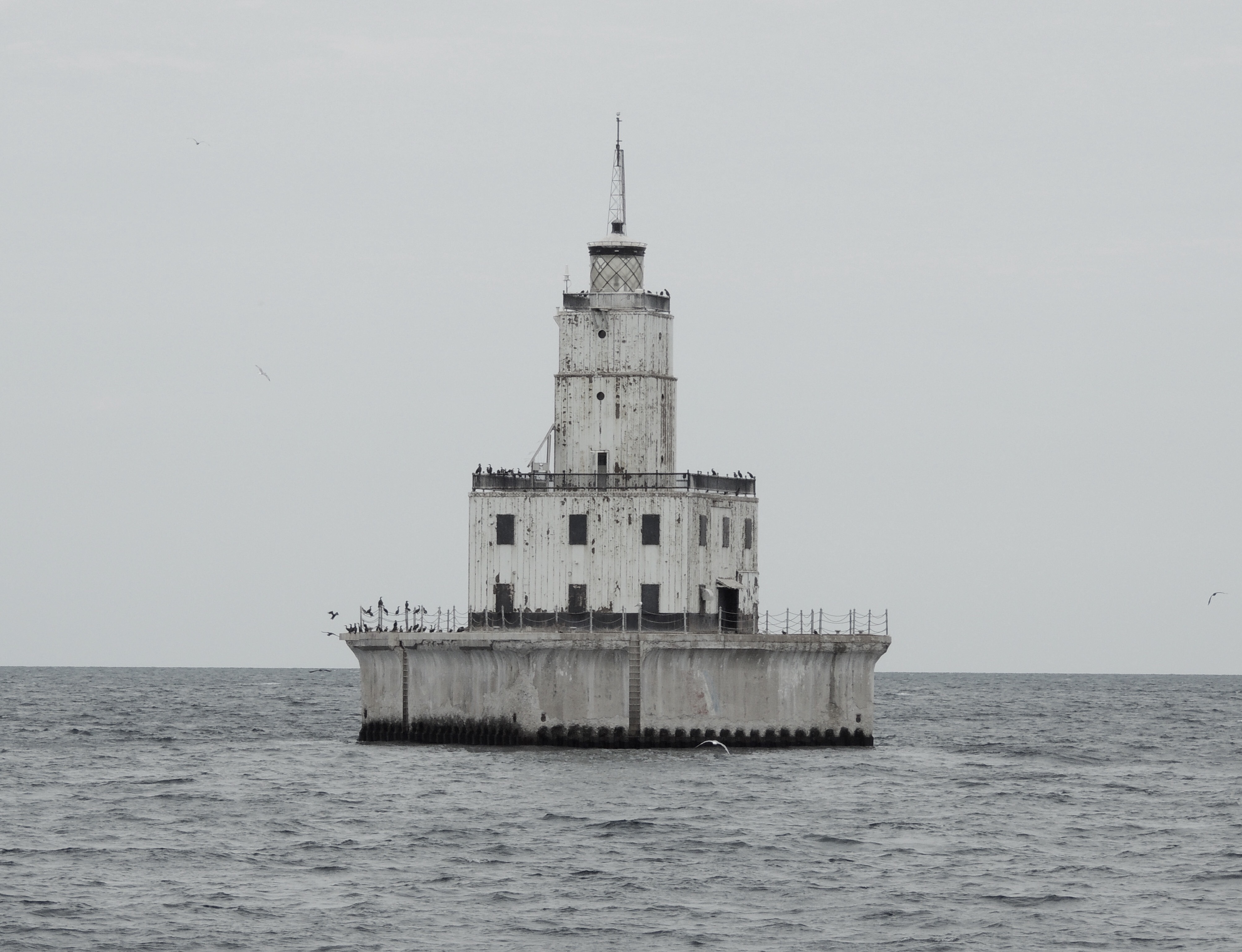
On the way to the islands, we passed the North Manitou Shoal Light Station. This lighthouse was built in 1935 and was the last manned offshore light on the Great Lakes when it was automated in 1980. It sits in 26 feet of water and the focal plane of the light is 79 feet above the surface of the lake. The sea birds sure appreciate it! The lighthouse is currently up for auction, with a bid of $10,000 already posted online. If you are considering bidding on it, be warned that it is still active…including the fog horn. 🙂
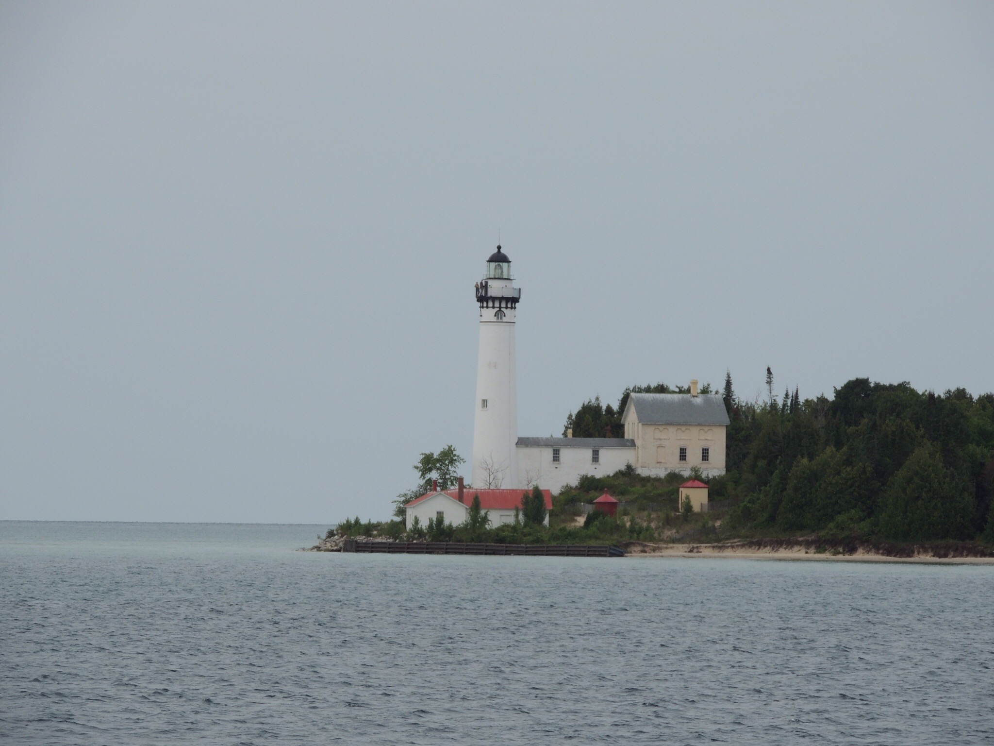
As we approached our first stop, the South Manitou Light Station came into view.
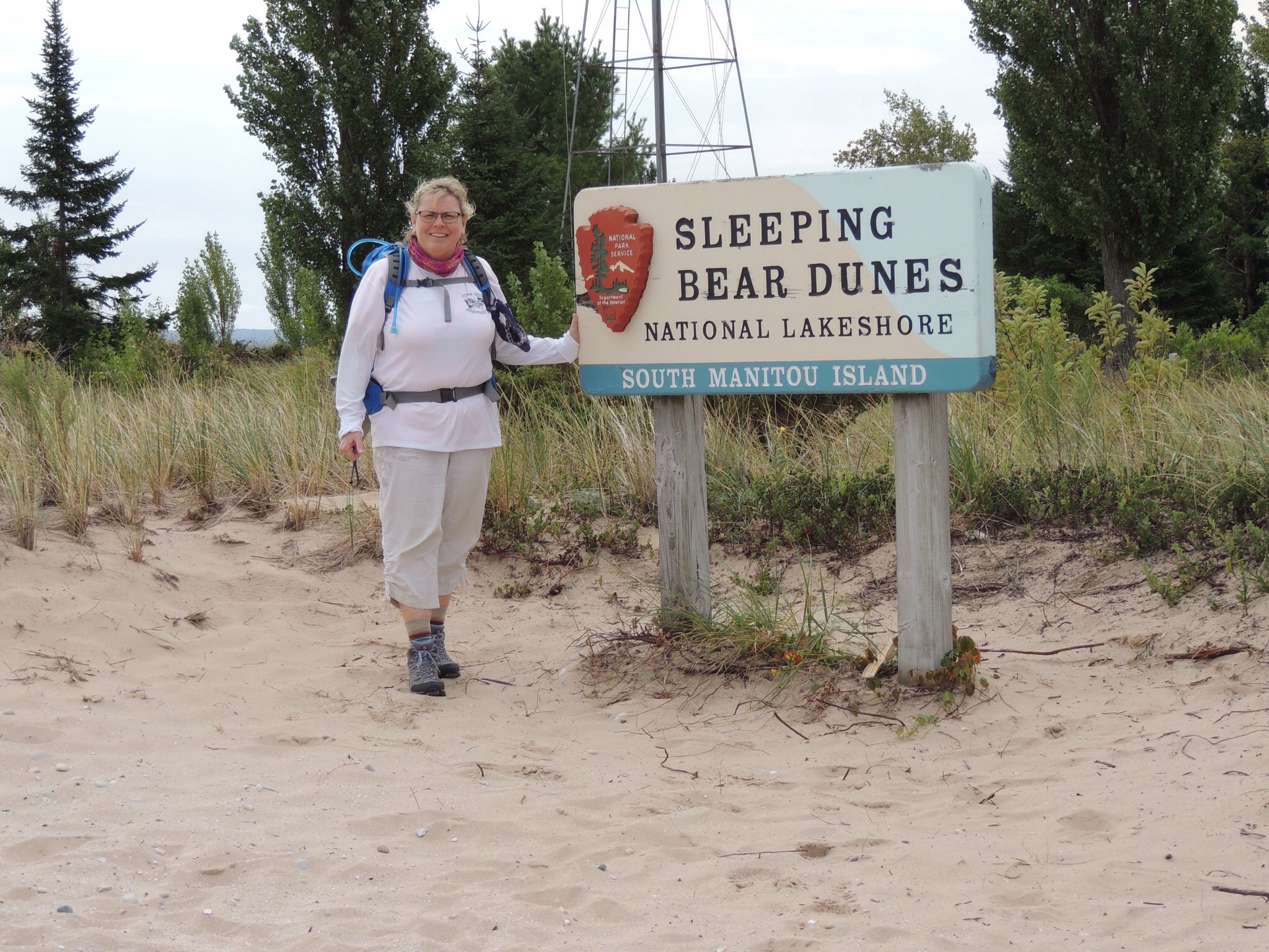
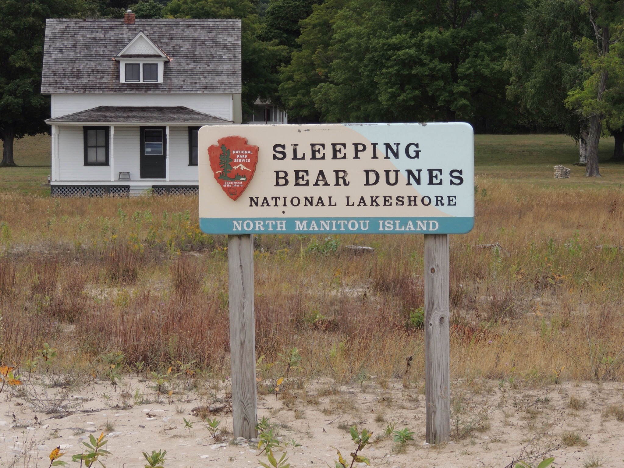
After years of visiting this region, we’ve finally made it to South Manitou Island! The smaller of the two isles, South Manitou is 8.2 square miles. There is a ranger station that houses a few seasonal workers, but no permanent residents. That’s not to say it was always that way though. The island has been home to lumbermen, farmers, lighthouse keepers, and lifesaving crews.
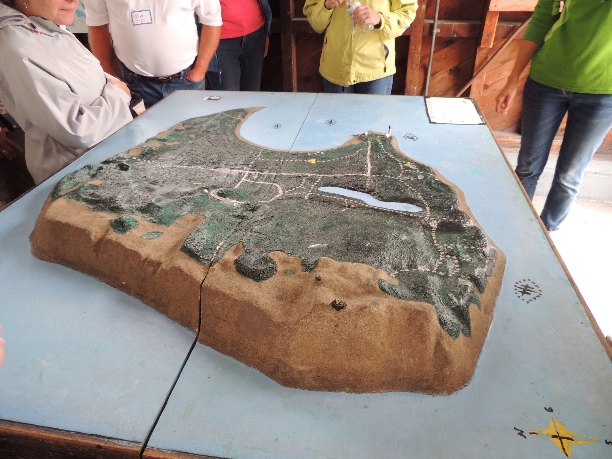
This relief model of the island shows how the western side is dominated by dunes. Both North and South share this feature, as do the Fox islands to the north, as well as most of the shoreline of the mainland in Leelanau County. The model also shows the crescent-shaped harbor, which is the only natural deep water harbor between Buffalo, NY and Chicago. The football-shapes in the water are shipwrecks. The one on the right is the latest shipwreck, the Francisco Morazan…a 234 foot steamer which ran aground in a November gale in 1960. Most of the vessel is still visible above the waterline. Time constraints did not allow us to visit the wreck or the giant 500 year old cedar trees that stand west of it.
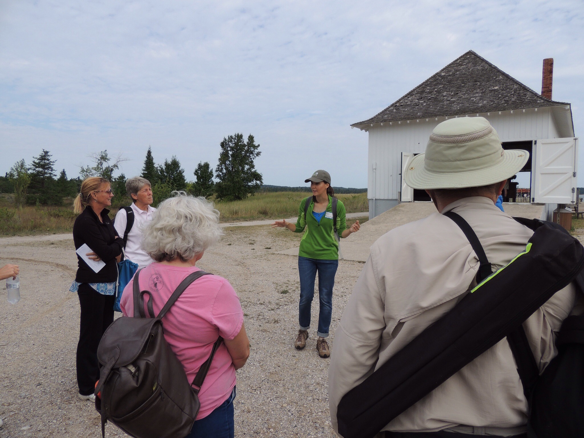
If you recall in my previous post, Port Oneida Fair, I spoke of a ship owner named Thomas Kelderhouse. On this day, we were honored to have our tour guide be his great-great-great granddaughter, Kim Kelderhouse! Here she is explaining the legend of the Sleeping Bear, which is how the dunes and the national lakeshore received their names. According to Native American folklore, a mother bear and her two cubs were driven into Lake Michigan by a great forest fire in Wisconsin. Knowing their only escape was to get to the other side, they swam day and night. The cubs lagged behind and drowned just off the Michigan shore, where their mother waited for them. The Great Spirit eventually covered the cubs with sand, creating the Manitou Islands. As the mother bear slept, he also blanketed her, creating the Sleeping Bear dunes. As Kim stated, it is indeed a sad tale.
After leaving the dock area, which is where the former lifesaving station stands, we split up into two groups. One group headed to the farm and cemetery, and our group headed with Kim to the lighthouse.
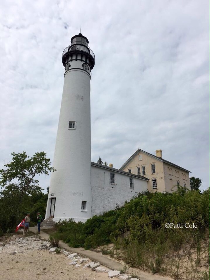
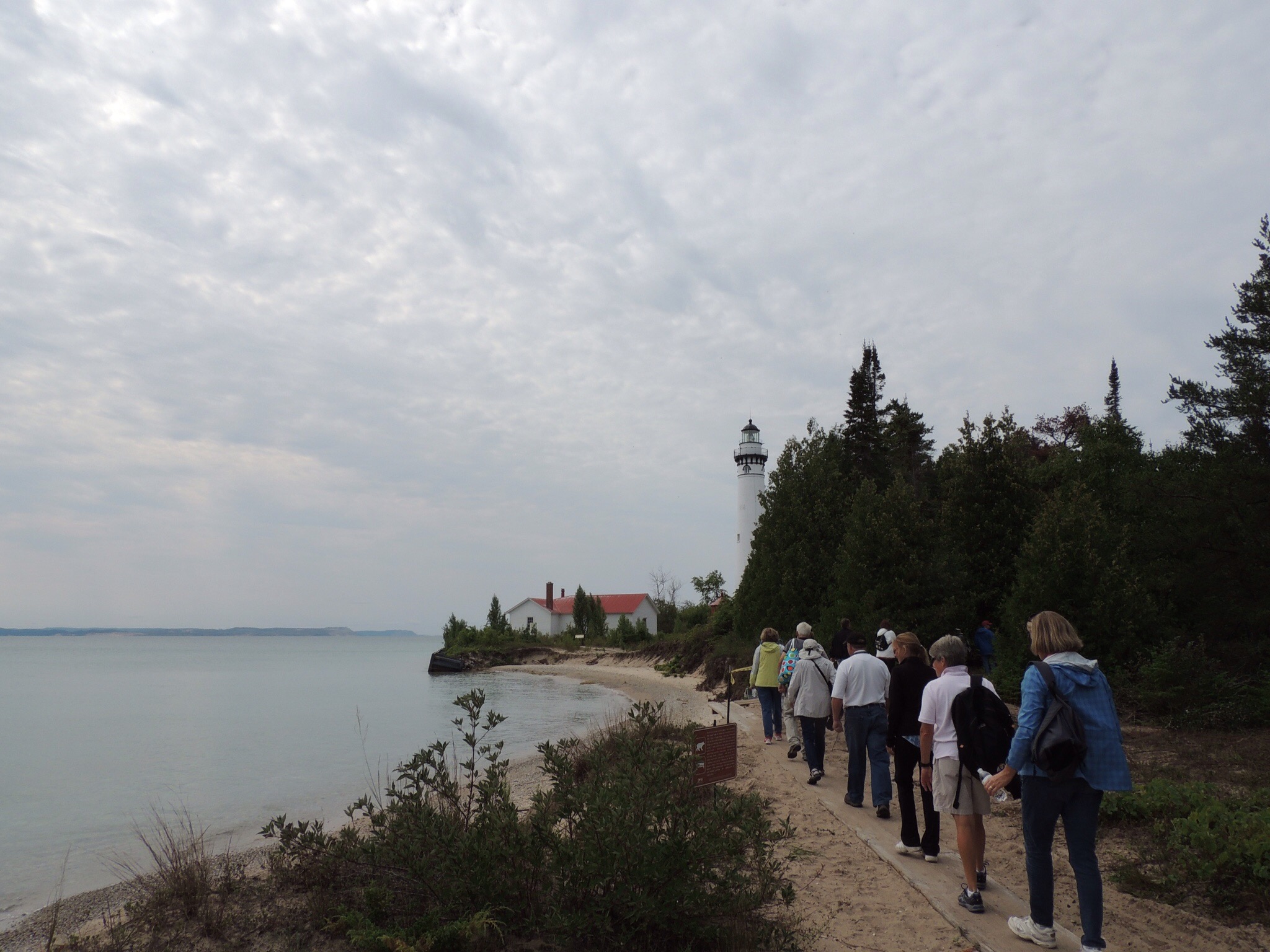
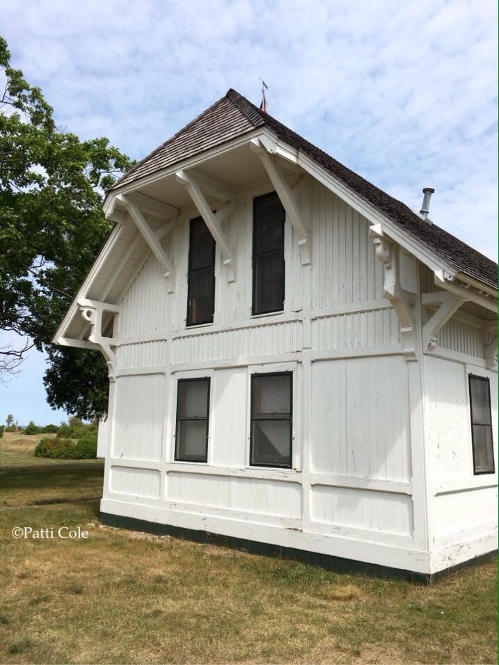
South Manitou Light Station was first established in 1840. The original tower was replaced in 1858 by the cream brick structure in the photo above, which had a lantern room on top. It was deemed that light was too short (64 feet), so the current tower was built in 1872, closer to the water. It has a focal plane of 104 feet above the lake surface.
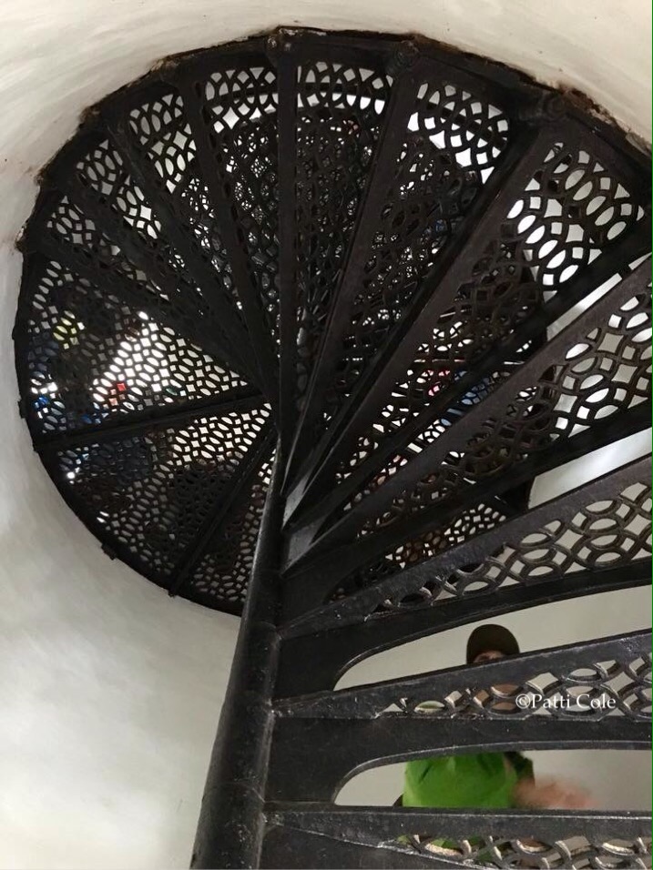
Kim explained how the spiral staircase is only supported in the center. If it were attached to the sides, the tower would crumble as it shifted in the wind and the stairs pulled at the walls. I’ve been to many lighthouses over the years and never knew that fact. Learn something new every day!
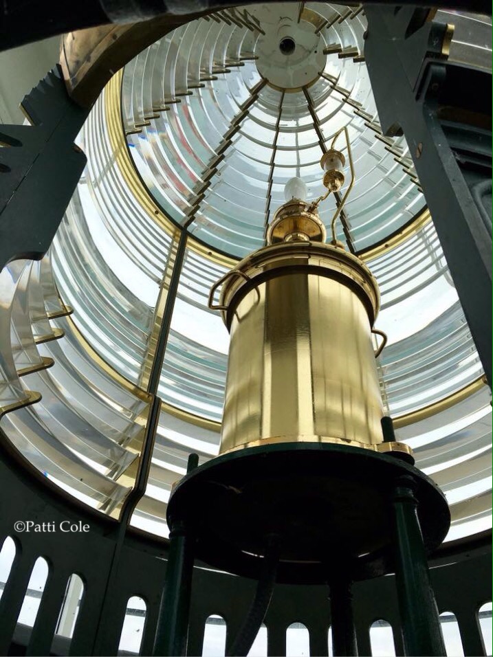
The third order Fresnel lens is a replica. The light shines nightly from May through October.

Here’s the motley crew on the lighthouse gallery!
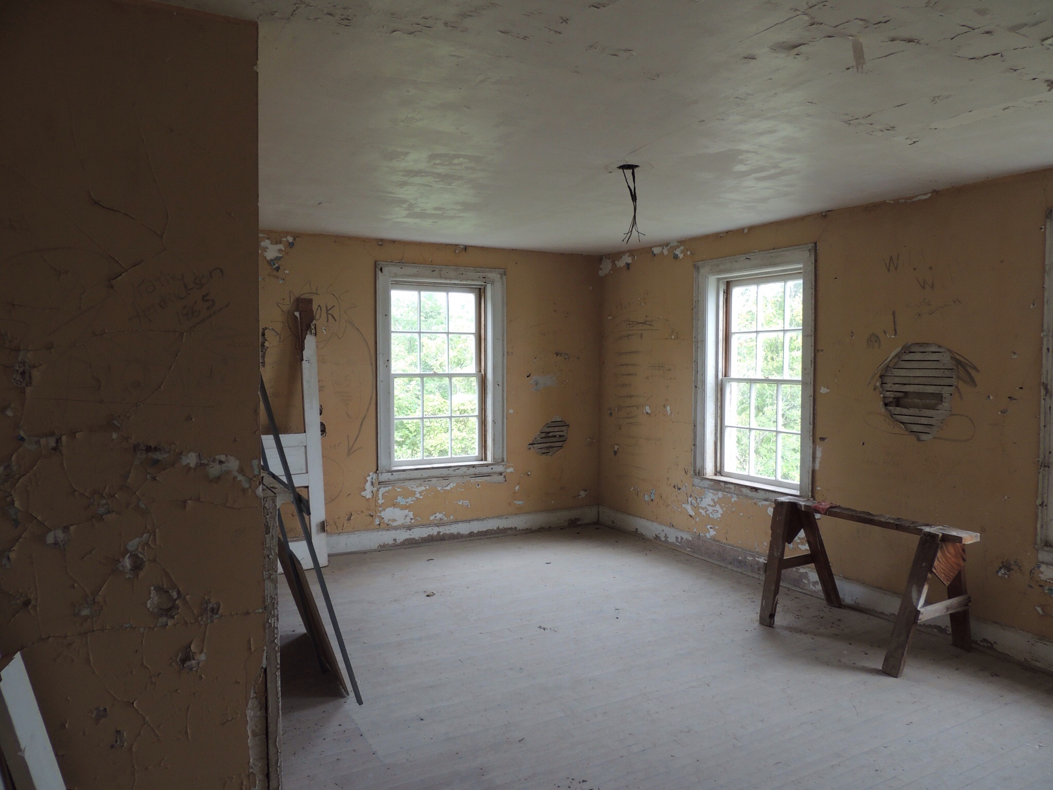
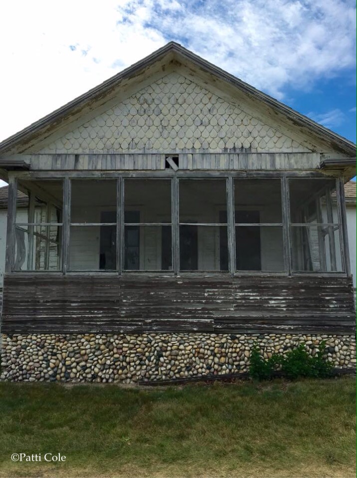
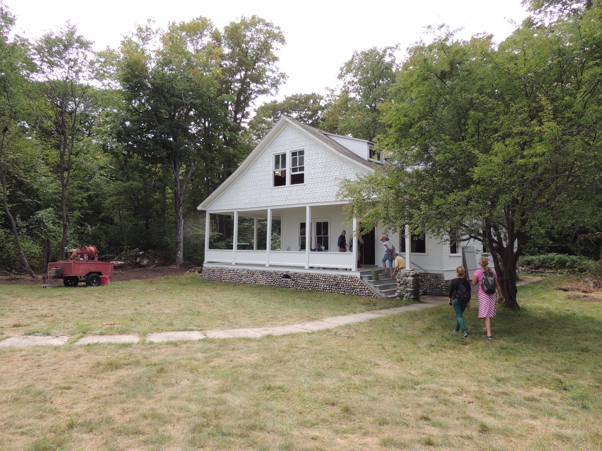
Kim took us into the keeper’s quarters, which is awaiting restoration. The windows were recently replaced, thereby stabilizing the building.
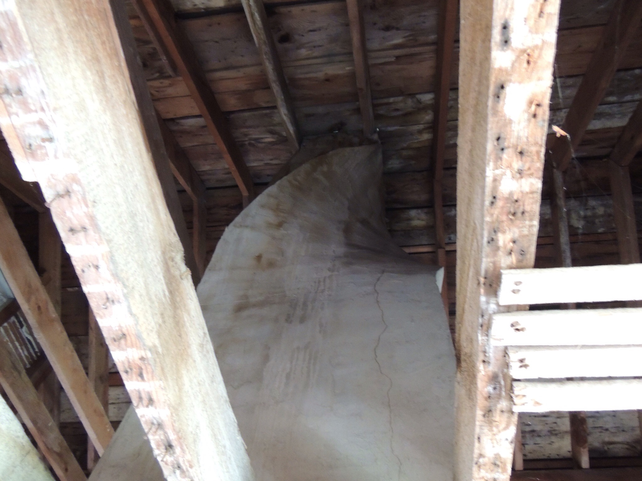
The lack of a ceiling upstairs allowed us to see this interesting twist in the chimney, which made it possible to exit the roof without disrupting the rafters.
From the lighthouse, we headed back to the boat and headed off to North Manitou Island.

Just a couple of kids out for a boat ride. 🙂
As was the case at our previous stop, North Manitou Island’s dock is near the lifesaving station.
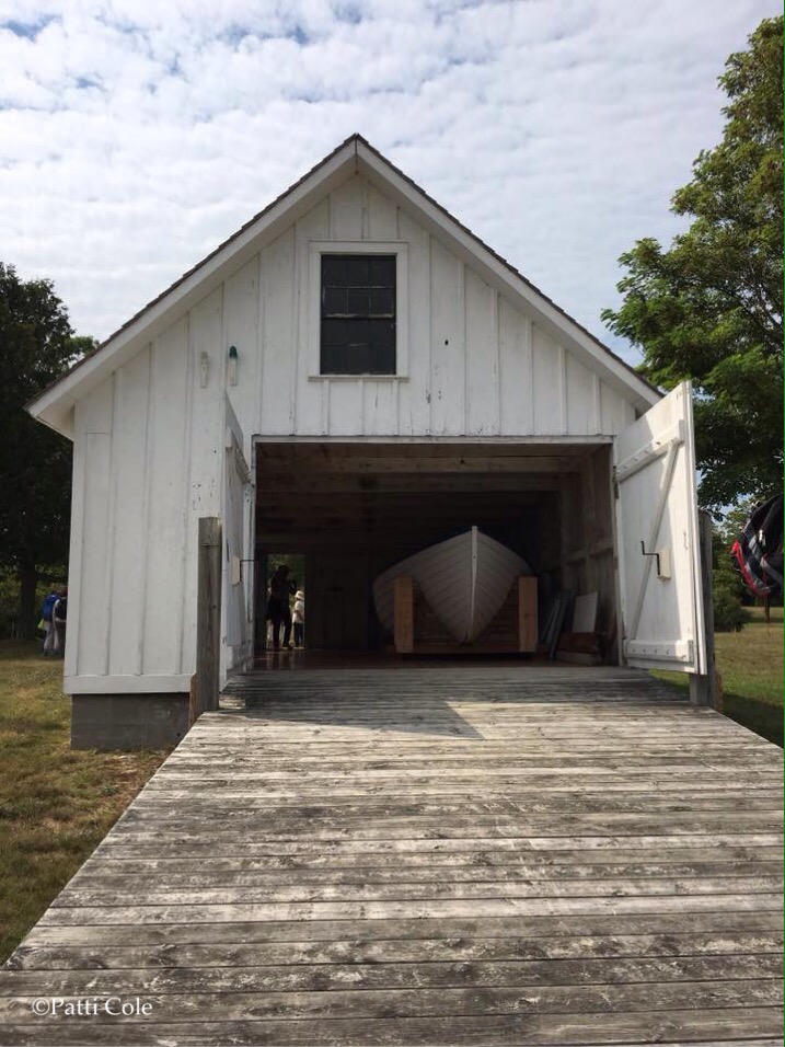
The unique thing about this location is that it is the only remaining station to have buildings that were used from the beginning of the Lifesaving Service through the Coast Guard. This boathouse is the only remaining example that used the original 1854 standardized plans, and it was built that same year.
The 1877 Lifesaving Station was a combination crew quarters and boathouse. It was later converted to quarters and a storehouse by the Manitou Island Association, and then to a dormitory by the National Park Service.
As was the case on South Manitou, North started out in the lumbering business selling cordwood to passing steamers. When the trees were exhausted, the Manitou Island Association formed, which farmed the land. A large barn from the farming era still exists to the north of the village near the dock.
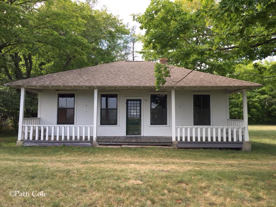
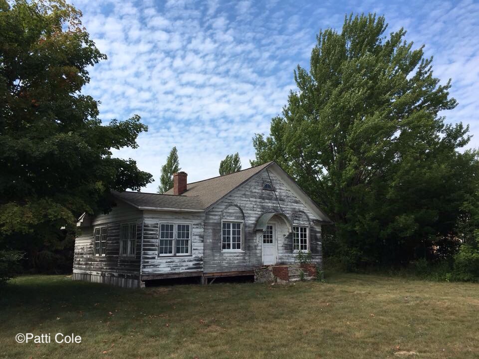
A unique feature on North Manitou is Cottage Row. There are 10 parcels that were owned by successful Chicago business owners who vacationed here in the summer months. The cottages on these lots were built between 1893 and 1924.
This cottage, the Monte Carlo, was designed by a 26 year old Frank Lloyd Wright when he was employed at the Sullivan firm in Chicago. It was built in 1894.
Also built that year was the Trude-Fiske cottage. It remained in the family until 1979.
The Wing Cottage was also built in 1894 and was owned by several families over the years. Note the fieldstone foundation.
The Riggs-Londergan Cottage was built in 1924. The Manitou Island Association purchased it in 1958.
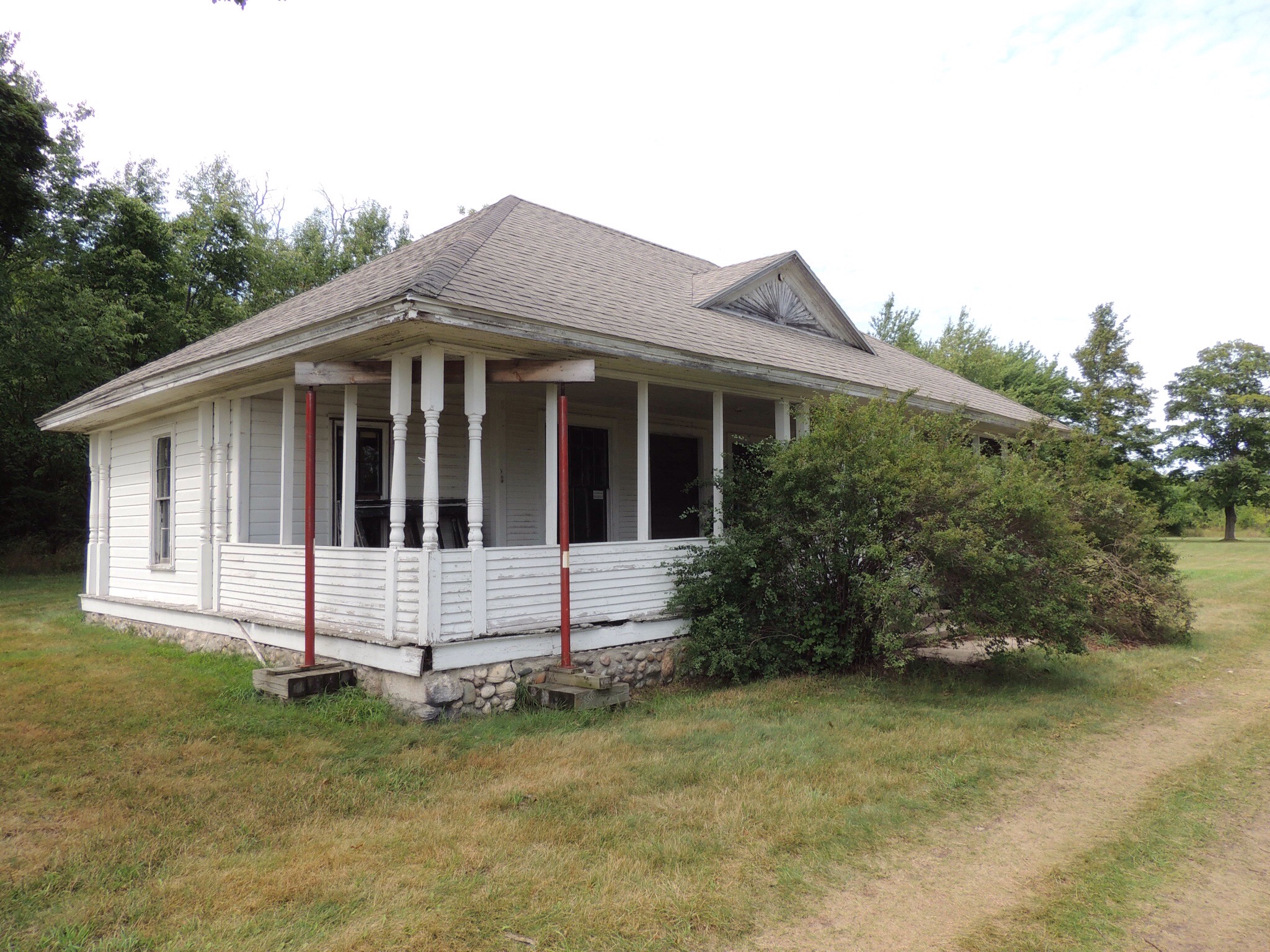
This is the Katie Shepard Hotel, which is currently being restored by Preserve Historic Sleeping Bear volunteers. It was built in 1895. Although plans aren’t firm, the thought is that visitors will be able to use it as an alternative to tent camping, similar to a hostel.
There are a few other cottages, including one that was ordered out of the Sears catalogue. Diana found it interesting that, of all the places these wealthy city dwellers could have chosen to spend their summers, they decided on an island in northern Lake Michigan without electricity or running water.
From North Manitou, we headed back to the mainland to the dock at Fishtown.
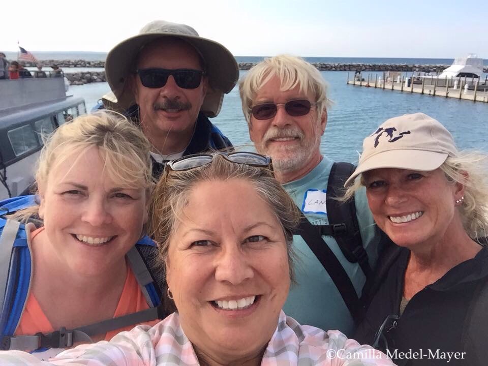
Camilla took one of her famous selfies to document our safe return! What a great day with friends!
—————————————-
Search and shop exploRVistas Amazon link here!
—————————————-
explorRVistas is a participant in the Amazon Services LLC Associates Program, an affiliate advertising program designed to provide a means for sites to earn advertising fees by advertising and linking to Amazon .com. Shopping through our link doesn’t add anything to your cost, but it does help support this blog. Thank you for shopping through exploRVistas!

What a great trip to the islands!
LikeLiked by 1 person
Can’t wait to explore them even more, Jim!
LikeLike
Too many years ago we ferried our kayaks to South Manitou Island and tent camped on the western shore for a couple of days. We hiked to portions of the island and snorkeled on the Francisco Morazan and the Three Brothers (sunk near the docks). It was a great trip and I want to go back to backpack around both North and South Manitou.
LikeLiked by 1 person
Did you see the remains of the Frost under the Morazan, Bob? I guess the Morazan ran over the older shipwreck on its way into the shore.
I definitely want to see the west side of South Manitou!
LikeLike
What a great advantage to make the trip with the Historical Society and get to see both islands! I love all the beautiful cottages. Too bad they can’t all be restored and opened for rent.
LikeLiked by 1 person
It was a nice way to get an introduction to both islands, Pam. We really would like to hike on both islands someday!
LikeLiked by 1 person
Looks like a fun trip. Fishtown sounds right up my alley!
Considering the Lake, I sure wouldn’t want to be stationed at the lighthouse year round! Man, that would be grueling!
Funny you mention the auction. They did that for a lighthouse in the Milwaukee harbor some years ago — now there’s a (?) lawyer I think living out at our old lighthouse who commutes to downtown by boat. But come to think of it I haven’t seen him coming or going the last couple times we were in town — might have to do some research and see what happened to him.
Saw our first flock of American Pelicans migrating yesterday — about 50 of them.
LikeLiked by 1 person
While there isn’t a lot at Fishtown, it definitely is worth checking out. The Leland Mercantile up the street…with its creaky wooden floors…is fun to check out.
A land based lighthouse would be OK, but a crib lighthouse in the middle of the lake would be nuts!
We saw a few Sandhill cranes in Port Oneida, the day after the fair. The flocks should be coming through soon!
LikeLike
I played a song many years ago as part of a musical group called Legend of the Sleeping Bear! It’s based off of these islands so ever since then I’ve wanted to visit them. Looks like you had such a fun trip!
LikeLiked by 1 person
That’s really cool! Definitely check out the Manitous if you get a chance, Diana!
LikeLiked by 1 person
What a great way to learn more about the islands. I love the story about how Sleeping Bear got its name. I remember reading the legend when I did research for a blog post. Interesting about how the circular stairs are attached in the lighthouse. I had never thought about it but it makes perfect sense.
LikeLiked by 1 person
I was amazed…after all the years I’ve been around lighthouses…that I hadn’t heard that before, LuAnn. It does make sense! 😀
LikeLiked by 1 person
What a wonderful treat to see both islands in such detail, and to do so with someone whose history goes back so far! Love the lighthouses.Looks like you all had a wonderful day.
LikeLiked by 1 person
The person leading the tour can make or break the experience, and Kim definitely had done her homework. We are looking forward to exploring more on those islands!
LikeLike
Having the stories from a good leader changes the experience.
LikeLiked by 1 person
Yes it does, Debbie!
LikeLike
Finally catching up on blog reading! What a great day you guys had! Bill and I sure do hope to get up that way someday! I’ll be referencing your posts for sure when we do!
LikeLiked by 1 person
I sure am hoping you can get here, Kelly!
LikeLike
What a great post – and what a great way of celebrating 100th birthday of the NPS! Many great photos and I learnt a lot today – for example I also hadn’t thought about why the stairs in a lighthouse would only be supported from the center, but now it makes perfectly sense!
Hope you have had a lovely summer! We have just returned after 3 lovely weeks of vacation.
LikeLiked by 1 person
Thank you, Inger! Where did you go on vacation?
LikeLiked by 1 person
After being abroad for almost 4 years we thought it was time for spending more time with family so we went north to where the rest of my family live. We also used the time to do some more exploring in northern Norway – had a wonderful time!
LikeLiked by 1 person
I love the legend about the name of the Sleeping Bear park, this is so cute, with the two cubs 🙂 South Manitou Island is such a small island, I can understand why no permanent residents are living there ! The lighthouse will be fabulous once restored. There are so many lighthouses around Lake Michigan, this is crazy !!
LikeLiked by 1 person
Few people realize that Michigan has more lighthouses than any other U.S. state. that’s because there is so much coastline. 🙂
LikeLiked by 1 person
Yes I remember seeing a map with the lighthouses and I was so shocked ! It think it was more than 200 I can remember the exact number !
LikeLiked by 1 person
Looks like a fabulous day and how perfect that it turned out to be the 100th anniversary! I had no idea about the stairwell not being attached to the exterior walls. Yes learning something new every day! Thanks!
LikeLiked by 1 person
That one little tidbit was worth the trip to a couple of lighthouse geeks like Diana and I, Sue! 😃
LikeLiked by 1 person